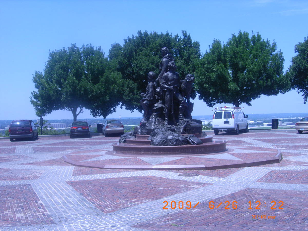
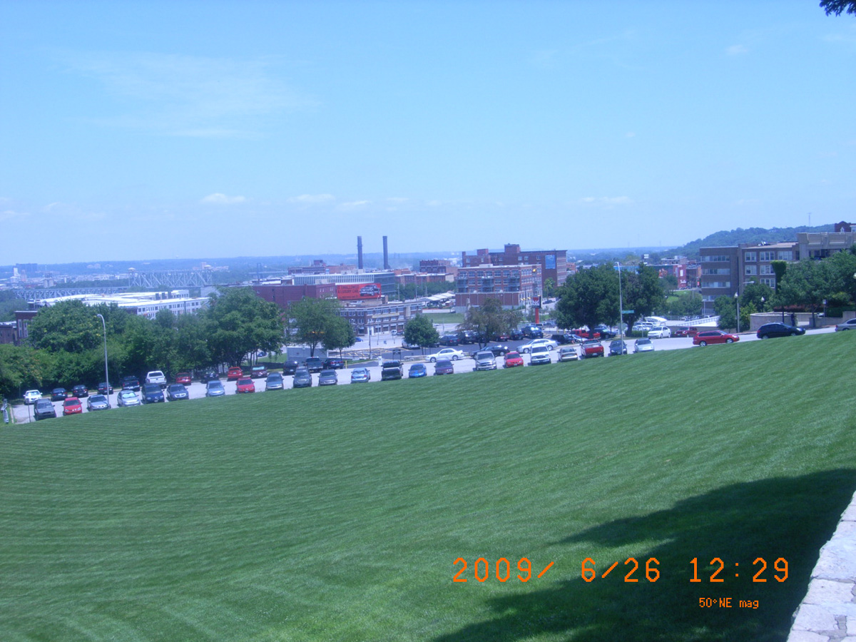
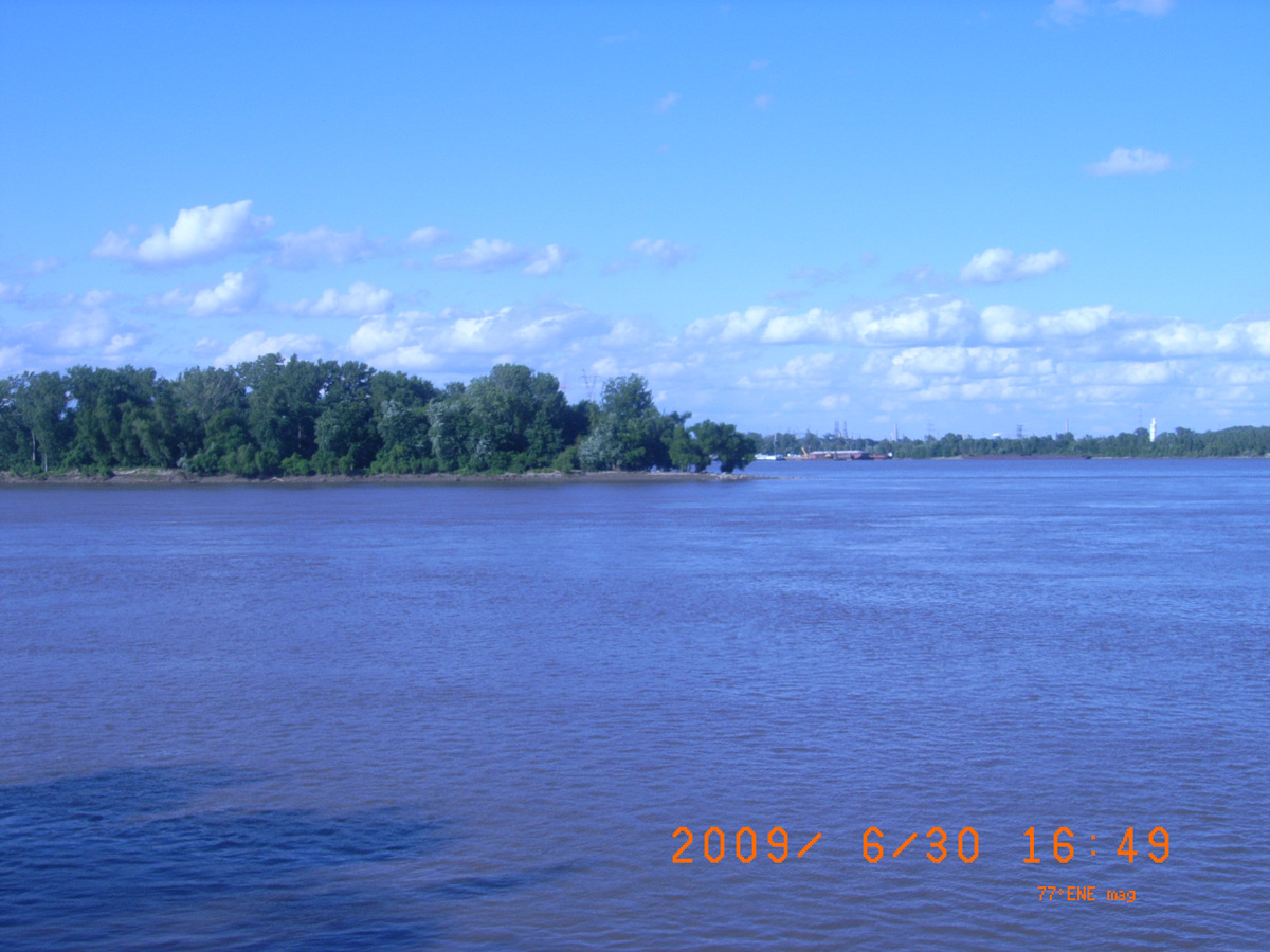
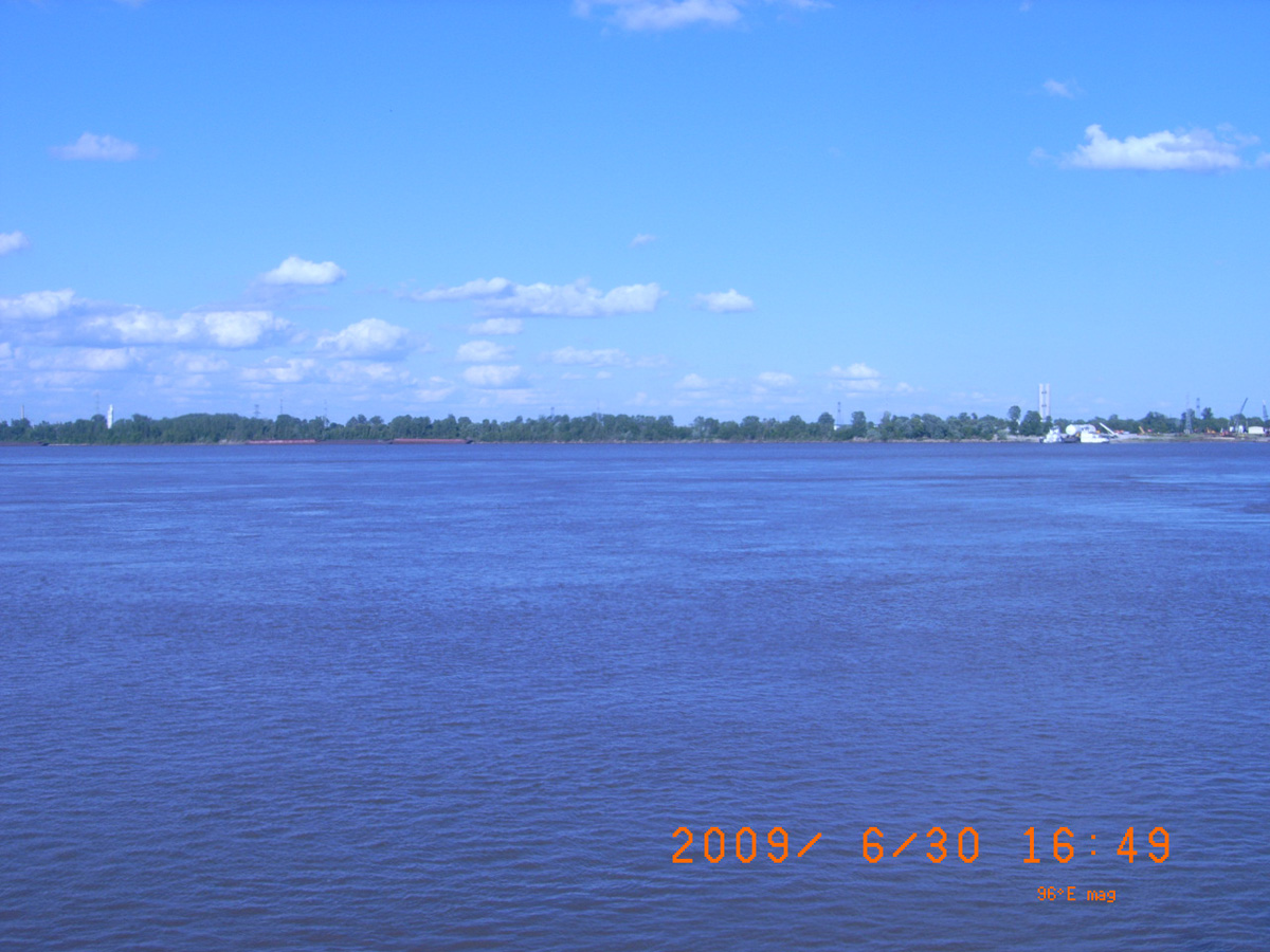
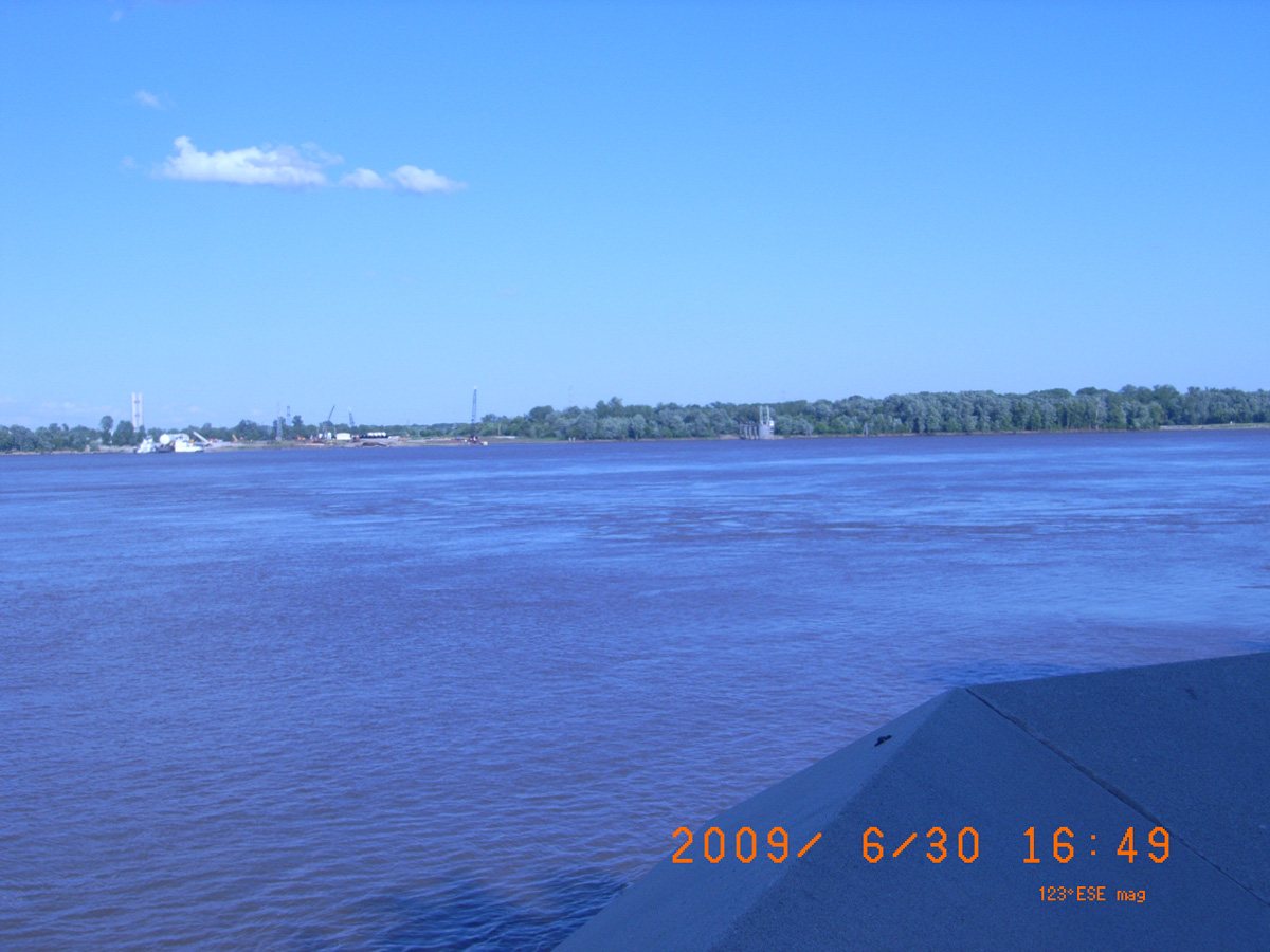
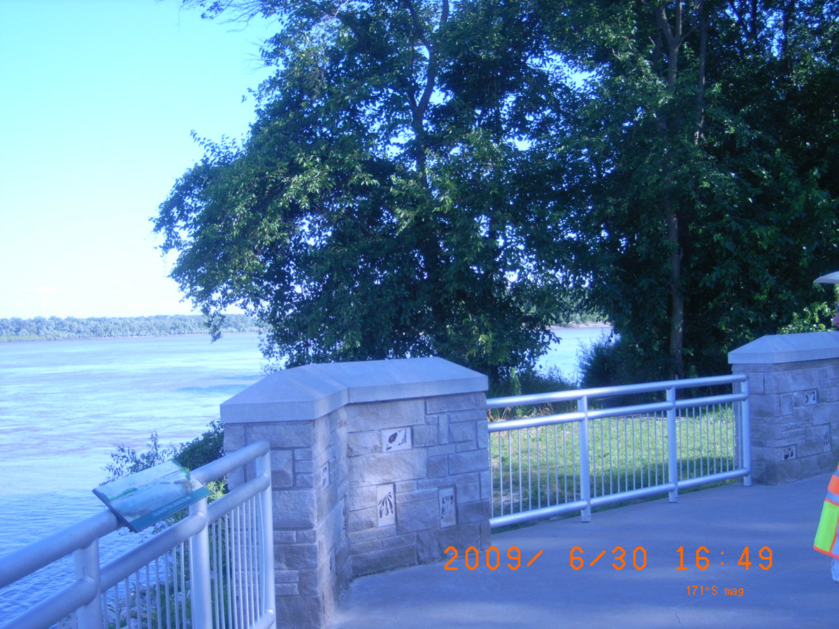
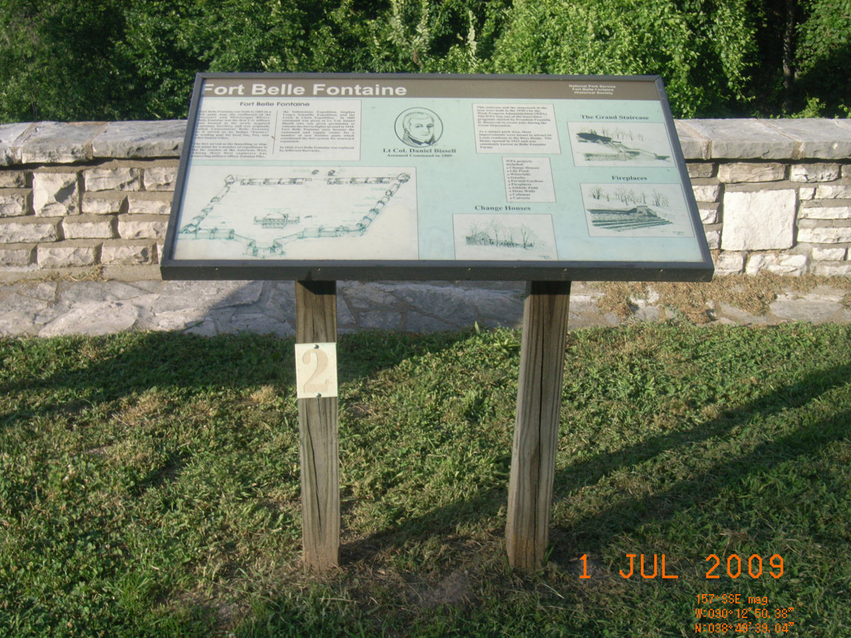
West Terrace, Kansas City
Jackson County, Missouri: 39.10475745, -94.59198752
- Date Assessed: 2009-06-26
- File Name: RIMG0115.JPG
- Folder: C26JuneCam2
- Camera Direction: 315°
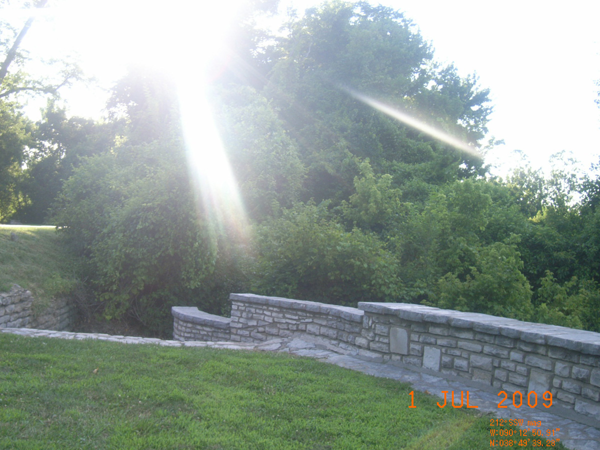
- Date Assessed: 2009-06-26
- File Name: RIMG0116.JPG
- Folder: C26JuneCam2
- Camera Direction: 315°
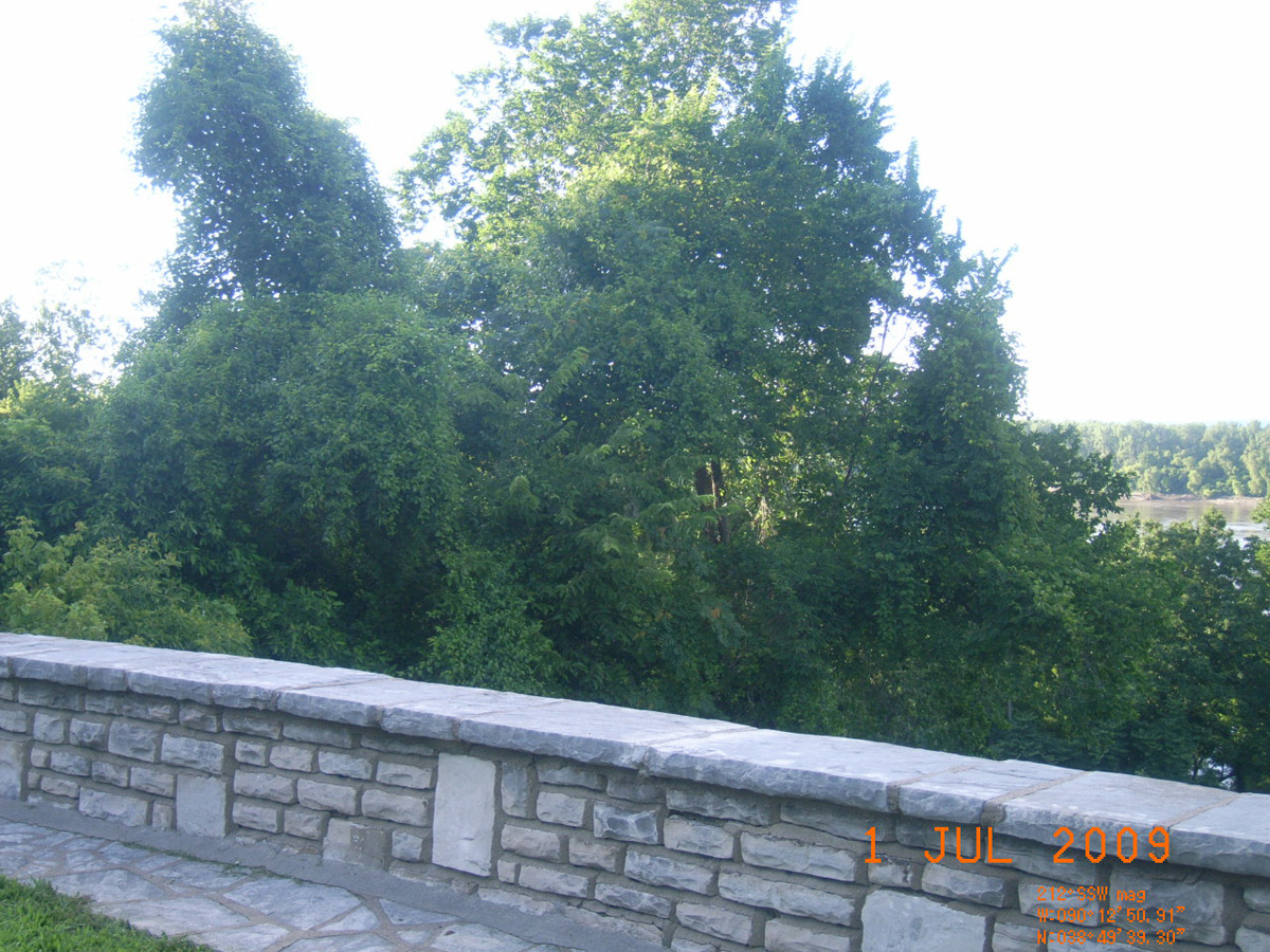
- Date Assessed: 2009-06-26
- File Name: RIMG0117.JPG
- Folder: C26JuneCam2
- Camera Direction: 189°
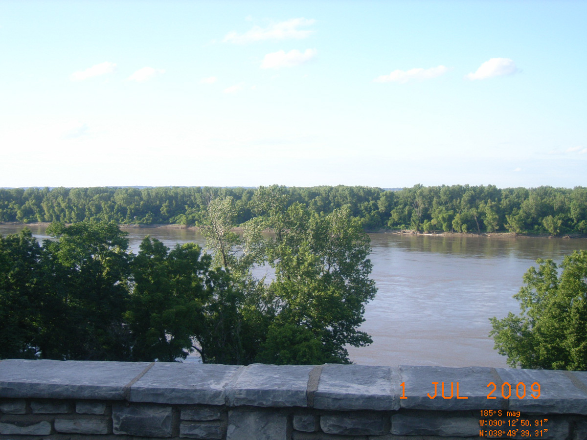
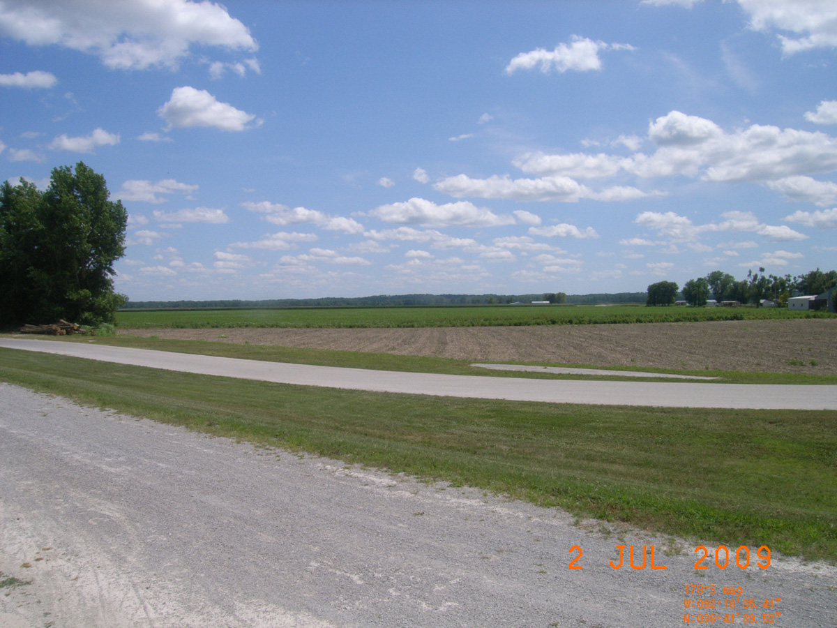
- Date Assessed: 2009-06-26
- File Name: RIMG0118.JPG
- Folder: C26JuneCam2
- Camera Direction: 178°
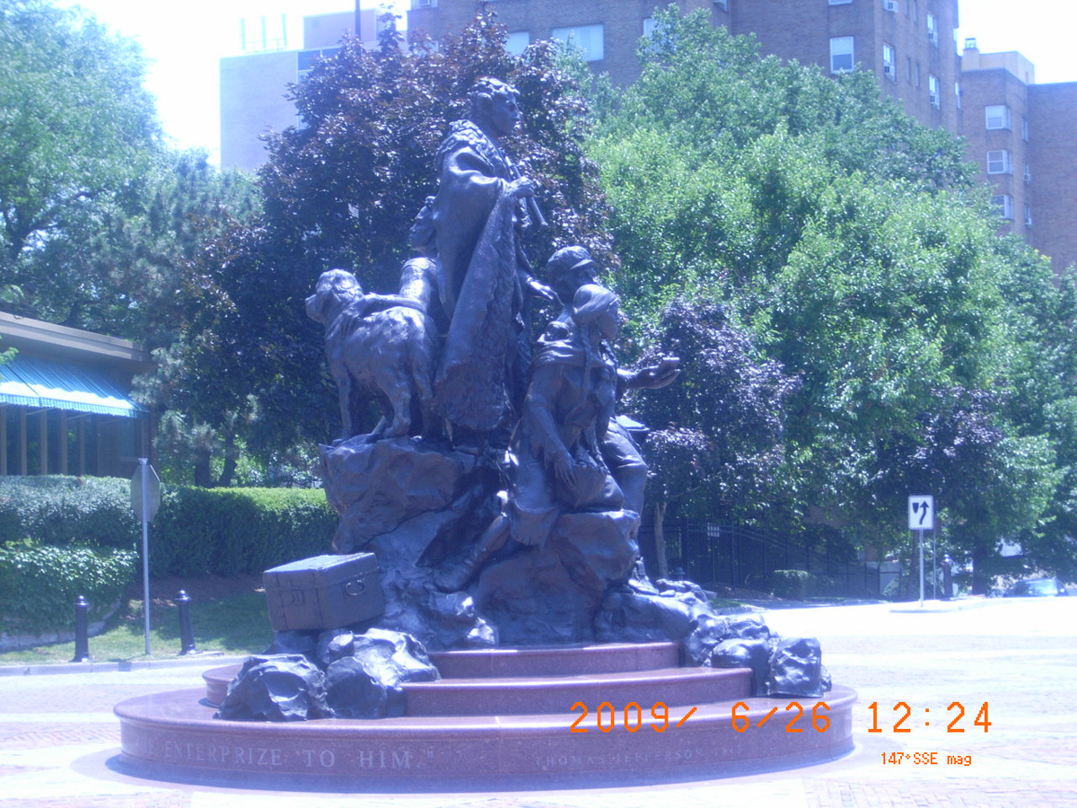
Etienne Veniard, Sieur de Bourgmont (French)
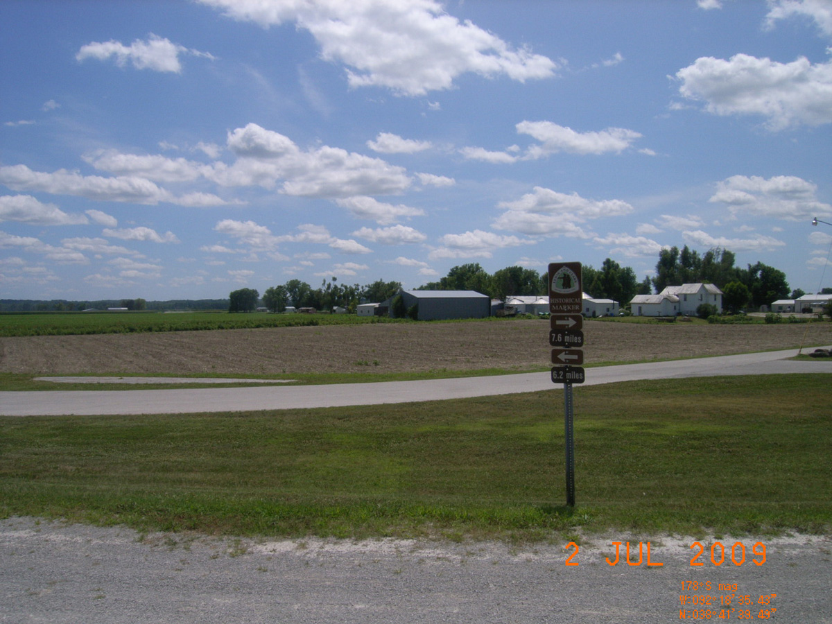
- Date Assessed: 2009-06-26
- File Name: RIMG0119.JPG
- Folder: C26JuneCam2
- Camera Direction: 178°
Etienne Veniard, Sieur de Bourgmont (English)
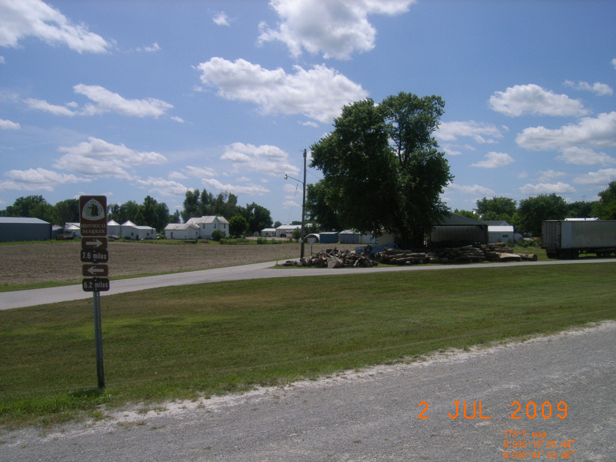
- Date Assessed: 2009-06-26
- File Name: RIMG0120.JPG
- Folder: C26JuneCam2
- Camera Direction: 209°
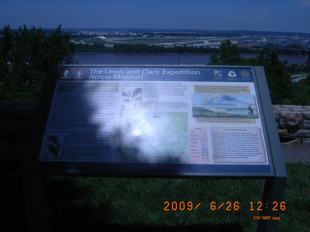
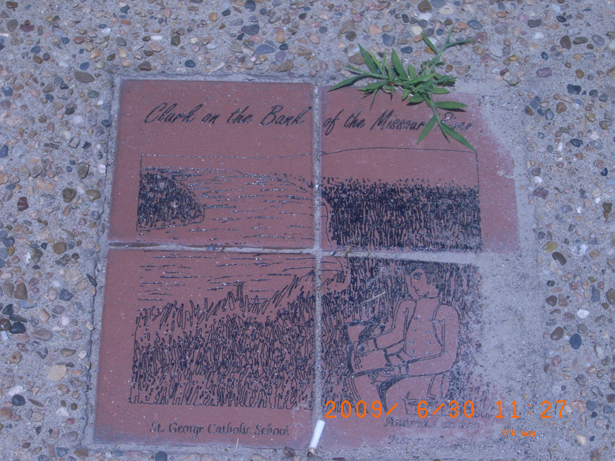
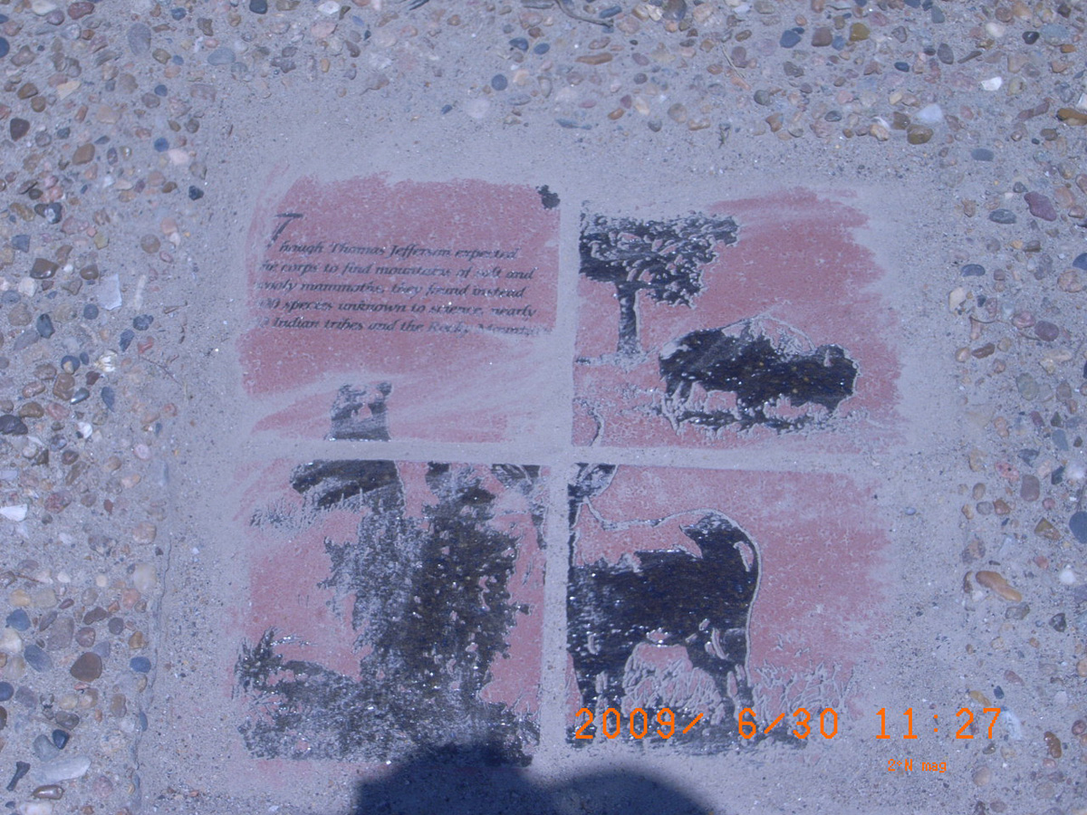
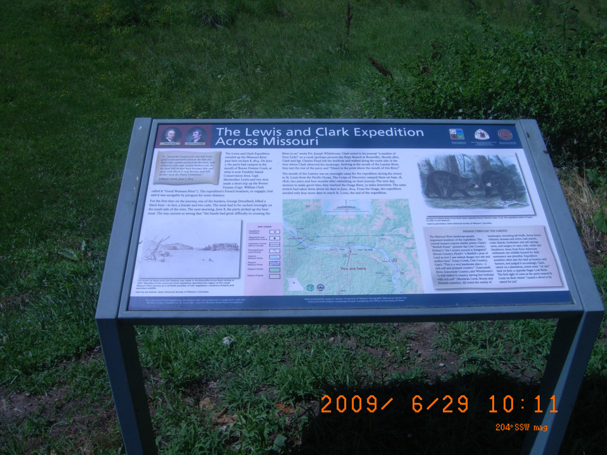
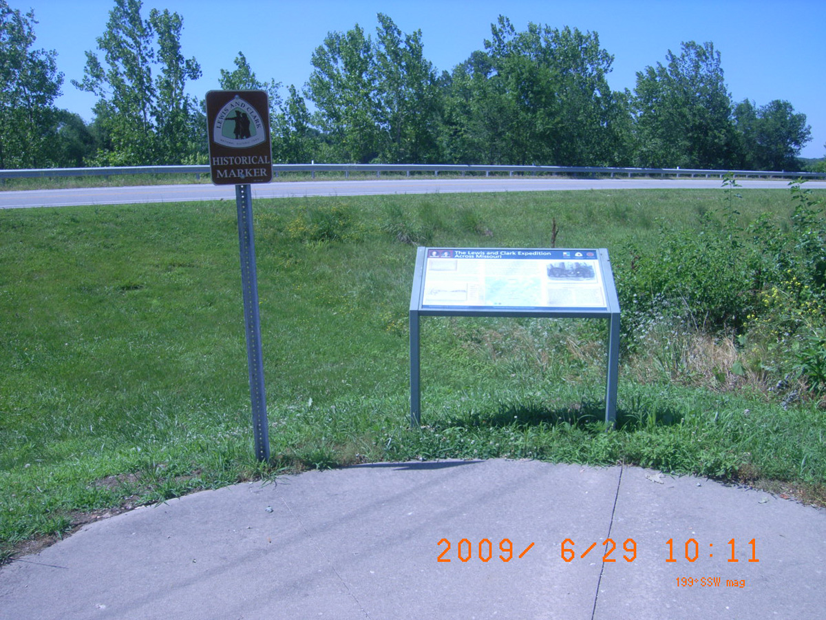
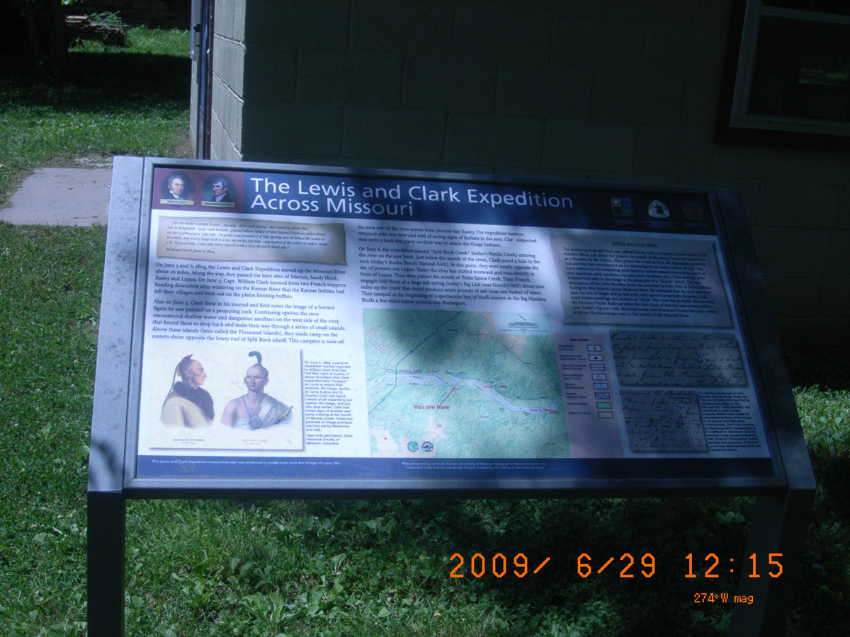
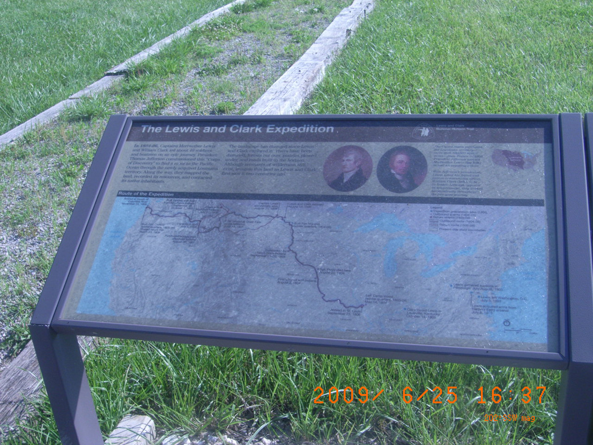
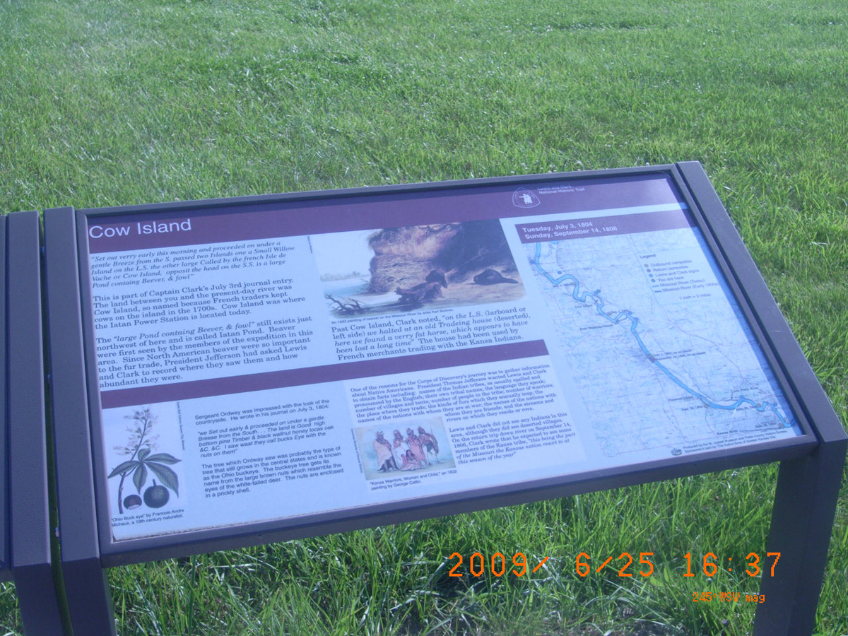
The Lewis and Clark Expedition Across Missouri
- Date Assessed: 2009-06-26
- File Name: RIMG0121.JPG
- Folder: C26JuneCam2
- Camera Direction: 171°
- Date Assessed: 2009-06-26
- File Name: RIMG0122.JPG
- Folder: C26JuneCam2
- Camera Direction: 171°
- Date Assessed: 2009-06-26
- File Name: RIMG0123.JPG
- Folder: C26JuneCam2
- Camera Direction: 171°
- Date Assessed: 2009-06-26
- File Name: RIMG0124.JPG
- Folder: C26JuneCam2
- Camera Direction: 176°
- Date Assessed: 2009-06-26
- File Name: RIMG0125.JPG
- Folder: C26JuneCam2
- Camera Direction: 176°
- Date Assessed: 2009-06-26
- File Name: RIMG0126.JPG
- Folder: C26JuneCam2
- Camera Direction: 176°
- Date Assessed: 2009-06-26
- File Name: RIMG0127.JPG
- Folder: C26JuneCam2
- Camera Direction: 178°
- Date Assessed: 2009-06-26
- File Name: RIMG0128.JPG
- Folder: C26JuneCam2
- Camera Direction: 169°
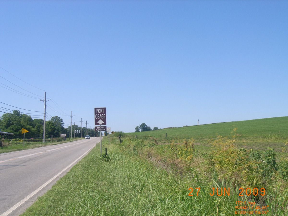
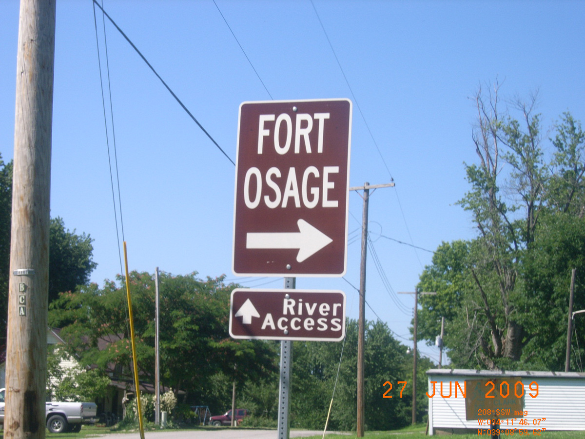
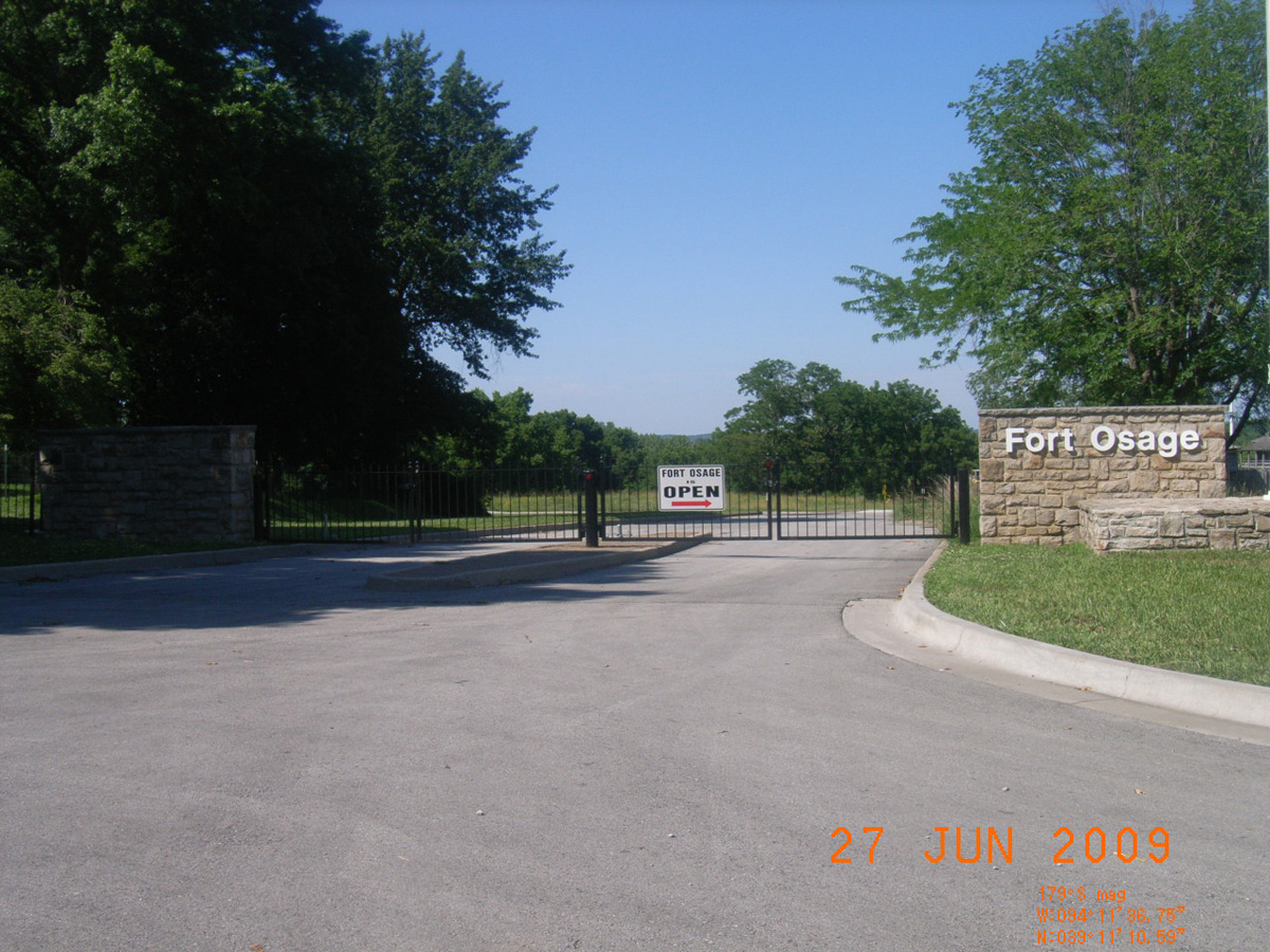
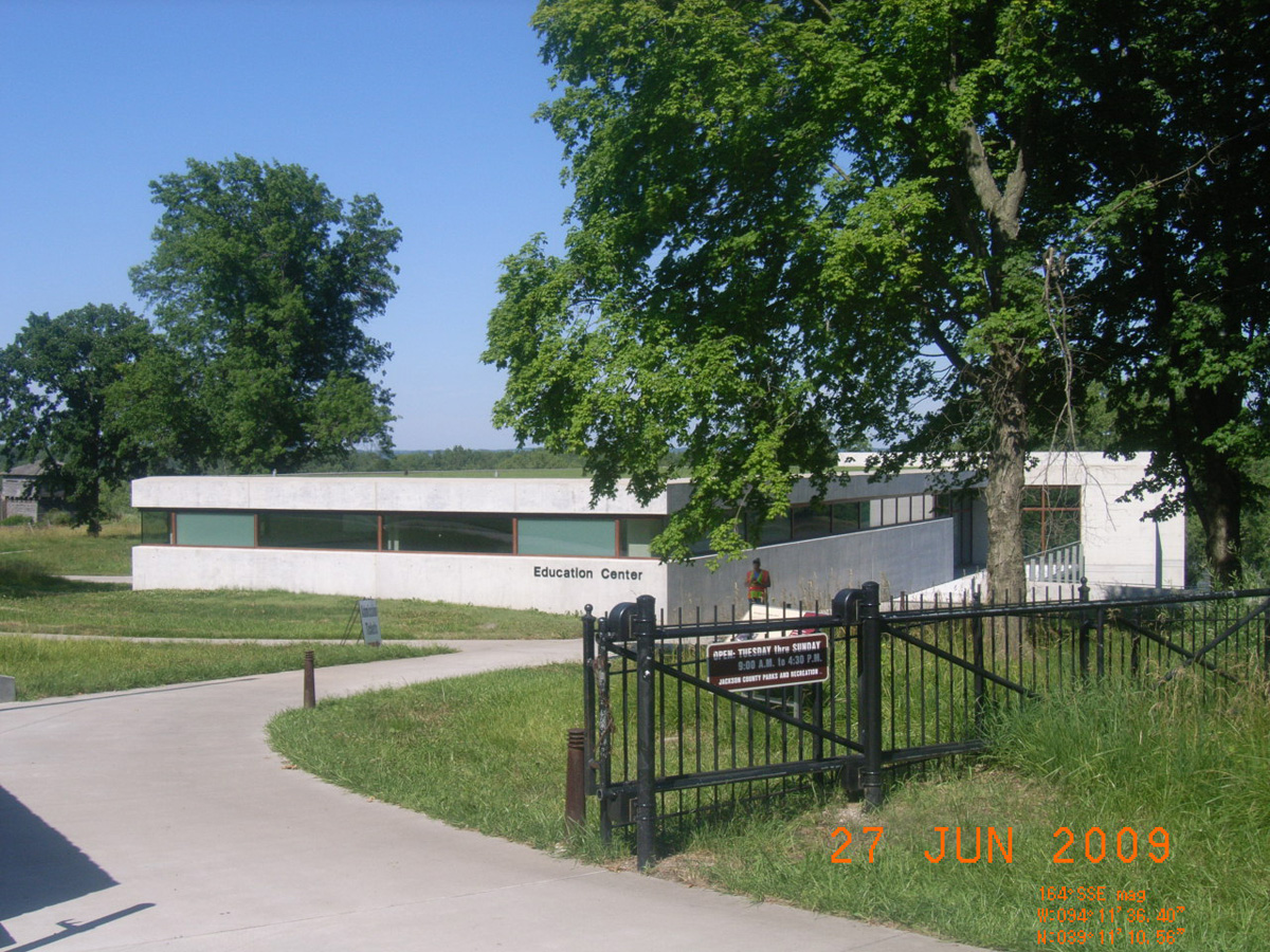
Fort Osage
Jackson County, Missouri: 39.18638074, -94.19313879
Fort Osage
- Date Assessed: 2009-06-27
- File Name: RIMG0188.JPG
- Folder: C26JuneCam1
- Camera Direction: 163°
Fort Osage -->
- Date Assessed: 2009-06-27
- File Name: RIMG0189.JPG
- Folder: C26JuneCam1
- Camera Direction: 163°
Fort Osage
- Date Assessed: 2009-06-27
- File Name: RIMG0190.JPG
- Folder: C26JuneCam1
- Camera Direction: 163°
Education Center
- Date Assessed: 2009-06-27
- File Name: RIMG0191.JPG
- Folder: C26JuneCam1
- Camera Direction: 202°
- Date Assessed: 2009-06-27
- File Name: RIMG0192.JPG
- Folder: C26JuneCam1
- Camera Direction: 214°
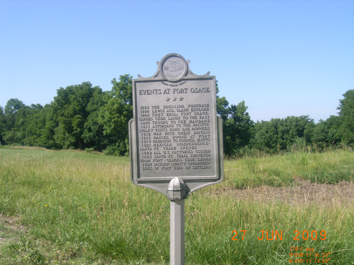
Events at Fort Osage
- Date Assessed: 2009-06-27
- File Name: RIMG0193.JPG
- Folder: C26JuneCam1
- Camera Direction: 204°
- Date Assessed: 2009-06-27
- File Name: RIMG0194.JPG
- Folder: C26JuneCam1
- Camera Direction: 233°
- Date Assessed: 2009-06-27
- File Name: RIMG0195.JPG
- Folder: C26JuneCam1
- Camera Direction: 260°
- Date Assessed: 2009-06-27
- File Name: RIMG0196.JPG
- Folder: C26JuneCam1
- Camera Direction: 213°
- Date Assessed: 2009-06-27
- File Name: RIMG0197.JPG
- Folder: C26JuneCam1
- Camera Direction: 215°
- Date Assessed: 2009-06-27
- File Name: RIMG0198.JPG
- Folder: C26JuneCam1
- Camera Direction: 224°
- Date Assessed: 2009-06-27
- File Name: RIMG0199.JPG
- Folder: C26JuneCam1
- Camera Direction: 220°
- Date Assessed: 2009-06-27
- File Name: RIMG0200.JPG
- Folder: C26JuneCam1
- Camera Direction: 221°
Fort Osage (Continued from other side)
- Date Assessed: 2009-06-27
- File Name: RIMG0201.JPG
- Folder: C26JuneCam1
- Camera Direction: 208°
June 13, 1804 Campsite, Brunswick
Chariton County, Missouri: 39.4220283, -93.13174483
Old Dorion and the Fur Trade
- Date Assessed: 0000-00-00
- File Name: Picture 136.jpg
- Folder: C27JuneCam1
- Camera Direction: 95°
Lewis & Clark Campsite, June 13 1804
- Date Assessed: 0000-00-00
- File Name: Picture 137.jpg
- Folder: C27JuneCam1
- Camera Direction: 95°
Miami Boat Ramp
Saline County, Missouri: 39.32536422, -93.22985433
Reading the River
- Date Assessed: 0000-00-00
- File Name: Picture 123.jpg
- Folder: C27JuneCam1
- Camera Direction: 86°
Van Meter State Park
Saline County, Missouri: 39.28102025, -93.26375486
Historical Marker
- Date Assessed: 0000-00-00
- File Name: Picture 131.jpg
- Folder: C27JuneCam1
- Camera Direction: 86°
[Unreadable from photo]
- Date Assessed: 0000-00-00
- File Name: Picture 132.jpg
- Folder: C27JuneCam1
- Camera Direction: 307°
Moreau Public Fishing Access
Cole County, Missouri: 38.54169875, -92.10654784
Moreau 50 Public Fishing Access
- Date Assessed: 2009-06-29
- File Name: RIMG0282.JPG
- Folder: C29JuneCam2
- Camera Direction: 340°
This Bird Sang All Last Night
- Date Assessed: 2009-06-29
- File Name: RIMG0283.JPG
- Folder: C29JuneCam2
- Camera Direction: 224°
- Date Assessed: 2009-06-29
- File Name: RIMG0284.JPG
- Folder: C29JuneCam2
- Camera Direction: 86°
- Date Assessed: 2009-06-29
- File Name: RIMG0285.JPG
- Folder: C29JuneCam2
- Camera Direction: 170°
- Date Assessed: 2009-06-29
- File Name: RIMG0286.JPG
- Folder: C29JuneCam2
- Camera Direction: 171°
- Date Assessed: 2009-06-29
- File Name: RIMG0287.JPG
- Folder: C29JuneCam2
- Camera Direction: 154°
- Date Assessed: 2009-06-29
- File Name: RIMG0288.JPG
- Folder: C29JuneCam2
- Camera Direction: 219°
- Date Assessed: 2009-06-29
- File Name: RIMG0289.JPG
- Folder: C29JuneCam2
- Camera Direction: 218°
- Date Assessed: 2009-06-29
- File Name: RIMG0290.JPG
- Folder: C29JuneCam2
- Camera Direction: 177°
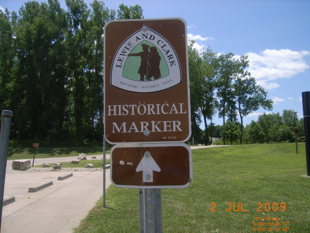
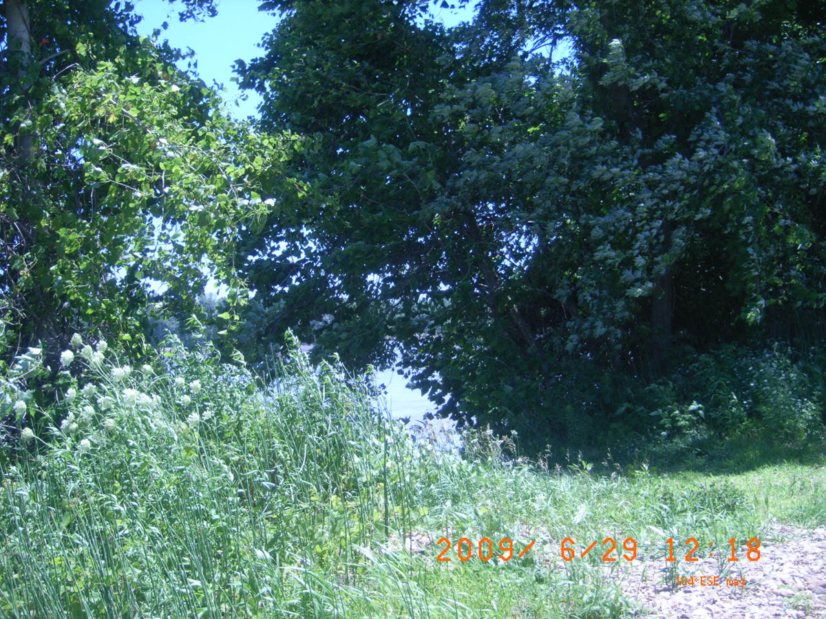
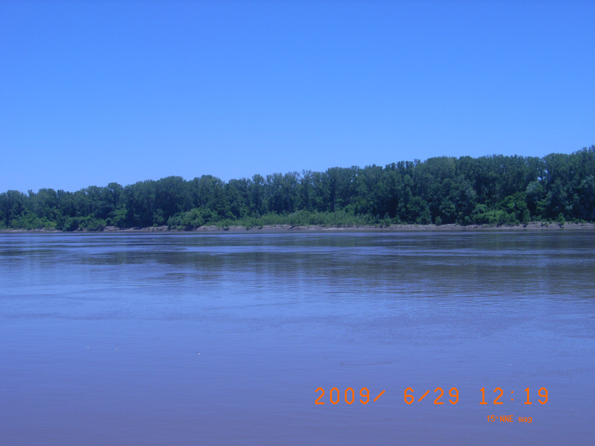
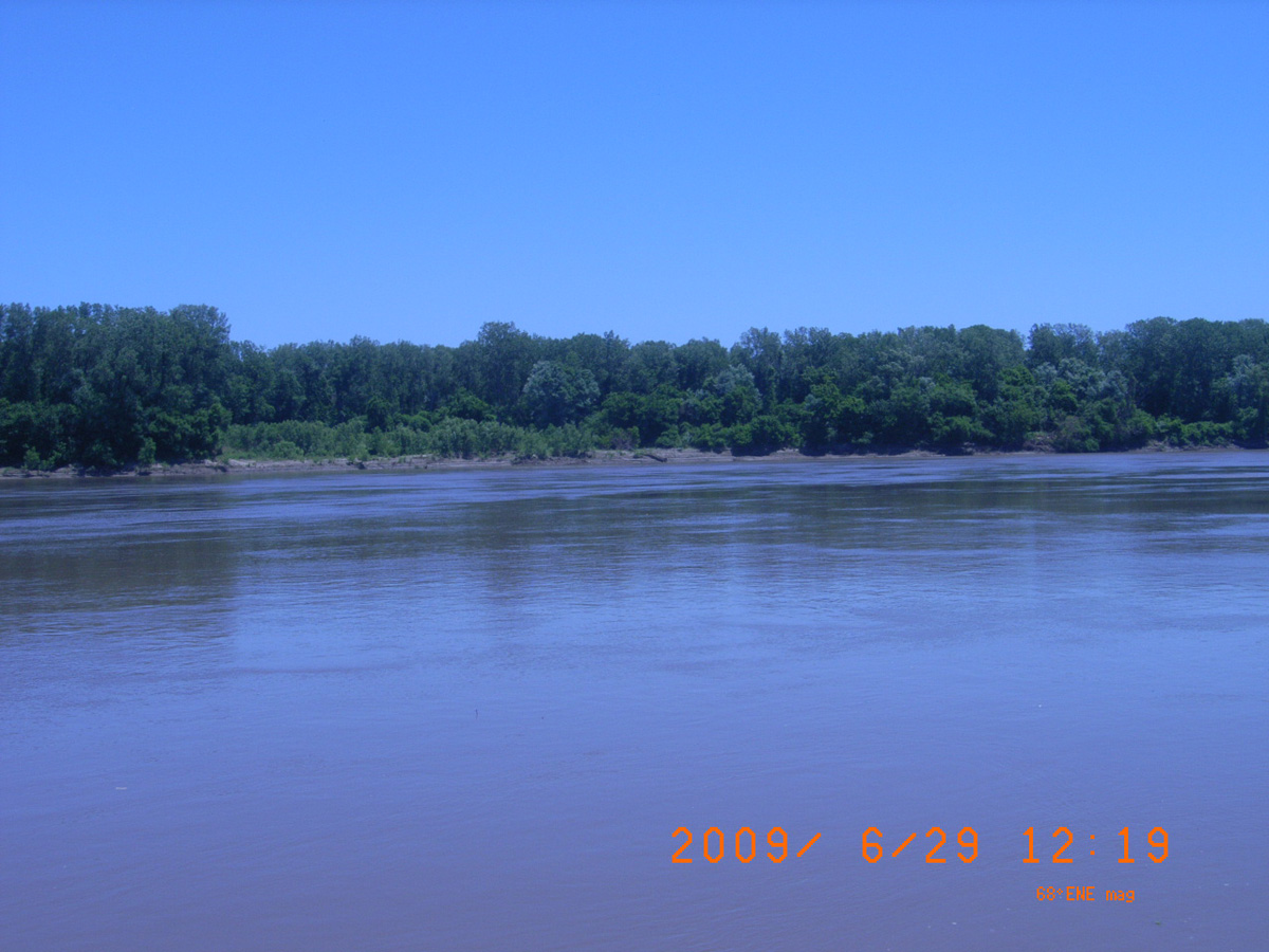
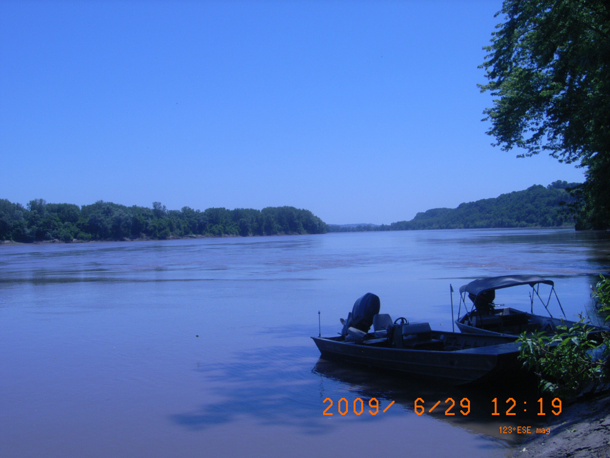
Clark's Hill / Norton State Historic Site / Osage Trail
Cole County, Missouri: 38.55846474, -92.02974821
Clark's Hill / Norton State Historic Site
- Date Assessed: 2009-06-29
- File Name: RIMG0298.JPG
- Folder: C29JuneCam2
- Camera Direction: 168°
Historical Marker
- Date Assessed: 2009-06-29
- File Name: RIMG0299.JPG
- Folder: C29JuneCam2
- Camera Direction: 165°
Osage Trail
- Date Assessed: 2009-06-29
- File Name: RIMG0300.JPG
- Folder: C29JuneCam2
- Camera Direction: 169°
Cultural History of Clark's Hill
- Date Assessed: 2009-06-29
- File Name: RIMG0301.JPG
- Folder: C29JuneCam2
- Camera Direction: 194°
Lewis and Clark in Missouri
- Date Assessed: 2009-06-29
- File Name: RIMG0302.JPG
- Folder: C29JuneCam2
- Camera Direction: 280°
Natural History of Clark's Hill
- Date Assessed: 2009-06-29
- File Name: RIMG0303.JPG
- Folder: C29JuneCam2
- Camera Direction: 130°
Osage Trail 1/2 mile
- Date Assessed: 2009-06-29
- File Name: RIMG0304.JPG
- Folder: C29JuneCam2
- Camera Direction: 189°
Osage Trail 1/2 mile
- Date Assessed: 2009-06-29
- File Name: RIMG0305.JPG
- Folder: C29JuneCam2
- Camera Direction: 189°
Smoky Waters Conservation Area
Cole County, Missouri: 38.56374306, -92.02047723
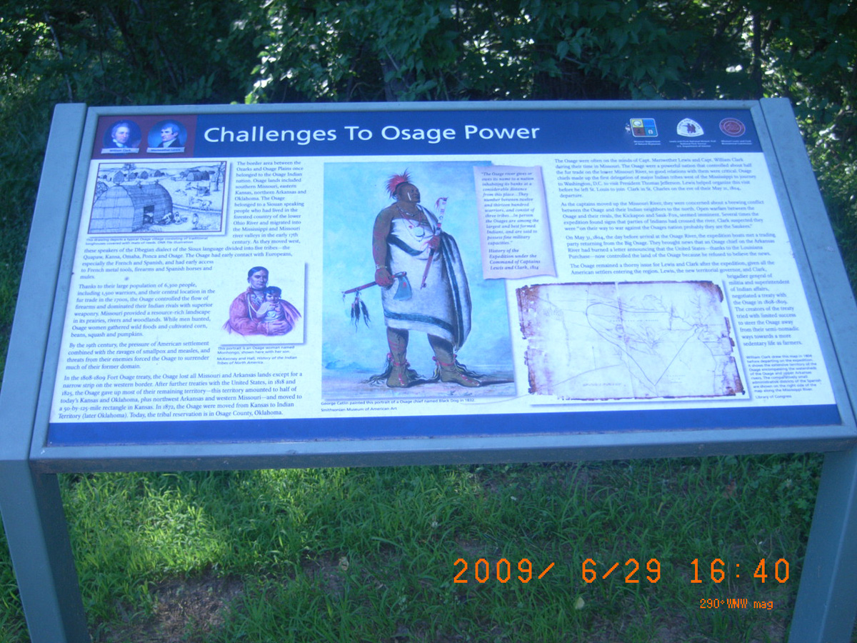
Challenges to Osage Power
- Date Assessed: 2009-06-29
- File Name: RIMG0306.JPG
- Folder: C29JuneCam2
- Camera Direction: 17°
The Mouth of the Osage
- Date Assessed: 2009-06-29
- File Name: RIMG0308.JPG
- Folder: C29JuneCam2
- Camera Direction: 14°
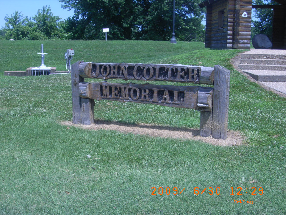
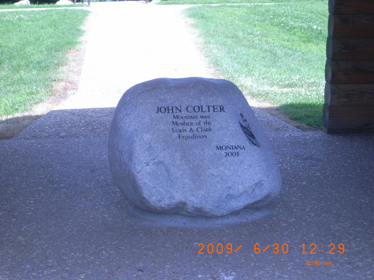
John Colter Memorial, New Haven
Franklin County, Missouri: 38.61498, -91.21323
John Colter Memorial
- Date Assessed: 2009-06-30
- File Name: Picture 104.jpg
- Folder: C30JuneCam2
- Camera Direction: 222°
Private John Colter ca. 1775-1812
- Date Assessed: 2009-06-30
- File Name: Picture 105.jpg
- Folder: C30JuneCam2
- Camera Direction: 222°
John Colter: Mountain man, member of the Lewis & Clark Expedition
- Date Assessed: 2009-06-30
- File Name: Picture 106.jpg
- Folder: C30JuneCam2
- Camera Direction: 257°
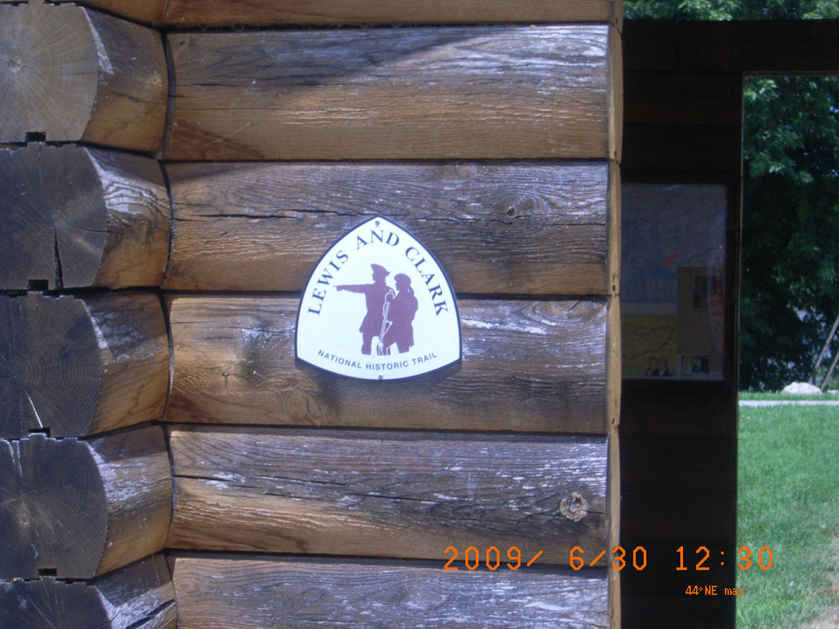
Lewis and Clark National Historic Trail
- Date Assessed: 2009-06-30
- File Name: Picture 107.jpg
- Folder: C30JuneCam2
- Camera Direction: 257°
Private John Colter
- Date Assessed: 2009-06-30
- File Name: Picture 108.jpg
- Folder: C30JuneCam2
- Camera Direction: 193°
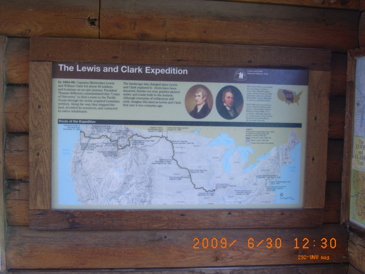
The Lewis and Clark Expedition
- Date Assessed: 2009-06-30
- File Name: Picture 109.jpg
- Folder: C30JuneCam2
- Camera Direction: 179°
The Lewis and Clark Trail
- Date Assessed: 2009-06-30
- File Name: Picture 110.jpg
- Folder: C30JuneCam2
- Camera Direction: 110°
Colter's Escape from the Blackfeet Indians
- Date Assessed: 2009-06-30
- File Name: Picture 111.jpg
- Folder: C30JuneCam2
- Camera Direction: 181°
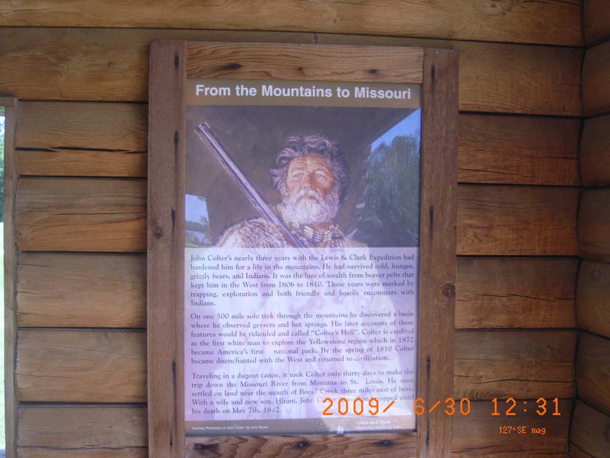
From the Mountains to the Missouri
- Date Assessed: 2009-06-30
- File Name: Picture 112.jpg
- Folder: C30JuneCam2
- Camera Direction: 204°
Private John Colter
- Date Assessed: 2009-06-30
- File Name: Picture 113.jpg
- Folder: C30JuneCam2
- Camera Direction: 208°
- Date Assessed: 2009-06-30
- File Name: Picture 114.jpg
- Folder: C30JuneCam2
- Camera Direction: 170°
- Date Assessed: 2009-06-30
- File Name: Picture 115.jpg
- Folder: C30JuneCam2
- Camera Direction: 214°
- Date Assessed: 2009-06-30
- File Name: Picture 116.jpg
- Folder: C30JuneCam2
- Camera Direction: 335°
- Date Assessed: 2009-06-30
- File Name: Picture 117.jpg
- Folder: C30JuneCam2
- Camera Direction: 344°
- Date Assessed: 2009-06-30
- File Name: Picture 118.jpg
- Folder: C30JuneCam2
- Camera Direction: 53°
- Date Assessed: 2009-06-30
- File Name: Picture 119.jpg
- Folder: C30JuneCam2
- Camera Direction: 69°
Ferryboat Landing, New Haven
Franklin County, Missouri: 38.61309, -91.21114
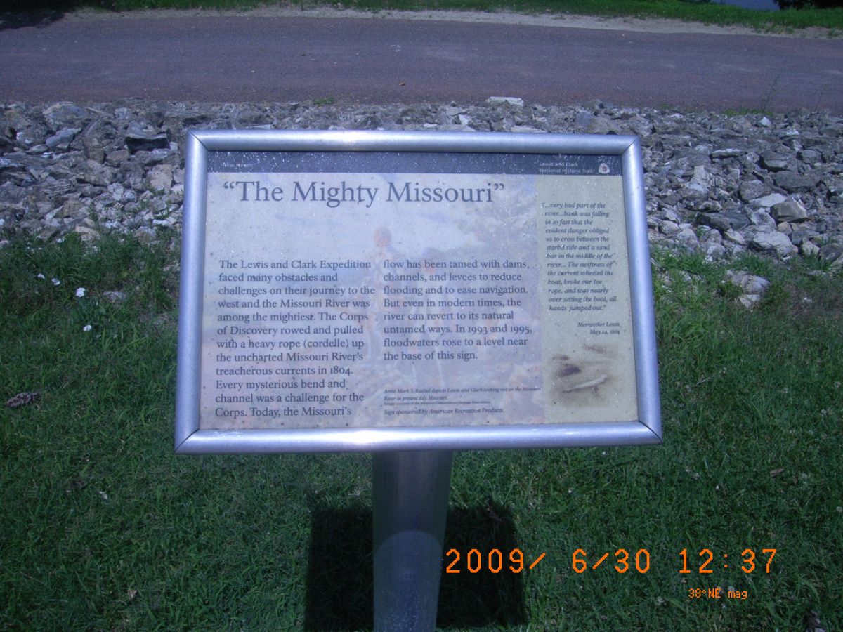
'The Mighty Missouri'
- Date Assessed: 2009-06-30
- File Name: Picture 120.jpg
- Folder: C30JuneCam2
- Camera Direction: 88°
'Boeuf Creek'
- Date Assessed: 2009-06-30
- File Name: Picture 121.jpg
- Folder: C30JuneCam2
- Camera Direction: 114°
Private John Colter
- Date Assessed: 2009-06-30
- File Name: Picture 122.jpg
- Folder: C30JuneCam2
- Camera Direction: 148°
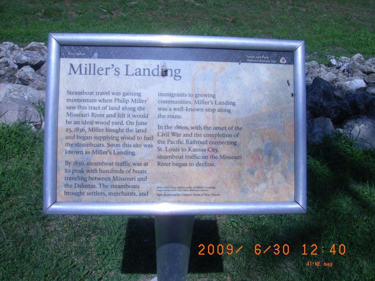
Miller's Landing
- Date Assessed: 2009-06-30
- File Name: Picture 123.jpg
- Folder: C30JuneCam2
- Camera Direction: 153°
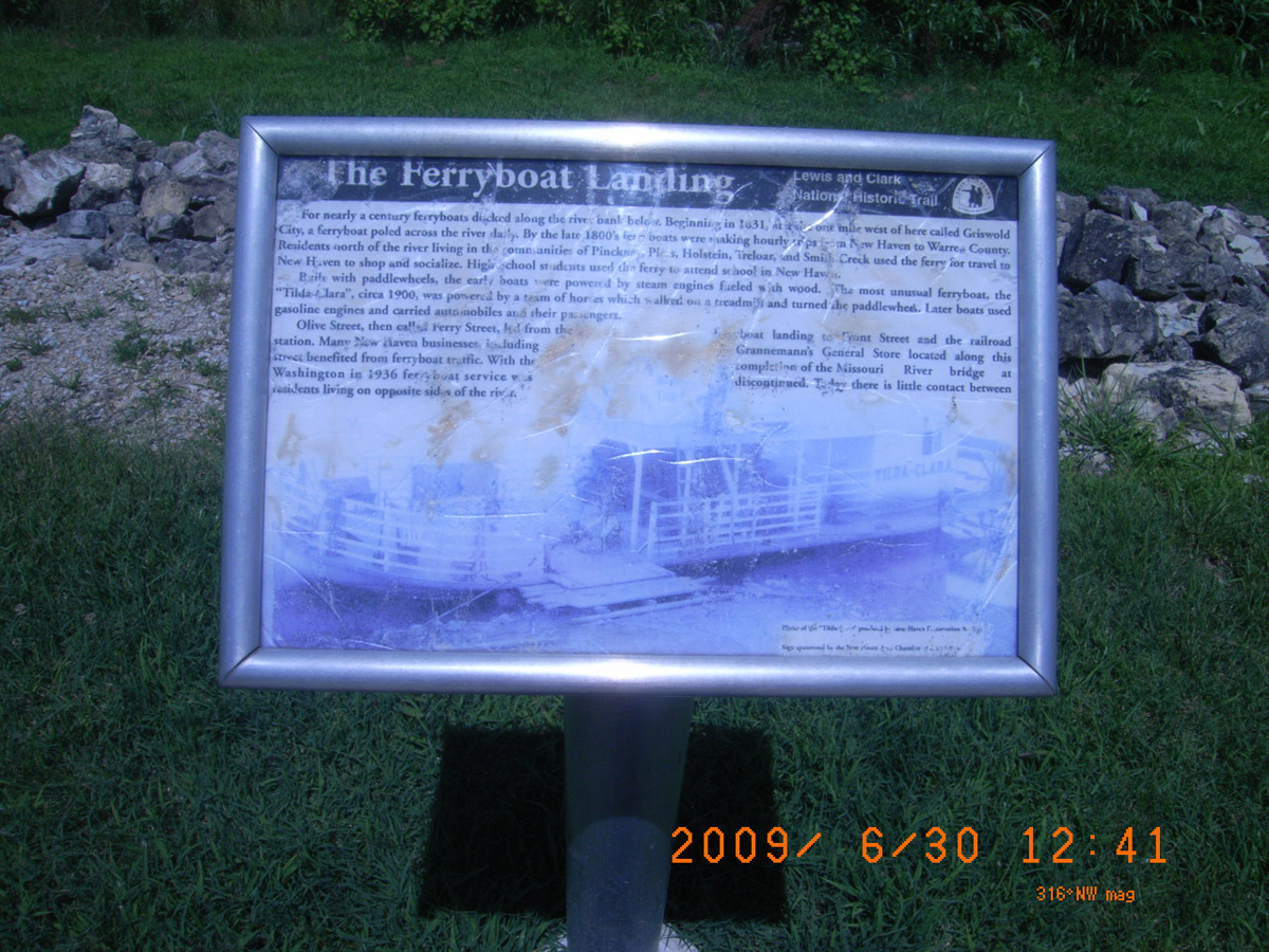
The Ferryboat Landing
- Date Assessed: 2009-06-30
- File Name: Picture 124.jpg
- Folder: C30JuneCam2
- Camera Direction: 185°
Colter's Landing Public Fishing Access
Franklin County, Missouri: 38.58926736, -91.16281629
Colter's Landing Public Fishing Access
- Date Assessed: 2009-06-30
- File Name: Picture 131.jpg
- Folder: C30JuneCam2
- Camera Direction: 190°
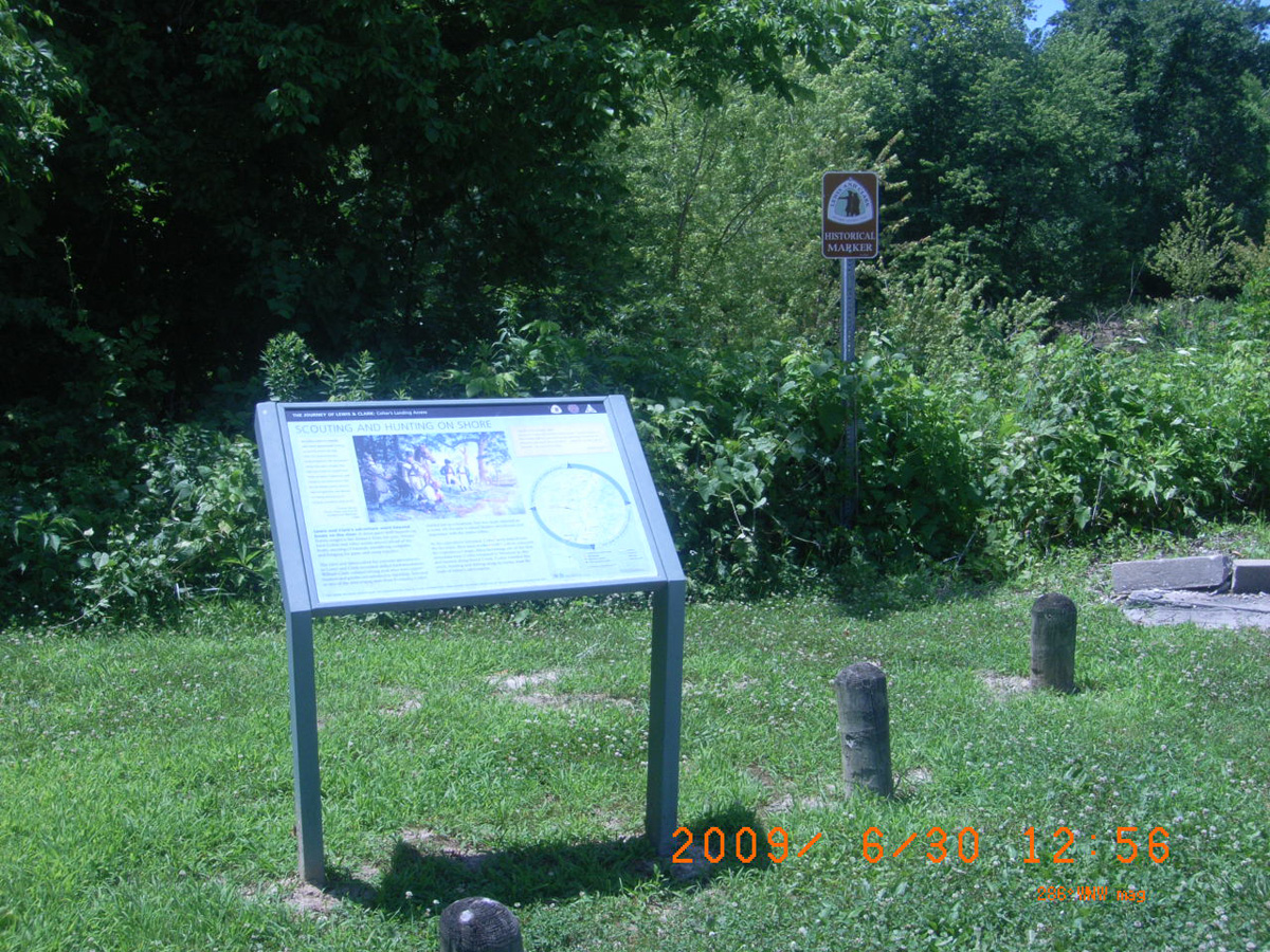
Scouting and Hunting on Shore
- Date Assessed: 2009-06-30
- File Name: Picture 132.jpg
- Folder: C30JuneCam2
- Camera Direction: 79°
Scouting and Hunting on Shore
- Date Assessed: 2009-06-30
- File Name: Picture 133.jpg
- Folder: C30JuneCam2
- Camera Direction: 126°
- Date Assessed: 2009-06-30
- File Name: Picture 134.jpg
- Folder: C30JuneCam2
- Camera Direction: 94°
- Date Assessed: 2009-06-30
- File Name: Picture 135.jpg
- Folder: C30JuneCam2
- Camera Direction: 300°
- Date Assessed: 2009-06-30
- File Name: Picture 136.jpg
- Folder: C30JuneCam2
- Camera Direction: 299°
- Date Assessed: 2009-06-30
- File Name: Picture 137.jpg
- Folder: C30JuneCam2
- Camera Direction: 259°
- Date Assessed: 2009-06-30
- File Name: Picture 138.jpg
- Folder: C30JuneCam2
- Camera Direction: 131°
- Date Assessed: 2009-06-30
- File Name: Picture 139.jpg
- Folder: C30JuneCam2
- Camera Direction: 102°
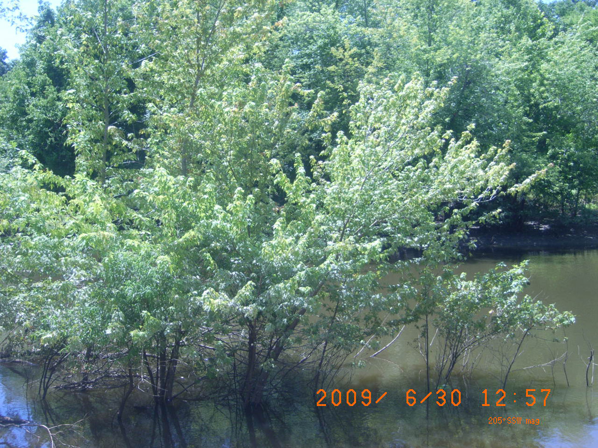
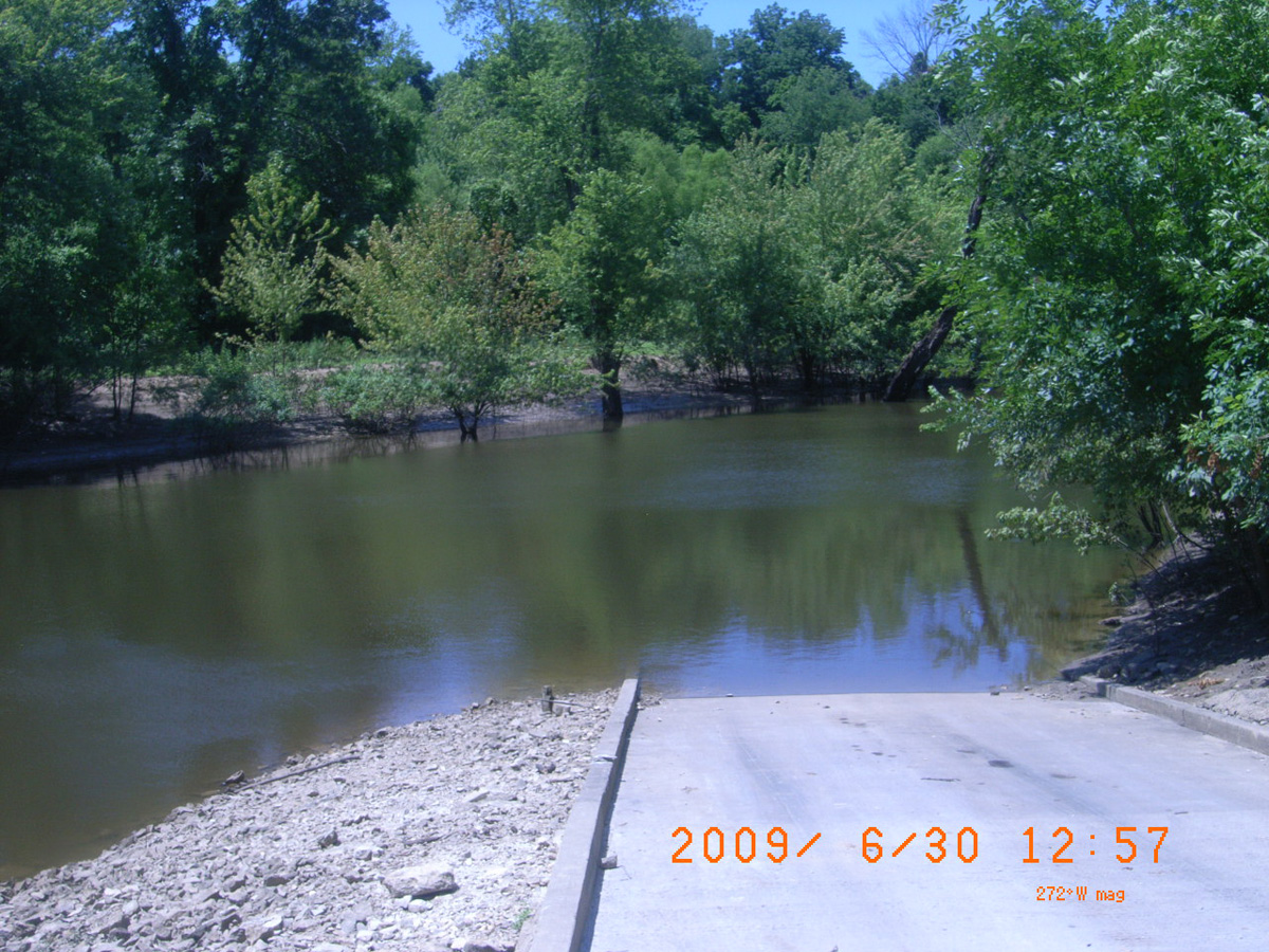
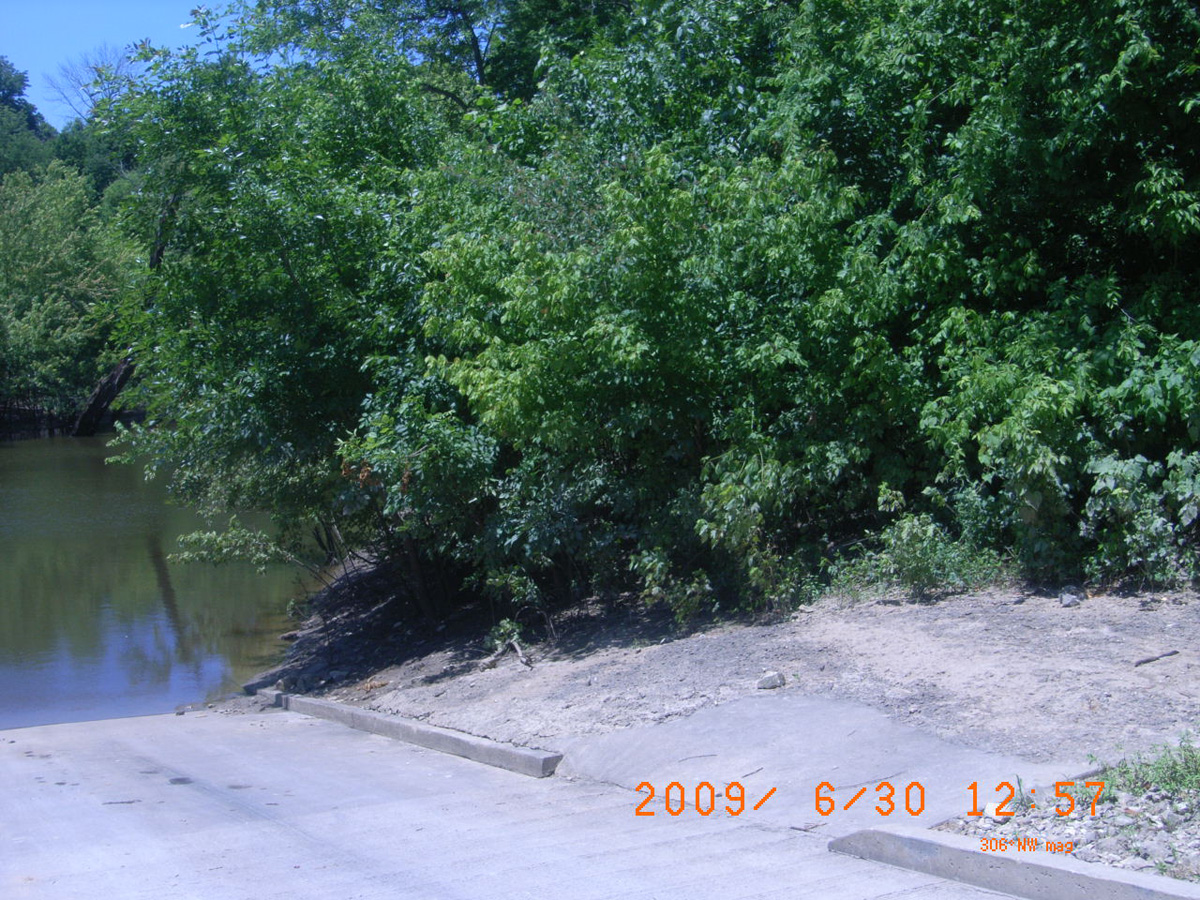
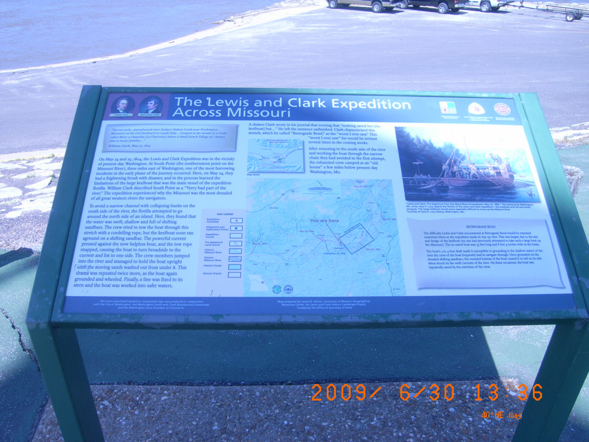
Riverside Park, Washington
Franklin County, Missouri: 38.56091265, -91.01034066
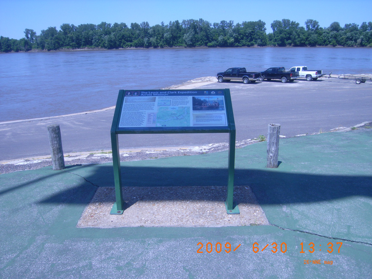
The Lewis and Clark Expedition Across the Missouri
- Date Assessed: 2009-06-30
- File Name: Picture 176.jpg
- Folder: C30JuneCam2
- Camera Direction: 93°
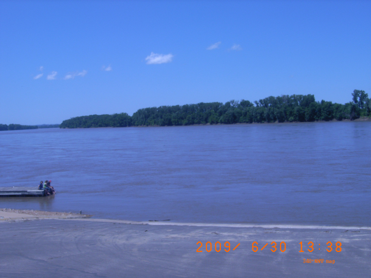
The Lewis and Clark Expedition Across the Missouri
- Date Assessed: 2009-06-30
- File Name: Picture 177.jpg
- Folder: C30JuneCam2
- Camera Direction: 214°
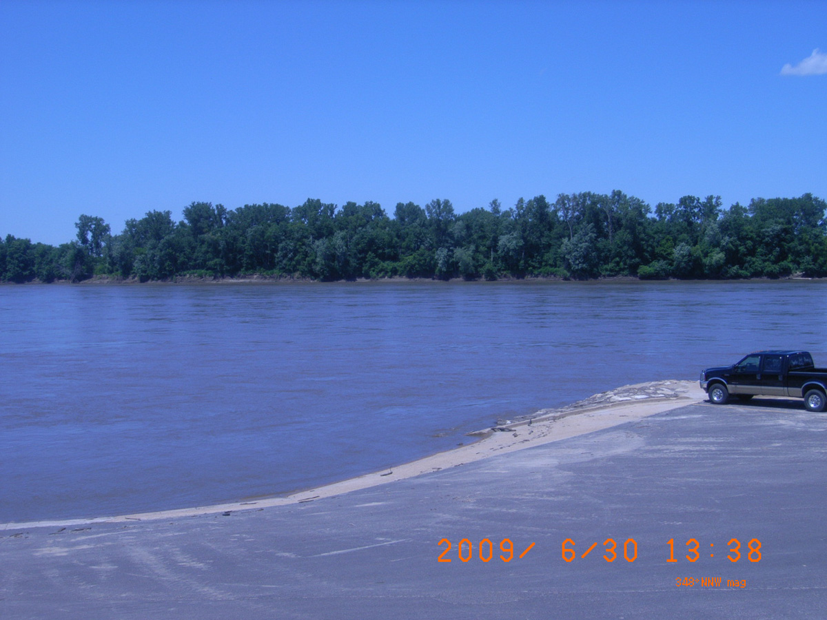
The Lewis and Clark Expedition Across the Missouri
- Date Assessed: 2009-06-30
- File Name: Picture 178.jpg
- Folder: C30JuneCam2
- Camera Direction: 216°
Peace and Friendship
- Date Assessed: 2009-06-30
- File Name: Picture 179.jpg
- Folder: C30JuneCam2
- Camera Direction: 219°
Robert Frazer
- Date Assessed: 2009-06-30
- File Name: Picture 180.jpg
- Folder: C30JuneCam2
- Camera Direction: 204°
- Date Assessed: 2009-06-30
- File Name: Picture 181.jpg
- Folder: C30JuneCam2
- Camera Direction: 203°
- Date Assessed: 2009-06-30
- File Name: Picture 182.jpg
- Folder: C30JuneCam2
- Camera Direction: 162°
- Date Assessed: 2009-06-30
- File Name: Picture 183.jpg
- Folder: C30JuneCam2
- Camera Direction: 174°
- Date Assessed: 2009-06-30
- File Name: Picture 184.jpg
- Folder: C30JuneCam2
- Camera Direction: 290°
- Date Assessed: 2009-06-30
- File Name: Picture 185.jpg
- Folder: C30JuneCam2
- Camera Direction: 117°
- Date Assessed: 2009-06-30
- File Name: Picture 186.jpg
- Folder: C30JuneCam2
- Camera Direction: 138°
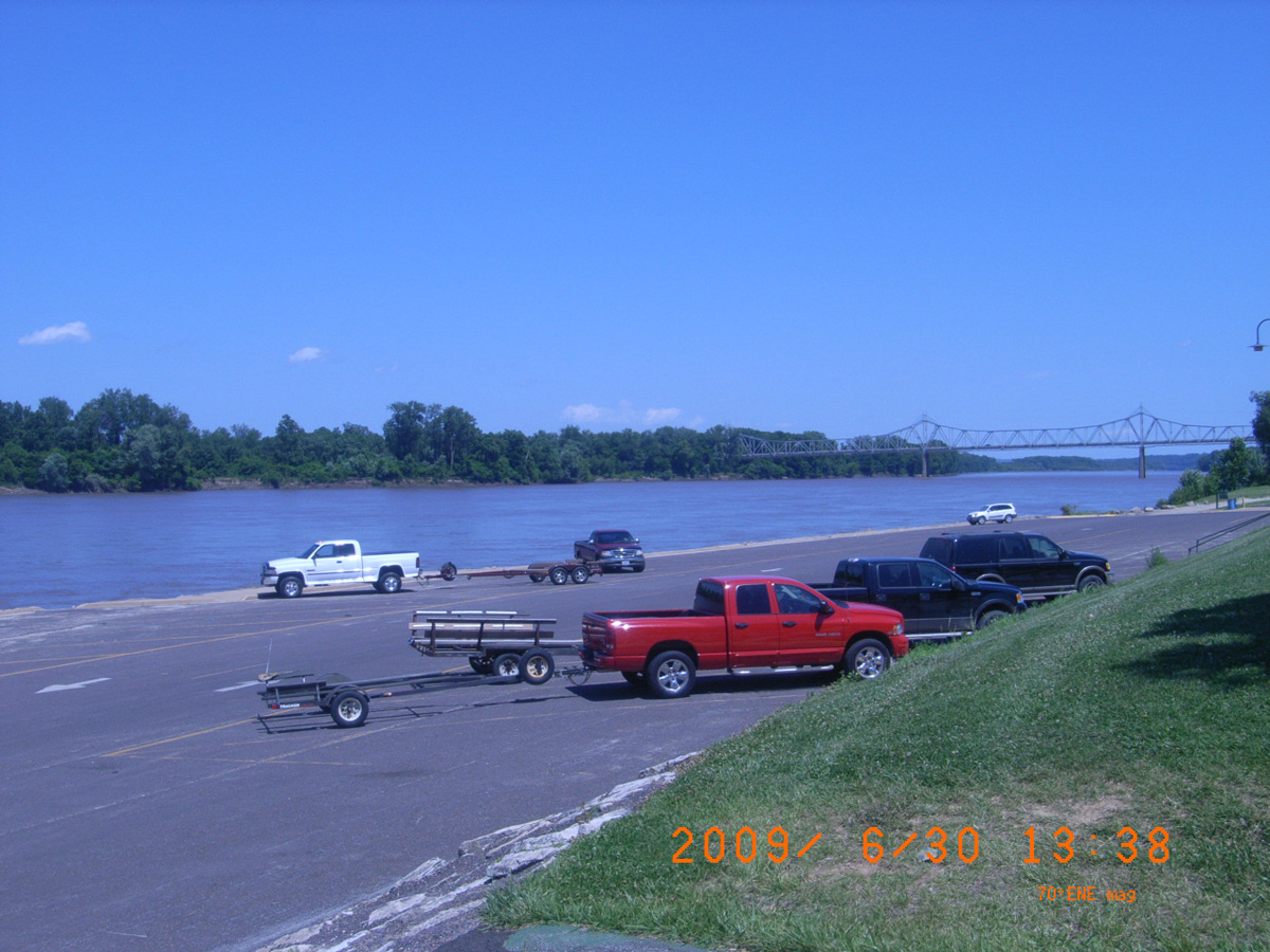
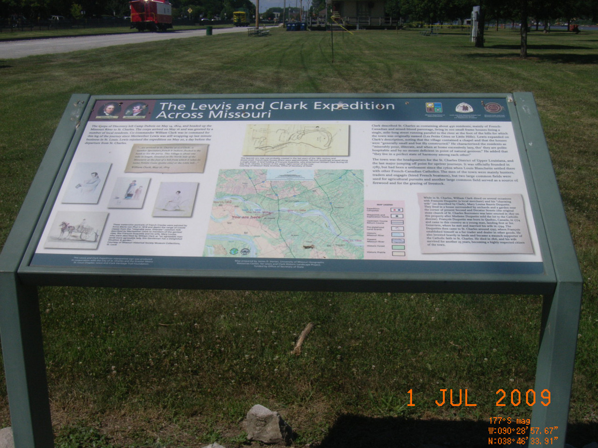
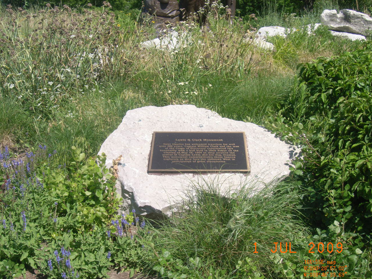
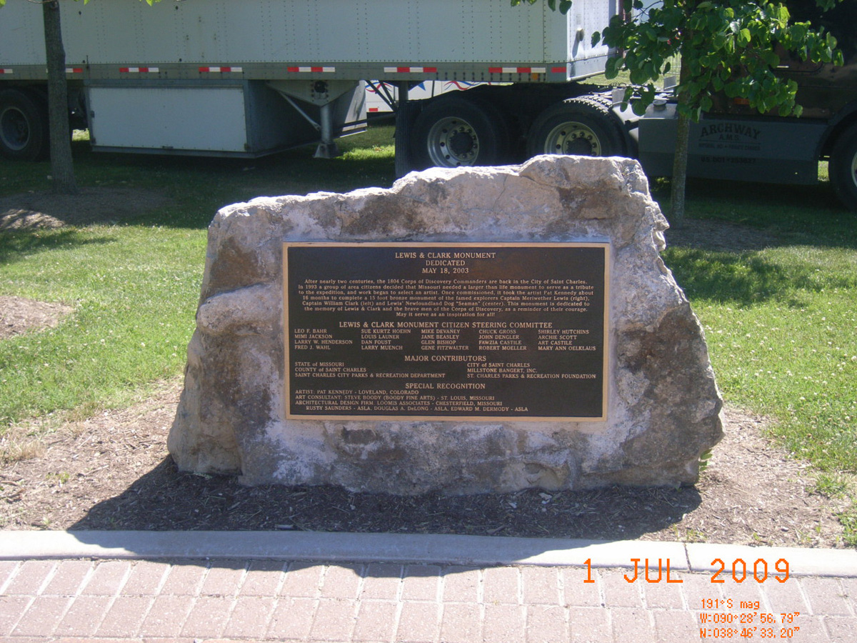
Frontier Park, Katy Trail, St. Charles
St. Charles County, Missouri: 38.77601522, -90.48252007
Frontier Park, City of St. Charles Parks & Recreation
- Date Assessed: 2009-06-30
- File Name: RIMG0169.JPG
- Folder: C30JuneCam1
- Camera Direction: 230°
The Lewis and Clark Expedition Across the Missouri
- Date Assessed: 2009-06-30
- File Name: RIMG0170.JPG
- Folder: C30JuneCam1
- Camera Direction: 220°
Lewis & Clark Monument
- Date Assessed: 2009-06-30
- File Name: RIMG0171.JPG
- Folder: C30JuneCam1
- Camera Direction: 175°
Lewis & Clark Monument Dedicated May 18, 2003
- Date Assessed: 2009-06-30
- File Name: RIMG0172.JPG
- Folder: C30JuneCam1
- Camera Direction: 141°
Captain Clark's Journal . . . St. Charles episode
- Date Assessed: 2009-06-30
- File Name: RIMG0173.JPG
- Folder: C30JuneCam1
- Camera Direction: 73°
Lewis & Clark Monument
- Date Assessed: 2009-06-30
- File Name: RIMG0174.JPG
- Folder: C30JuneCam1
- Camera Direction: 43°
River's Edge Trail, Missouri and Mississippi confluence (SW)
St. Louis County, Missouri: 38.81379675, -90.12578867
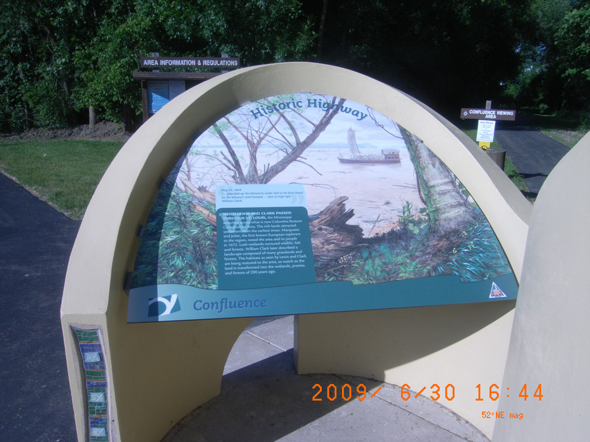
Historic Highway
- Date Assessed: 2009-06-30
- File Name: Picture 207.jpg
- Folder: C30JuneCam2
- Camera Direction: 111°
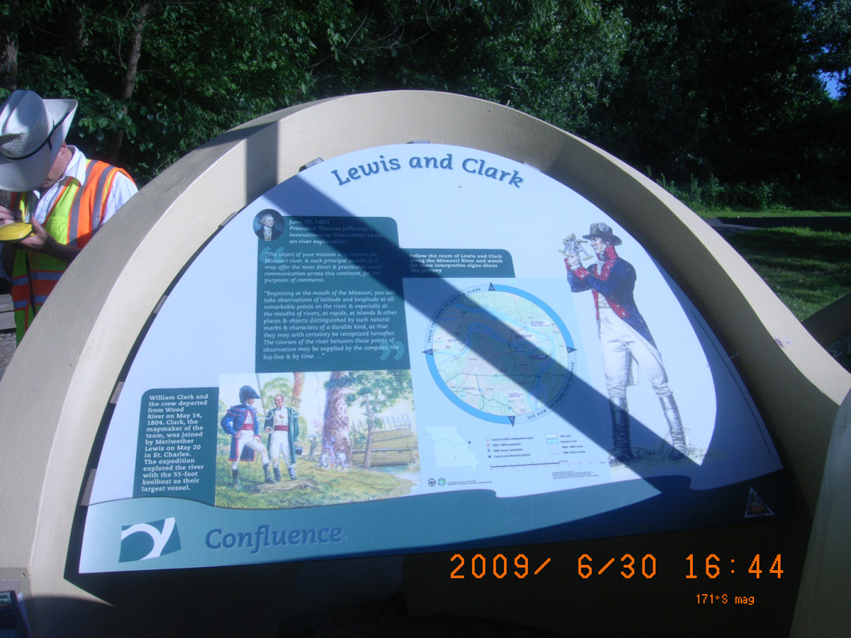
Lewis and Clark
- Date Assessed: 2009-06-30
- File Name: Picture 208.jpg
- Folder: C30JuneCam2
- Camera Direction: 194°
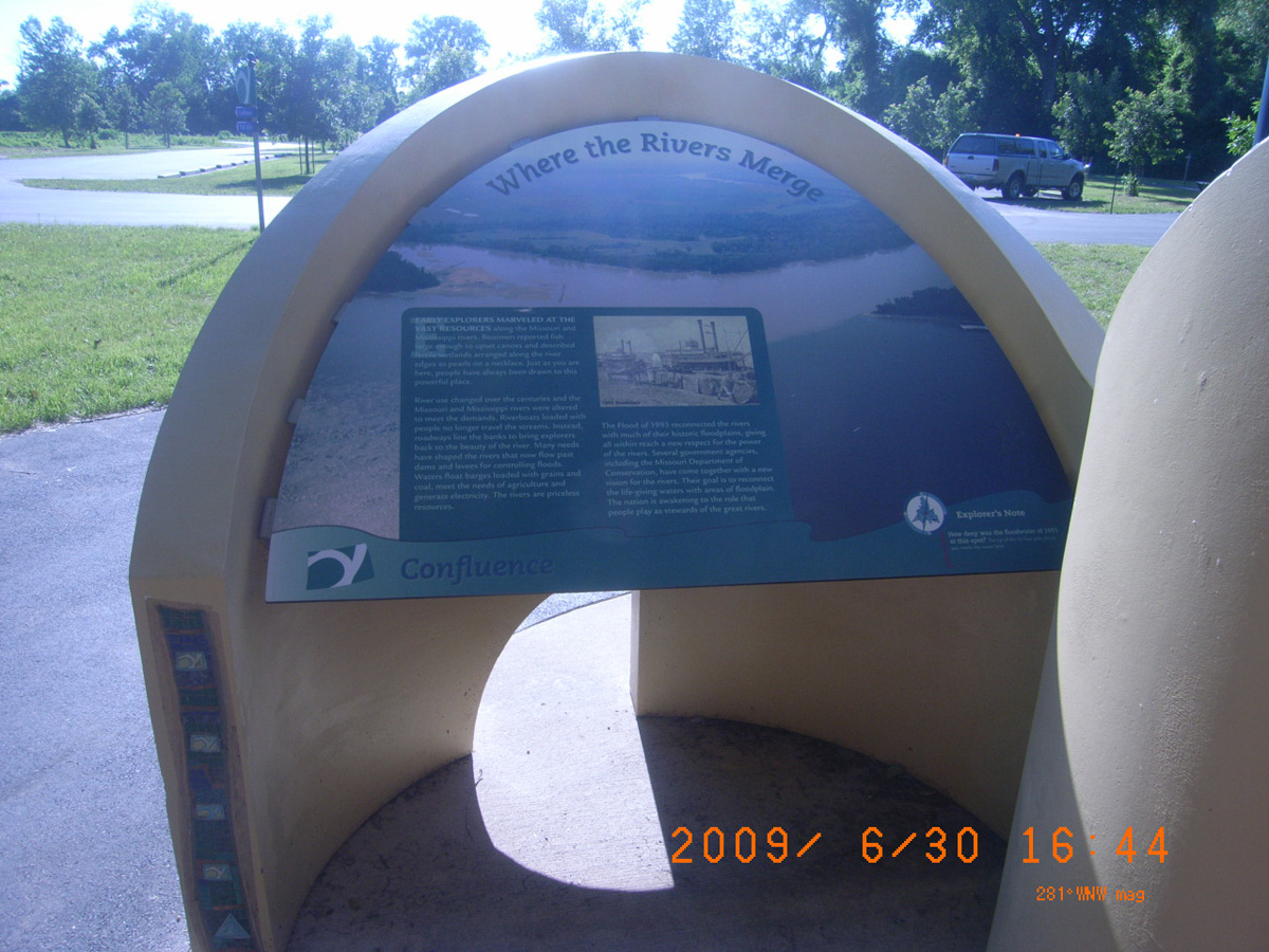
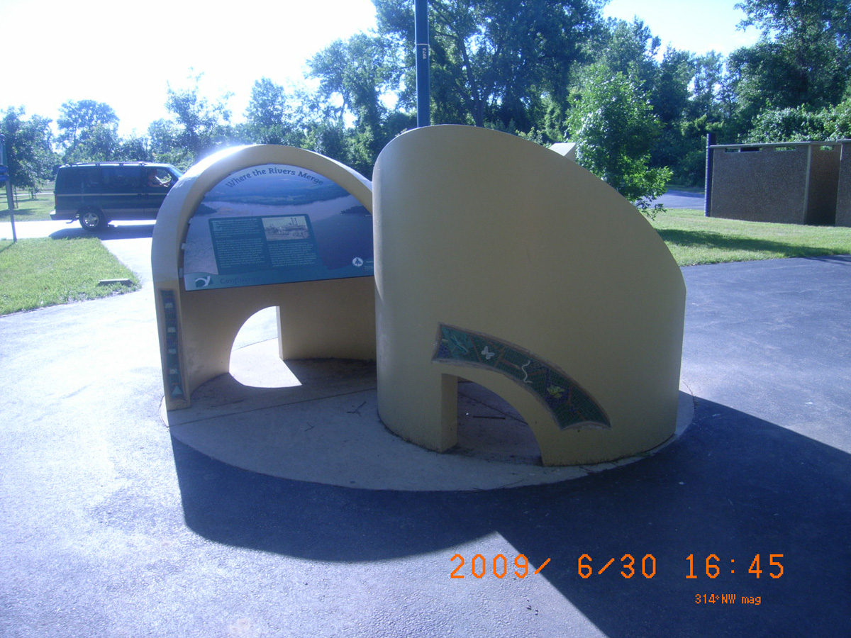
Where the Rivers Merge
- Date Assessed: 2009-06-30
- File Name: Picture 209.jpg
- Folder: C30JuneCam2
- Camera Direction: 139°
- Date Assessed: 2009-06-30
- File Name: Picture 210.jpg
- Folder: C30JuneCam2
- Camera Direction: 236°
- Date Assessed: 2009-06-30
- File Name: Picture 211.jpg
- Folder: C30JuneCam2
- Camera Direction: 233°
- Date Assessed: 2009-06-30
- File Name: Picture 212.jpg
- Folder: C30JuneCam2
- Camera Direction: 180°
- Date Assessed: 2009-06-30
- File Name: Picture 213.jpg
- Folder: C30JuneCam2
- Camera Direction: 202°
- Date Assessed: 2009-06-30
- File Name: Picture 214.jpg
- Folder: C30JuneCam2
- Camera Direction: 231°
- Date Assessed: 2009-06-30
- File Name: Picture 215.jpg
- Folder: C30JuneCam2
- Camera Direction: 239°
- Date Assessed: 2009-06-30
- File Name: Picture 216.jpg
- Folder: C30JuneCam2
- Camera Direction: 309°
- Date Assessed: 2009-06-30
- File Name: Picture 217.jpg
- Folder: C30JuneCam2
- Camera Direction: 317°
- Date Assessed: 2009-06-30
- File Name: Picture 218.jpg
- Folder: C30JuneCam2
- Camera Direction: 11°
- Date Assessed: 2009-06-30
- File Name: Picture 219.jpg
- Folder: C30JuneCam2
- Camera Direction: 174°
Klondike Park Boat Ramp, Klondike trail head, Katy Trail
St. Charles County, Missouri: 38.58403236, -90.8197862
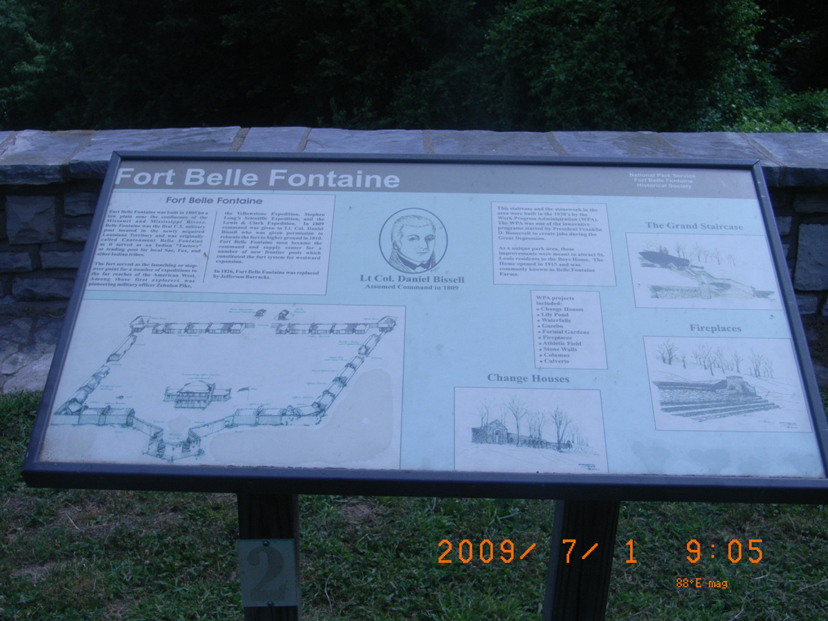
Klondike Park Boat Ramp
- Date Assessed: 2009-07-01
- File Name: RIMG0032.JPG
- Folder: C01JulyCam1
- Camera Direction: 164°
The Missouri River During The Lewis & Clark (Corps of Discovery) Expedition
- Date Assessed: 2009-07-01
- File Name: RIMG0033.JPG
- Folder: C01JulyCam1
- Camera Direction: 164°
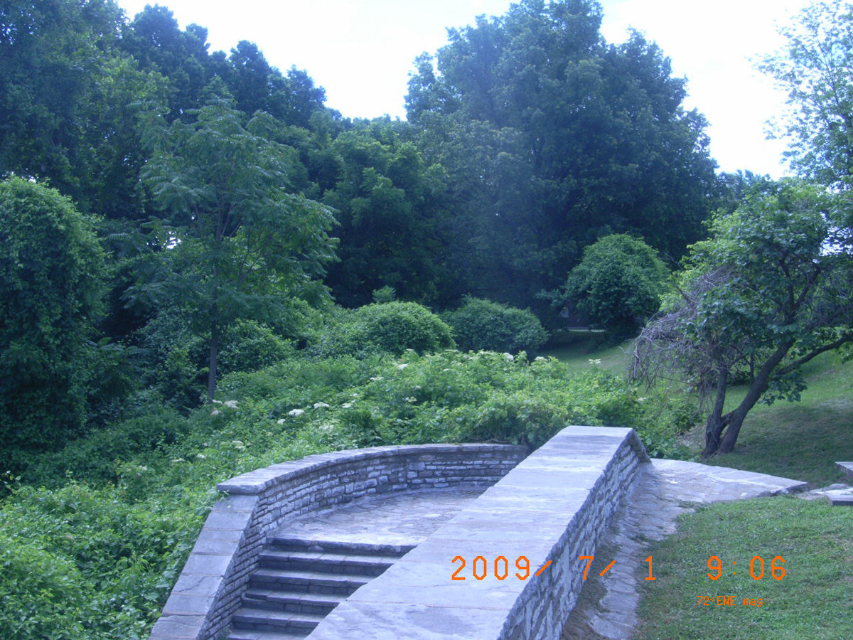
- Date Assessed: 2009-07-01
- File Name: RIMG0034.JPG
- Folder: C01JulyCam1
- Camera Direction: 164°
- Date Assessed: 2009-07-01
- File Name: RIMG0035.JPG
- Folder: C01JulyCam1
- Camera Direction: 219°
- Date Assessed: 2009-07-01
- File Name: RIMG0036.JPG
- Folder: C01JulyCam1
- Camera Direction: 198°
- Date Assessed: 2009-07-01
- File Name: RIMG0037.JPG
- Folder: C01JulyCam1
- Camera Direction: 180°
- Date Assessed: 2009-07-01
- File Name: RIMG0038.JPG
- Folder: C01JulyCam1
- Camera Direction: 203°
- Date Assessed: 2009-07-01
- File Name: RIMG0039.JPG
- Folder: C01JulyCam1
- Camera Direction: 203°
Carl R. Noren Public Fishing Access
Callaway County, Missouri: 38.58945741, -92.17911921
<-- Carl R. Noren Public Fishing Access
- Date Assessed: 2009-07-02
- File Name: RIMG0069.JPG
- Folder: C01JulyCam1
- Camera Direction: 206°
Welcome to Carl R. Noren Public Fishing Access
- Date Assessed: 2009-07-02
- File Name: RIMG0070.JPG
- Folder: C01JulyCam1
- Camera Direction: 226°
Historical Marker
- Date Assessed: 2009-07-02
- File Name: RIMG0071.JPG
- Folder: C01JulyCam1
- Camera Direction: 170°
[Text unreadable from photo]
- Date Assessed: 2009-07-02
- File Name: RIMG0072.JPG
- Folder: C01JulyCam1
- Camera Direction: 182°
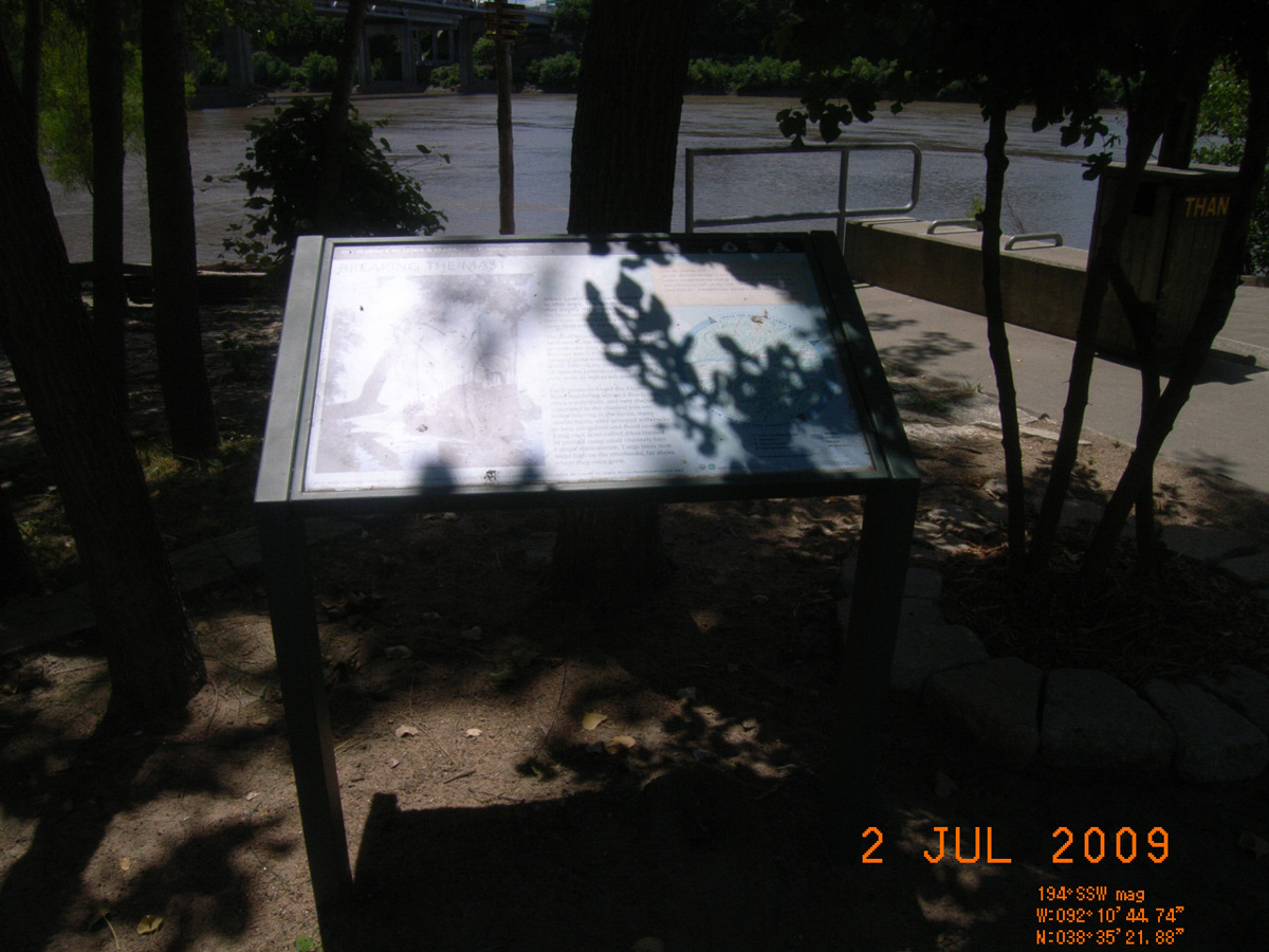
Breaking the Mast
- Date Assessed: 2009-07-02
- File Name: RIMG0073.JPG
- Folder: C01JulyCam1
- Camera Direction: 179°
- Date Assessed: 2009-07-02
- File Name: RIMG0074.JPG
- Folder: C01JulyCam1
- Camera Direction: 179°
- Date Assessed: 2009-07-02
- File Name: RIMG0075.JPG
- Folder: C01JulyCam1
- Camera Direction: 198°
- Date Assessed: 2009-07-02
- File Name: RIMG0076.JPG
- Folder: C01JulyCam1
- Camera Direction: 198°
- Date Assessed: 2009-07-02
- File Name: RIMG0077.JPG
- Folder: C01JulyCam1
- Camera Direction: 183°
- Date Assessed: 2009-07-02
- File Name: RIMG0078.JPG
- Folder: C01JulyCam1
- Camera Direction: 184°
- Date Assessed: 2009-07-02
- File Name: RIMG0079.JPG
- Folder: C01JulyCam1
- Camera Direction: 184°
- Date Assessed: 2009-07-02
- File Name: RIMG0080.JPG
- Folder: C01JulyCam1
- Camera Direction: 182°
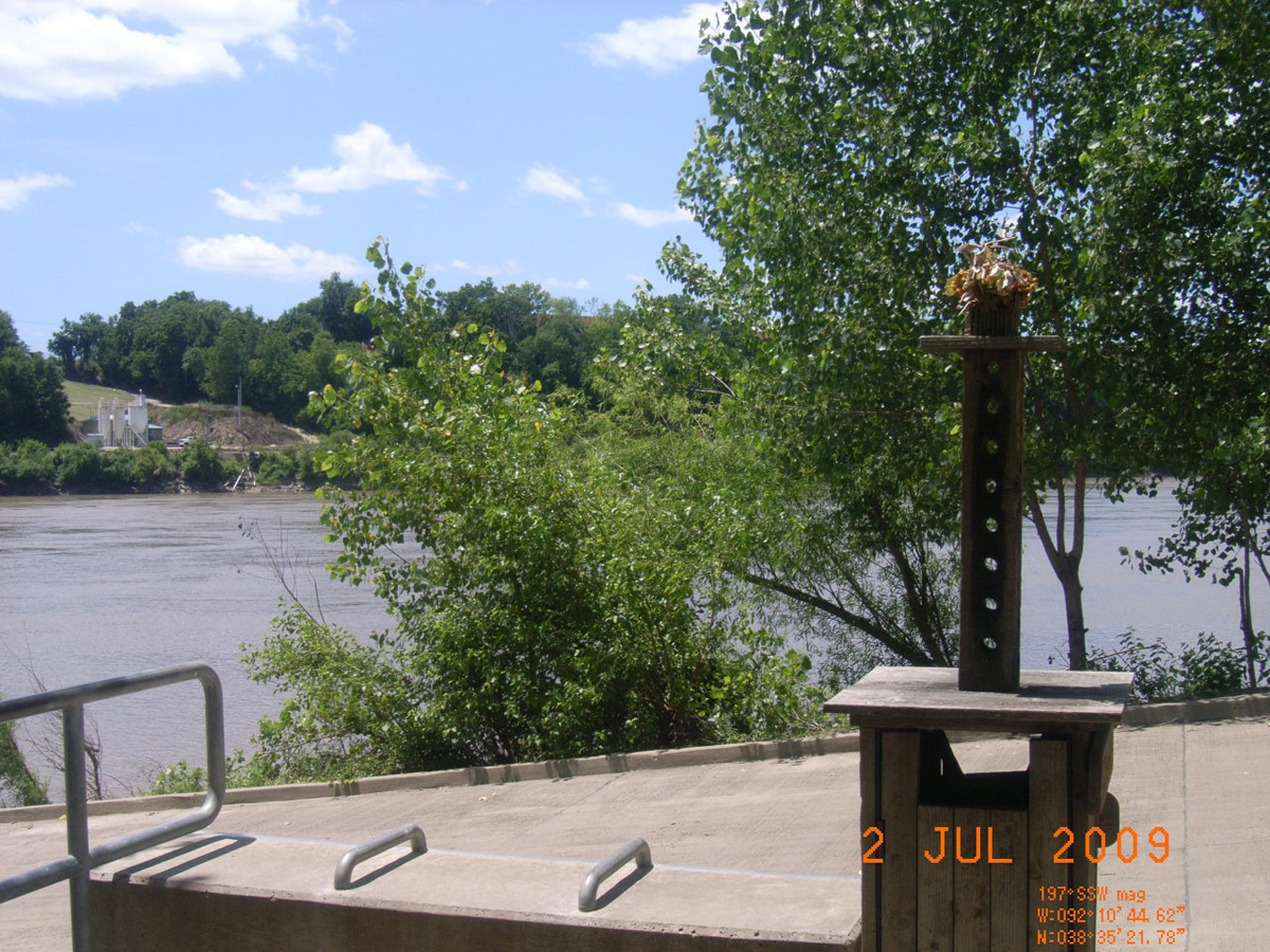
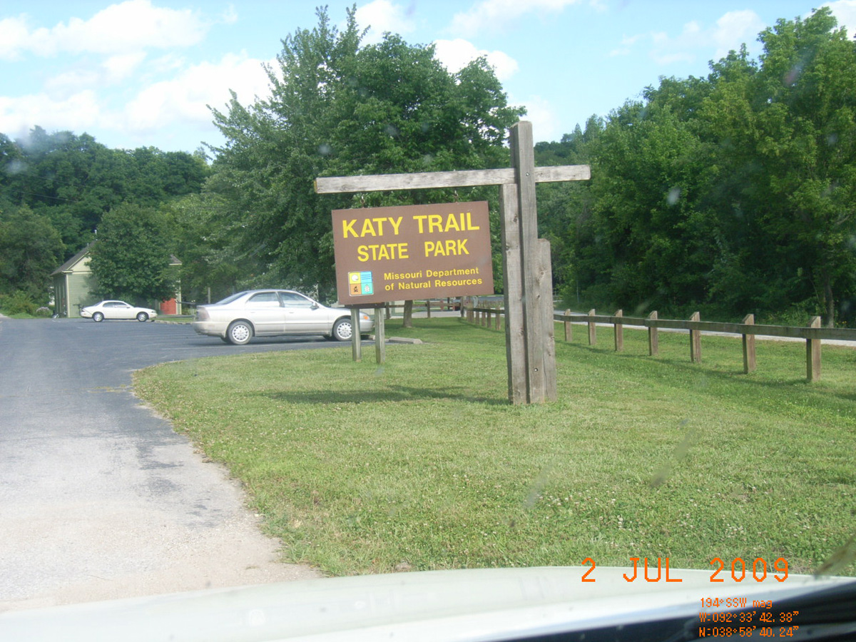
Katy Trail State Park, North Jefferson
St. Charles County, Missouri: 38.60585, -92.162902
Katy Trail State Park -->
- Date Assessed: 2009-07-02
- File Name: RIMG0082.JPG
- Folder: C01JulyCam1
- Camera Direction: 182°
Katy Trail State Park
- Date Assessed: 2009-07-02
- File Name: RIMG0083.JPG
- Folder: C01JulyCam1
- Camera Direction: 210°
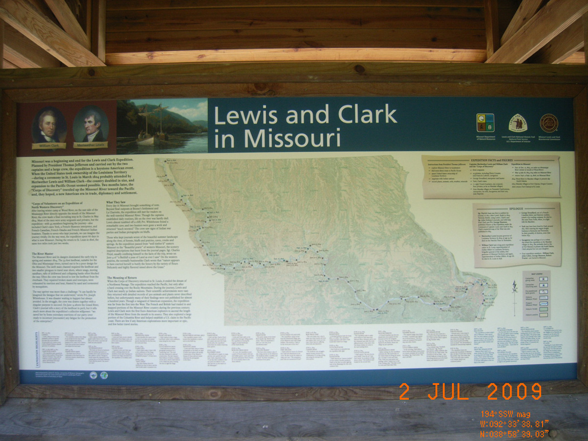
Lewis and Clark in Missouri
- Date Assessed: 2009-07-02
- File Name: RIMG0084.JPG
- Folder: C01JulyCam1
- Camera Direction: 210°
N. Jefferson to Hartsburg
- Date Assessed: 2009-07-02
- File Name: RIMG0085.JPG
- Folder: C01JulyCam1
- Camera Direction: 169°
N. Jefferson to Tebbetts
- Date Assessed: 2009-07-02
- File Name: RIMG0086.JPG
- Folder: C01JulyCam1
- Camera Direction: 172°
Katy Trail State Park - N. Jefferson
- Date Assessed: 2009-07-02
- File Name: RIMG0087.JPG
- Folder: C01JulyCam1
- Camera Direction: 16°
- Date Assessed: 2009-07-02
- File Name: RIMG0088.JPG
- Folder: C01JulyCam1
- Camera Direction: 188°
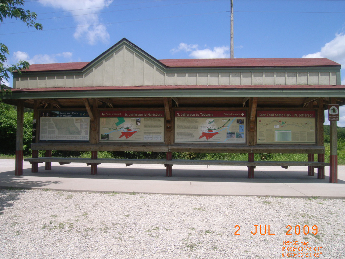
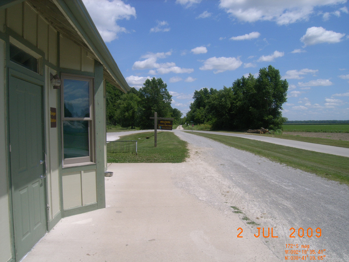
Katy Trail State Park, Hartsburg
Boone County, Missouri: 38.69438187, -92.3098049
Katy Trail State Park - Hartsburg
- Date Assessed: 2009-07-02
- File Name: RIMG0093.JPG
- Folder: C01JulyCam1
- Camera Direction: 210°
Hartsburg to N. Jefferson
- Date Assessed: 2009-07-02
- File Name: RIMG0094.JPG
- Folder: C01JulyCam1
- Camera Direction: 210°
Hartsburg to McBaine
- Date Assessed: 2009-07-02
- File Name: RIMG0095.JPG
- Folder: C01JulyCam1
- Camera Direction: 192°
Historical Marker
- Date Assessed: 2009-07-02
- File Name: RIMG0096.JPG
- Folder: C01JulyCam1
- Camera Direction: 176°
Hartsburg Community Services
- Date Assessed: 2009-07-02
- File Name: RIMG0097.JPG
- Folder: C01JulyCam1
- Camera Direction: 170°
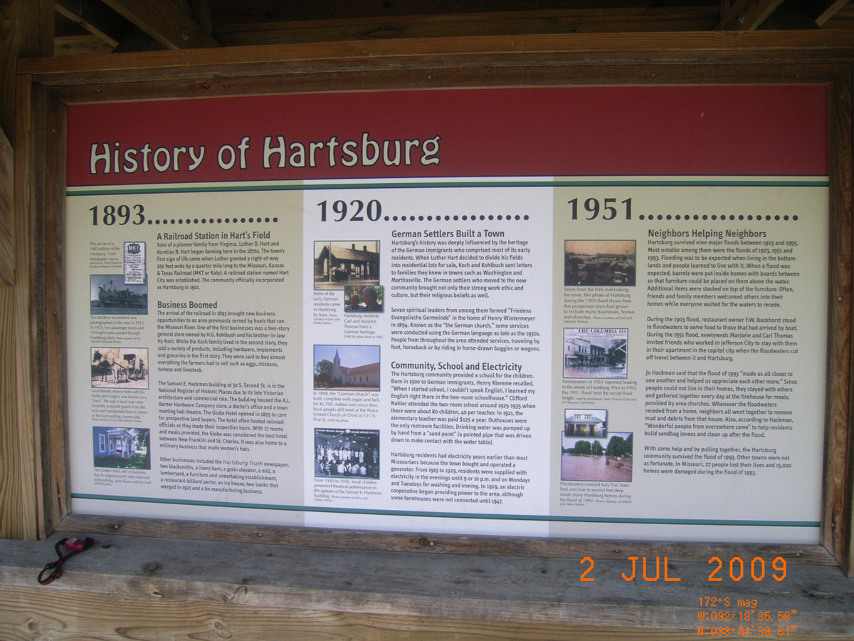
History of Hartsburg
- Date Assessed: 2009-07-02
- File Name: RIMG0098.JPG
- Folder: C01JulyCam1
- Camera Direction: 198°
Hartsburg Bottoms and Bluffs
- Date Assessed: 2009-07-02
- File Name: RIMG0099.JPG
- Folder: C01JulyCam1
- Camera Direction: 198°
Welcome
- Date Assessed: 2009-07-02
- File Name: RIMG0100.JPG
- Folder: C01JulyCam1
- Camera Direction: 198°
- Date Assessed: 2009-07-02
- File Name: RIMG0101.JPG
- Folder: C01JulyCam1
- Camera Direction: 227°
- Date Assessed: 2009-07-02
- File Name: RIMG0102.JPG
- Folder: C01JulyCam1
- Camera Direction: 177°
- Date Assessed: 2009-07-02
- File Name: RIMG0103.JPG
- Folder: C01JulyCam1
- Camera Direction: 165°
- Date Assessed: 2009-07-02
- File Name: RIMG0104.JPG
- Folder: C01JulyCam1
- Camera Direction: 194°
Katy Trail State Park Hartsburg
- Date Assessed: 2009-07-02
- File Name: RIMG0105.JPG
- Folder: C01JulyCam1
- Camera Direction: 194°
Katy Trail State Park, Rocheport
Boone County, Missouri: 38.97750053, -92.56082234
<-- Historical Marker
- Date Assessed: 2009-07-02
- File Name: RIMG0132.JPG
- Folder: C01JulyCam1
- Camera Direction: 195°
Katy Trail State Park
- Date Assessed: 2009-07-02
- File Name: RIMG0133.JPG
- Folder: C01JulyCam1
- Camera Direction: 219°
Lewis and Clark in Missouri
- Date Assessed: 2009-07-02
- File Name: RIMG0134.JPG
- Folder: C01JulyCam1
- Camera Direction: 164°
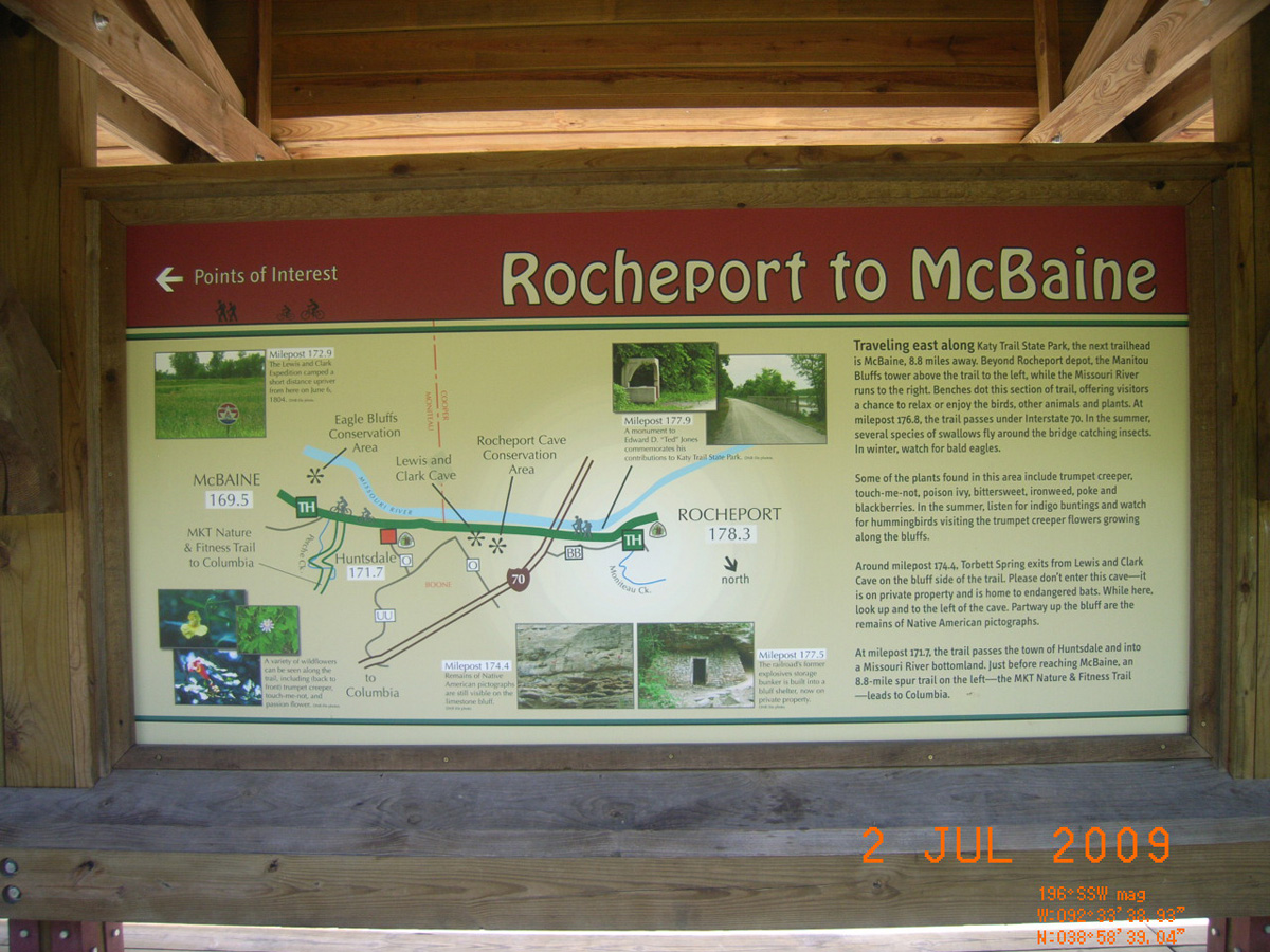
Rocheport to McBaine
- Date Assessed: 2009-07-02
- File Name: RIMG0135.JPG
- Folder: C01JulyCam1
- Camera Direction: 162°
Rocheport to New Franklin
- Date Assessed: 2009-07-02
- File Name: RIMG0136.JPG
- Folder: C01JulyCam1
- Camera Direction: 232°
Katy Trail State Park - Rocheport
- Date Assessed: 2009-07-02
- File Name: RIMG0137.JPG
- Folder: C01JulyCam1
- Camera Direction: 170°
Rocheport Community Services
- Date Assessed: 2009-07-02
- File Name: RIMG0138.JPG
- Folder: C01JulyCam1
- Camera Direction: 180°
History of Rocheport
- Date Assessed: 2009-07-02
- File Name: RIMG0139.JPG
- Folder: C01JulyCam1
- Camera Direction: 182°
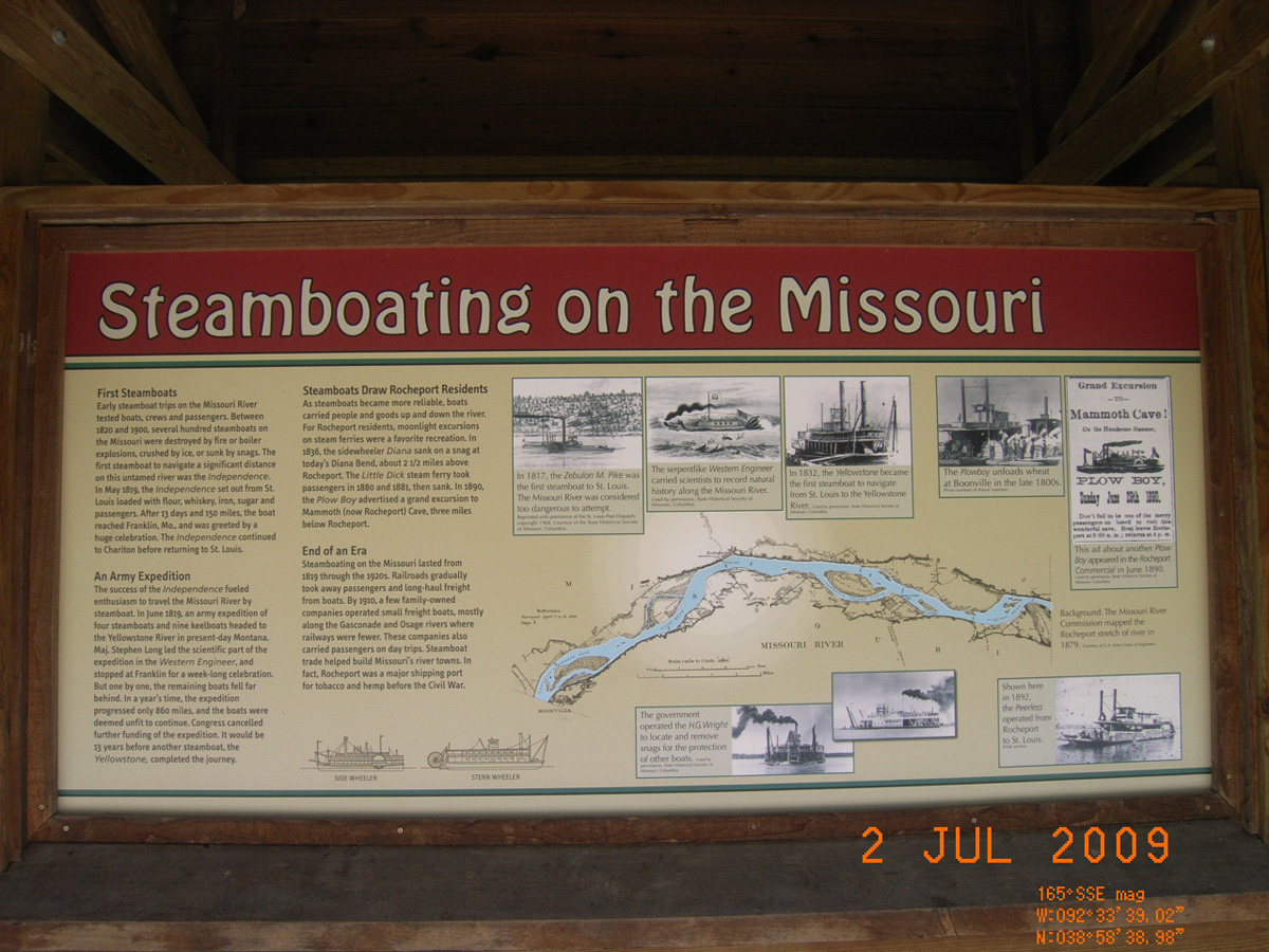
Steamboating on the Missouri
- Date Assessed: 2009-07-02
- File Name: RIMG0140.JPG
- Folder: C01JulyCam1
- Camera Direction: 215°
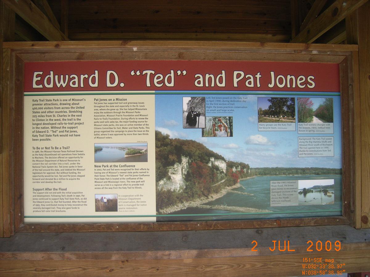
Edward D. 'Ted' and Pat Jones
- Date Assessed: 2009-07-02
- File Name: RIMG0141.JPG
- Folder: C01JulyCam1
- Camera Direction: 183°
- Date Assessed: 2009-07-02
- File Name: RIMG0142.JPG
- Folder: C01JulyCam1
- Camera Direction: 235°
- Date Assessed: 2009-07-02
- File Name: RIMG0143.JPG
- Folder: C01JulyCam1
- Camera Direction: 210°
<-- Historical Marker
- Date Assessed: 2009-07-02
- File Name: RIMG0144.JPG
- Folder: C01JulyCam1
- Camera Direction: 200°
- Date Assessed: 2009-07-02
- File Name: RIMG0145.JPG
- Folder: C01JulyCam1
- Camera Direction: 200°
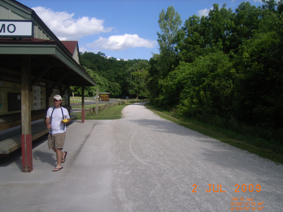
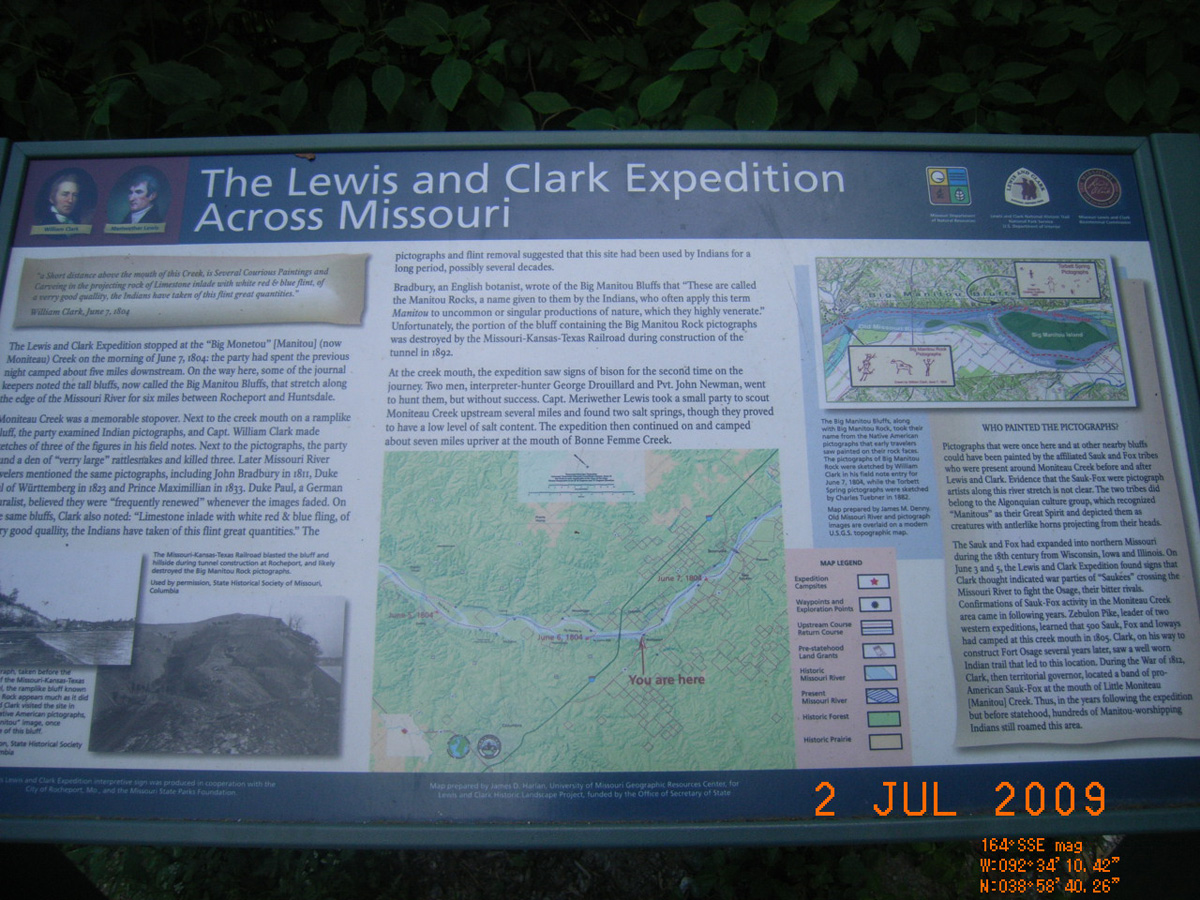
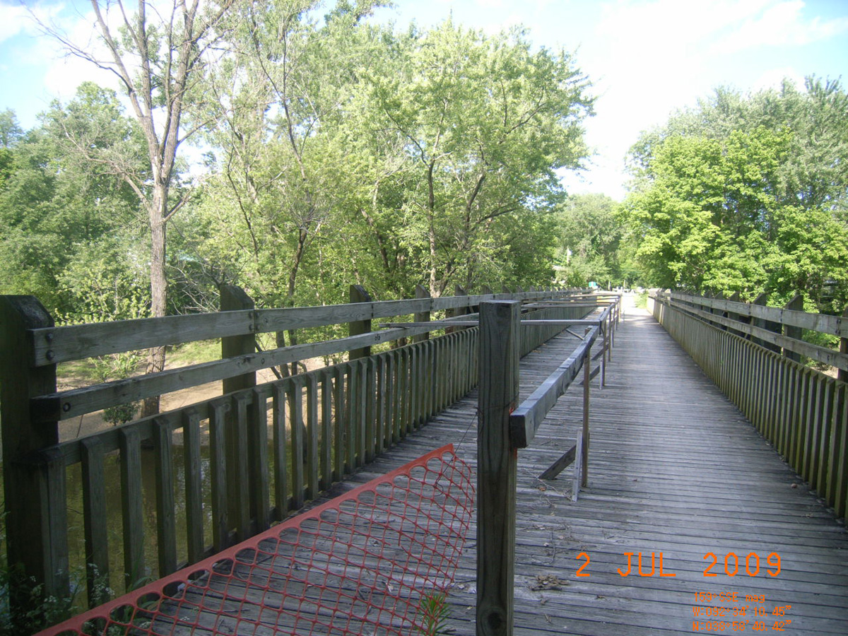
Katy Trail, Moniteau Creek
Howard County, Missouri: 38.9778596, -92.56960321
Lewis and Clark Expedition Across Missouri
- Date Assessed: 2009-07-02
- File Name: RIMG0149.JPG
- Folder: C01JulyCam1
- Camera Direction: 204°
Lewis and Clark Expedition Across Missouri
- Date Assessed: 2009-07-02
- File Name: RIMG0150.JPG
- Folder: C01JulyCam1
- Camera Direction: 205°
- Date Assessed: 2009-07-02
- File Name: RIMG0151.JPG
- Folder: C01JulyCam1
- Camera Direction: 210°
- Date Assessed: 2009-07-02
- File Name: RIMG0152.JPG
- Folder: C01JulyCam1
- Camera Direction: 210°
Moniteau Creek
- Date Assessed: 2009-07-02
- File Name: RIMG0153.JPG
- Folder: C01JulyCam1
- Camera Direction: 210°
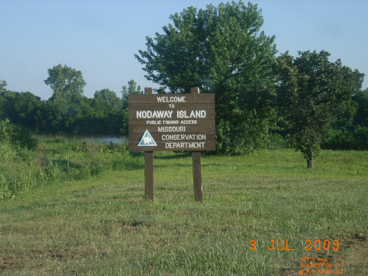
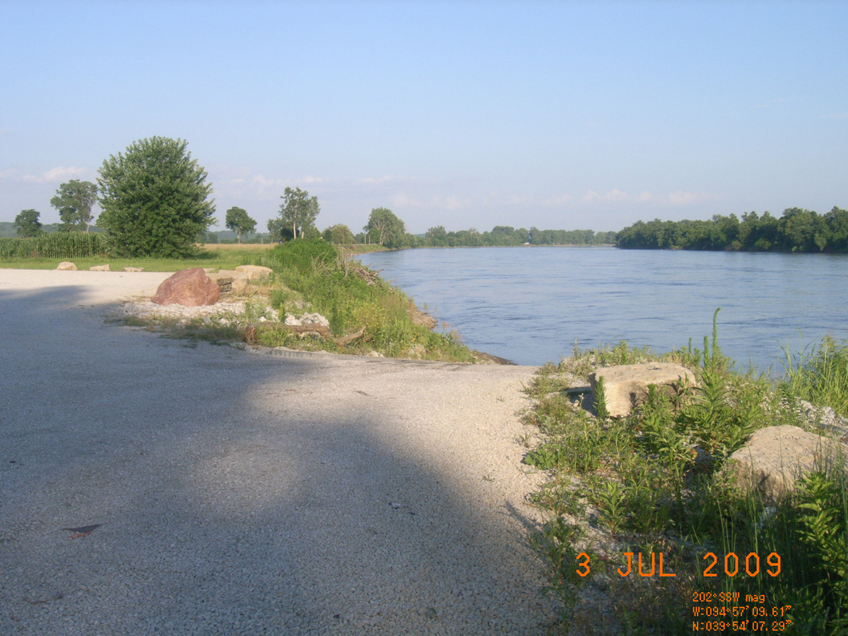
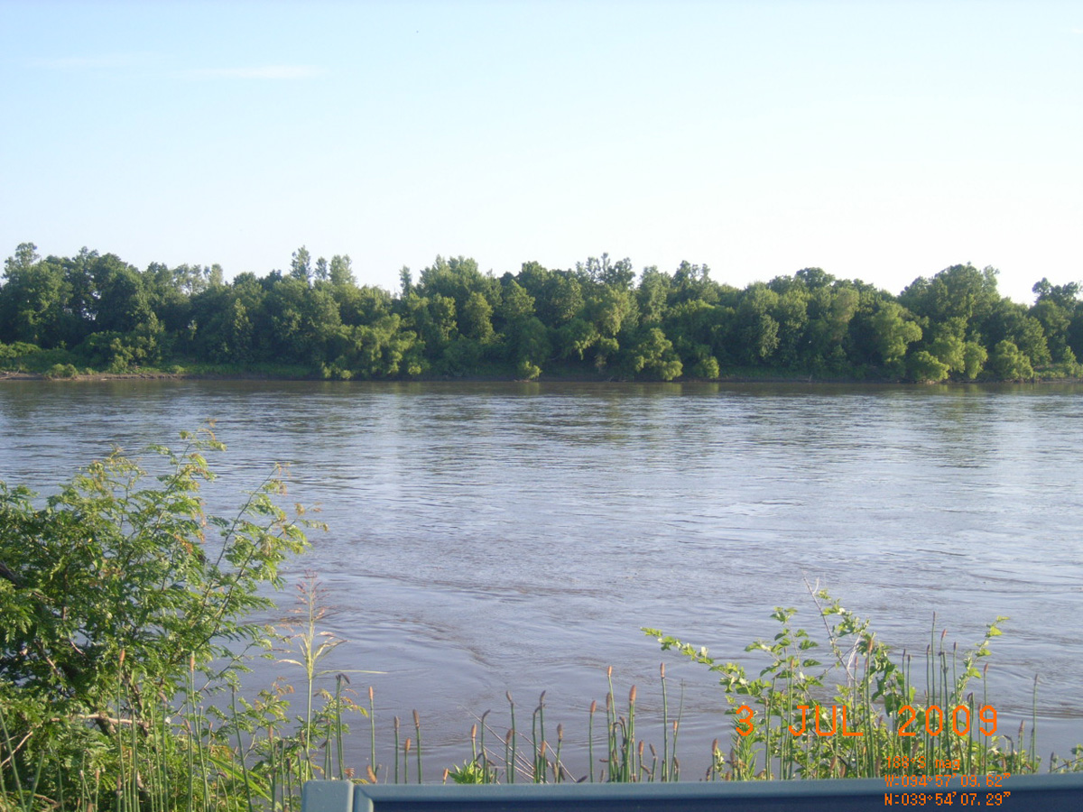
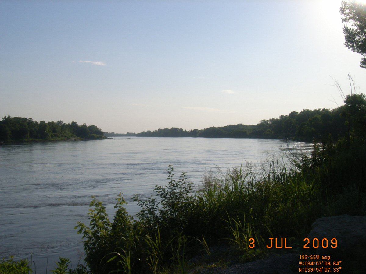
Nodaway Island Public Fishing Access
Andrew County, Missouri: 39.90203709, -94.95266583
Nodaway Island Public Fishing Access -->
- Date Assessed: 2009-07-03
- File Name: RIMG0116.JPG
- Folder: C02JulyCam1
- Camera Direction: 185°
Historical Marker
- Date Assessed: 2009-07-03
- File Name: RIMG0117.JPG
- Folder: C02JulyCam1
- Camera Direction: 155°
Welcome to Nodaway Island Public Fishing Access
- Date Assessed: 2009-07-03
- File Name: RIMG0118.JPG
- Folder: C02JulyCam1
- Camera Direction: 153°
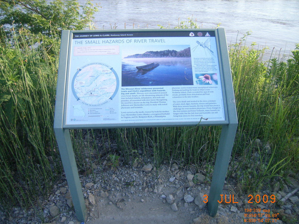
The Small Hazards of River Travel
- Date Assessed: 2009-07-03
- File Name: RIMG0119.JPG
- Folder: C02JulyCam1
- Camera Direction: 159°
- Date Assessed: 2009-07-03
- File Name: RIMG0120.JPG
- Folder: C02JulyCam1
- Camera Direction: 184°
- Date Assessed: 2009-07-03
- File Name: RIMG0121.JPG
- Folder: C02JulyCam1
- Camera Direction: 202°
- Date Assessed: 2009-07-03
- File Name: RIMG0122.JPG
- Folder: C02JulyCam1
- Camera Direction: 193°
- Date Assessed: 2009-07-03
- File Name: RIMG0123.JPG
- Folder: C02JulyCam1
- Camera Direction: 180°
- Date Assessed: 2009-07-03
- File Name: RIMG0124.JPG
- Folder: C02JulyCam1
- Camera Direction: 180°
- Date Assessed: 2009-07-03
- File Name: RIMG0125.JPG
- Folder: C02JulyCam1
- Camera Direction: 203°
- Date Assessed: 2009-07-03
- File Name: RIMG0126.JPG
- Folder: C02JulyCam1
- Camera Direction: 214°
Riverfront Park, Hermann
Gasconade County, Missouri: 38.70782821, -91.43196214
- Date Assessed: 2009-06-30
- File Name: Picture 055.jpg
- Folder: C30JuneCam2
- Camera Direction: 284°
The Lewis and Clark Expedition Across Missouri
- Date Assessed: 2009-06-30
- File Name: Picture 032.jpg
- Folder: C30JuneCam2
- Camera Direction: 189°
- Date Assessed: 2009-06-30
- File Name: Picture 033.jpg
- Folder: C30JuneCam2
- Camera Direction: 223°
Historical Marker
- Date Assessed: 2009-06-30
- File Name: Picture 034.jpg
- Folder: C30JuneCam2
- Camera Direction: 219°
- Date Assessed: 2009-06-30
- File Name: Picture 035.jpg
- Folder: C30JuneCam2
- Camera Direction: 219°
- Date Assessed: 2009-06-30
- File Name: Picture 036.jpg
- Folder: C30JuneCam2
- Camera Direction: 228°
- Date Assessed: 2009-06-30
- File Name: Picture 037.jpg
- Folder: C30JuneCam2
- Camera Direction: 94°
- Date Assessed: 2009-06-30
- File Name: Picture 038.jpg
- Folder: C30JuneCam2
- Camera Direction: 248°
- Date Assessed: 2009-06-30
- File Name: Picture 039.jpg
- Folder: C30JuneCam2
- Camera Direction: 248°
- Date Assessed: 2009-06-30
- File Name: Picture 040.jpg
- Folder: C30JuneCam2
- Camera Direction: 248°
- Date Assessed: 2009-06-30
- File Name: Picture 041.jpg
- Folder: C30JuneCam2
- Camera Direction: 248°
- Date Assessed: 2009-06-30
- File Name: Picture 042.jpg
- Folder: C30JuneCam2
- Camera Direction: 44°
- Date Assessed: 2009-06-30
- File Name: Picture 043.jpg
- Folder: C30JuneCam2
- Camera Direction: 337°
- Date Assessed: 2009-06-30
- File Name: Picture 044.jpg
- Folder: C30JuneCam2
- Camera Direction: 317°
- Date Assessed: 2009-06-30
- File Name: Picture 045.jpg
- Folder: C30JuneCam2
- Camera Direction: 166°
- Date Assessed: 2009-06-30
- File Name: Picture 046.jpg
- Folder: C30JuneCam2
- Camera Direction: 196°
- Date Assessed: 2009-06-30
- File Name: Picture 047.jpg
- Folder: C30JuneCam2
- Camera Direction: 131°
- Date Assessed: 2009-06-30
- File Name: Picture 048.jpg
- Folder: C30JuneCam2
- Camera Direction: 119°
- Date Assessed: 2009-06-30
- File Name: Picture 049.jpg
- Folder: C30JuneCam2
- Camera Direction: 159°
- Date Assessed: 2009-06-30
- File Name: Picture 050.jpg
- Folder: C30JuneCam2
- Camera Direction: 349°
- Date Assessed: 2009-06-30
- File Name: Picture 051.jpg
- Folder: C30JuneCam2
- Camera Direction: 212°
- Date Assessed: 2009-06-30
- File Name: Picture 052.jpg
- Folder: C30JuneCam2
- Camera Direction: 212°
- Date Assessed: 2009-06-30
- File Name: Picture 053.jpg
- Folder: C30JuneCam2
- Camera Direction: 160°
- Date Assessed: 2009-06-30
- File Name: Picture 054.jpg
- Folder: C30JuneCam2
- Camera Direction: 166°
Napoleon
Lafayette County, Missouri: 39.13318431, -94.06427572
The Lewis and Clark Expedition Across Missouri
- Date Assessed: 2009-06-27
- File Name: Picture 193.jpg
- Folder: C27JuneCam2
- Camera Direction: 191°
The Lewis and Clark Expedition Across Missouri
- Date Assessed: 2009-06-27
- File Name: Picture 194.jpg
- Folder: C27JuneCam2
- Camera Direction: 191°
- Date Assessed: 2009-06-27
- File Name: Picture 195.jpg
- Folder: C27JuneCam2
- Camera Direction: 162°
- Date Assessed: 2009-06-27
- File Name: Picture 196.jpg
- Folder: C27JuneCam2
- Camera Direction: 166°
- Date Assessed: 2009-06-27
- File Name: Picture 197.jpg
- Folder: C27JuneCam2
- Camera Direction: 187°
- Date Assessed: 2009-06-27
- File Name: Picture 198.jpg
- Folder: C27JuneCam2
- Camera Direction: 186°
- Date Assessed: 2009-06-27
- File Name: Picture 199.jpg
- Folder: C27JuneCam2
- Camera Direction: 188°
- Date Assessed: 2009-06-27
- File Name: Picture 200.jpg
- Folder: C27JuneCam2
- Camera Direction: 200°
Lexington Riverfront Park, Lexington
Lafayette County, Missouri: 39.19563771, -93.88398277
The Lewis and Clark Expedition Across Missouri
- Date Assessed: 2009-06-27
- File Name: Picture 226.jpg
- Folder: C27JuneCam2
- Camera Direction: 131°
The Lewis and Clark Expedition Across Missouri
- Date Assessed: 2009-06-27
- File Name: Picture 227.jpg
- Folder: C27JuneCam2
- Camera Direction: 209°
Port of Waverly
Lafayette County, Missouri: 39.21329891, -93.51711048
Port of Waverly
- Date Assessed: 2009-06-27
- File Name: Picture 282.jpg
- Folder: C27JuneCam2
- Camera Direction: 208°
The Lewis and Clark Expedition Across Missouri
- Date Assessed: 2009-06-27
- File Name: Picture 283.jpg
- Folder: C27JuneCam2
- Camera Direction: 0°
The Lewis and Clark Expedition Across Missouri
- Date Assessed: 2009-06-27
- File Name: Picture 284.jpg
- Folder: C27JuneCam2
- Camera Direction: 0°
- Date Assessed: 2009-06-27
- File Name: Picture 285.jpg
- Folder: C27JuneCam2
- Camera Direction: 0°
- Date Assessed: 2009-06-27
- File Name: Picture 286.jpg
- Folder: C27JuneCam2
- Camera Direction: 244°
- Date Assessed: 2009-06-27
- File Name: Picture 287.jpg
- Folder: C27JuneCam2
- Camera Direction: 233°
- Date Assessed: 2009-06-27
- File Name: Picture 288.jpg
- Folder: C27JuneCam2
- Camera Direction: 181°
- Date Assessed: 2009-06-27
- File Name: Picture 289.jpg
- Folder: C27JuneCam2
- Camera Direction: 302°
- Date Assessed: 2009-06-27
- File Name: Picture 290.jpg
- Folder: C27JuneCam2
- Camera Direction: 178°
- Date Assessed: 2009-06-27
- File Name: Picture 291.jpg
- Folder: C27JuneCam2
- Camera Direction: 183°
Katy Trail, HW 87, opposite Boonville
Howard County, Missouri: 38.98729138, -92.75528704
The Lewis and Clark Expedition Across Missouri
- Date Assessed: 2009-06-29
- File Name: RIMG0056.JPG
- Folder: C29JuneCam2
- Camera Direction: 23°
The Lewis and Clark Expedition Across Missouri
- Date Assessed: 2009-06-29
- File Name: RIMG0057.JPG
- Folder: C29JuneCam2
- Camera Direction: 175°
Katy Trail State Park
- Date Assessed: 2009-06-29
- File Name: RIMG0058.JPG
- Folder: C29JuneCam2
- Camera Direction: 139°
- Date Assessed: 2009-06-29
- File Name: RIMG0059.JPG
- Folder: C29JuneCam2
- Camera Direction: 149°
- Date Assessed: 2009-06-29
- File Name: RIMG0060.JPG
- Folder: C29JuneCam2
- Camera Direction: 167°
- Date Assessed: 2009-06-29
- File Name: RIMG0061.JPG
- Folder: C29JuneCam2
- Camera Direction: 233°
- Date Assessed: 2009-06-29
- File Name: RIMG0062.JPG
- Folder: C29JuneCam2
- Camera Direction: 11°
- Date Assessed: 2009-06-29
- File Name: RIMG0063.JPG
- Folder: C29JuneCam2
- Camera Direction: 84°
Franklin Island Public Fishing Access
Howard County, Missouri: 38.98579017, -92.71992794
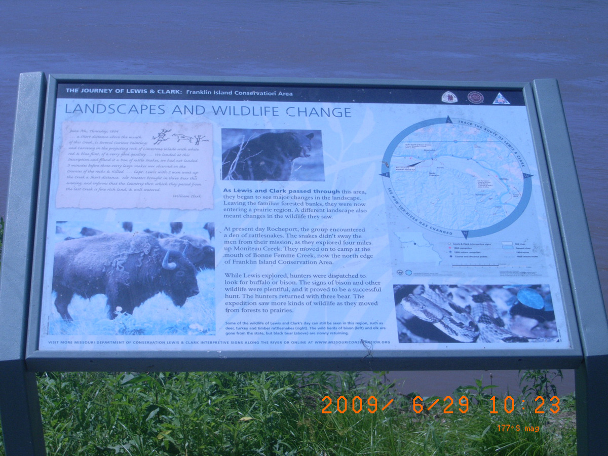
Landscapes and Wildlife Change
- Date Assessed: 2009-06-29
- File Name: RIMG0065.JPG
- Folder: C29JuneCam2
- Camera Direction: 119°
Landscapes and Wildlife Change
- Date Assessed: 2009-06-29
- File Name: RIMG0066.JPG
- Folder: C29JuneCam2
- Camera Direction: 163°
- Date Assessed: 2009-06-29
- File Name: RIMG0067.JPG
- Folder: C29JuneCam2
- Camera Direction: 163°
- Date Assessed: 2009-06-29
- File Name: RIMG0068.JPG
- Folder: C29JuneCam2
- Camera Direction: 206°
- Date Assessed: 2009-06-29
- File Name: RIMG0069.JPG
- Folder: C29JuneCam2
- Camera Direction: 255°
- Date Assessed: 2009-06-29
- File Name: RIMG0070.JPG
- Folder: C29JuneCam2
- Camera Direction: 264°
- Date Assessed: 2009-06-29
- File Name: RIMG0071.JPG
- Folder: C29JuneCam2
- Camera Direction: 284°
- Date Assessed: 2009-06-29
- File Name: RIMG0072.JPG
- Folder: C29JuneCam2
- Camera Direction: 355°
Lupus
Moniteau County, Missouri: 38.84531796, -92.4520549
The Lewis and Clark Expedition Across Missouri
- Date Assessed: 2009-06-29
- File Name: RIMG0147.JPG
- Folder: C29JuneCam2
- Camera Direction: 358°
The Lewis and Clark Expedition Across Missouri
- Date Assessed: 2009-06-29
- File Name: RIMG0148.JPG
- Folder: C29JuneCam2
- Camera Direction: 247°
- Date Assessed: 2009-06-29
- File Name: RIMG0149.JPG
- Folder: C29JuneCam2
- Camera Direction: 125°
- Date Assessed: 2009-06-29
- File Name: RIMG0150.JPG
- Folder: C29JuneCam2
- Camera Direction: 49°
- Date Assessed: 2009-06-29
- File Name: RIMG0151.JPG
- Folder: C29JuneCam2
- Camera Direction: 135°
- Date Assessed: 2009-06-29
- File Name: RIMG0152.JPG
- Folder: C29JuneCam2
- Camera Direction: 67°
- Date Assessed: 2009-06-29
- File Name: RIMG0153.JPG
- Folder: C29JuneCam2
- Camera Direction: 155°
- Date Assessed: 2009-06-29
- File Name: RIMG0154.JPG
- Folder: C29JuneCam2
- Camera Direction: 312°
- Date Assessed: 2009-06-29
- File Name: RIMG0155.JPG
- Folder: C29JuneCam2
- Camera Direction: 160°
- Date Assessed: 2009-06-29
- File Name: RIMG0156.JPG
- Folder: C29JuneCam2
- Camera Direction: 160°
- Date Assessed: 2009-06-29
- File Name: RIMG0157.JPG
- Folder: C29JuneCam2
- Camera Direction: 121°
- Date Assessed: 2009-06-29
- File Name: RIMG0158.JPG
- Folder: C29JuneCam2
- Camera Direction: 173°
- Date Assessed: 2009-06-29
- File Name: RIMG0159.JPG
- Folder: C29JuneCam2
- Camera Direction: 110°
- Date Assessed: 2009-06-29
- File Name: RIMG0160.JPG
- Folder: C29JuneCam2
- Camera Direction: 64°
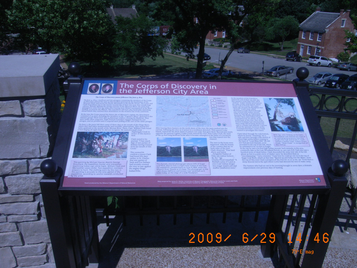
Missouri State Capital, Jefferson City
Cole County, Missouri: 38.57848604, -92.17137619
The Corps of Discovery in the Jefferson City Area
- Date Assessed: 2009-06-29
- File Name: RIMG0250.JPG
- Folder: C29JuneCam2
- Camera Direction: 139°
The Missouri River Valley as a Transportation Corridor
- Date Assessed: 2009-06-29
- File Name: RIMG0251.JPG
- Folder: C29JuneCam2
- Camera Direction: 149°
- Date Assessed: 2009-06-29
- File Name: RIMG0252.JPG
- Folder: C29JuneCam2
- Camera Direction: 149°
Lewis and Clark Bicentennial Monument
- Date Assessed: 2009-06-29
- File Name: RIMG0253.JPG
- Folder: C29JuneCam2
- Camera Direction: 253°
Jefferson City Greenway: Lewis and Clark Trailhead Plaza
- Date Assessed: 2009-06-29
- File Name: RIMG0254.JPG
- Folder: C29JuneCam2
- Camera Direction: 257°
Ellis-Porter Park, Jefferson City
Cole County, Missouri: 38.56911014, -92.14430128
The Lewis and Clark Expedition Across Missouri
- Date Assessed: 2009-06-29
- File Name: RIMG0257.JPG
- Folder: C29JuneCam2
- Camera Direction: 208°
The Lewis and Clark Expedition Across Missouri
- Date Assessed: 2009-06-29
- File Name: RIMG0258.JPG
- Folder: C29JuneCam2
- Camera Direction: 268°
- Date Assessed: 2009-06-29
- File Name: RIMG0259.JPG
- Folder: C29JuneCam2
- Camera Direction: 153°
- Date Assessed: 2009-06-29
- File Name: RIMG0260.JPG
- Folder: C29JuneCam2
- Camera Direction: 0°
- Date Assessed: 2009-06-29
- File Name: RIMG0261.JPG
- Folder: C29JuneCam2
- Camera Direction: 281°
- Date Assessed: 2009-06-29
- File Name: RIMG0262.JPG
- Folder: C29JuneCam2
- Camera Direction: 274°
- Date Assessed: 2009-06-29
- File Name: RIMG0263.JPG
- Folder: C29JuneCam2
- Camera Direction: 283°
- Date Assessed: 2009-06-29
- File Name: RIMG0264.JPG
- Folder: C29JuneCam2
- Camera Direction: 161°
- Date Assessed: 2009-06-29
- File Name: RIMG0265.JPG
- Folder: C29JuneCam2
- Camera Direction: 161°
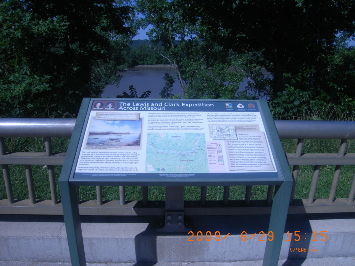
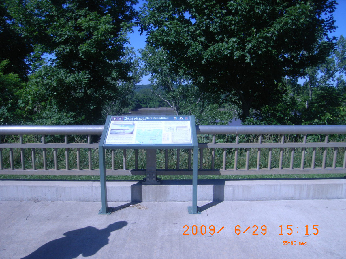
Chamois Access
Osage County, Missouri: 38.68121044, -91.77217016
The Lewis and Clark Expedition Across Missouri
- Date Assessed: 2009-06-29
- File Name: RIMG0320.JPG
- Folder: C29JuneCam2
- Camera Direction: 183°
The Lewis and Clark Expedition Across Missouri
- Date Assessed: 2009-06-29
- File Name: RIMG0321.JPG
- Folder: C29JuneCam2
- Camera Direction: 149°
Little Bean Marsh
Platte County, Missouri: 39.49758, -95.02146
Little Bean Marsh
- Date Assessed: 2009-06-25
- File Name: RIMG0268.JPG
- Folder: C25JuneCam2
- Camera Direction: 252°
Wetlands Habitats of the Past
- Date Assessed: 2009-06-25
- File Name: RIMG0269.JPG
- Folder: C25JuneCam2
- Camera Direction: 281°
- Date Assessed: 2009-06-25
- File Name: RIMG0270.JPG
- Folder: C25JuneCam2
- Camera Direction: 313°
- Date Assessed: 2009-06-25
- File Name: RIMG0271.JPG
- Folder: C25JuneCam2
- Camera Direction: 91°
- Date Assessed: 2009-06-25
- File Name: RIMG0272.JPG
- Folder: C25JuneCam2
- Camera Direction: 114°
- Date Assessed: 2009-06-25
- File Name: RIMG0273.JPG
- Folder: C25JuneCam2
- Camera Direction: 39°
- Date Assessed: 2009-06-25
- File Name: RIMG0274.JPG
- Folder: C25JuneCam2
- Camera Direction: 42°
- Date Assessed: 2009-06-25
- File Name: RIMG0275.JPG
- Folder: C25JuneCam2
- Camera Direction: 351°
- Date Assessed: 2009-06-25
- File Name: RIMG0276.JPG
- Folder: C25JuneCam2
- Camera Direction: 304°
- Date Assessed: 2009-06-25
- File Name: RIMG0277.JPG
- Folder: C25JuneCam2
- Camera Direction: 236°
- Date Assessed: 2009-06-25
- File Name: RIMG0278.JPG
- Folder: C25JuneCam2
- Camera Direction: 196°
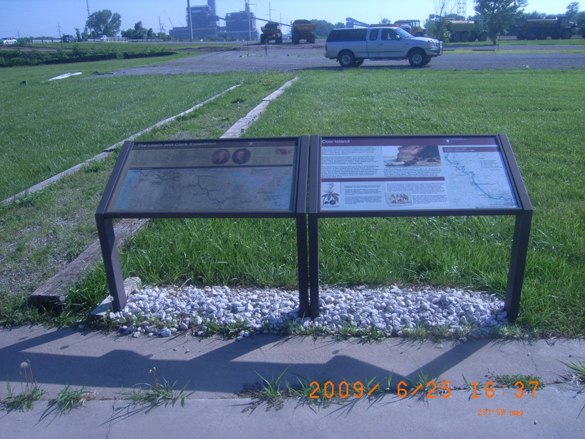
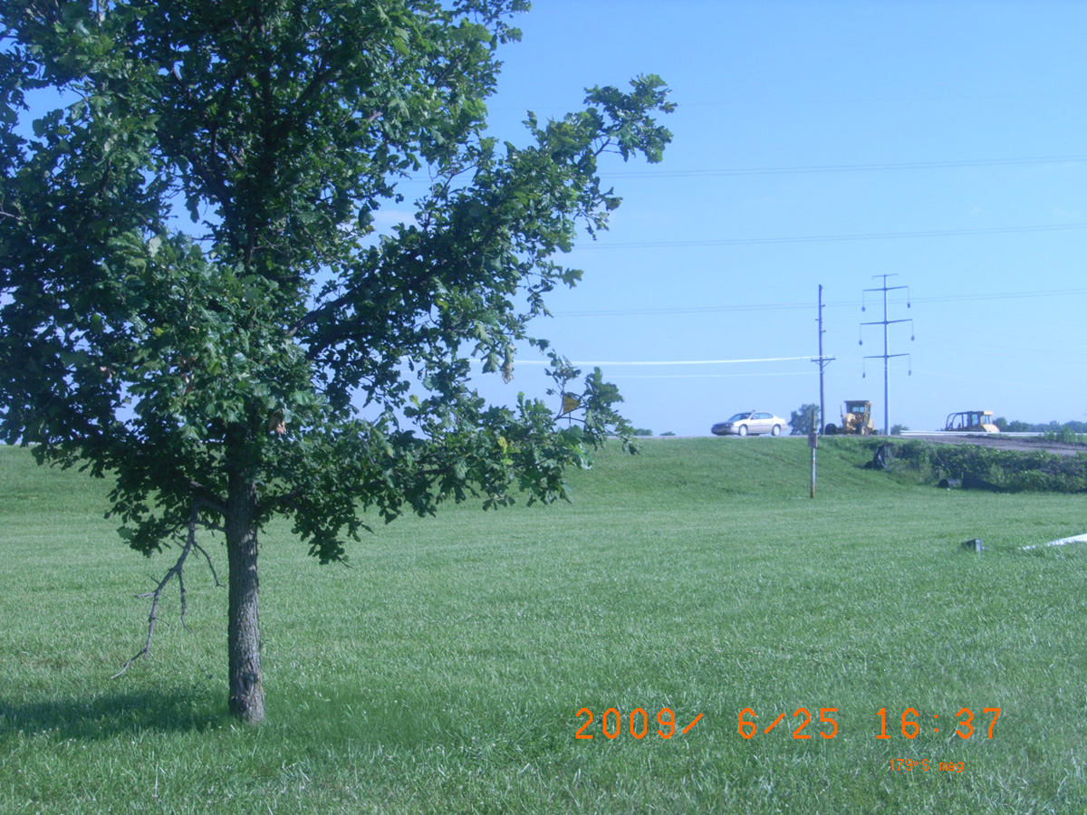
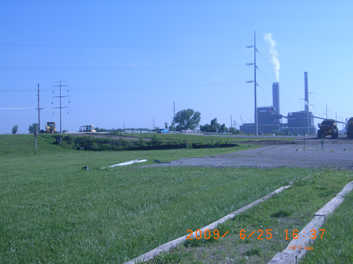
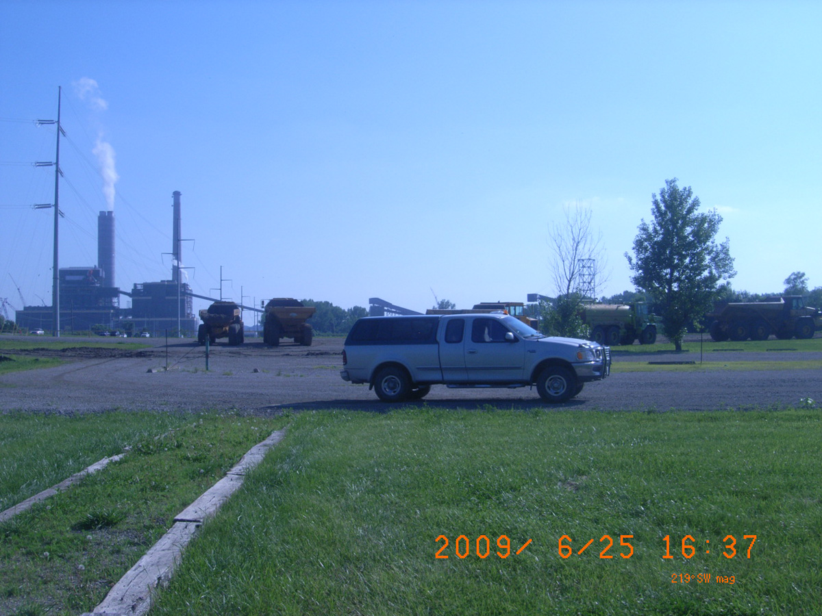
Cow Island, Iatan
Platte County, Missouri: 39.45794, -94.96962
The Lewis and Clark Expedition
- Date Assessed: 2009-06-25
- File Name: RIMG0291.JPG
- Folder: C25JuneCam2
- Camera Direction: 201°
Cow Island
- Date Assessed: 2009-06-25
- File Name: RIMG0292.JPG
- Folder: C25JuneCam2
- Camera Direction: 209°
- Date Assessed: 2009-06-25
- File Name: RIMG0293.JPG
- Folder: C25JuneCam2
- Camera Direction: 222°
- Date Assessed: 2009-06-25
- File Name: RIMG0294.JPG
- Folder: C25JuneCam2
- Camera Direction: 213°
- Date Assessed: 2009-06-25
- File Name: RIMG0295.JPG
- Folder: C25JuneCam2
- Camera Direction: 136°
- Date Assessed: 2009-06-25
- File Name: RIMG0296.JPG
- Folder: C25JuneCam2
- Camera Direction: 221°
- Date Assessed: 2009-06-25
- File Name: RIMG0297.JPG
- Folder: C25JuneCam2
- Camera Direction: 167°
- Date Assessed: 2009-06-25
- File Name: RIMG0298.JPG
- Folder: C25JuneCam2
- Camera Direction: 172°
- Date Assessed: 2009-06-25
- File Name: RIMG0299.JPG
- Folder: C25JuneCam2
- Camera Direction: 169°
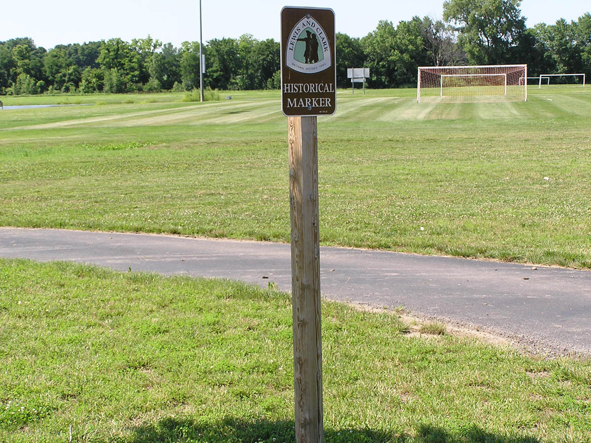
Fountain Bluff Sports Complex
Clay County, Missouri: 39.20576514, -94.38315121
Historical Marker -->
- Date Assessed: 0000-00-00
- File Name: RIMG0193.JPG
- Folder: C26JuneCam2
- Camera Direction: 120°
Historical Marker -->
- Date Assessed: 0000-00-00
- File Name: RIMG0194.JPG
- Folder: C26JuneCam2
- Camera Direction: 138°
Historical Marker
- Date Assessed: 0000-00-00
- File Name: RIMG0195.JPG
- Folder: C26JuneCam2
- Camera Direction: 138°
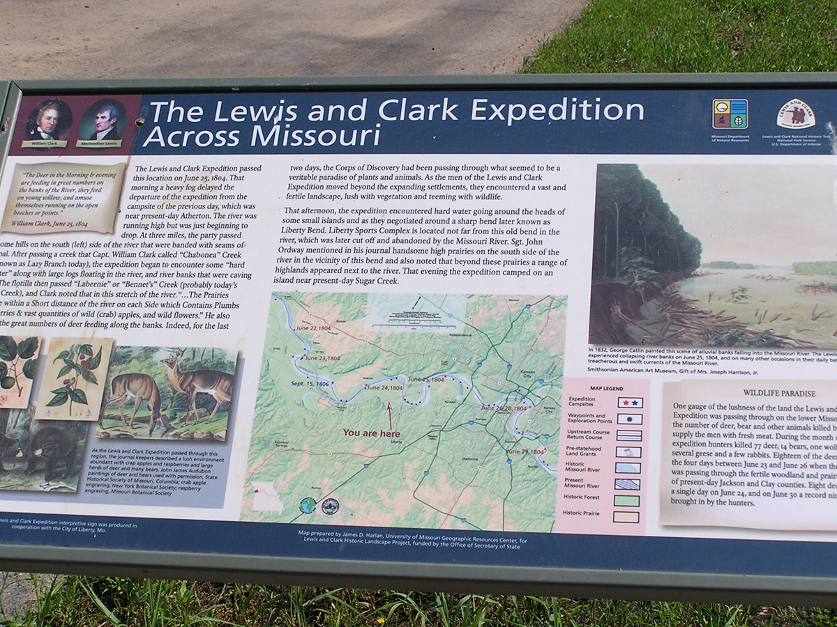
Lewis and Clark Expedition Across Missouri
- Date Assessed: 0000-00-00
- File Name: RIMG0196.JPG
- Folder: C26JuneCam2
- Camera Direction: 138°
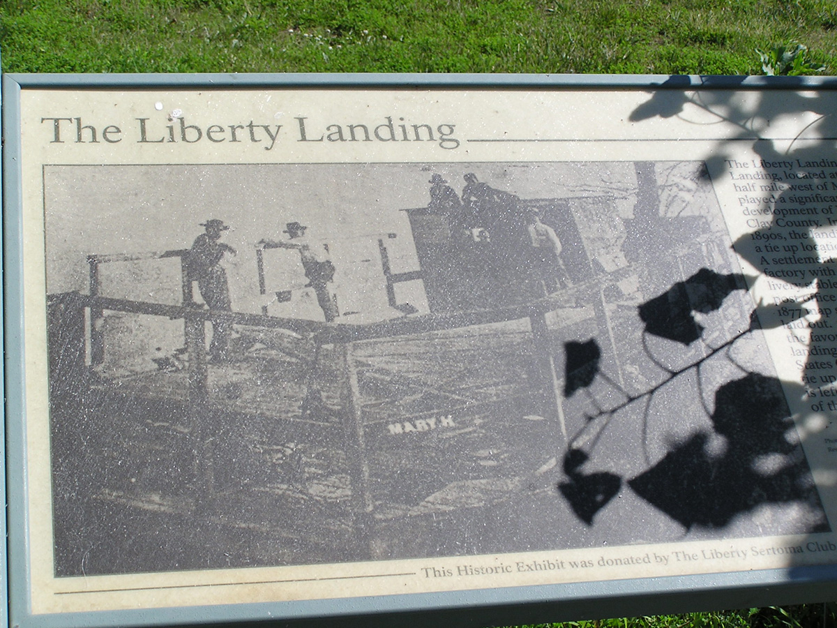
The Liberty Landing
- Date Assessed: 0000-00-00
- File Name: RIMG0197.JPG
- Folder: C26JuneCam2
- Camera Direction: 174°
Missouri City
Clay County, Missouri: 39.23881045, -94.29318505
Lewis and Clark Expedition Across Missouri
- Date Assessed: 0000-00-00
- File Name: RIMG0206.JPG
- Folder: C26JuneCam2
- Camera Direction: 176°
- Date Assessed: 0000-00-00
- File Name: RIMG0207.JPG
- Folder: C26JuneCam2
- Camera Direction: 1°
- Date Assessed: 0000-00-00
- File Name: RIMG0208.JPG
- Folder: C26JuneCam2
- Camera Direction: 1°