Beaverhead Rock
Madison County, Montana: 45.37446558, -112.4620171
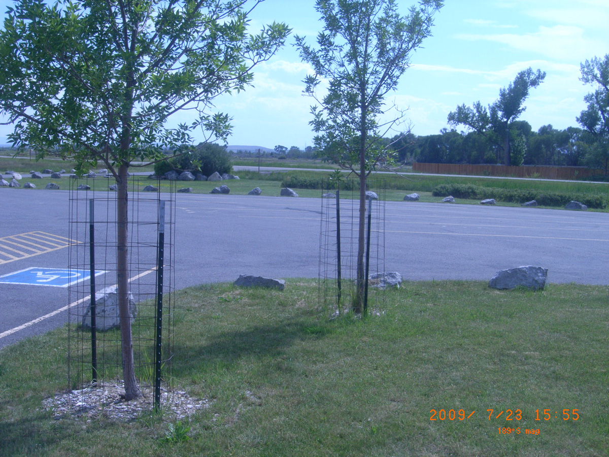
Welcome to Beaverhead Gateway Ranch
- Date Assessed: 2009-07-24
- File Name: RIMG0043.JPG
- Folder: C23JulyCam1
- Camera Direction: 219°
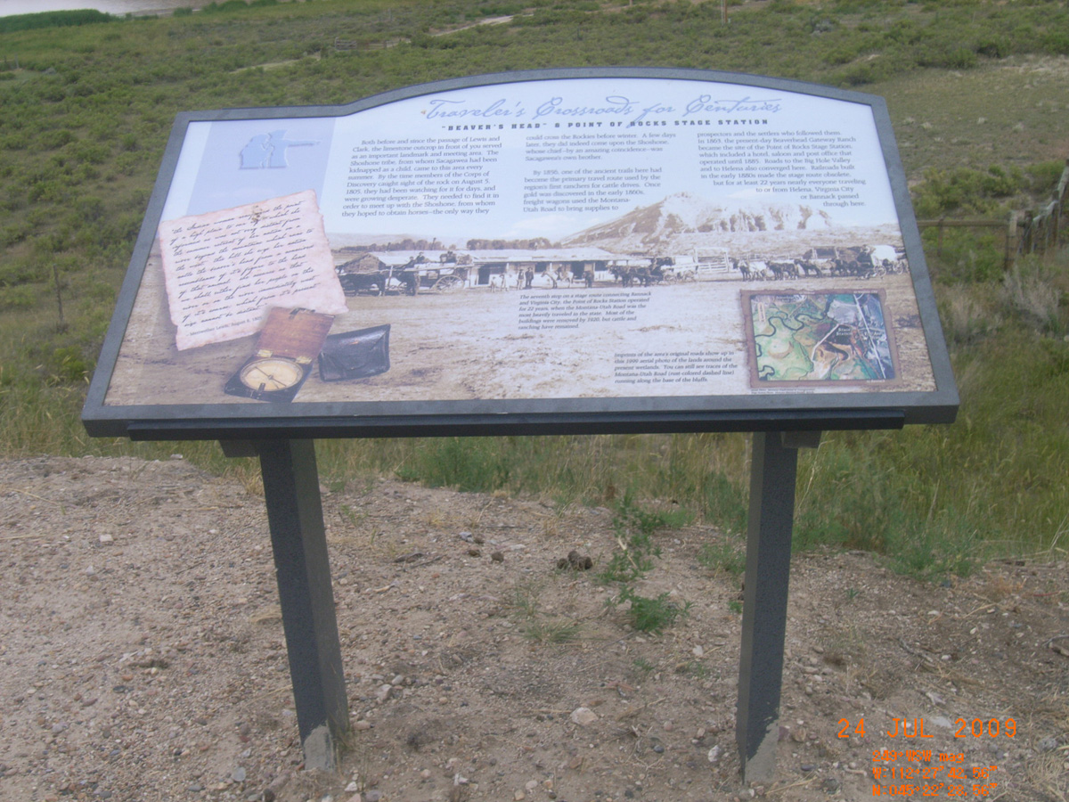
Traveler's Crossroads for Centuries
- Date Assessed: 2009-07-24
- File Name: RIMG0044.JPG
- Folder: C23JulyCam1
- Camera Direction: 293°
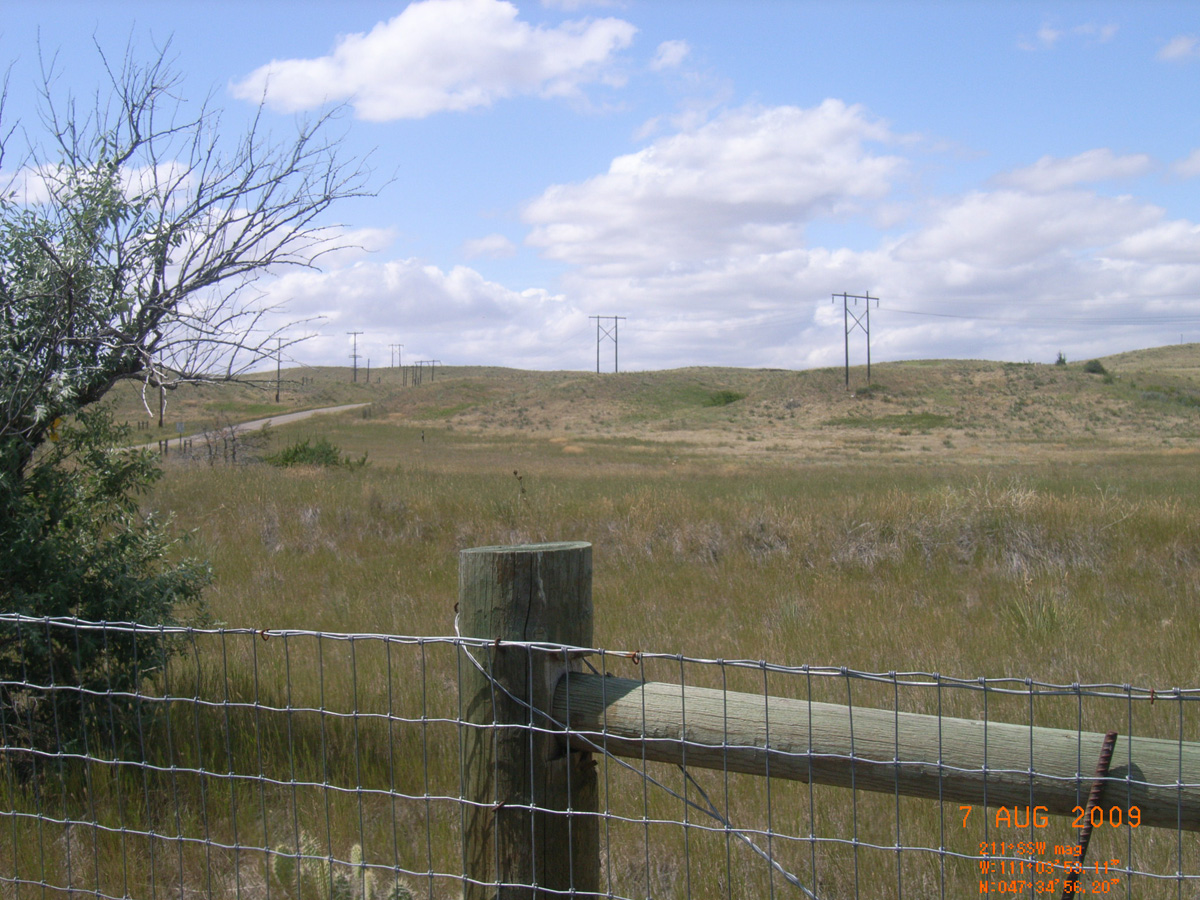
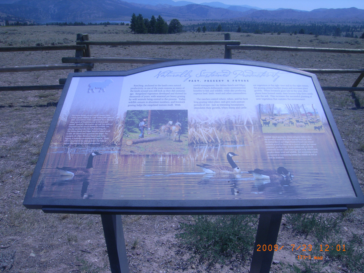
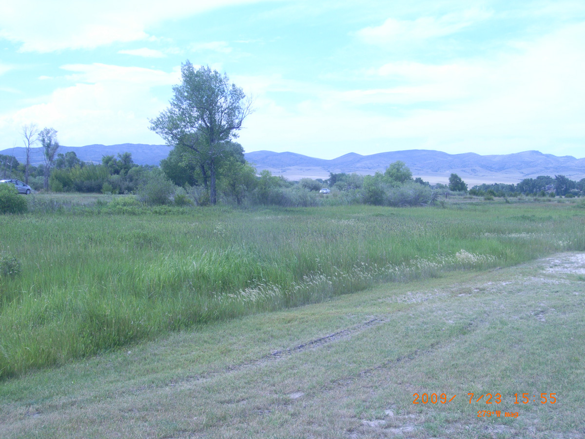
Naturally Sustained Productivity
- Date Assessed: 2009-07-24
- File Name: RIMG0045.JPG
- Folder: C23JulyCam1
- Camera Direction: 293°
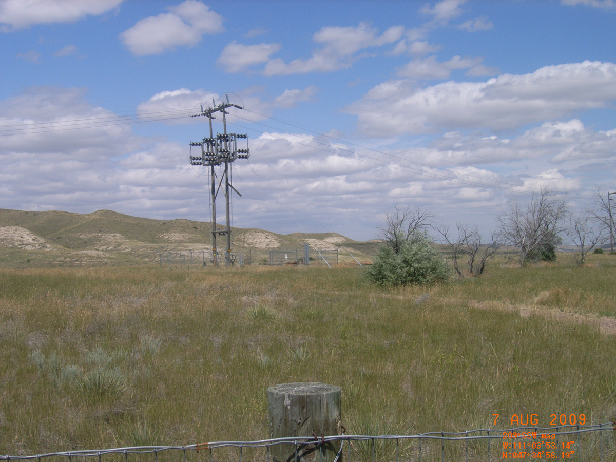
Undaunted Stewardship
- Date Assessed: 2009-07-24
- File Name: RIMG0046.JPG
- Folder: C23JulyCam1
- Camera Direction: 293°
Clark's Lookout State Park
Beaverhead County, Montana: 45.2352983, -112.6329469
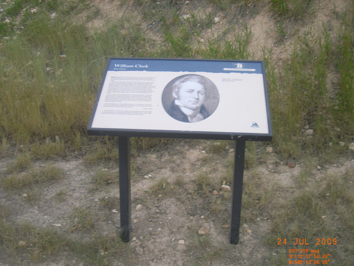
William Clark
- Date Assessed: 2009-07-24
- File Name: RIMG0073.JPG
- Folder: C23JulyCam1
- Camera Direction: 41°
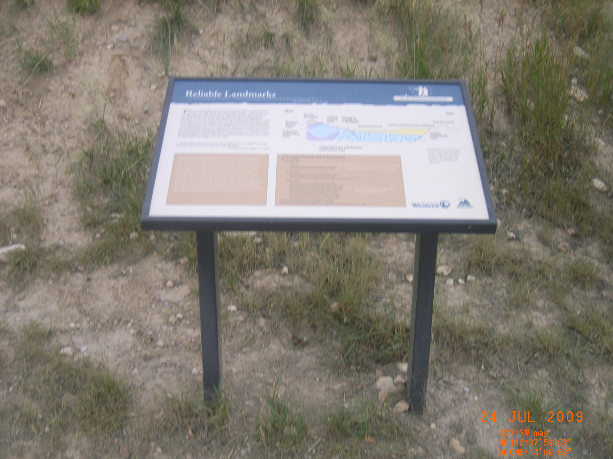
Reliable Landmarks
- Date Assessed: 2009-07-24
- File Name: RIMG0074.JPG
- Folder: C23JulyCam1
- Camera Direction: 34°
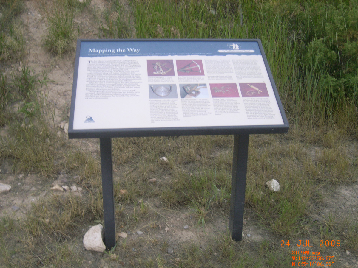
Mapping the Way
- Date Assessed: 2009-07-24
- File Name: RIMG0075.JPG
- Folder: C23JulyCam1
- Camera Direction: 42°
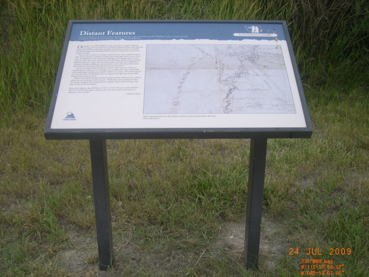
Distant Features
- Date Assessed: 2009-07-24
- File Name: RIMG0076.JPG
- Folder: C23JulyCam1
- Camera Direction: 42°
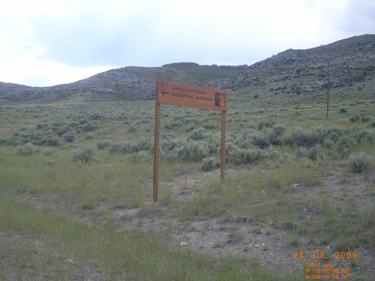
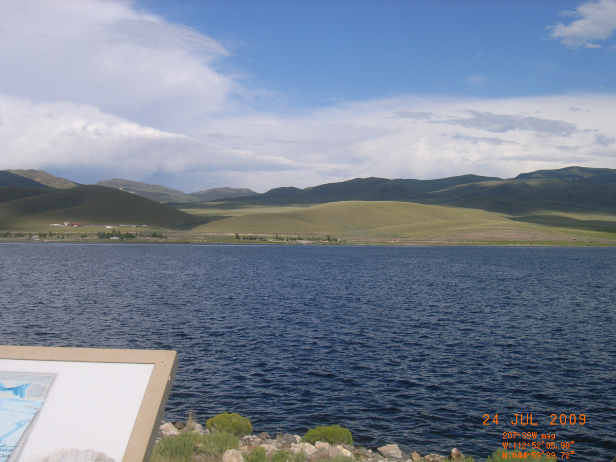
Camp Fortunate Historical Overlook
Beaverhead County, Montana: 44.99464505, -112.8687657
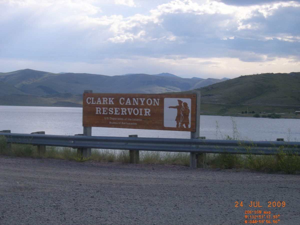
Clark Canyon Reservoir
- Date Assessed: 2009-07-24
- File Name: RIMG0077.JPG
- Folder: C23JulyCam1
- Camera Direction: 42°
Camp Fortunate Historical Overlook
- Date Assessed: 2009-07-24
- File Name: RIMG0078.JPG
- Folder: C23JulyCam1
- Camera Direction: 42°
- Date Assessed: 2009-07-24
- File Name: RIMG0079.JPG
- Folder: C23JulyCam1
- Camera Direction: 17°
- Date Assessed: 2009-07-24
- File Name: RIMG0080.JPG
- Folder: C23JulyCam1
- Camera Direction: 23°
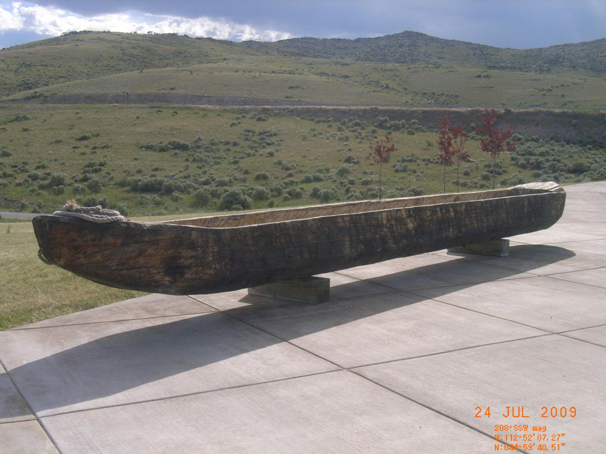
Camp Fortunate
- Date Assessed: 2009-07-24
- File Name: RIMG0081.JPG
- Folder: C23JulyCam1
- Camera Direction: 29°
Reunion at Camp Fortunate
- Date Assessed: 2009-07-24
- File Name: RIMG0082.JPG
- Folder: C23JulyCam1
- Camera Direction: 29°
The Route and Campsites of Lewis and Clark in Montana: A Geologic Perspective
- Date Assessed: 2009-07-24
- File Name: RIMG0083.JPG
- Folder: C23JulyCam1
- Camera Direction: 29°
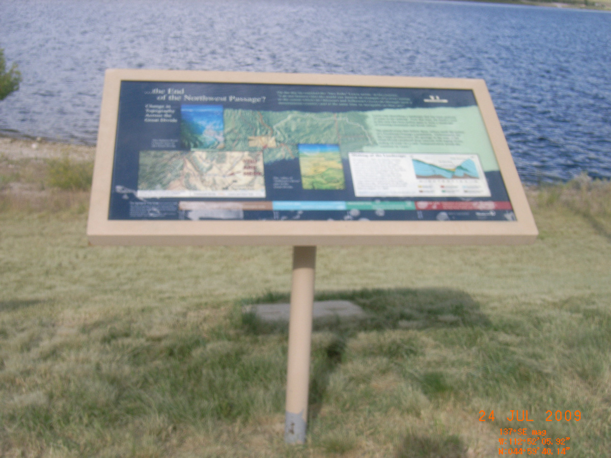
The End of the Northwest Passage?
- Date Assessed: 2009-07-24
- File Name: RIMG0084.JPG
- Folder: C23JulyCam1
- Camera Direction: 308°
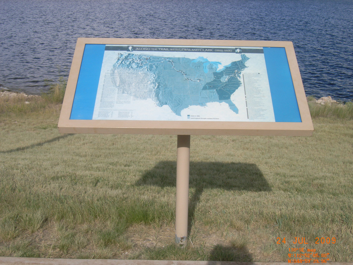
Along the Trail with Lewis and Clark
- Date Assessed: 2009-07-24
- File Name: RIMG0085.JPG
- Folder: C23JulyCam1
- Camera Direction: 54°
It has a singular appearance
- Date Assessed: 2009-07-24
- File Name: RIMG0086.JPG
- Folder: C23JulyCam1
- Camera Direction: 51°
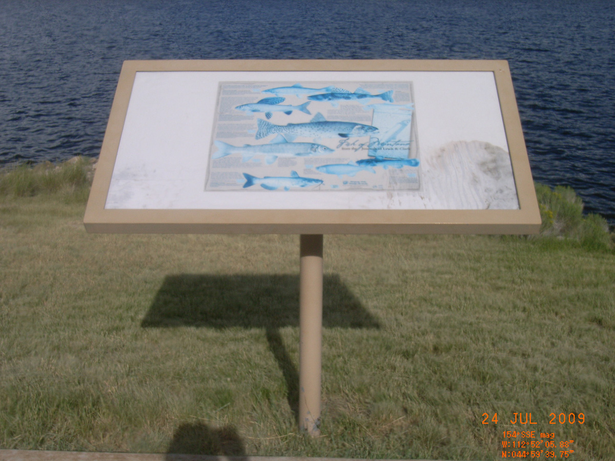
Fish of Montana
- Date Assessed: 2009-07-24
- File Name: RIMG0087.JPG
- Folder: C23JulyCam1
- Camera Direction: 47°
it was mutually advantageous...'
- Date Assessed: 2009-07-24
- File Name: RIMG0088.JPG
- Folder: C23JulyCam1
- Camera Direction: 47°
- Date Assessed: 2009-07-24
- File Name: RIMG0089.JPG
- Folder: C23JulyCam1
- Camera Direction: 47°
- Date Assessed: 2009-07-24
- File Name: RIMG0090.JPG
- Folder: C23JulyCam1
- Camera Direction: 47°
- Date Assessed: 2009-07-24
- File Name: RIMG0091.JPG
- Folder: C23JulyCam1
- Camera Direction: 52°
- Date Assessed: 2009-07-24
- File Name: RIMG0092.JPG
- Folder: C23JulyCam1
- Camera Direction: 32°
- Date Assessed: 2009-07-24
- File Name: RIMG0093.JPG
- Folder: C23JulyCam1
- Camera Direction: 95°
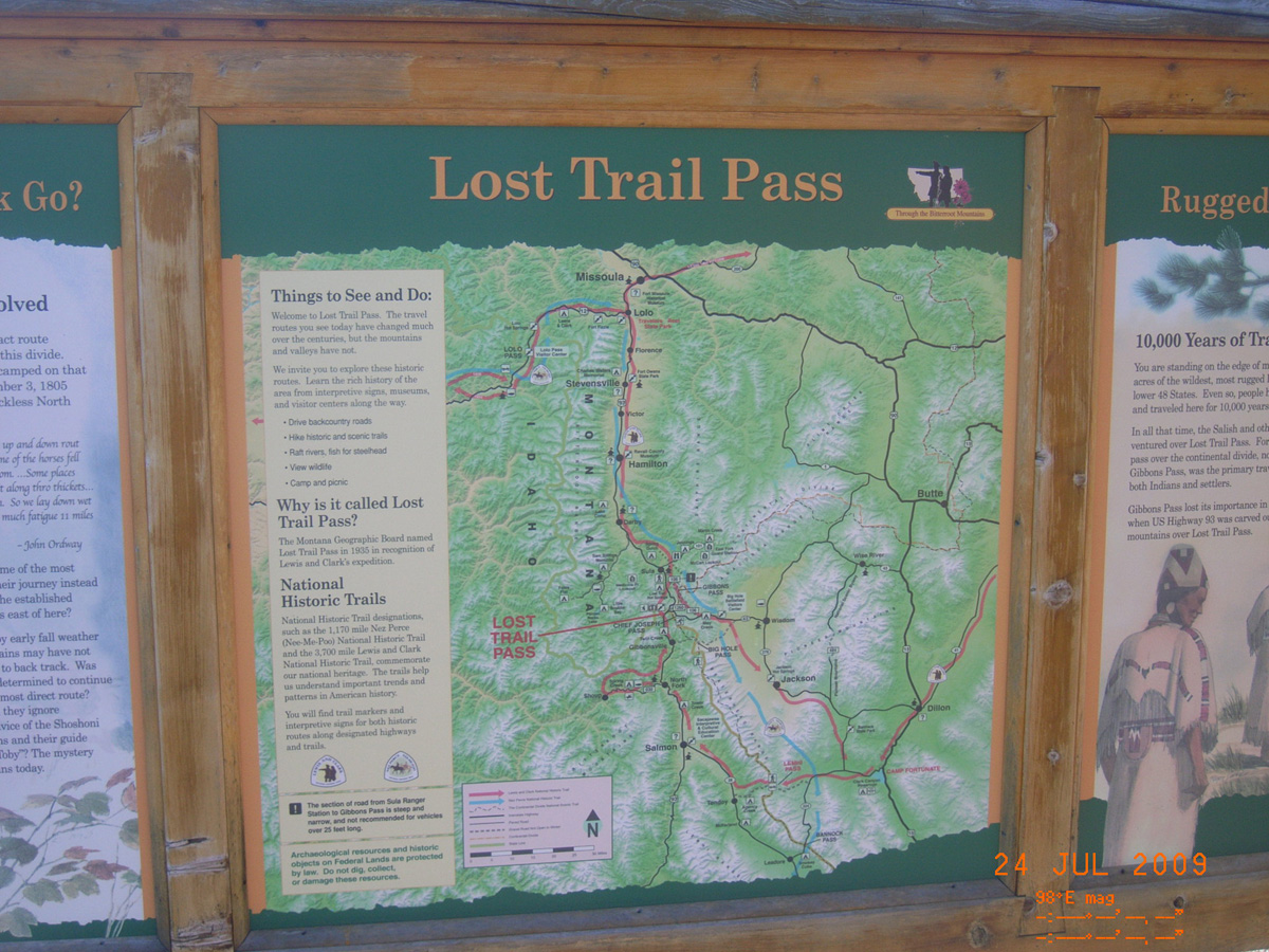
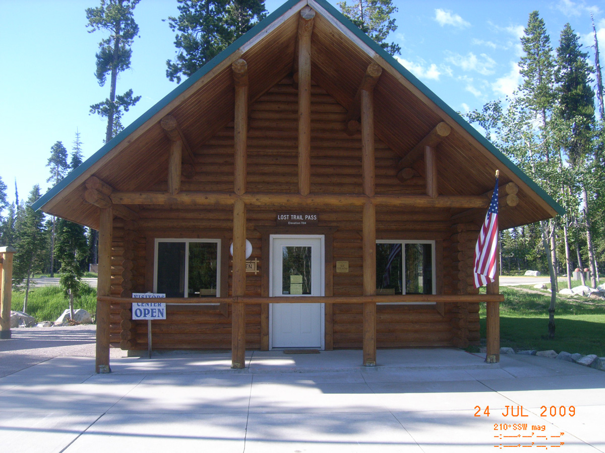
Lost Trail Pass Summit
Ravalli County, Montana: 45.69360396, -113.9499652
Which Way Did Lewis & Clark Go?
- Date Assessed: 2009-07-24
- File Name: RIMG0094.JPG
- Folder: C24JulyCam1
- Camera Direction: 126°
Lost Trail Pass
- Date Assessed: 2009-07-24
- File Name: RIMG0095.JPG
- Folder: C24JulyCam1
- Camera Direction: 126°
Rugged Mountain Crossing
- Date Assessed: 2009-07-24
- File Name: RIMG0096.JPG
- Folder: C24JulyCam1
- Camera Direction: 325°
- Date Assessed: 2009-07-24
- File Name: RIMG0097.JPG
- Folder: C24JulyCam1
- Camera Direction: 59°
- Date Assessed: 2009-07-24
- File Name: RIMG0098.JPG
- Folder: C24JulyCam1
- Camera Direction: 59°
- Date Assessed: 2009-07-24
- File Name: RIMG0099.JPG
- Folder: C24JulyCam1
- Camera Direction: 53°
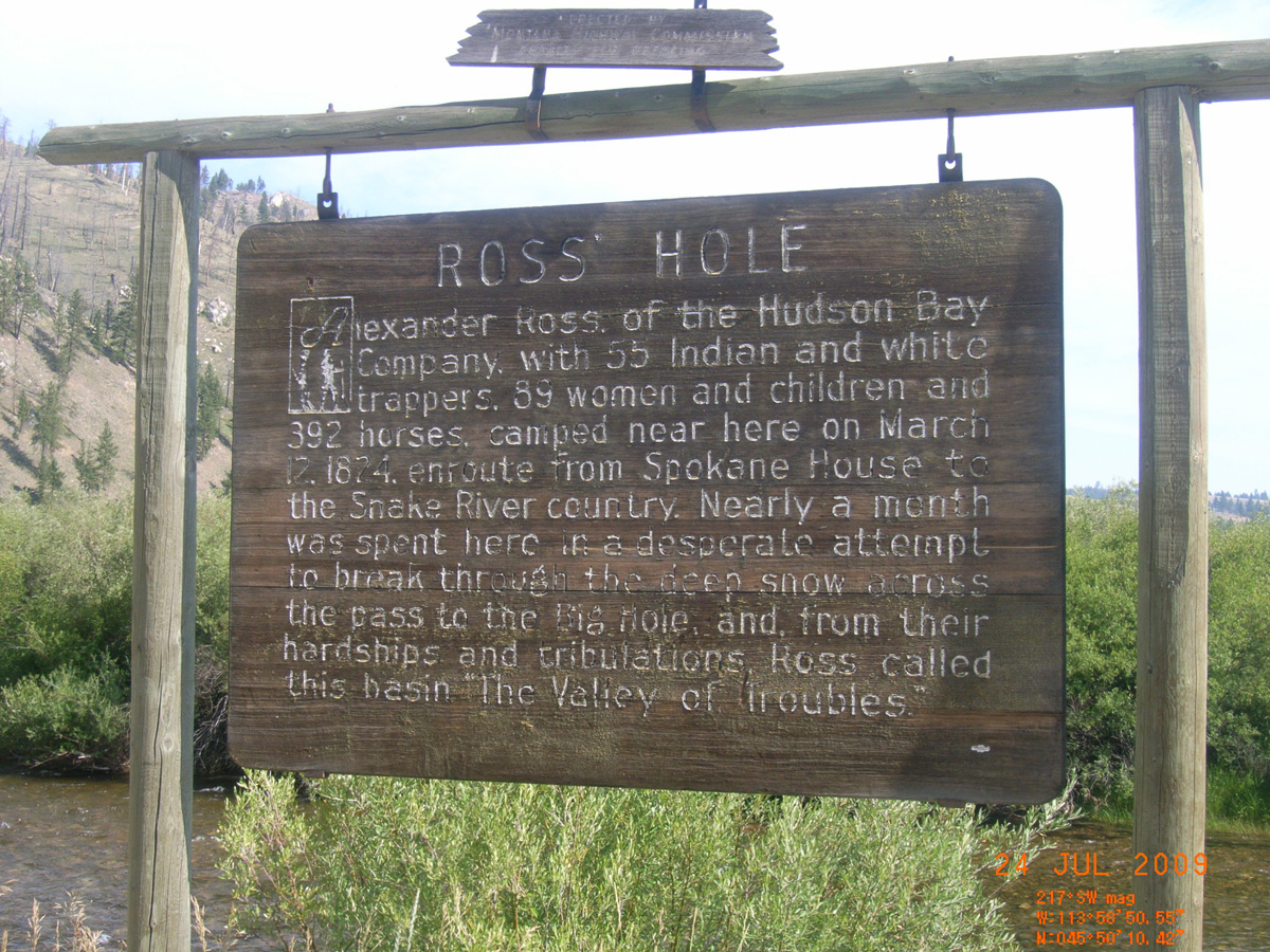
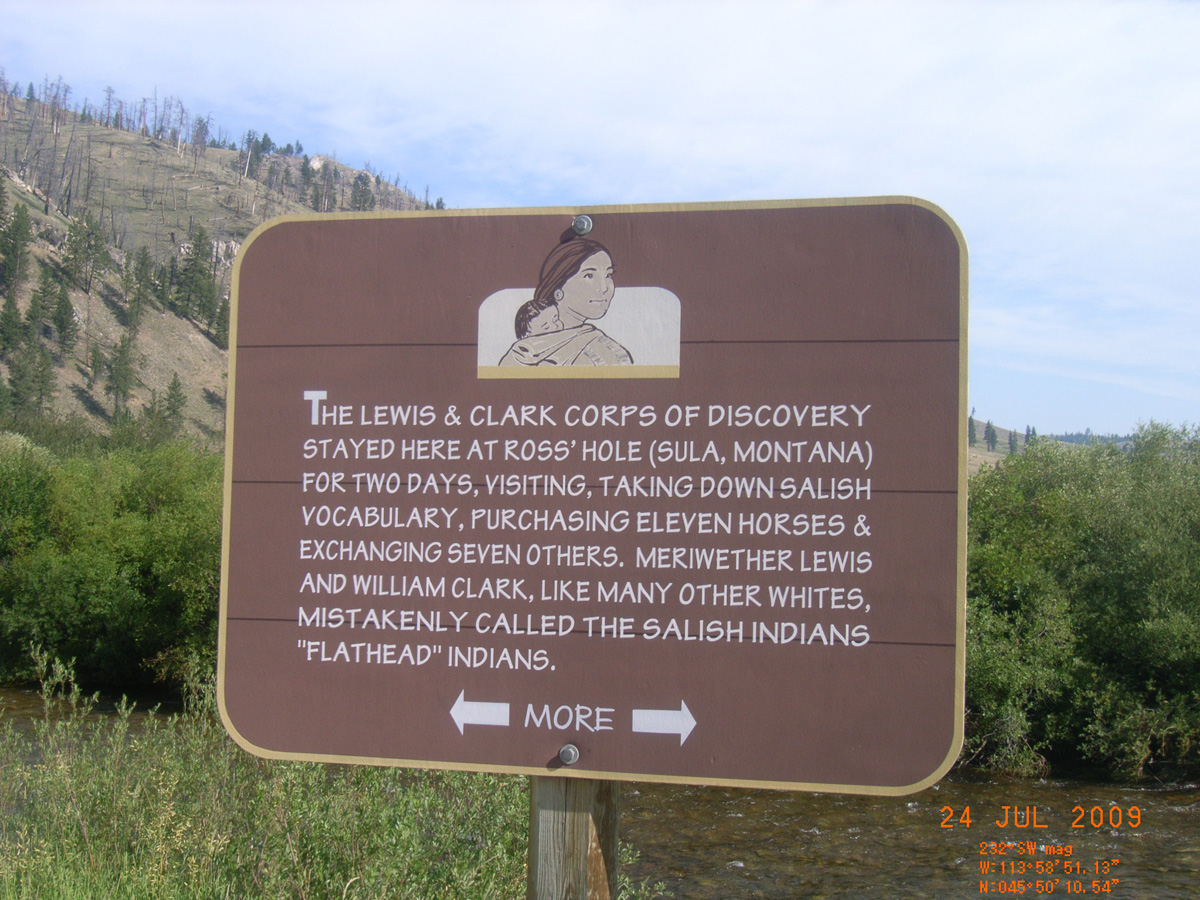
Ross Hole
Ravalli County, Montana: 45.83625165, -113.9807924
Ross Hole
- Date Assessed: 2009-07-24
- File Name: RIMG0112.JPG
- Folder: C24JulyCam1
- Camera Direction: 123°
Welcome...
- Date Assessed: 2009-07-24
- File Name: RIMG0113.JPG
- Folder: C24JulyCam1
- Camera Direction: 123°
[Lewis and Clark stayed here]
- Date Assessed: 2009-07-24
- File Name: RIMG0114.JPG
- Folder: C24JulyCam1
- Camera Direction: 349°
[Clark wrote...]
- Date Assessed: 2009-07-24
- File Name: RIMG0115.JPG
- Folder: C24JulyCam1
- Camera Direction: 77°
- Date Assessed: 2009-07-24
- File Name: RIMG0116.JPG
- Folder: C24JulyCam1
- Camera Direction: 53°
- Date Assessed: 2009-07-24
- File Name: RIMG0117.JPG
- Folder: C24JulyCam1
- Camera Direction: 72°
- Date Assessed: 2009-07-24
- File Name: RIMG0118.JPG
- Folder: C24JulyCam1
- Camera Direction: 151°
- Date Assessed: 2009-07-24
- File Name: RIMG0119.JPG
- Folder: C24JulyCam1
- Camera Direction: 151°
- Date Assessed: 2009-07-24
- File Name: RIMG0120.JPG
- Folder: C24JulyCam1
- Camera Direction: 359°
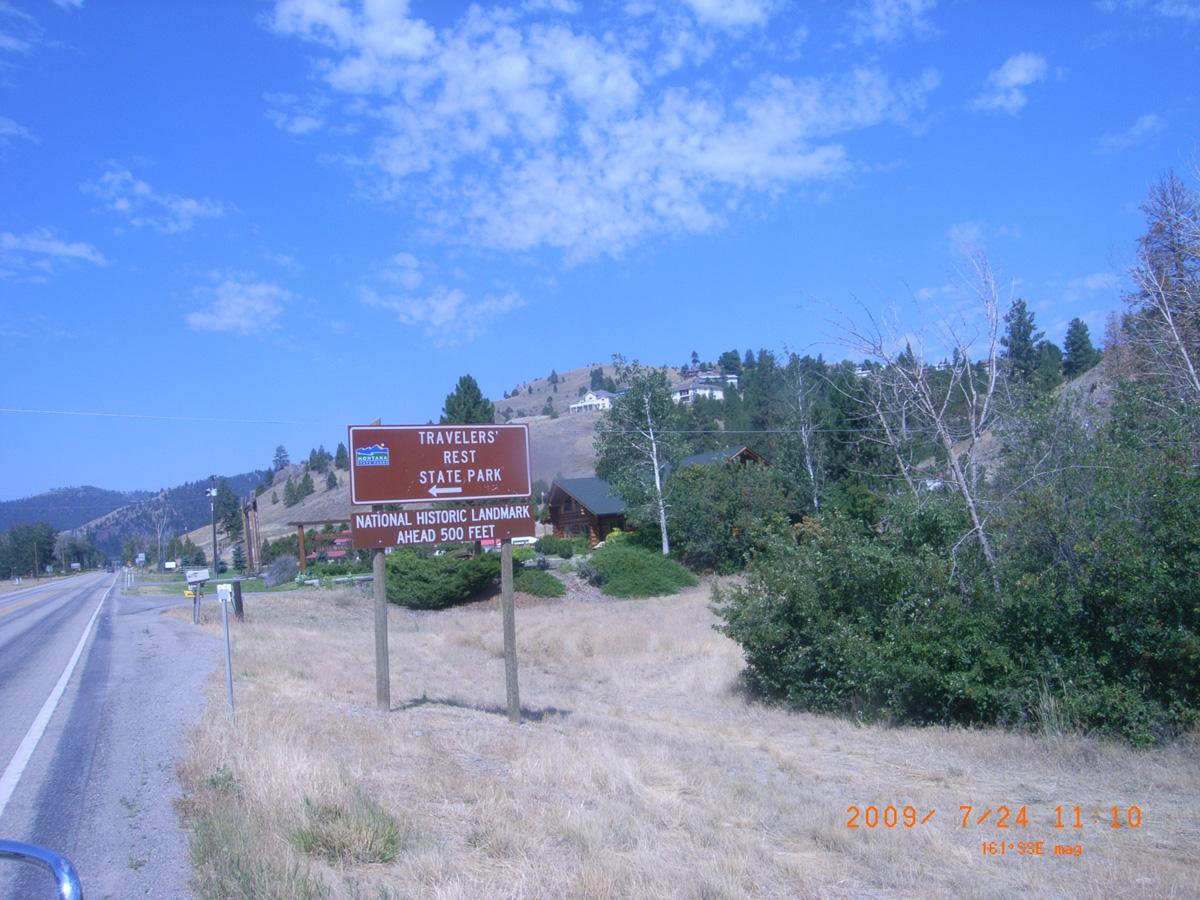
Travelers' Rest State Park
Missoula County, Montana: 46.75280051, -114.0888557
Nez Perce Trail
- Date Assessed: 2009-07-24
- File Name: RIMG0047.JPG
- Folder: C24JulyCam2
- Camera Direction: 68°
Travelers' Rest State Park
- Date Assessed: 2009-07-24
- File Name: RIMG0048.JPG
- Folder: C24JulyCam2
- Camera Direction: 52°
- Date Assessed: 2009-07-24
- File Name: RIMG0049.JPG
- Folder: C24JulyCam2
- Camera Direction: 90°
Travelers' Rest State Park
- Date Assessed: 2009-07-24
- File Name: RIMG0050.JPG
- Folder: C24JulyCam2
- Camera Direction: 90°
Welcome to...
- Date Assessed: 2009-07-24
- File Name: RIMG0051.JPG
- Folder: C24JulyCam2
- Camera Direction: 90°
Travelers' Rest (DAR plaque)
- Date Assessed: 2009-07-24
- File Name: RIMG0052.JPG
- Folder: C24JulyCam2
- Camera Direction: 354°
Travelers' Rest (DAR plaque)
- Date Assessed: 2009-07-24
- File Name: RIMG0053.JPG
- Folder: C24JulyCam2
- Camera Direction: 66°
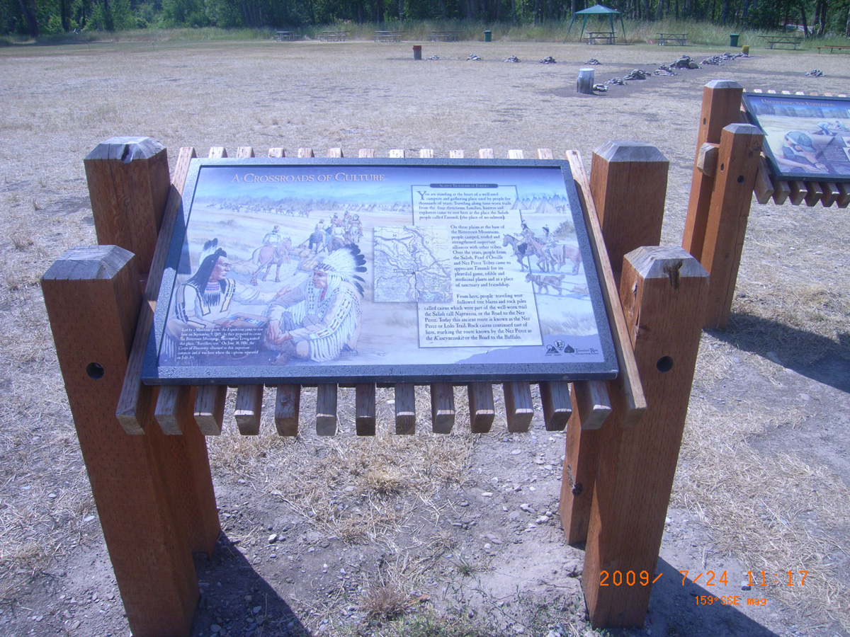
A Crossroads of Culture
- Material: Porcelain Enamel
- Condition: Good
- Date Assessed: 2009-07-24
- File Name: RIMG0054.JPG
- Folder: C24JulyCam2
- Camera Direction: 65°
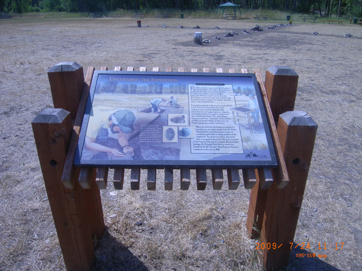
Uncovering the Expedition
- Material: Porcelain Enamel
- Condition: Good
- Date Assessed: 2009-07-24
- File Name: RIMG0055.JPG
- Folder: C24JulyCam2
- Camera Direction: 53°
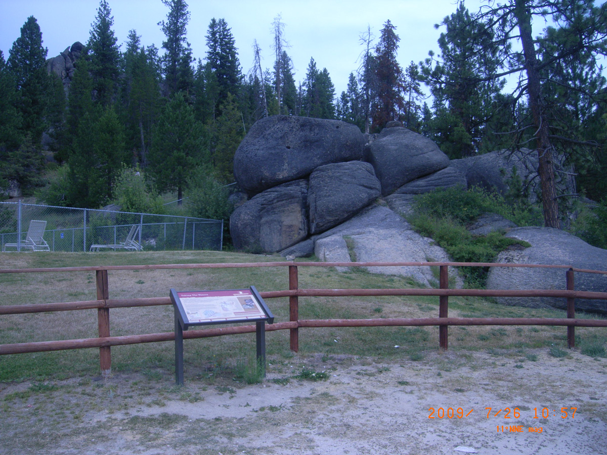
Lolo Hot Springs
Missoula County, Montana: 46.72569848, -114.5327535
Taking the Waters
- Date Assessed: 2009-07-26
- File Name: RIMG0001.JPG
- Folder: C26JulyCam2
- Camera Direction: 54°
Everybody Stopped Here
- Date Assessed: 2009-07-26
- File Name: RIMG0002.JPG
- Folder: C26JulyCam2
- Camera Direction: 350°
Taking the Waters
- Date Assessed: 2009-07-26
- File Name: RIMG0005.JPG
- Folder: C26JulyCam2
- Camera Direction: 341°
Taking the Waters
- Date Assessed: 2009-07-26
- File Name: RIMG0006.JPG
- Folder: C26JulyCam2
- Camera Direction: 322°
HW 12 at Bear and Lolo Creek Confluence
Missoula County, Montana: 46.76433185, -114.328822
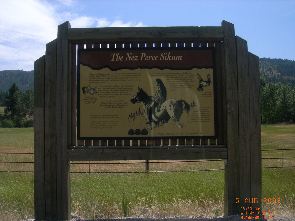
The Nez Perce Sikum
- Date Assessed: 2009-08-05
- File Name: RIMG0165.JPG
- Folder: C04AugustCam1
- Camera Direction: 147°
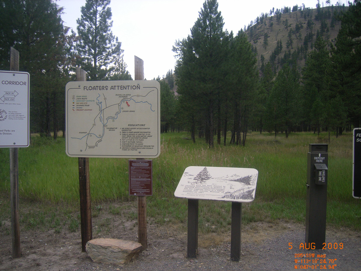
Russell Gates FAS
Missoula County, Montana: 47.02318972, -113.3086743
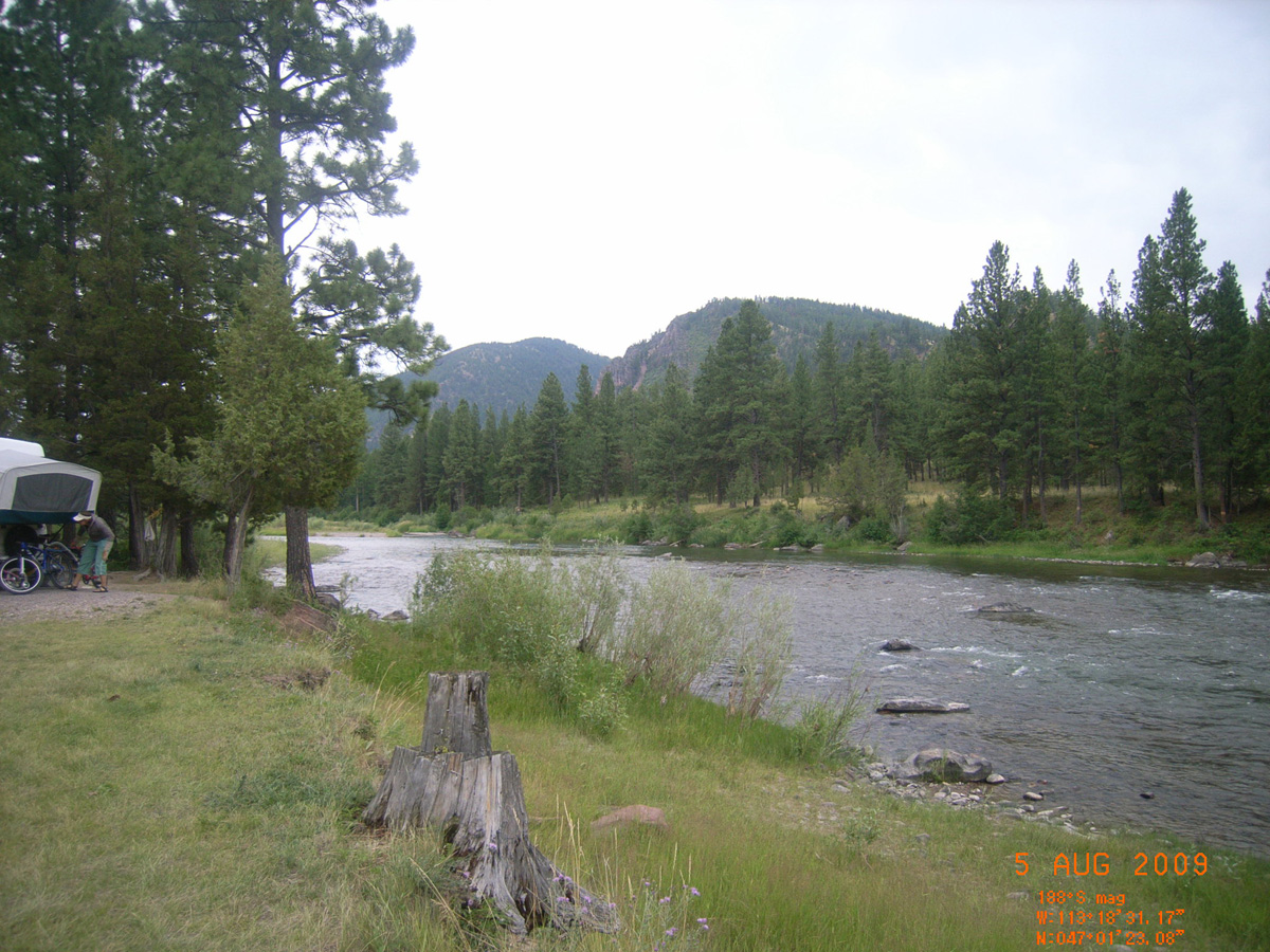
Fishing Access Campground
- Date Assessed: 2009-08-05
- File Name: RIMG0020.JPG
- Folder: C05AugustCam1
- Camera Direction: 132°
Floaters Attention, etc
- Date Assessed: 2009-08-05
- File Name: RIMG0021.JPG
- Folder: C05AugustCam1
- Camera Direction: 180°
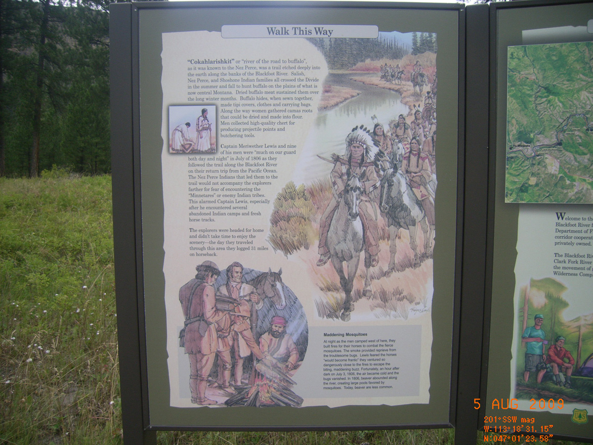
Walk This Way
- Material: Fiberglass
- Condition: Good
- Date Assessed: 2009-08-05
- File Name: RIMG0022.JPG
- Folder: C05AugustCam1
- Camera Direction: 182°
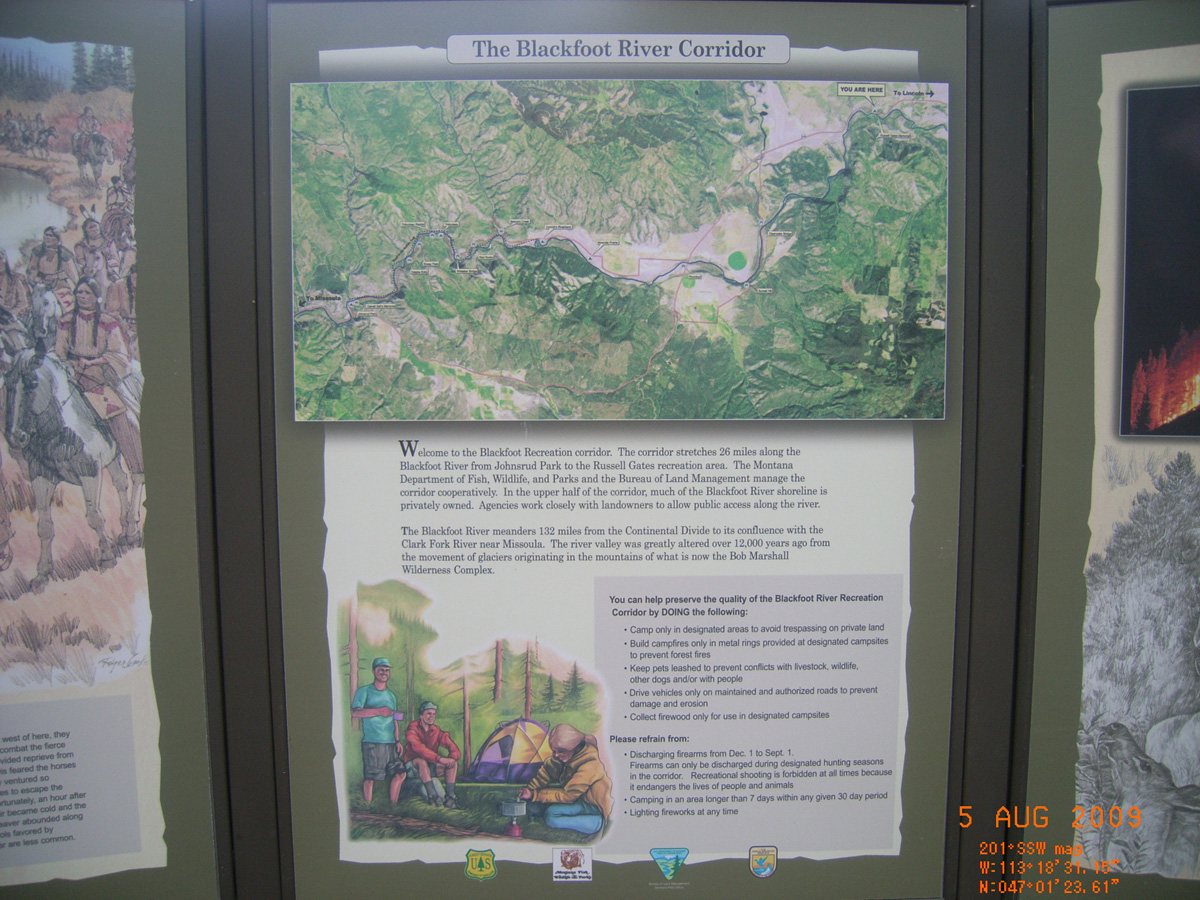
The Blackfoot River Corridor
- Material: Fiberglass
- Condition: Good
- Date Assessed: 2009-08-05
- File Name: RIMG0023.JPG
- Folder: C05AugustCam1
- Camera Direction: 248°
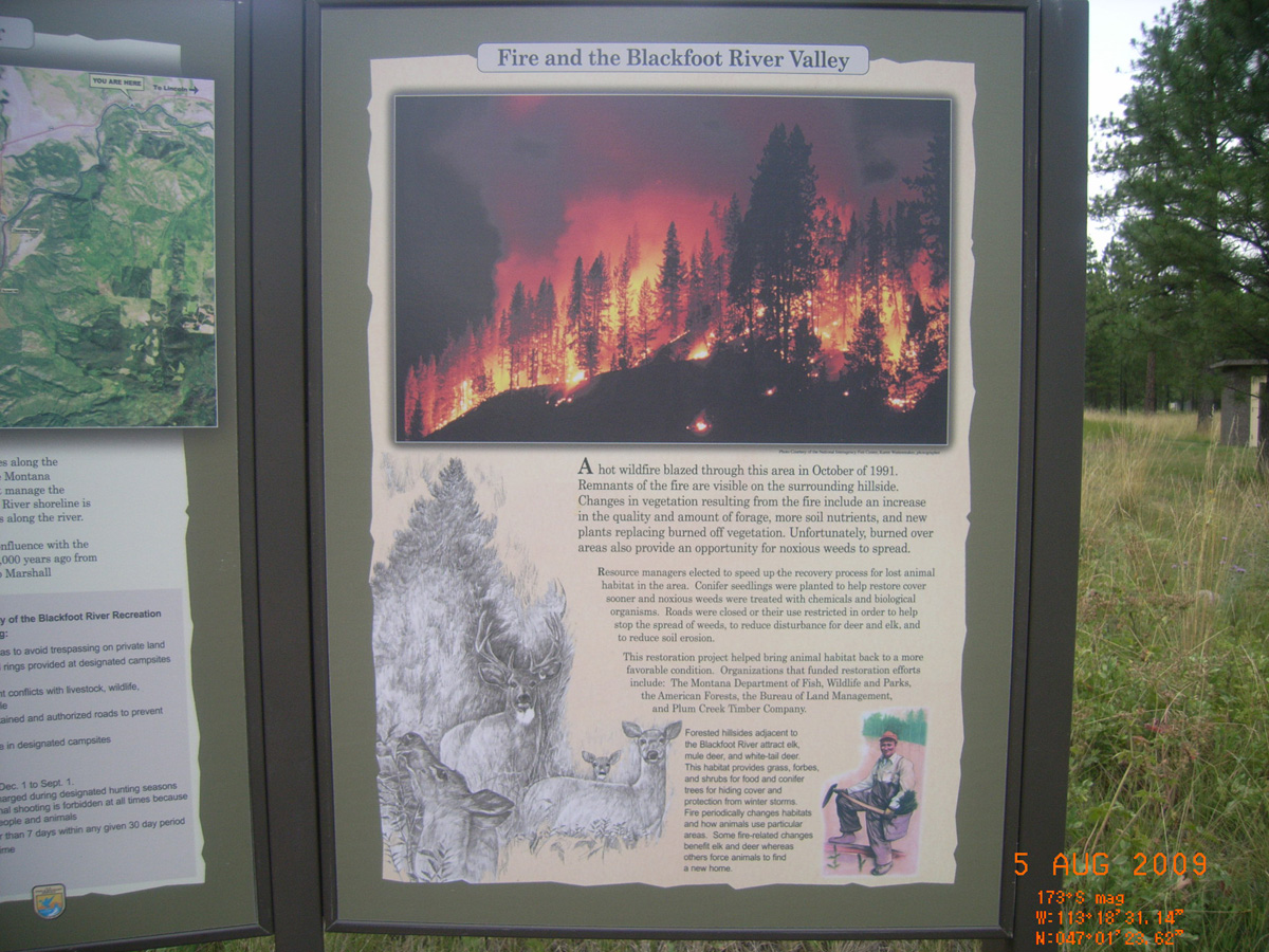
Fire and the Blackfoot River Valley
- Material: Fiberglass
- Condition: Good
- Date Assessed: 2009-08-05
- File Name: RIMG0024.JPG
- Folder: C05AugustCam1
- Camera Direction: 344°
- Date Assessed: 2009-08-05
- File Name: RIMG0025.JPG
- Folder: C05AugustCam1
- Camera Direction: 347°
- Date Assessed: 2009-08-05
- File Name: RIMG0026.JPG
- Folder: C05AugustCam1
- Camera Direction: 357°
- Date Assessed: 2009-08-05
- File Name: RIMG0027.JPG
- Folder: C05AugustCam1
- Camera Direction: 160°
- Date Assessed: 2009-08-05
- File Name: RIMG0028.JPG
- Folder: C05AugustCam1
- Camera Direction: 189°
- Date Assessed: 2009-08-05
- File Name: RIMG0029.JPG
- Folder: C05AugustCam1
- Camera Direction: 189°
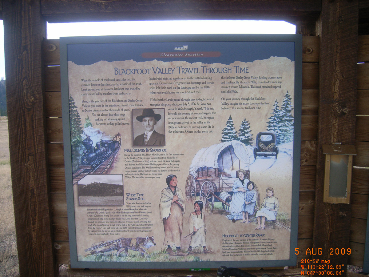
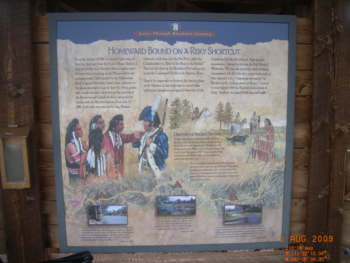
Clearwater Junction
Missoula County, Montana: 47.00183971, -113.3700342
Blackfoot Valley Travel Through Time
- Date Assessed: 2009-08-05
- File Name: RIMG0030.JPG
- Folder: C05AugustCam1
- Camera Direction: 212°
Homeward Bound on a risky Shortcut
- Date Assessed: 2009-08-05
- File Name: RIMG0031.JPG
- Folder: C05AugustCam1
- Camera Direction: 154°
Vital Passageway for People and Wildlife
- Date Assessed: 2009-08-05
- File Name: RIMG0032.JPG
- Folder: C05AugustCam1
- Camera Direction: 101°
Journey through the Blackfoot
- Date Assessed: 2009-08-05
- File Name: RIMG0033.JPG
- Folder: C05AugustCam1
- Camera Direction: 240°
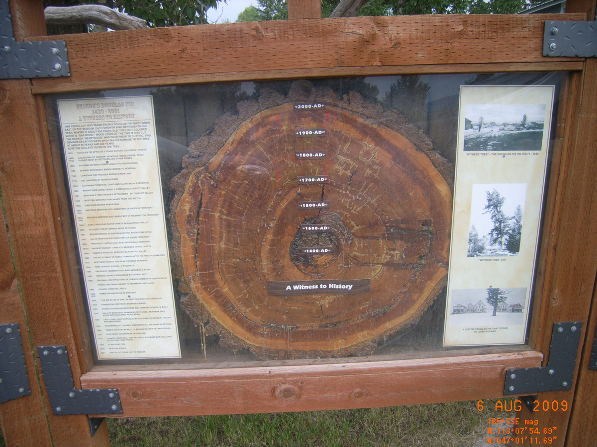
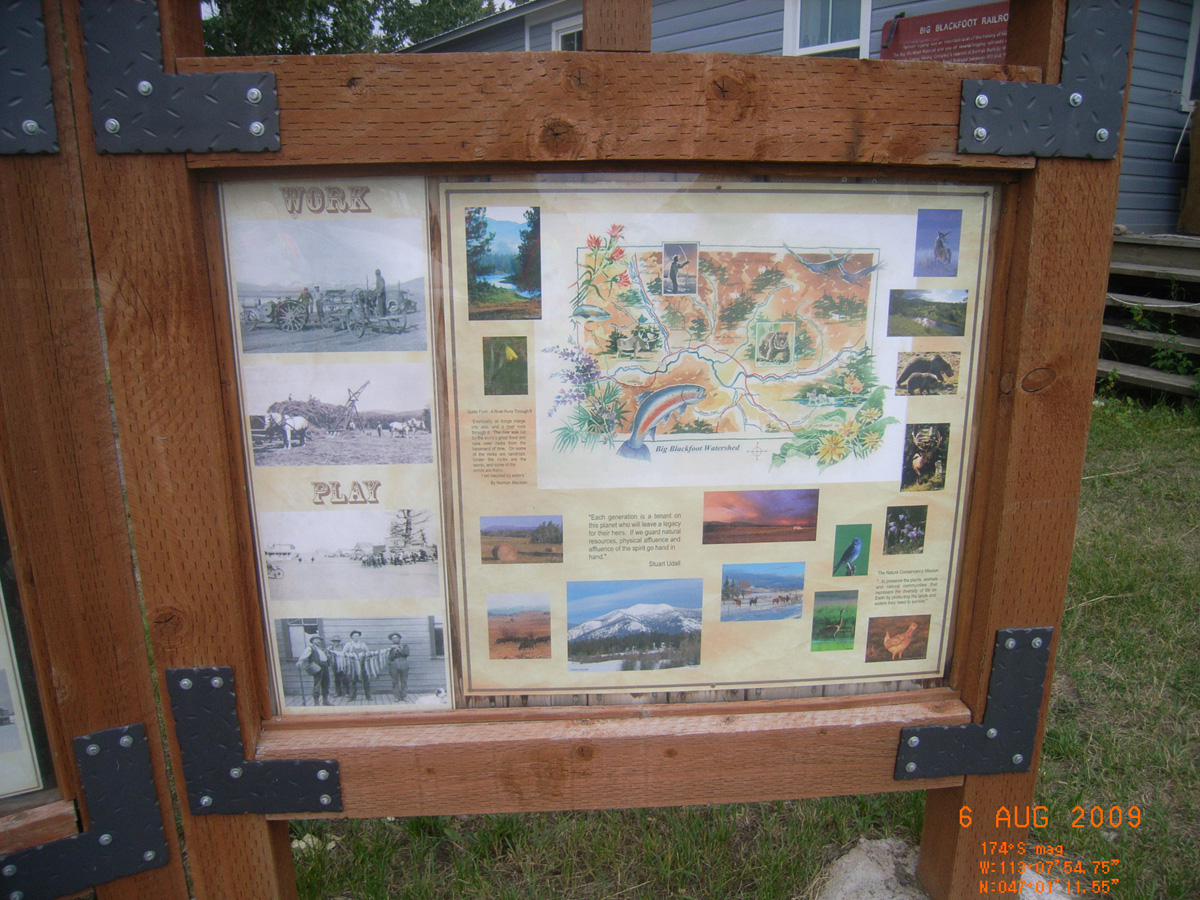
Ovando
Powell County, Montana: 47.01991714, -113.1319147
Early Ovando Years
- Date Assessed: 2009-08-06
- File Name: RIMG0035.JPG
- Folder: C05AugustCam1
- Camera Direction: 302°
Ovando's Douglas Fir
- Date Assessed: 2009-08-06
- File Name: RIMG0036.JPG
- Folder: C05AugustCam1
- Camera Direction: 7°
Work / Play
- Date Assessed: 2009-08-06
- File Name: RIMG0037.JPG
- Folder: C05AugustCam1
- Camera Direction: 114°
- Date Assessed: 2009-08-06
- File Name: RIMG0038.JPG
- Folder: C05AugustCam1
- Camera Direction: 149°
Lewis Minus Clark Expedition
- Date Assessed: 2009-08-06
- File Name: RIMG0039.JPG
- Folder: C05AugustCam1
- Camera Direction: 227°
- Date Assessed: 2009-08-06
- File Name: RIMG0040.JPG
- Folder: C05AugustCam1
- Camera Direction: 227°
Lincoln Ranger Station
Lewis and Clark County, Montana: 46.95667294, -112.656294
Intro Blackfeet Country
- Date Assessed: 2009-08-06
- File Name: RIMG0046.JPG
- Folder: C05AugustCam1
- Camera Direction: 351°
Homeward Bound on a Risky Shortcut
- Date Assessed: 2009-08-06
- File Name: RIMG0041.JPG
- Folder: C05AugustCam1
- Camera Direction: 351°
Aspen Grove Picnic Area, Lander's Fork
Lewis and Clark County, Montana: 46.97818895, -112.5335094
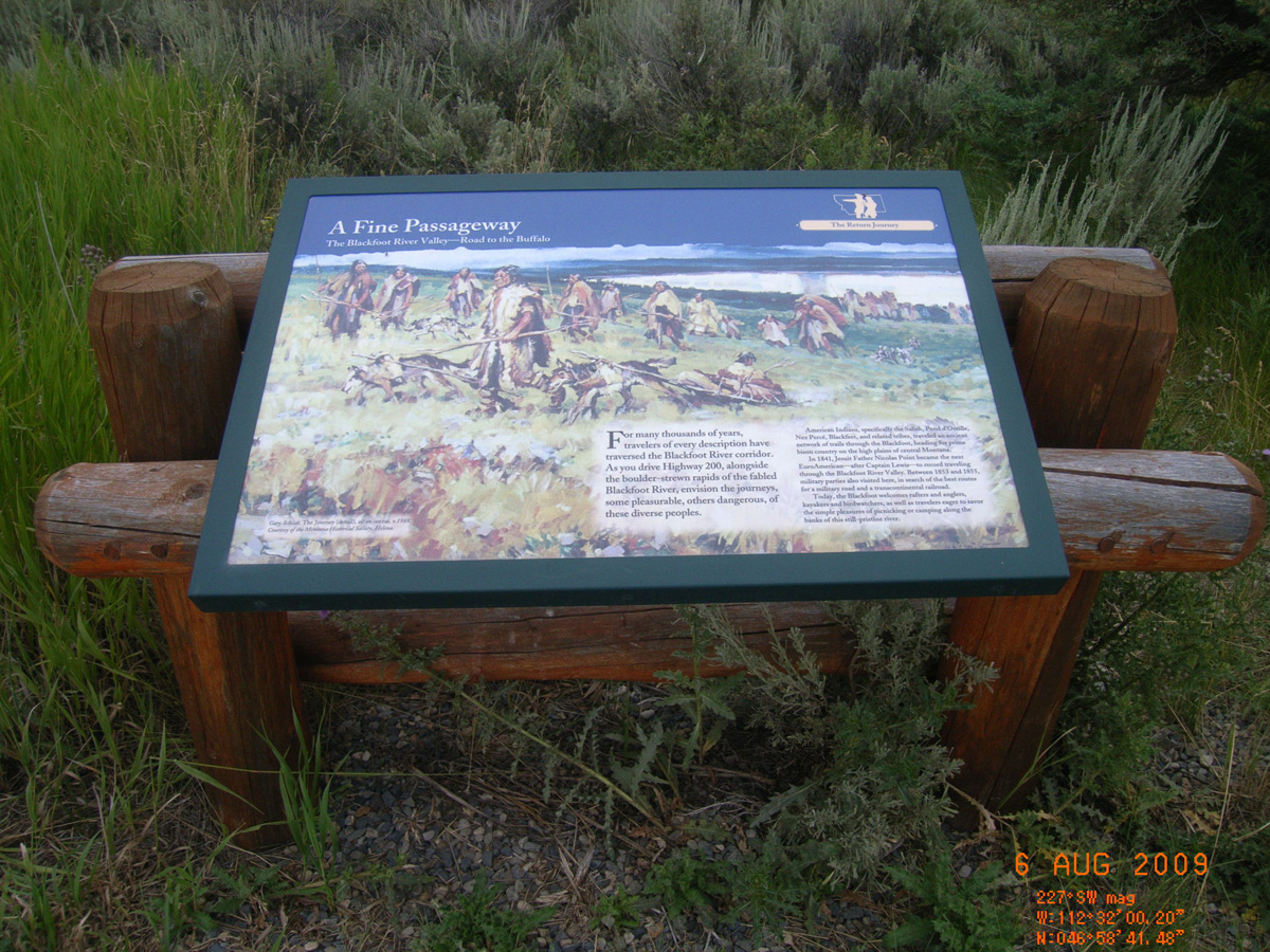
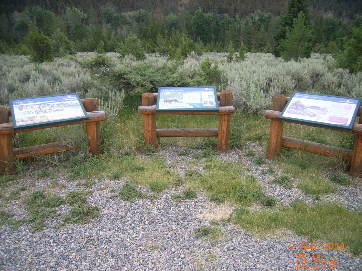
A Fine Passageway
- Date Assessed: 2009-08-06
- File Name: RIMG0047.JPG
- Folder: C05AugustCam1
- Camera Direction: 168°
A River Runs Through It
- Date Assessed: 2009-08-06
- File Name: RIMG0048.JPG
- Folder: C05AugustCam1
- Camera Direction: 162°
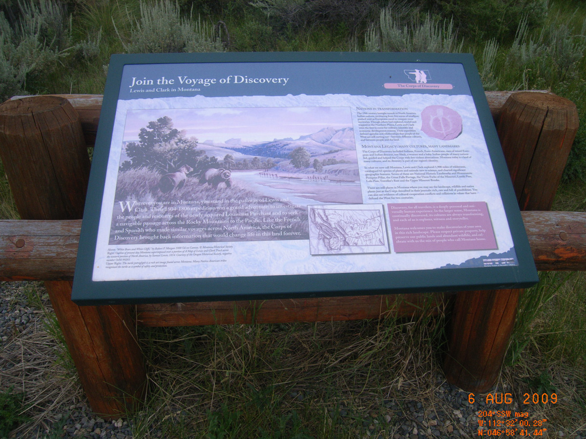
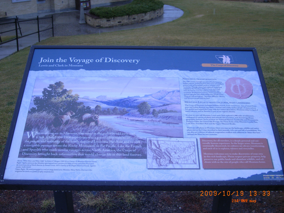
Join the Voyage of Discovery
- Date Assessed: 2009-08-06
- File Name: RIMG0049.JPG
- Folder: C05AugustCam1
- Camera Direction: 198°
- Date Assessed: 2009-08-06
- File Name: RIMG0050.JPG
- Folder: C05AugustCam1
- Camera Direction: 266°
Dearborn I-15 Rest Stop
Lewis and Clark County, Montana: 47.13115872, -111.9009938
Dearborn's River
- Date Assessed: 2009-08-06
- File Name: RIMG0064.JPG
- Folder: C05AugustCam1
- Camera Direction: 266°
Bighorned Animals
- Date Assessed: 2009-08-06
- File Name: RIMG0065.JPG
- Folder: C05AugustCam1
- Camera Direction: 77°
Join the Voyage of Discovery
- Date Assessed: 2009-08-06
- File Name: RIMG0066.JPG
- Folder: C05AugustCam1
- Camera Direction: 155°
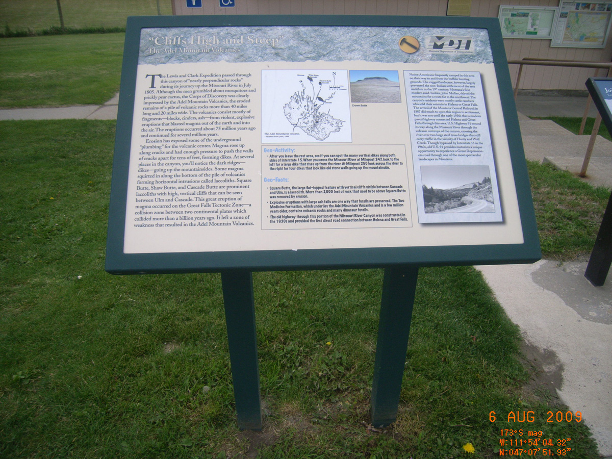
Cliffs High and Steep
- Date Assessed: 2009-08-06
- File Name: RIMG0067.JPG
- Folder: C05AugustCam1
- Camera Direction: 134°
HW 89, Birch Creek near Valier
Pondera County, Montana: 48.32139406, -112.5424111
Captain Meriwether Lewis
- Date Assessed: 2009-08-06
- File Name: RIMG0094.JPG
- Folder: C05AugustCam1
- Camera Direction: 116°
Captain Meriwether Lewis
- Date Assessed: 2009-08-06
- File Name: RIMG0095.JPG
- Folder: C05AugustCam1
- Camera Direction: 246°
Built by Paul & Olive Bruner...
- Date Assessed: 2009-08-06
- File Name: RIMG0096.JPG
- Folder: C05AugustCam1
- Camera Direction: 246°
HW 2, Great Northern's Camp Disappointment Statue
Glacier County, Montana: 48.59773233, -112.7968378
Camp Disappointment
- Date Assessed: 2009-08-06
- File Name: RIMG0112.JPG
- Folder: C06AugustCam1
- Camera Direction: 246°
- Date Assessed: 2009-08-06
- File Name: RIMG0113.JPG
- Folder: C06AugustCam1
- Camera Direction: 152°
- Date Assessed: 2009-08-06
- File Name: RIMG0114.JPG
- Folder: C06AugustCam1
- Camera Direction: 152°
I-15 Teton River Rest Stop (SB)
Teton County, Montana: 47.92447704, -111.735294
thunderclouds lowered around us
- Material: Fiberglass
- Condition: Good
- Date Assessed: 2009-08-06
- File Name: RIMG0144.JPG
- Folder: C06AugustCam1
- Camera Direction: 219°
The Lewis and Clark Expedition
- Material: Fiberglass
- Condition: Good
- Date Assessed: 2009-08-06
- File Name: RIMG0145.JPG
- Folder: C06AugustCam1
- Camera Direction: 191°
Join the Voyage of Discovery
- Material: Fiberglass
- Condition: Good
- Date Assessed: 2009-08-06
- File Name: RIMG0146.JPG
- Folder: C06AugustCam1
- Camera Direction: 191°
I-90 Bozeman Rest Stop
Gallatin County, Montana: 45.71213751, -111.0640364
- Material: Porcelain Enamel
- Condition: Good
- Date Assessed: 2009-08-06
- File Name: RIMG0230.JPG
- Folder: C06AugustCam2
- Camera Direction: 50°
Trail Through Time
- Material: Porcelain Enamel
- Condition: Good
- Date Assessed: 2009-08-06
- File Name: RIMG0231.JPG
- Folder: C06AugustCam2
- Camera Direction: 221°
First People in the Gallatin Valley
- Material: Porcelain Enamel
- Condition: Good
- Date Assessed: 2009-08-06
- File Name: RIMG0232.JPG
- Folder: C06AugustCam2
- Camera Direction: 159°
Lewis & Clark
- Material: Porcelain Enamel
- Condition: Fair
- Date Assessed: 2009-08-06
- File Name: RIMG0233.JPG
- Folder: C06AugustCam2
- Camera Direction: 166°
Fur Trade
- Material: Porcelain Enamel
- Condition: Good
- Date Assessed: 2009-08-06
- File Name: RIMG0234.JPG
- Folder: C06AugustCam2
- Camera Direction: 166°
Valley of Opportunity
- Date Assessed: 2009-08-06
- File Name: RIMG0235.JPG
- Folder: C06AugustCam2
- Camera Direction: 15°
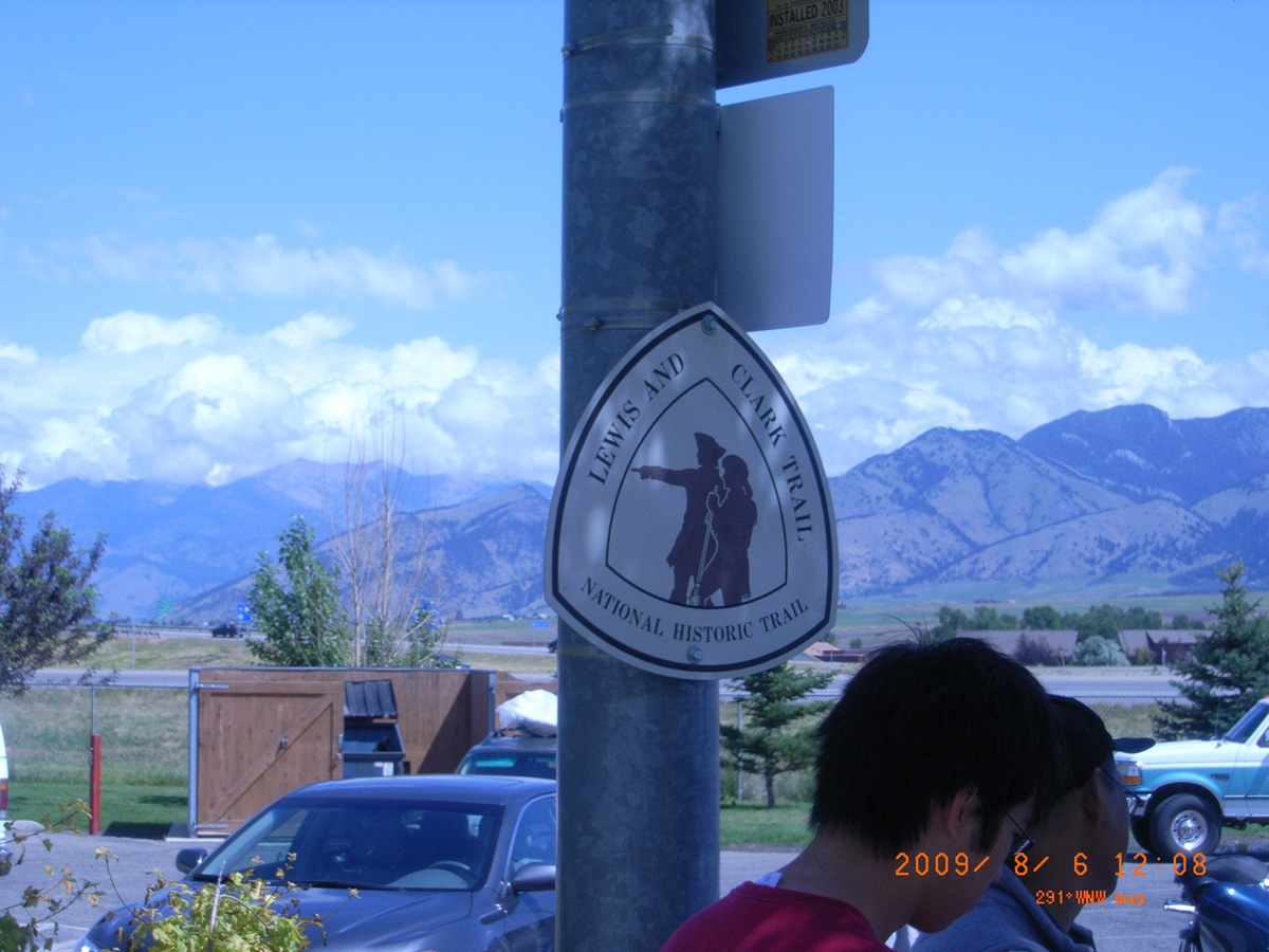
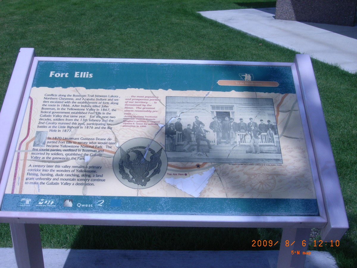
Fort Ellis
- Date Assessed: 2009-08-06
- File Name: RIMG0236.JPG
- Folder: C06AugustCam2
- Camera Direction: 15°
Bozeman, Kelly Canyon, Frontage Rd
Gallatin County, Montana: 45.6685228, -110.975304
The Bozeman Trail
- Date Assessed: 2009-08-06
- File Name: RIMG0238.JPG
- Folder: C06AugustCam2
- Camera Direction: 179°
Fort Ellis
- Date Assessed: 2009-08-06
- File Name: RIMG0239.JPG
- Folder: C06AugustCam2
- Camera Direction: 123°
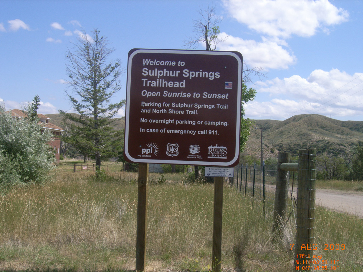
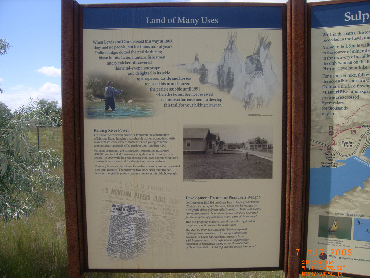
Sulphur Springs
Cascade County, Montana: 47.58212147, -111.0645626
Welcome to Sulphur Springs Trailhead
- Date Assessed: 2009-08-07
- File Name: RIMG0152.JPG
- Folder: C06AugustCam1
- Camera Direction: 213°
Land of Many Eyes
- Date Assessed: 2009-08-07
- File Name: RIMG0153.JPG
- Folder: C06AugustCam1
- Camera Direction: 207°
Sulpher Springs Hiking Trail
- Date Assessed: 2009-08-07
- File Name: RIMG0154.JPG
- Folder: C06AugustCam1
- Camera Direction: 164°
Lewis and Clark Reach the Rapids
- Date Assessed: 2009-08-07
- File Name: RIMG0155.JPG
- Folder: C06AugustCam1
- Camera Direction: 156°
- Date Assessed: 2009-08-07
- File Name: RIMG0156.JPG
- Folder: C06AugustCam1
- Camera Direction: 163°
- Date Assessed: 2009-08-07
- File Name: RIMG0157.JPG
- Folder: C06AugustCam1
- Camera Direction: 163°
- Date Assessed: 2009-08-07
- File Name: RIMG0158.JPG
- Folder: C06AugustCam1
- Camera Direction: 163°
- Date Assessed: 2009-08-07
- File Name: RIMG0159.JPG
- Folder: C06AugustCam1
- Camera Direction: 163°
- Date Assessed: 2009-08-07
- File Name: RIMG0160.JPG
- Folder: C06AugustCam1
- Camera Direction: 164°
- Date Assessed: 2009-08-07
- File Name: RIMG0161.JPG
- Folder: C06AugustCam1
- Camera Direction: 219°
- Date Assessed: 2009-08-07
- File Name: RIMG0162.JPG
- Folder: C06AugustCam1
- Camera Direction: 221°
- Date Assessed: 2009-08-07
- File Name: RIMG0163.JPG
- Folder: C06AugustCam1
- Camera Direction: 221°
Bozeman Pass
Gallatin County, Montana: 45.66682672, -110.8073413
The Lewis and Clark Expedition
- Date Assessed: 2009-08-06
- File Name: RIMG0253.JPG
- Folder: C06AugustCam2
- Camera Direction: 123°
Entering Yellowstone Valley
- Date Assessed: 2009-08-06
- File Name: RIMG0254.JPG
- Folder: C06AugustCam2
- Camera Direction: 37°
Columbus, Itch-Kep-Pe Park
Stillwater County, Montana: 45.6222807, -109.238488
Clark's Yellowstone River Camps
- Date Assessed: 2009-08-06
- File Name: RIMG0282.JPG
- Folder: C06AugustCam2
- Camera Direction: 71°
- Date Assessed: 2009-08-06
- File Name: RIMG0283.JPG
- Folder: C06AugustCam2
- Camera Direction: 71°
- Date Assessed: 2009-08-06
- File Name: RIMG0284.JPG
- Folder: C06AugustCam2
- Camera Direction: 76°
- Date Assessed: 2009-08-06
- File Name: RIMG0285.JPG
- Folder: C06AugustCam2
- Camera Direction: 68°
- Date Assessed: 2009-08-06
- File Name: RIMG0286.JPG
- Folder: C06AugustCam2
- Camera Direction: 68°
- Date Assessed: 2009-08-06
- File Name: RIMG0287.JPG
- Folder: C06AugustCam2
- Camera Direction: 68°
Itch-Kep-Pe
- Date Assessed: 2009-08-06
- File Name: RIMG0288.JPG
- Folder: C06AugustCam2
- Camera Direction: 300°
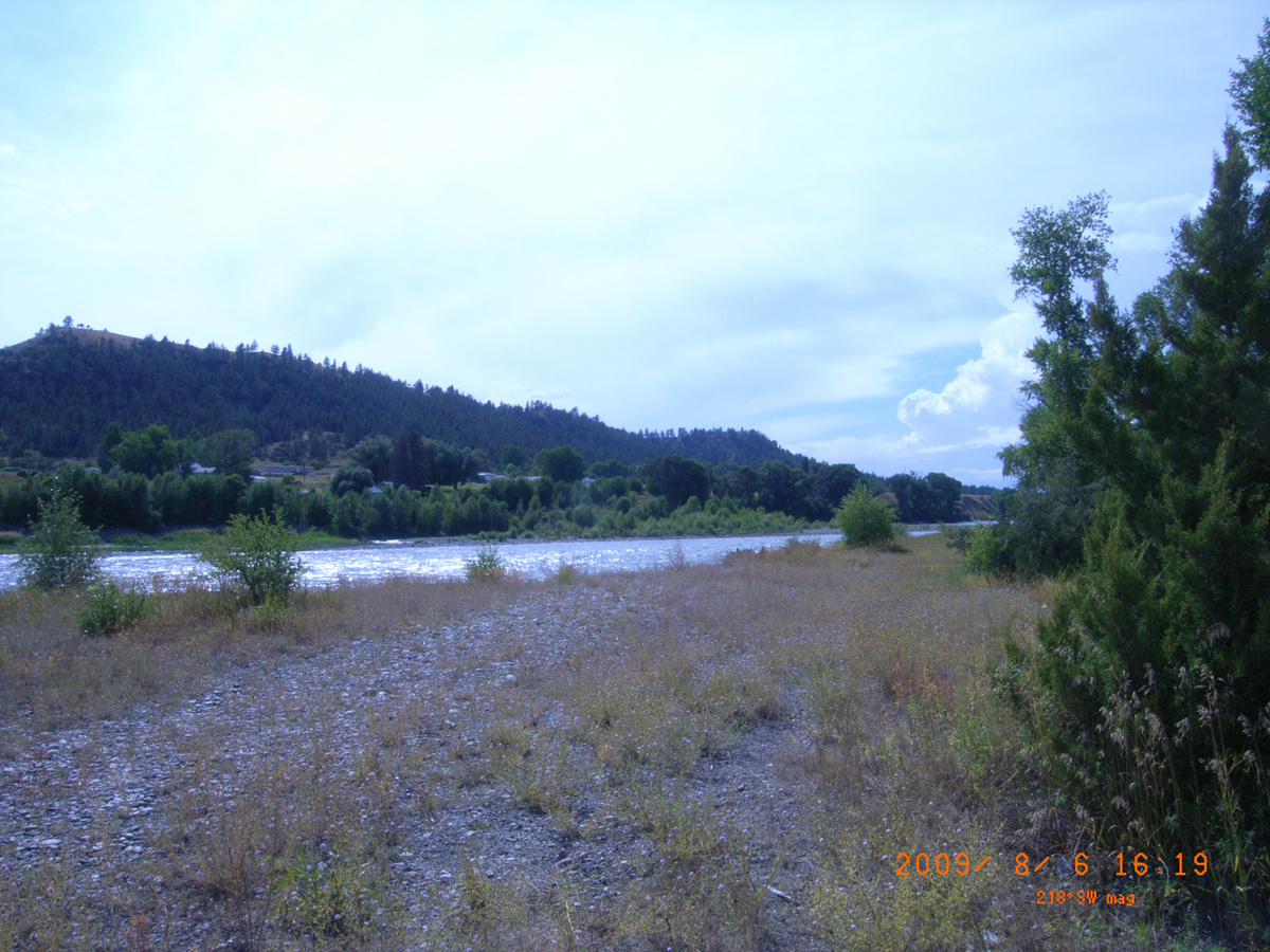
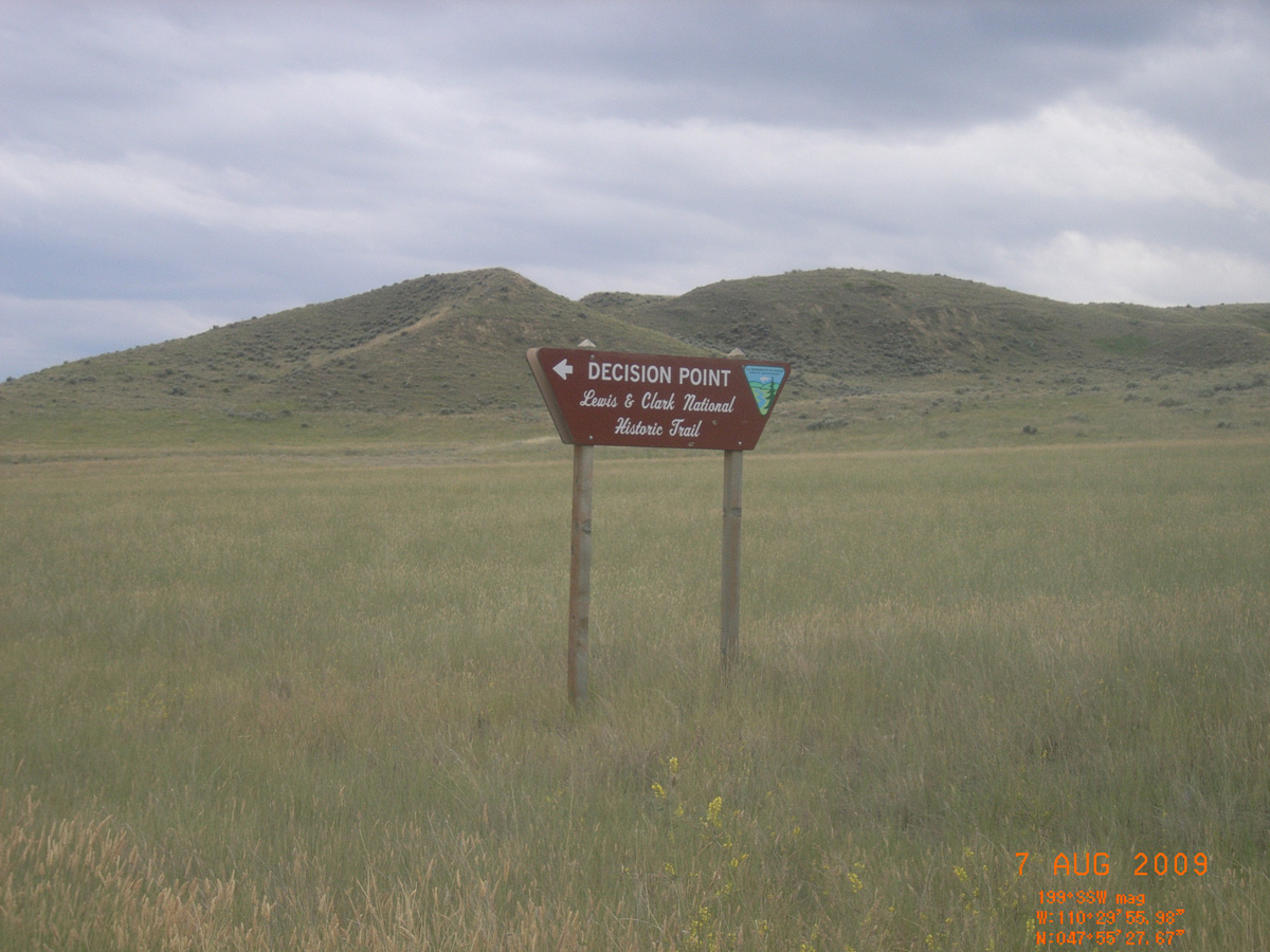
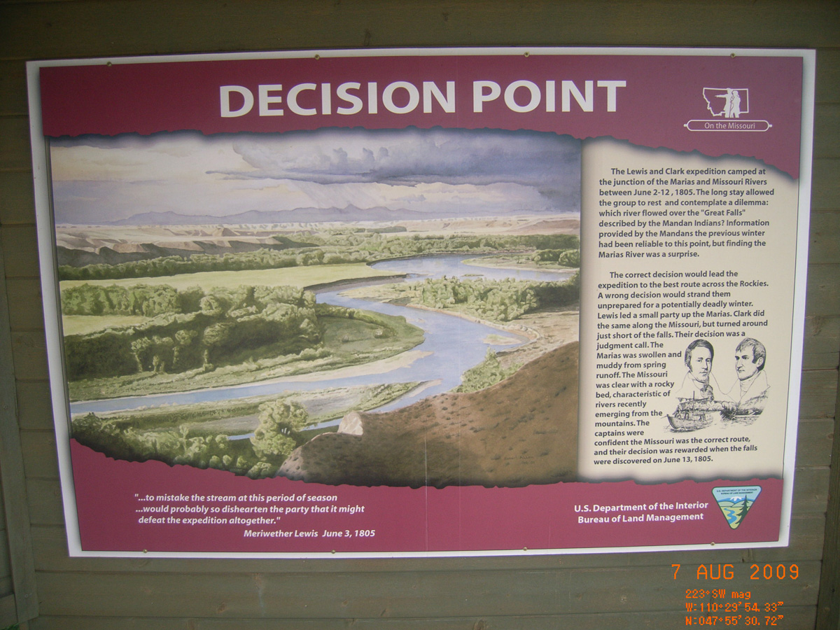
Decision Point
Chouteau County, Montana: 47.92504798, -110.4984337
Decision Point
- Date Assessed: 2009-08-07
- File Name: RIMG0183.JPG
- Folder: C06AugustCam1
- Camera Direction: 204°
The Lewis and Clark Expedition
- Date Assessed: 2009-08-07
- File Name: RIMG0184.JPG
- Folder: C06AugustCam1
- Camera Direction: 191°
Lewis and Clark in Montana
- Date Assessed: 2009-08-07
- File Name: RIMG0185.JPG
- Folder: C06AugustCam1
- Camera Direction: 198°
Decision Point
- Date Assessed: 2009-08-07
- File Name: RIMG0186.JPG
- Folder: C06AugustCam1
- Camera Direction: 329°
- Date Assessed: 2009-08-07
- File Name: RIMG0187.JPG
- Folder: C06AugustCam1
- Camera Direction: 177°
L&C Hiking Trail
- Date Assessed: 2009-08-07
- File Name: RIMG0188.JPG
- Folder: C06AugustCam1
- Camera Direction: 202°
Accessible View Point / L&C Campsite Marker
- Date Assessed: 2009-08-07
- File Name: RIMG0189.JPG
- Folder: C06AugustCam1
- Camera Direction: 202°
Decision Point Overlook
- Date Assessed: 2009-08-07
- File Name: RIMG0190.JPG
- Folder: C06AugustCam1
- Camera Direction: 202°
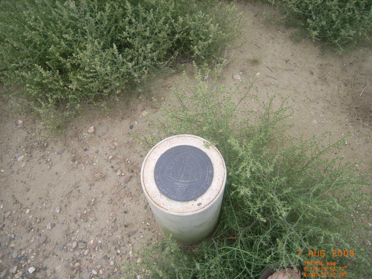
Lewis & Clark Campsite Benchmark
- Date Assessed: 2009-08-07
- File Name: RIMG0191.JPG
- Folder: C06AugustCam1
- Camera Direction: 186°
- Date Assessed: 2009-08-07
- File Name: RIMG0192.JPG
- Folder: C06AugustCam1
- Camera Direction: 222°
- Date Assessed: 2009-08-07
- File Name: RIMG0193.JPG
- Folder: C06AugustCam1
- Camera Direction: 173°
- Date Assessed: 2009-08-07
- File Name: RIMG0194.JPG
- Folder: C06AugustCam1
- Camera Direction: 173°
- Date Assessed: 2009-08-07
- File Name: RIMG0195.JPG
- Folder: C06AugustCam1
- Camera Direction: 215°
- Date Assessed: 2009-08-07
- File Name: RIMG0196.JPG
- Folder: C06AugustCam1
- Camera Direction: 215°
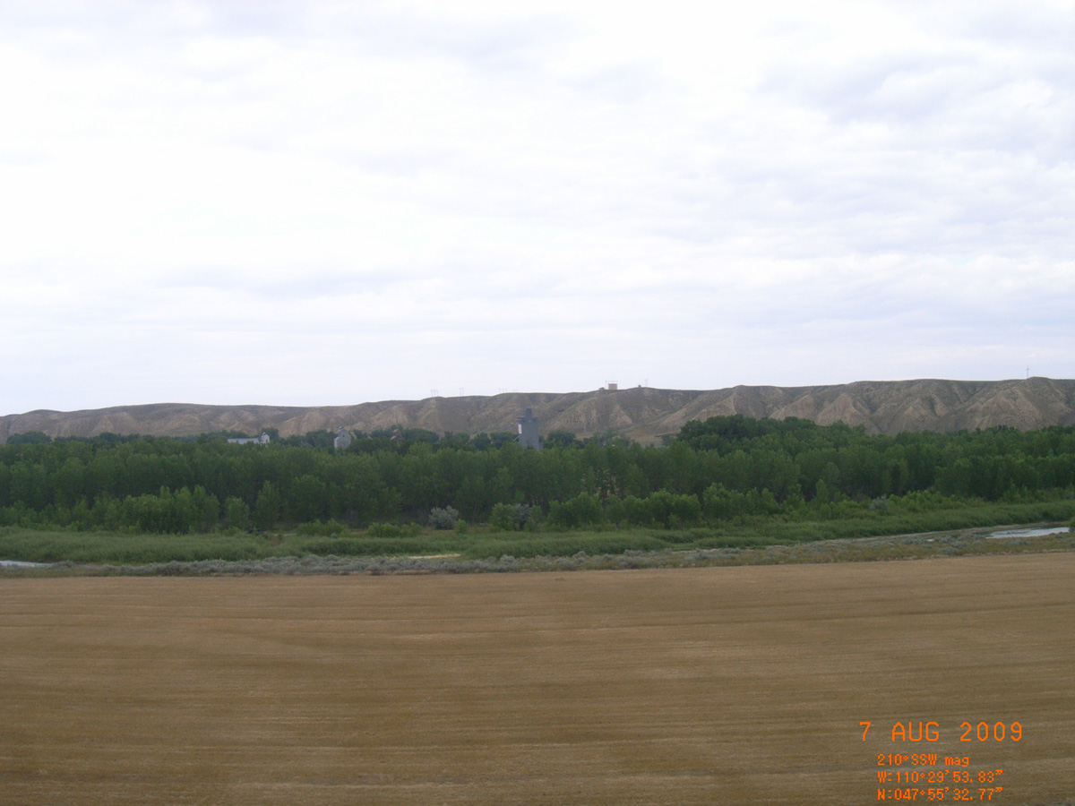
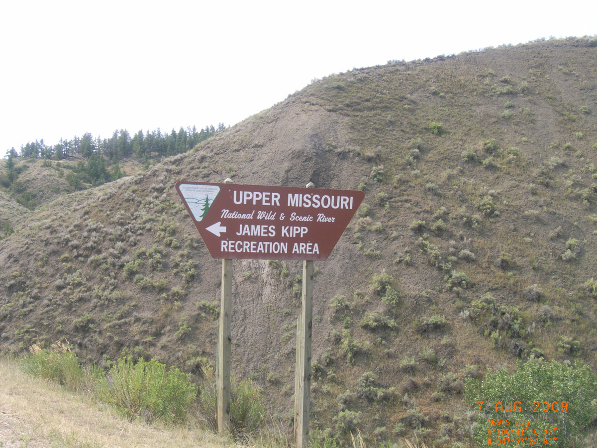
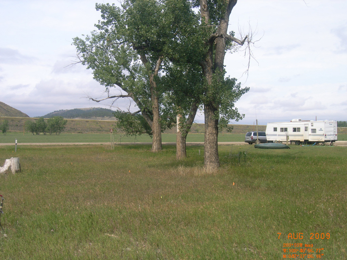
James Kipp Recreation Area
Fergus County, Montana: 47.62385332, -108.6823853
James Kipp Recreation Area
- Date Assessed: 2009-08-07
- File Name: RIMG0007.JPG
- Folder: C07AugustCam1
- Camera Direction: 164°
Upper Missouri River Breaks National Monument
- Date Assessed: 2009-08-07
- File Name: RIMG0008.JPG
- Folder: C07AugustCam1
- Camera Direction: 161°
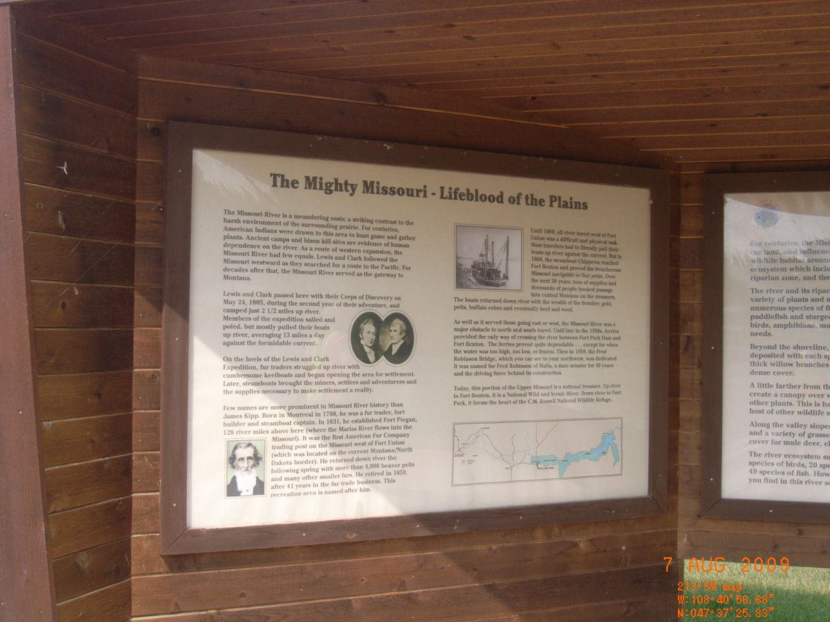
The Mighty Missouri - Lifeblood of the Plains
- Date Assessed: 2009-08-07
- File Name: RIMG0009.JPG
- Folder: C07AugustCam1
- Camera Direction: 160°
Pause and Experience the Amazing Diversity
- Date Assessed: 2009-08-07
- File Name: RIMG0010.JPG
- Folder: C07AugustCam1
- Camera Direction: 160°
Kipp Recreation Area (map)
- Date Assessed: 2009-08-07
- File Name: RIMG0011.JPG
- Folder: C07AugustCam1
- Camera Direction: 201°
- Date Assessed: 2009-08-07
- File Name: RIMG0012.JPG
- Folder: C07AugustCam1
- Camera Direction: 210°
- Date Assessed: 2009-08-07
- File Name: RIMG0013.JPG
- Folder: C07AugustCam1
- Camera Direction: 175°
- Date Assessed: 2009-08-07
- File Name: RIMG0014.JPG
- Folder: C07AugustCam1
- Camera Direction: 178°
- Date Assessed: 2009-08-07
- File Name: RIMG0015.JPG
- Folder: C07AugustCam1
- Camera Direction: 183°
- Date Assessed: 2009-08-07
- File Name: RIMG0016.JPG
- Folder: C07AugustCam1
- Camera Direction: 181°
- Date Assessed: 2009-08-07
- File Name: RIMG0017.JPG
- Folder: C07AugustCam1
- Camera Direction: 198°
Hathaway I-94 Eastbound Rest Area
Rosebud County, Montana: 46.26127778, -106.2794832
Join the Voyage of Discovery
- Date Assessed: 2009-08-07
- File Name: RIMG0057.JPG
- Folder: C07AugustCam2
- Camera Direction: 198°
The Hell Creek Formation
- Date Assessed: 2009-08-07
- File Name: RIMG0058.JPG
- Folder: C07AugustCam2
- Camera Direction: 50°
- Date Assessed: 2009-08-07
- File Name: RIMG0059.JPG
- Folder: C07AugustCam2
- Camera Direction: 172°
Fort Peck Dam
McCone County, Montana: 48.00975542, -106.3902216
Great Quantities of Every Species of Game Common Here
- Date Assessed: 2009-08-08
- File Name: RIMG0042.JPG
- Folder: C07AugustCam1
- Camera Direction: 227°
The Country is as Yesterday Beautiful in the Extreme
- Date Assessed: 2009-08-08
- File Name: RIMG0043.JPG
- Folder: C07AugustCam1
- Camera Direction: 262°
Sacagawea: Equal in Fortitude as any Member of the Party
- Date Assessed: 2009-08-08
- File Name: RIMG0044.JPG
- Folder: C07AugustCam1
- Camera Direction: 236°
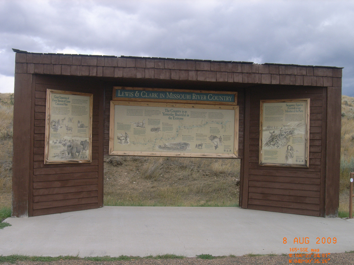
Lewis & Clark in Missouri River Country
- Date Assessed: 2009-08-08
- File Name: RIMG0045.JPG
- Folder: C07AugustCam1
- Camera Direction: 236°
Glendive
Dawson County, Montana: 47.1252048, -104.690301
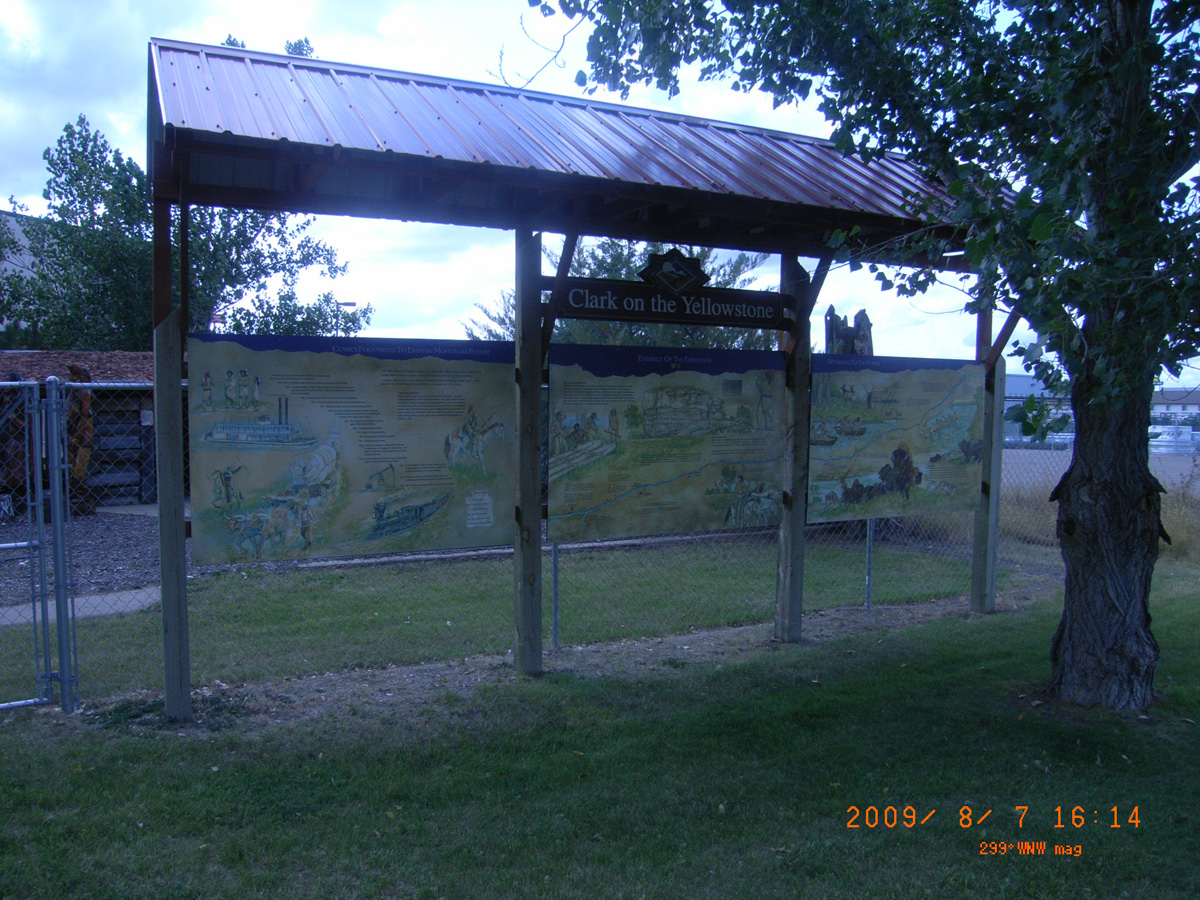
Clark on the Yellowstone
- Date Assessed: 2009-08-07
- File Name: RIMG0099.JPG
- Folder: C07AugustCam2
- Camera Direction: 65°
Clark's Footprints to Eastern Montana's Future
- Date Assessed: 2009-08-07
- File Name: RIMG0100.JPG
- Folder: C07AugustCam2
- Camera Direction: 203°
Experience of the Expedition
- Date Assessed: 2009-08-07
- File Name: RIMG0101.JPG
- Folder: C07AugustCam2
- Camera Direction: 246°
Returning to the Plains
- Date Assessed: 2009-08-07
- File Name: RIMG0102.JPG
- Folder: C07AugustCam2
- Camera Direction: 246°
- Date Assessed: 2009-08-07
- File Name: RIMG0103.JPG
- Folder: C07AugustCam2
- Camera Direction: 170°
- Date Assessed: 2009-08-07
- File Name: RIMG0104.JPG
- Folder: C07AugustCam2
- Camera Direction: 174°
Lewis and Clark Bridge near Wolf Point
McCone County, Montana: 48.06447529, -105.5338614
Lewis and Clark Bridge and Interpretive Site
- Date Assessed: 2009-08-08
- File Name: RIMG0062.JPG
- Folder: C07AugustCam1
- Camera Direction: 236°
The Wolf Point Bridge
- Date Assessed: 2009-08-08
- File Name: RIMG0063.JPG
- Folder: C07AugustCam1
- Camera Direction: 236°
Lewis & Clark Bridge and Interpretive Site
- Date Assessed: 2009-08-08
- File Name: RIMG0064.JPG
- Folder: C07AugustCam1
- Camera Direction: 245°
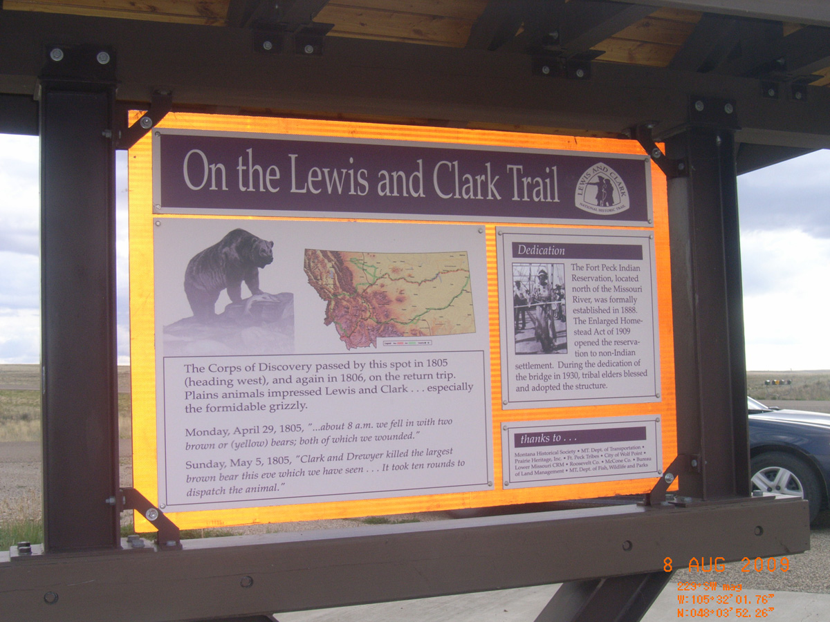
On the Lewis and Clark Trail
- Date Assessed: 2009-08-08
- File Name: RIMG0065.JPG
- Folder: C07AugustCam1
- Camera Direction: 244°
Two Camps Vista
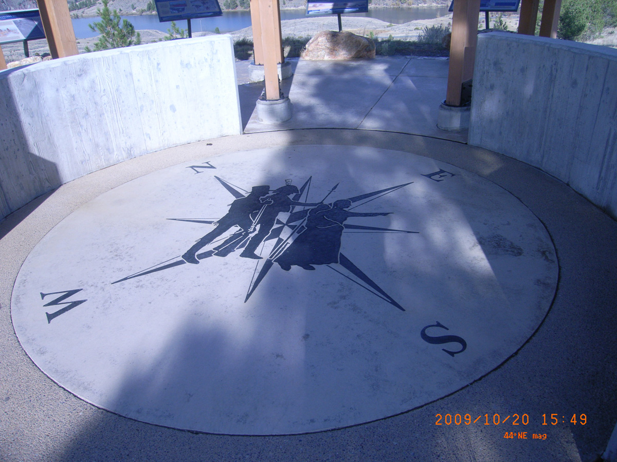
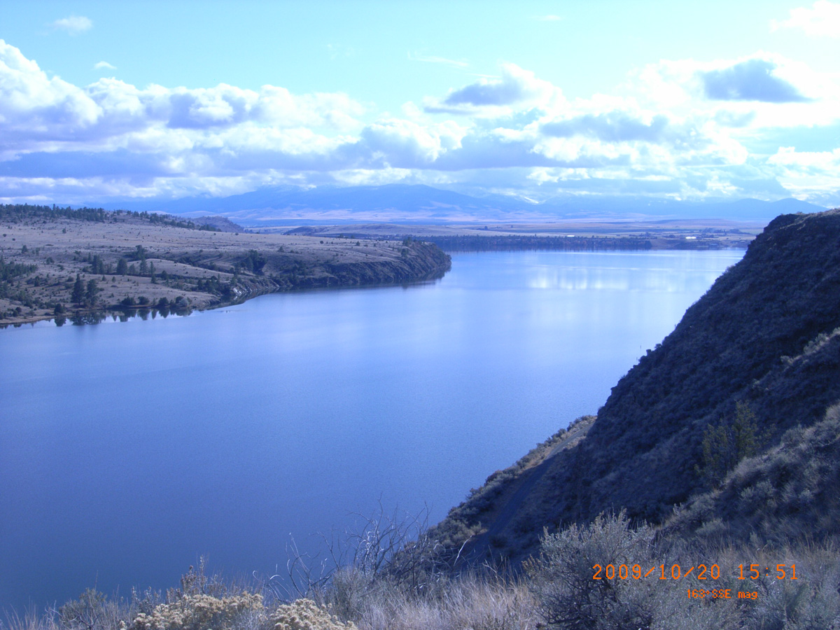
Lewis and Clark County, Montana: 46.69903394, -111.8110905
Two Camps Vista
- Date Assessed: 2009-10-20
- File Name: RIMG0051.JPG
- Folder: C20OctoberCam1
- Camera Direction: 58°
Two Camps Vista
- Date Assessed: 2009-10-20
- File Name: RIMG0052.JPG
- Folder: C20OctoberCam1
- Camera Direction: 253°
- Date Assessed: 2009-10-20
- File Name: RIMG0053.JPG
- Folder: C20OctoberCam1
- Camera Direction: 337°
From Faults to Fields & Flumes
- Date Assessed: 2009-10-20
- File Name: RIMG0054.JPG
- Folder: C20OctoberCam1
- Camera Direction: 62°
Early Travelers in the Valley
- Date Assessed: 2009-10-20
- File Name: RIMG0055.JPG
- Folder: C20OctoberCam1
- Camera Direction: 62°
Staking Their Claim
- Date Assessed: 2009-10-20
- File Name: RIMG0056.JPG
- Folder: C20OctoberCam1
- Camera Direction: 63°
Fields of Dreams
- Date Assessed: 2009-10-20
- File Name: RIMG0057.JPG
- Folder: C20OctoberCam1
- Camera Direction: 144°
Join the Corps of Discovery
- Date Assessed: 2009-10-20
- File Name: RIMG0058.JPG
- Folder: C20OctoberCam1
- Camera Direction: 144°
Fun in the Prickly Pear Valley
- Date Assessed: 2009-10-20
- File Name: RIMG0059.JPG
- Folder: C20OctoberCam1
- Camera Direction: 144°
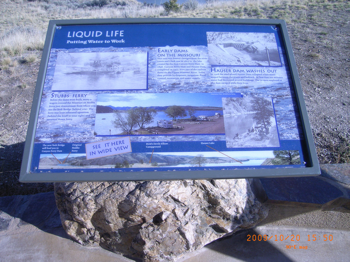
Liquid Life
- Date Assessed: 2009-10-20
- File Name: RIMG0060.JPG
- Folder: C20OctoberCam1
- Camera Direction: 141°
The Queen City of the Rockies
- Date Assessed: 2009-10-20
- File Name: RIMG0061.JPG
- Folder: C20OctoberCam1
- Camera Direction: 138°
- Date Assessed: 2009-10-20
- File Name: RIMG0062.JPG
- Folder: C20OctoberCam1
- Camera Direction: 152°
- Date Assessed: 2009-10-20
- File Name: RIMG0063.JPG
- Folder: C20OctoberCam1
- Camera Direction: 241°
- Date Assessed: 2009-10-20
- File Name: RIMG0064.JPG
- Folder: C20OctoberCam1
- Camera Direction: 332°
- Date Assessed: 2009-10-20
- File Name: RIMG0065.JPG
- Folder: C20OctoberCam1
- Camera Direction: 332°
- Date Assessed: 2009-10-20
- File Name: RIMG0066.JPG
- Folder: C20OctoberCam1
- Camera Direction: 146°
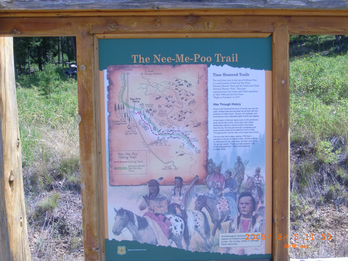
HW 93 near Indian Trees Campground
Ravalli County, Montana: 45.7570485, -113.9444242
The Nee-Me-Poo Trail
- Material: High Pres Laminate
- Condition: Good
- Date Assessed: 2009-08-05
- File Name: RIMG0032.JPG
- Folder: C05AugustCam2
- Camera Direction: 43°
Fort Benton
Chouteau County, Montana: 47.8200793, -110.664485
The Lewis and Clark Expedition
- Material: Fiberglass
- Condition: Good
- Date Assessed: 2009-07-22
- File Name: RIMG0034.JPG
- Folder: C22JulyCam1
- Camera Direction: 0°
Lewis and Clark Trail
- Material: Fiberglass
- Condition: Good
- Date Assessed: 2009-07-22
- File Name: RIMG0035.JPG
- Folder: C22JulyCam1
- Camera Direction: 0°
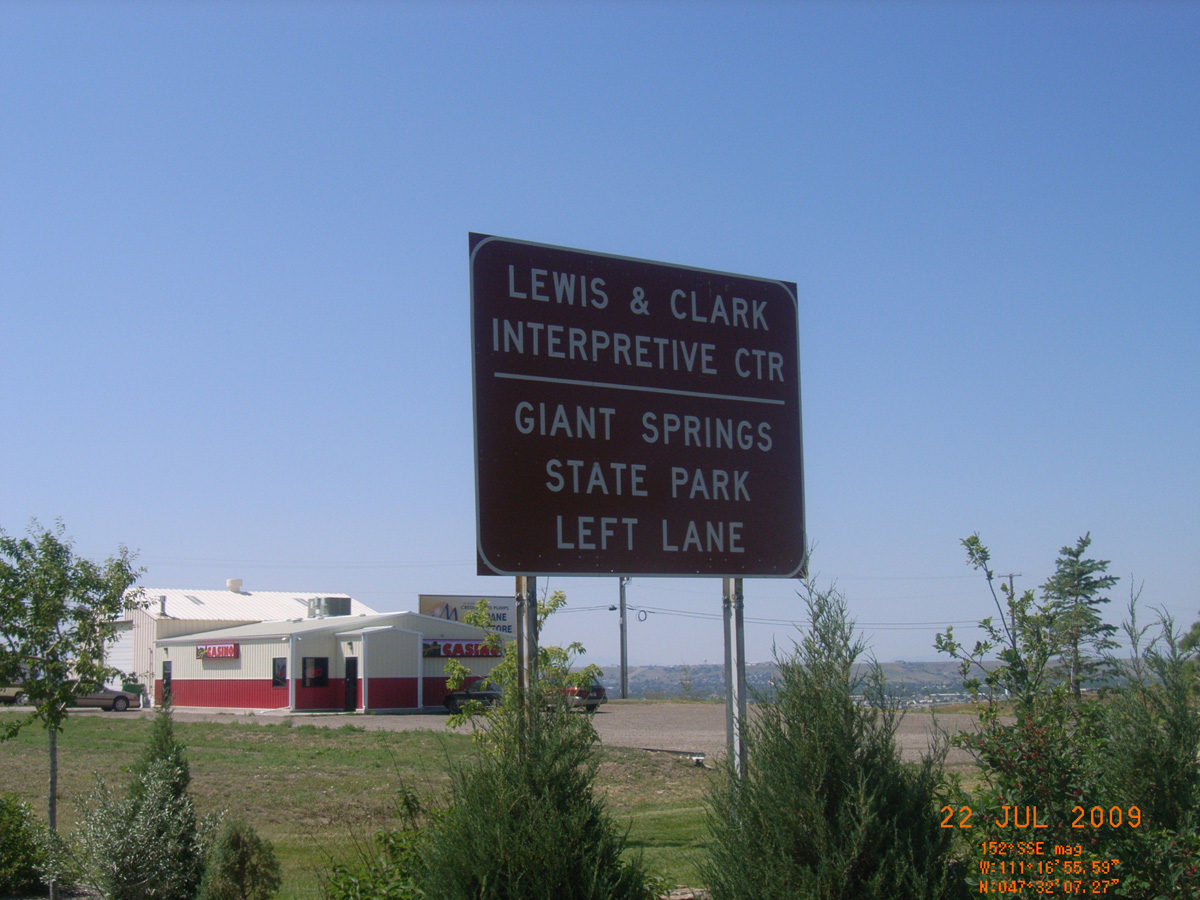
Giant Springs State Park
Cascade County, Montana: 47.53432991, -111.2298898
Giant Springs State Park
- Date Assessed: 2009-07-22
- File Name: RIMG0037.JPG
- Folder: C22JulyCam1
- Camera Direction: 0°
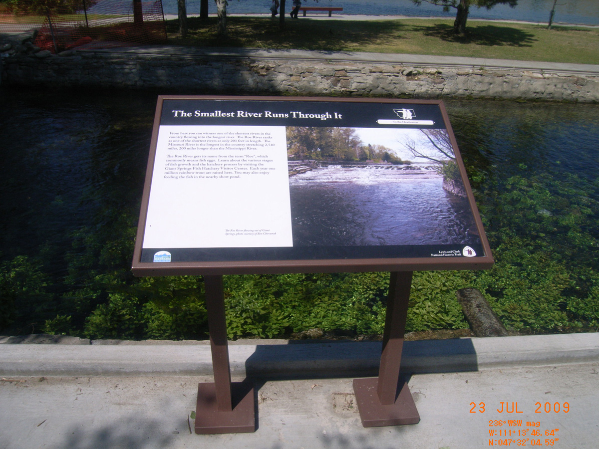
The Smallest River Runs Through It
- Material: Fiberglass
- Condition: Good
- Date Assessed: 2009-07-23
- File Name: RIMG0050.JPG
- Folder: C22JulyCam1
- Camera Direction: 80°
These Springs have Witnessed
- Material: Fiberglass
- Condition: Good
- Date Assessed: 2009-07-23
- File Name: RIMG0051.JPG
- Folder: C22JulyCam1
- Camera Direction: 80°
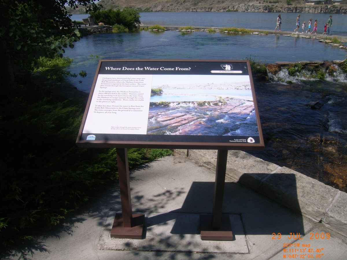
Where does the Water Come From?
- Material: Fiberglass
- Condition: Good
- Date Assessed: 2009-07-23
- File Name: RIMG0052.JPG
- Folder: C22JulyCam1
- Camera Direction: 56°
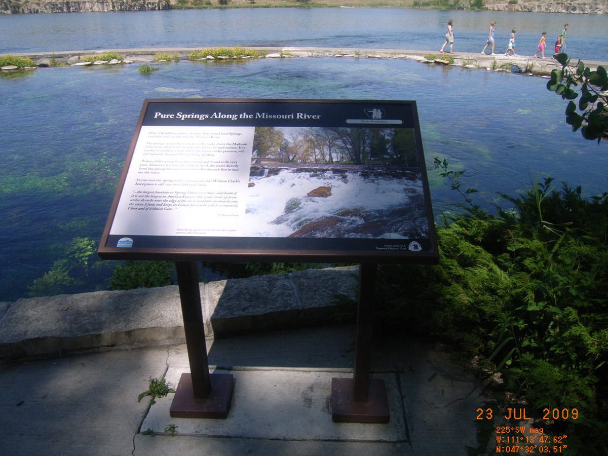
Pure Springs Along the Missouri River
- Material: Fiberglass
- Condition: Good
- Date Assessed: 2009-07-23
- File Name: RIMG0053.JPG
- Folder: C22JulyCam1
- Camera Direction: 137°
Tower Rock
Cascade County, Montana: 47.18812411, -111.8099669
Tower Rock Trail
- Material: Fiberglass
- Condition: Good
- Date Assessed: 2009-08-06
- File Name: RIMG0071.JPG
- Folder: C05AugustCam1
- Camera Direction: 300°
High Winds Stop the Journey
- Material: Fiberglass
- Condition: Good
- Date Assessed: 2009-08-06
- File Name: RIMG0072.JPG
- Folder: C05AugustCam1
- Camera Direction: 87°
Transitional Terrain
- Material: Fiberglass
- Condition: Good
- Date Assessed: 2009-08-06
- File Name: RIMG0073.JPG
- Folder: C05AugustCam1
- Camera Direction: 79°
This rock I called the Tower'
- Material: Fiberglass
- Condition: Good
- Date Assessed: 2009-08-06
- File Name: RIMG0074.JPG
- Folder: C05AugustCam1
- Camera Direction: 89°
A Well Traveled Path
- Material: Fiberglass
- Condition: Good
- Date Assessed: 2009-08-06
- File Name: RIMG0075.JPG
- Folder: C05AugustCam1
- Camera Direction: 185°
Tiber Dam
Liberty County, Montana: 48.32578423, -111.079416
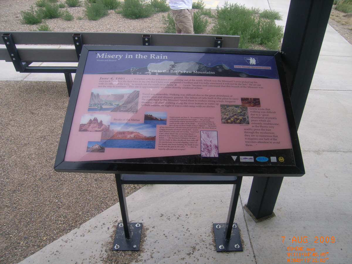
Misery in the Rain
- Material: Fiberglass
- Condition: Good
- Date Assessed: 2009-08-07
- File Name: RIMG0169.JPG
- Folder: C06AugustCam1
- Camera Direction: 170°
Lewis on the Marias
- Material: Fiberglass
- Condition: Good
- Date Assessed: 2009-08-07
- File Name: RIMG0170.JPG
- Folder: C06AugustCam1
- Camera Direction: 189°
A Ride Through the Buffalo
- Material: Fiberglass
- Condition: Good
- Date Assessed: 2009-08-07
- File Name: RIMG0171.JPG
- Folder: C06AugustCam1
- Camera Direction: 214°
The Lewis and Clark Expedition
- Material: Fiberglass
- Condition: Good
- Date Assessed: 2009-08-07
- File Name: RIMG0172.JPG
- Folder: C06AugustCam1
- Camera Direction: 214°
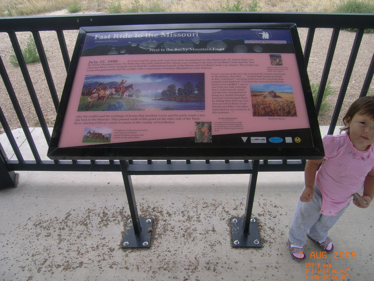
Fast Ride to the Missouri
- Material: Fiberglass
- Condition: Good
- Date Assessed: 2009-08-07
- File Name: RIMG0173.JPG
- Folder: C06AugustCam1
- Camera Direction: 167°
Back on the Marias
- Date Assessed: 2009-08-07
- File Name: RIMG0174.JPG
- Folder: C06AugustCam1
- Camera Direction: 165°
- Date Assessed: 2009-08-07
- File Name: RIMG0175.JPG
- Folder: C06AugustCam1
- Camera Direction: 154°
I-94 Hilger exit
Lewis and Clark County, Montana: 46.81970012, -111.9970734
Welcome to the Gates of the Mountains
- Material: High Pres Laminate
- Condition: Good
- Date Assessed: 2009-07-23
- File Name: RIMG0001.JPG
- Folder: C23JulyCam2
- Camera Direction: 268°
Shrewd Businessman, Caring Neighbor
- Material: High Pres Laminate
- Condition: Good
- Date Assessed: 2009-07-23
- File Name: RIMG0002.JPG
- Folder: C23JulyCam2
- Camera Direction: 10°
Innovative Pioneer, Lasting Legacies
- Material: High Pres Laminate
- Condition: Good
- Date Assessed: 2009-07-23
- File Name: RIMG0003.JPG
- Folder: C23JulyCam2
- Camera Direction: 139°
Naturally Sustained Productivity
- Material: High Pres Laminate
- Condition: Good
- Date Assessed: 2009-07-23
- File Name: RIMG0004.JPG
- Folder: C23JulyCam2
- Camera Direction: 141°
Undaunted Stewardship
- Material: High Pres Laminate
- Condition: Good
- Date Assessed: 2009-07-23
- File Name: RIMG0005.JPG
- Folder: C23JulyCam2
- Camera Direction: 203°
Explorers, Prospectors, & Ranchers
- Date Assessed: 2009-07-23
- File Name: RIMG0006.JPG
- Folder: C23JulyCam2
- Camera Direction: 203°
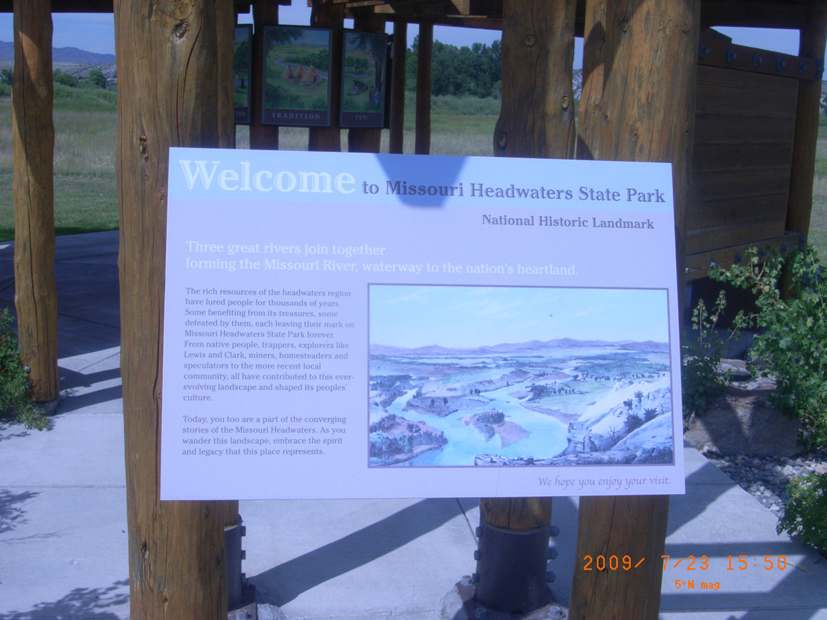
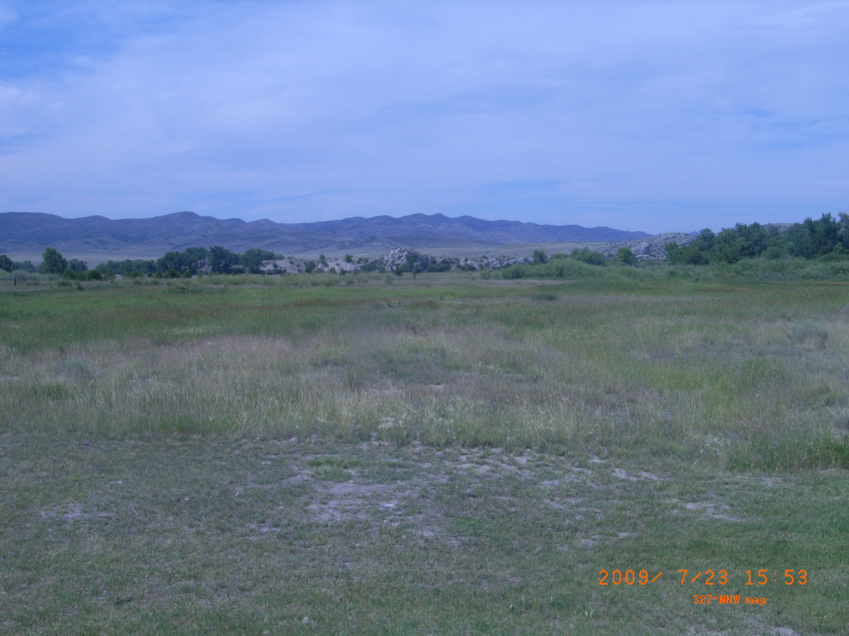
Missouri Headwaters State Park
Gallatin County, Montana: 45.92043289, -111.4988043
Welcome to Missouri Headwaters State Park
- Material: High Pres Laminate
- Condition: Good
- Date Assessed: 2009-07-23
- File Name: RIMG0027.JPG
- Folder: C23JulyCam2
- Camera Direction: 348°
Montana's past comes alive
- Material: High Pres Laminate
- Condition: Good
- Date Assessed: 2009-07-23
- File Name: RIMG0028.JPG
- Folder: C23JulyCam2
- Camera Direction: 348°
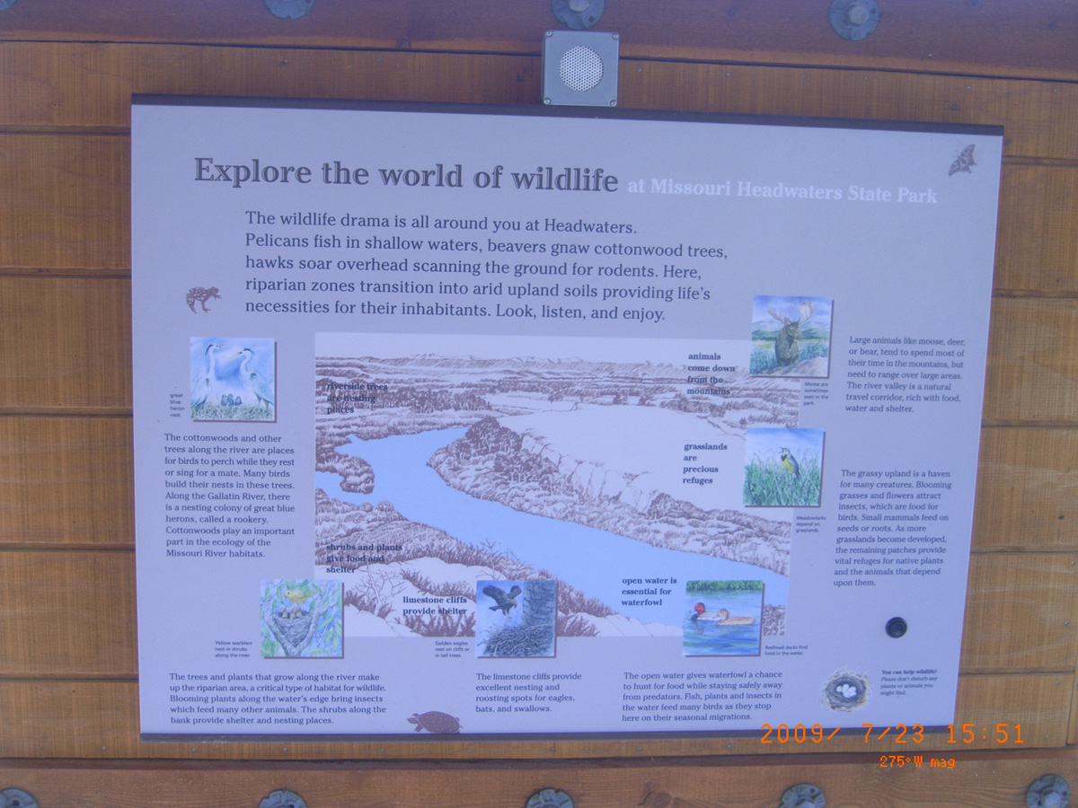
Explore the world of wildlife
- Material: High Pres Laminate
- Condition: Good
- Date Assessed: 2009-07-23
- File Name: RIMG0029.JPG
- Folder: C23JulyCam2
- Camera Direction: 73°
- Material: High Pres Laminate
- Condition: Good
- Date Assessed: 2009-07-23
- File Name: RIMG0030.JPG
- Folder: C23JulyCam2
- Camera Direction: 75°
- Material: High Pres Laminate
- Condition: Good
- Date Assessed: 2009-07-23
- File Name: RIMG0031.JPG
- Folder: C23JulyCam2
- Camera Direction: 65°
- Date Assessed: 2009-07-23
- File Name: RIMG0032.JPG
- Folder: C23JulyCam2
- Camera Direction: 177°
- Date Assessed: 2009-07-23
- File Name: RIMG0033.JPG
- Folder: C23JulyCam2
- Camera Direction: 271°
- Date Assessed: 2009-07-23
- File Name: RIMG0034.JPG
- Folder: C23JulyCam2
- Camera Direction: 271°
- Date Assessed: 2009-07-23
- File Name: RIMG0035.JPG
- Folder: C23JulyCam2
- Camera Direction: 155°
- Date Assessed: 2009-07-23
- File Name: RIMG0036.JPG
- Folder: C23JulyCam2
- Camera Direction: 151°
- Date Assessed: 2009-07-23
- File Name: RIMG0037.JPG
- Folder: C23JulyCam2
- Camera Direction: 145°
- Date Assessed: 2009-07-23
- File Name: RIMG0038.JPG
- Folder: C23JulyCam2
- Camera Direction: 145°
- Date Assessed: 2009-07-23
- File Name: RIMG0039.JPG
- Folder: C23JulyCam2
- Camera Direction: 2°
- Date Assessed: 2009-07-23
- File Name: RIMG0040.JPG
- Folder: C23JulyCam2
- Camera Direction: 3°
- Date Assessed: 2009-07-23
- File Name: RIMG0041.JPG
- Folder: C23JulyCam2
- Camera Direction: 154°
- Date Assessed: 2009-07-23
- File Name: RIMG0042.JPG
- Folder: C23JulyCam2
- Camera Direction: 153°
- Date Assessed: 2009-07-23
- File Name: RIMG0043.JPG
- Folder: C23JulyCam2
- Camera Direction: 140°
- Date Assessed: 2009-07-23
- File Name: RIMG0044.JPG
- Folder: C23JulyCam2
- Camera Direction: 140°
- Date Assessed: 2009-07-23
- File Name: RIMG0045.JPG
- Folder: C23JulyCam2
- Camera Direction: 358°
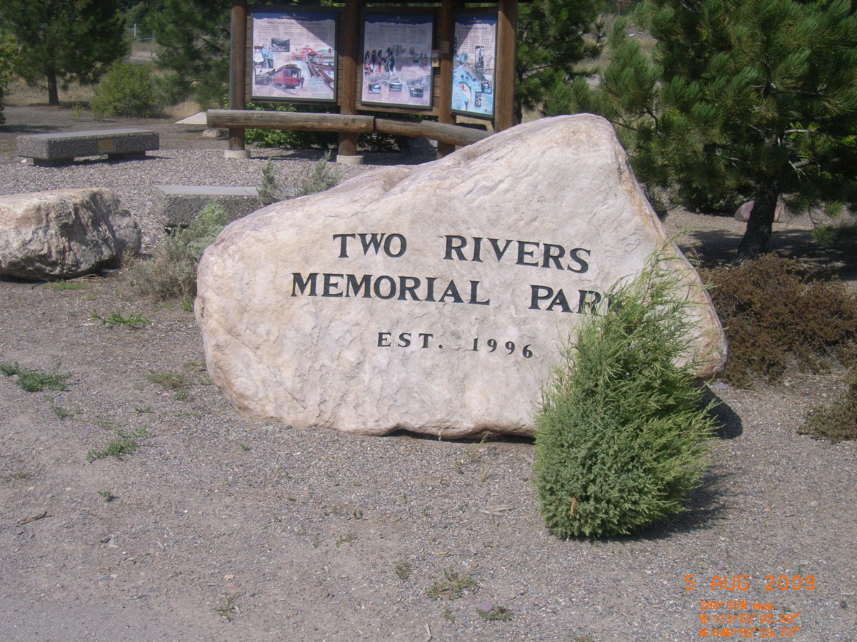
Two Rivers Memorial Park
Missoula County, Montana: 46.87503576, -113.8855476
Homeward Bound on a Risky Shortcut
- Material: High Pres Laminate
- Condition: Good
- Date Assessed: 2009-08-05
- File Name: RIMG0166.JPG
- Folder: C04AugustCam1
- Camera Direction: 265°
Many Cultures Forged Strong Communities
- Material: High Pres Laminate
- Condition: Good
- Date Assessed: 2009-08-05
- File Name: RIMG0167.JPG
- Folder: C04AugustCam1
- Camera Direction: 266°
Vital Passageway for People and Wildlife
- Material: High Pres Laminate
- Condition: Good
- Date Assessed: 2009-08-05
- File Name: RIMG0168.JPG
- Folder: C04AugustCam1
- Camera Direction: 256°
Journey Through the Blackfoot
- Date Assessed: 2009-08-05
- File Name: RIMG0169.JPG
- Folder: C04AugustCam1
- Camera Direction: 302°
Two Rivers Memorial Park
- Date Assessed: 2009-08-05
- File Name: RIMG0170.JPG
- Folder: C04AugustCam1
- Camera Direction: 104°
Captain Meriwether Lewis and Seaman
- Date Assessed: 2009-08-05
- File Name: RIMG0171.JPG
- Folder: C04AugustCam1
- Camera Direction: 179°
Fort Peck Dam
McCone County, Montana: 48.00964783, -106.3895834
Pecular White Water Named the Milk River
- Material: Fiberglass
- Condition: Poor
- Date Assessed: 2009-08-08
- File Name: RIMG0046.JPG
- Folder: C07AugustCam1
- Camera Direction: 231°
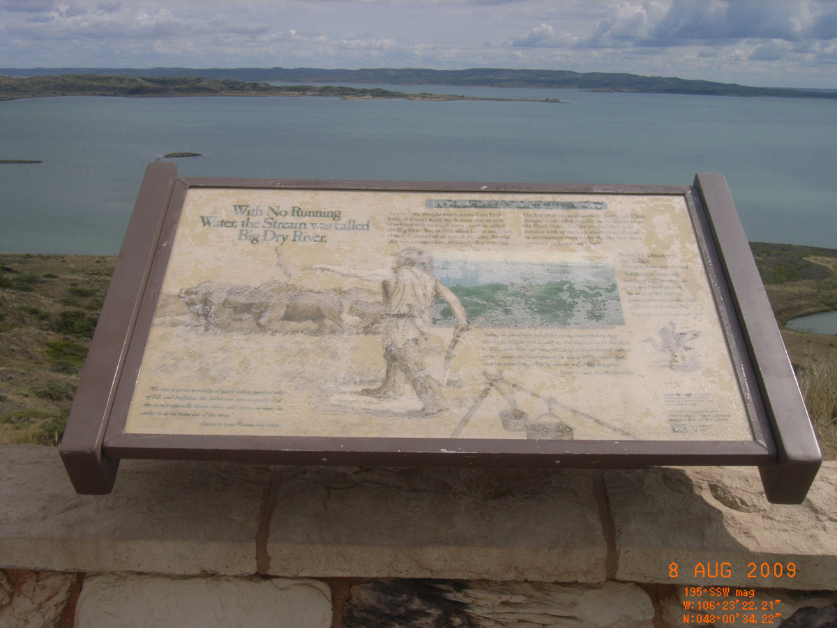
With No Running Water, the Stream was called Big Dry River
- Material: Fiberglass
- Condition: Poor
- Date Assessed: 2009-08-08
- File Name: RIMG0047.JPG
- Folder: C07AugustCam1
- Camera Direction: 231°
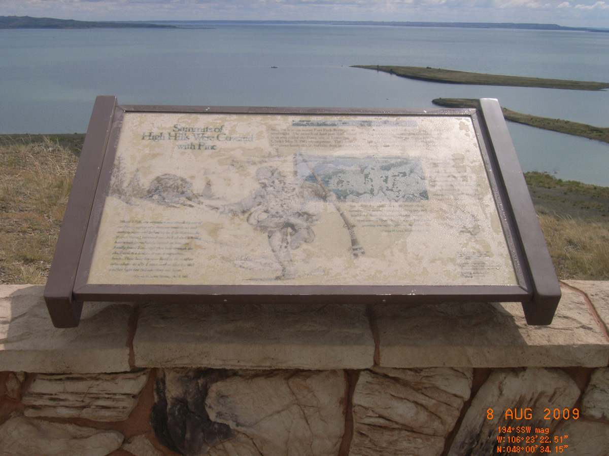
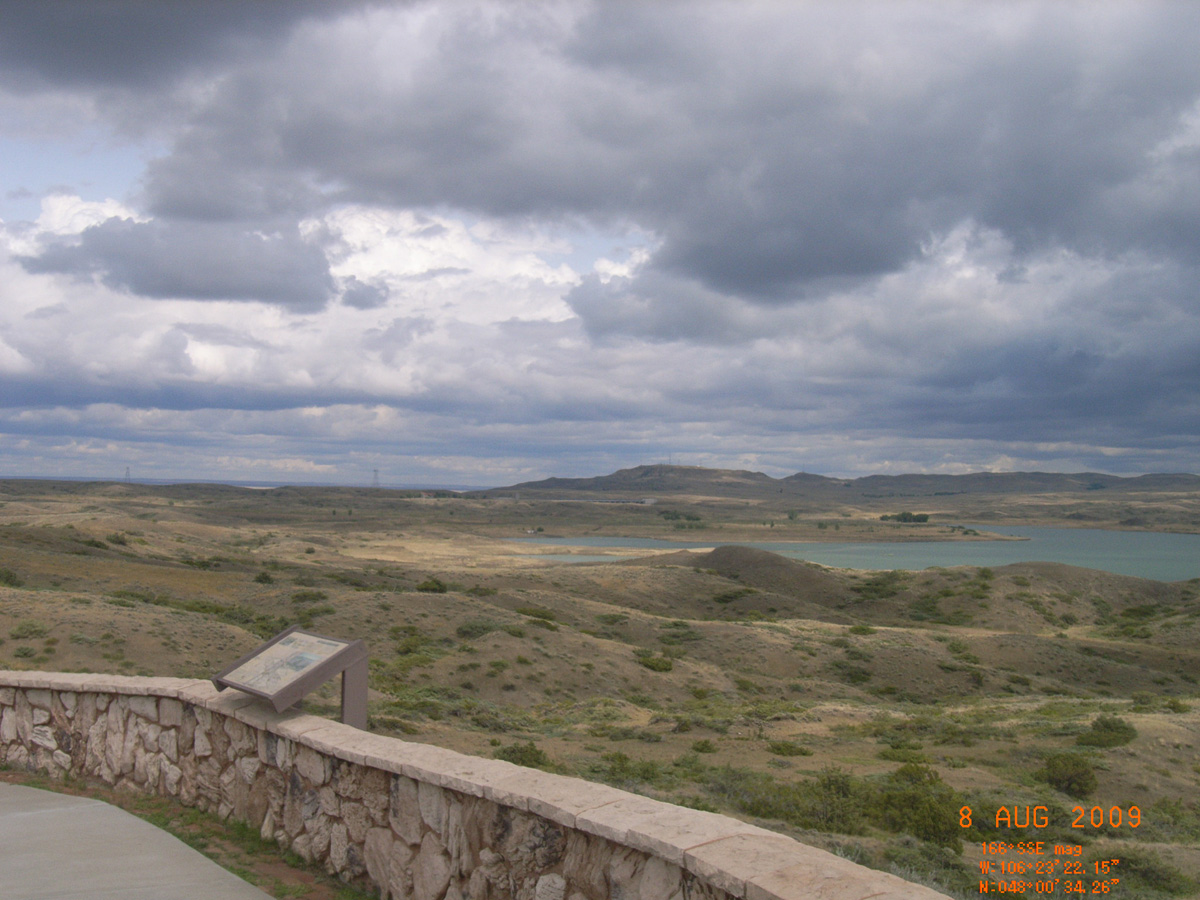
Summits of High Hills Were Covered with Pine
- Material: Fiberglass
- Condition: Poor
- Date Assessed: 2009-08-08
- File Name: RIMG0048.JPG
- Folder: C07AugustCam1
- Camera Direction: 59°
- Date Assessed: 2009-08-08
- File Name: RIMG0049.JPG
- Folder: C07AugustCam1
- Camera Direction: 59°
- Date Assessed: 2009-08-08
- File Name: RIMG0050.JPG
- Folder: C07AugustCam1
- Camera Direction: 263°
- Date Assessed: 2009-08-08
- File Name: RIMG0051.JPG
- Folder: C07AugustCam1
- Camera Direction: 263°
- Date Assessed: 2009-08-08
- File Name: RIMG0052.JPG
- Folder: C07AugustCam1
- Camera Direction: 229°
- Date Assessed: 2009-08-08
- File Name: RIMG0053.JPG
- Folder: C07AugustCam1
- Camera Direction: 229°
- Date Assessed: 2009-08-08
- File Name: RIMG0054.JPG
- Folder: C07AugustCam1
- Camera Direction: 229°
HW 16, Culbertson Bridge
Richland County, Montana: 48.12244598, -104.475958
Lewis & Clark Explore Uncharted Territory
- Material: High Pres Laminate
- Condition: Good
- Date Assessed: 2009-08-08
- File Name: RIMG0066.JPG
- Folder: C07AugustCam1
- Camera Direction: 229°
- Date Assessed: 2009-08-08
- File Name: RIMG0067.JPG
- Folder: C07AugustCam1
- Camera Direction: 326°
- Date Assessed: 2009-08-08
- File Name: RIMG0068.JPG
- Folder: C07AugustCam1
- Camera Direction: 6°
- Date Assessed: 2009-08-08
- File Name: RIMG0069.JPG
- Folder: C07AugustCam1
- Camera Direction: 308°
- Date Assessed: 2009-08-08
- File Name: RIMG0070.JPG
- Folder: C07AugustCam1
- Camera Direction: 43°
- Date Assessed: 2009-08-08
- File Name: RIMG0071.JPG
- Folder: C07AugustCam1
- Camera Direction: 43°
HW 2, Culbertson Rest Area
Roosevelt County, Montana: 48.14780233, -104.5041629
Join the Voyage of Discovery
- Material: High Pres Laminate
- Condition: Good
- Date Assessed: 2009-08-08
- File Name: RIMG0072.JPG
- Folder: C07AugustCam1
- Camera Direction: 213°
- Date Assessed: 2009-08-08
- File Name: RIMG0073.JPG
- Folder: C07AugustCam1
- Camera Direction: 344°
- Date Assessed: 2009-08-08
- File Name: RIMG0074.JPG
- Folder: C07AugustCam1
- Camera Direction: 347°
- Date Assessed: 2009-08-08
- File Name: RIMG0075.JPG
- Folder: C07AugustCam1
- Camera Direction: 347°
- Date Assessed: 2009-08-08
- File Name: RIMG0076.JPG
- Folder: C07AugustCam1
- Camera Direction: 30°
- Date Assessed: 2009-08-08
- File Name: RIMG0077.JPG
- Folder: C07AugustCam1
- Camera Direction: 30°
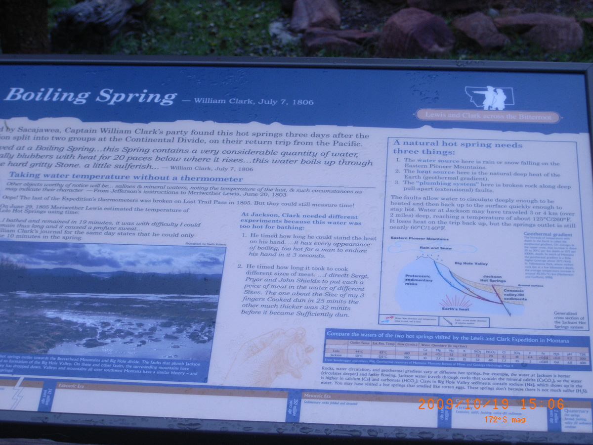
Jackson
Beaverhead County, Montana: 45.36781659, -113.4091775
Boiling Spring
- Material: High Pres Laminate
- Condition: Good
- Date Assessed: 2009-10-19
- File Name: RIMG0048.JPG
- Folder: C19OctoberCam1
- Camera Direction: 231°
- Date Assessed: 2009-10-19
- File Name: RIMG0049.JPG
- Folder: C19OctoberCam1
- Camera Direction: 37°
I-15 Southbound Rest Area (S of Butte)
Silver Bow County, Montana: 45.83638, -112.68565
Join the Voyage of Discovery
- Material: High Pres Laminate
- Condition: Good
- Date Assessed: 2009-10-19
- File Name: RIMG0043.JPG
- Folder: C19OctoberCam1
- Camera Direction: 205°
- Date Assessed: 2009-10-19
- File Name: RIMG0044.JPG
- Folder: C19OctoberCam1
- Camera Direction: 205°
- Date Assessed: 2009-10-19
- File Name: RIMG0045.JPG
- Folder: C19OctoberCam1
- Camera Direction: 165°
- Date Assessed: 2009-10-19
- File Name: RIMG0046.JPG
- Folder: C19OctoberCam1
- Camera Direction: 165°
- Date Assessed: 2009-10-19
- File Name: RIMG0047.JPG
- Folder: C19OctoberCam1
- Camera Direction: 204°
Missoula
Missoula County, Montana: 46.86892599, -113.9968893
Northwest Passage
- Material: High Pres Laminate
- Condition: Good
- Date Assessed: 2009-08-04
- File Name: RIMG0055.JPG
- Folder: C04AugustCam2
- Camera Direction: 297°
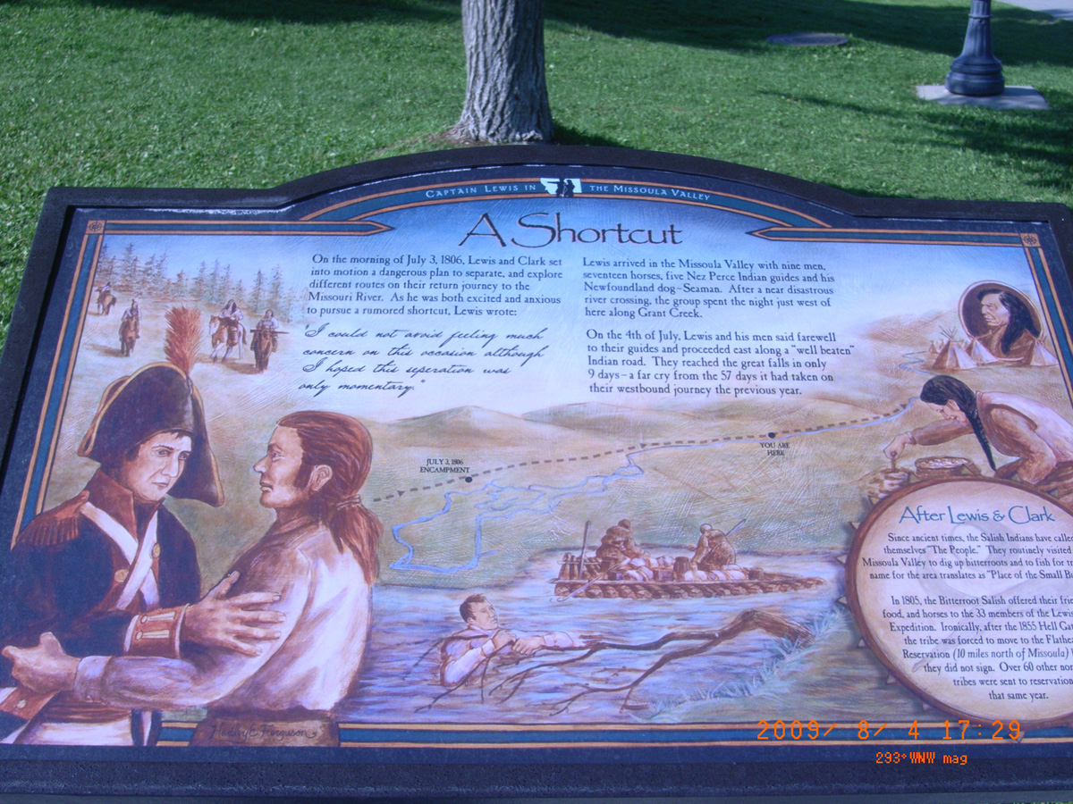
A Shortcut
- Material: High Pres Laminate
- Condition: Good
- Date Assessed: 2009-08-04
- File Name: RIMG0056.JPG
- Folder: C04AugustCam2
- Camera Direction: 297°
Name that River
- Material: High Pres Laminate
- Condition: Good
- Date Assessed: 2009-08-04
- File Name: RIMG0057.JPG
- Folder: C04AugustCam2
- Camera Direction: 278°
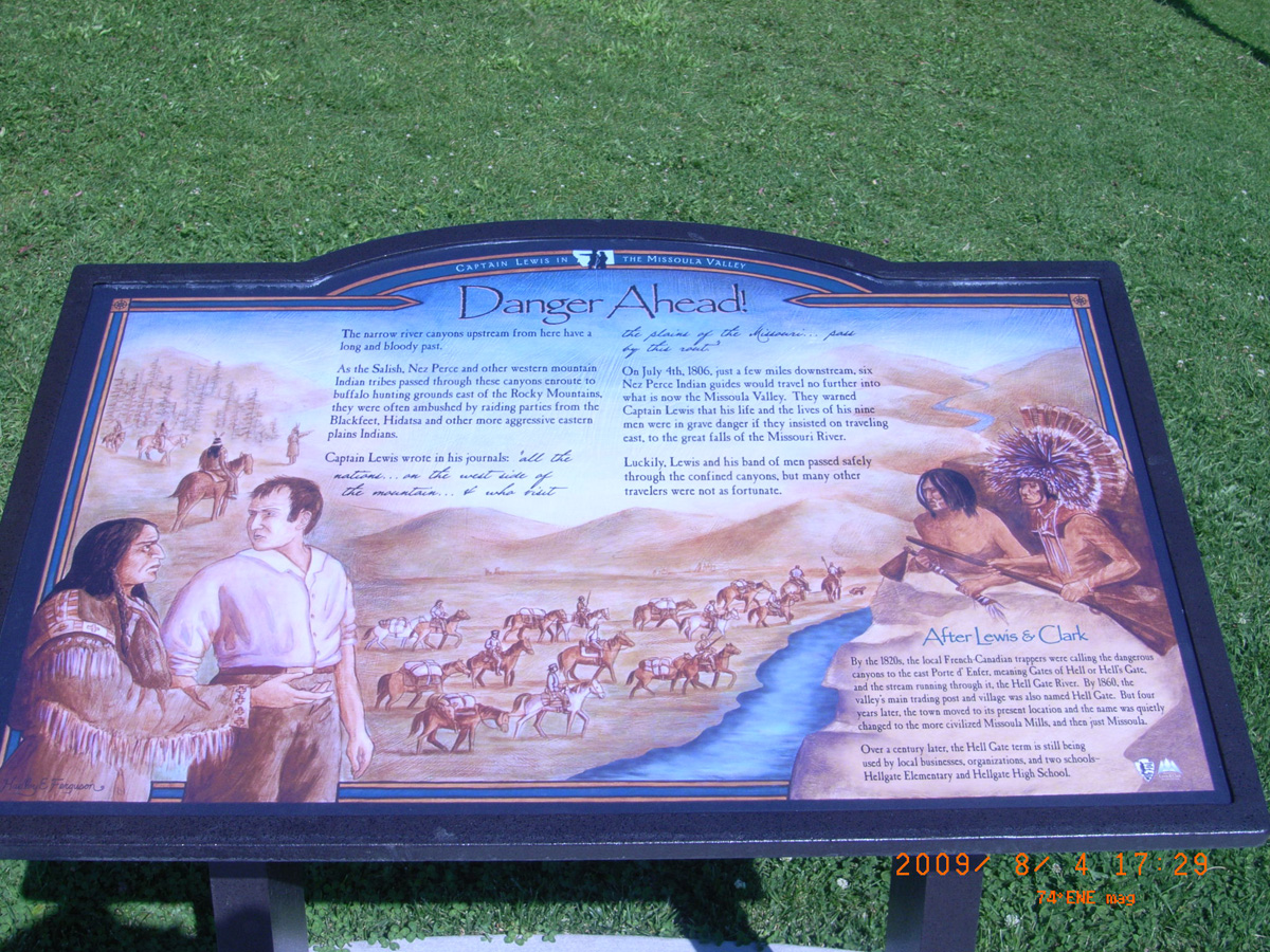
Danger Ahead!
- Material: High Pres Laminate
- Condition: Good
- Date Assessed: 2009-08-04
- File Name: RIMG0058.JPG
- Folder: C04AugustCam2
- Camera Direction: 272°
Big Timber, Crazy Mountain Museum
Sweet Grass County, Montana: 45.8244045, -109.9652785
- Material: Fiberglass
- Condition: Good
- Date Assessed: 2009-08-06
- File Name: RIMG0274.JPG
- Folder: C06AugustCam2
- Camera Direction: 283°
The Lewis and Clark Expedition
- Material: Porcelain Enamel
- Condition: Good
- Date Assessed: 2009-08-06
- File Name: RIMG0275.JPG
- Folder: C06AugustCam2
- Camera Direction: 3°
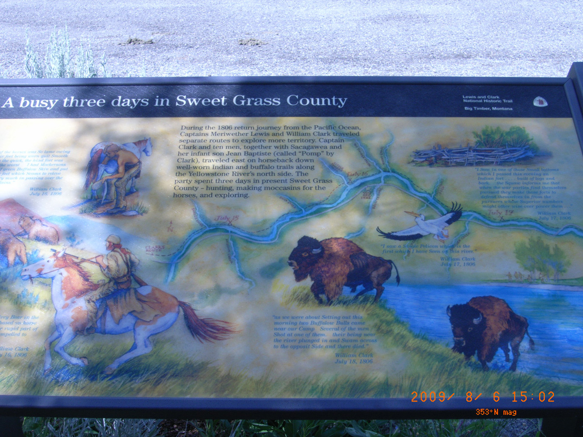
A busy three days in Sweet Grass County
- Material: Fiberglass
- Condition: Good
- Date Assessed: 2009-08-06
- File Name: RIMG0276.JPG
- Folder: C06AugustCam2
- Camera Direction: 181°
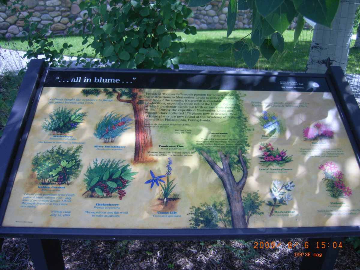
...all in blume'
- Material: Fiberglass
- Condition: Good
- Date Assessed: 2009-08-06
- File Name: RIMG0277.JPG
- Folder: C06AugustCam2
- Camera Direction: 164°
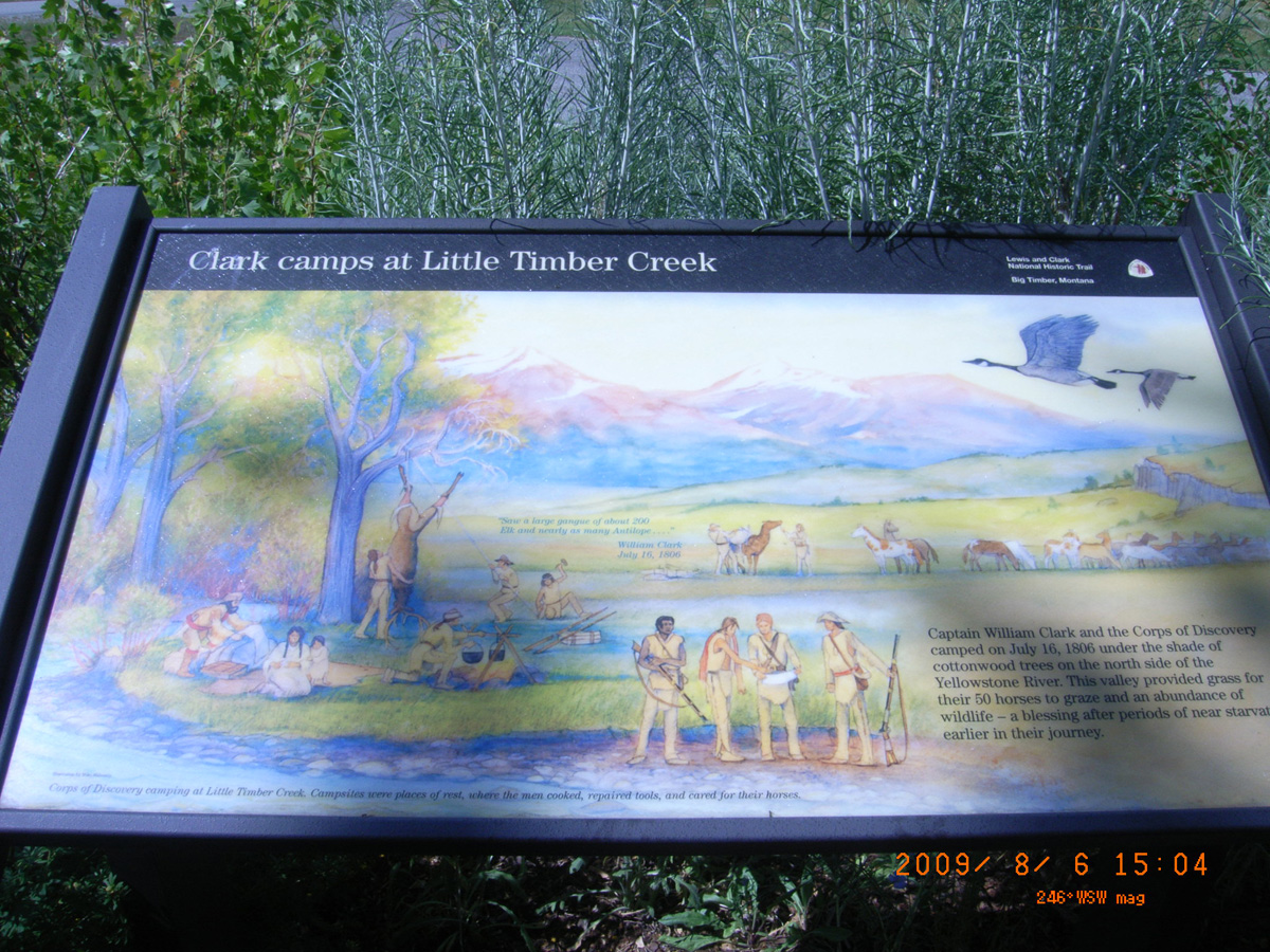
Clark camps at Little Timber Creek
- Material: Fiberglass
- Condition: Good
- Date Assessed: 2009-08-06
- File Name: RIMG0278.JPG
- Folder: C06AugustCam2
- Camera Direction: 183°
Clark the Cartographer
- Date Assessed: 2009-08-06
- File Name: RIMG0279.JPG
- Folder: C06AugustCam2
- Camera Direction: 275°
- Date Assessed: 2009-08-06
- File Name: RIMG0280.JPG
- Folder: C06AugustCam2
- Camera Direction: 275°
Crazy Mountain Museum
- Date Assessed: 2009-08-06
- File Name: RIMG0281.JPG
- Folder: C06AugustCam2
- Camera Direction: 275°
Fort Union Trading Post NHS
Roosevelt County, Montana: 47.99956703, -104.0442977
- Date Assessed: 2009-07-21
- File Name: RIMG0065.JPG
- Folder: C21JulyCam2
- Camera Direction: 218°
- Date Assessed: 2009-07-21
- File Name: RIMG0066.JPG
- Folder: C21JulyCam2
- Camera Direction: 220°
Fort Union Trading Post
- Date Assessed: 2009-07-21
- File Name: RIMG0064.JPG
- Folder: C21JulyCam1
- Camera Direction: 149°
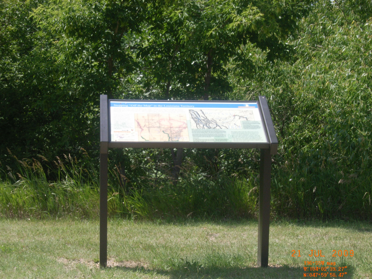
Stepping 'Off the Map' in the Louisiana Territory
- Material: High Pres Laminate
- Condition: Good
- Date Assessed: 2009-07-21
- File Name: RIMG0065.JPG
- Folder: C21JulyCam1
- Camera Direction: 238°
River Interstates
- Material: High Pres Laminate
- Condition: Good
- Date Assessed: 2009-07-21
- File Name: RIMG0066.JPG
- Folder: C21JulyCam1
- Camera Direction: 106°