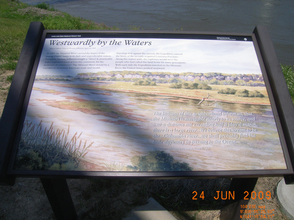
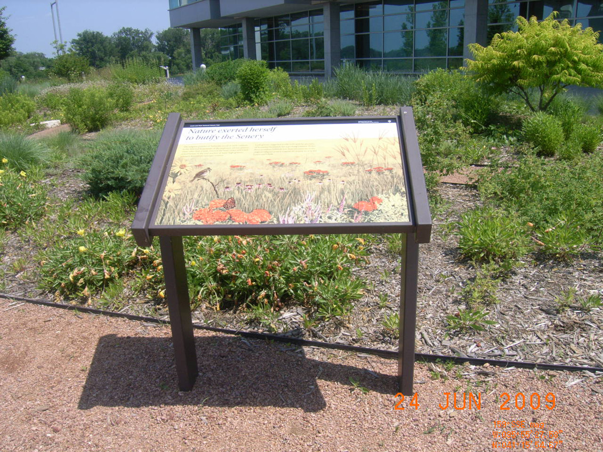
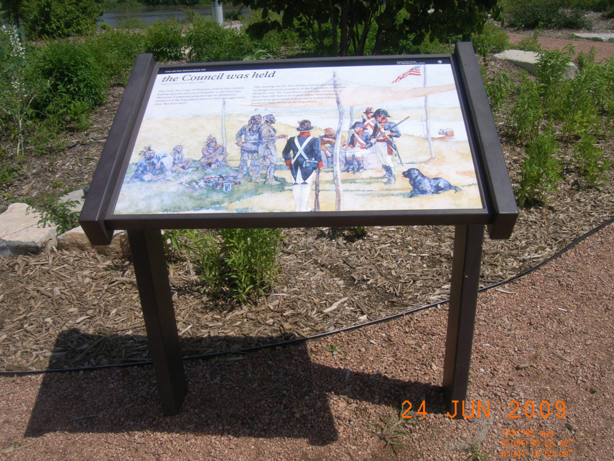
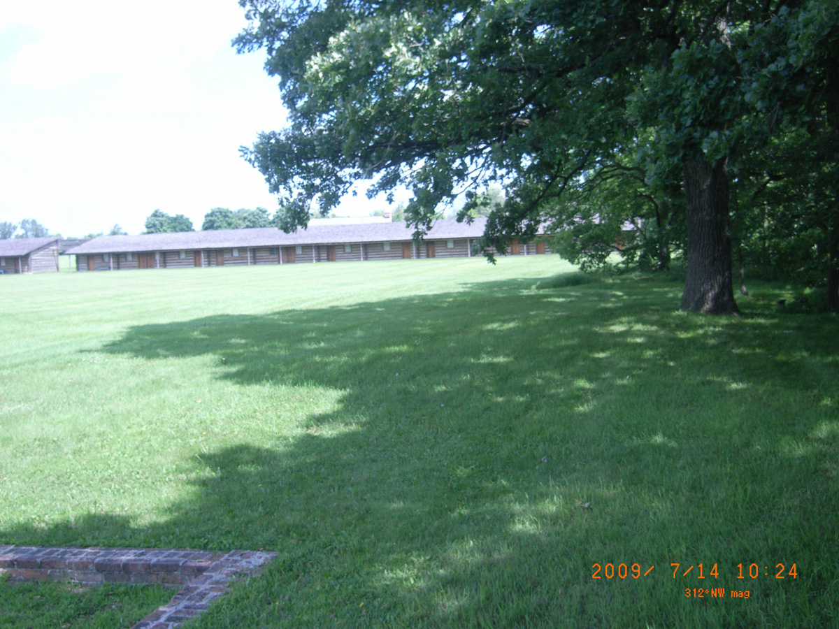
Lewis and Clark National Historic Trail Headquarters and Visitor Center
Douglas County, Nebraska: 41.26561202, -95.92440203
Westwardly by the Waters
- Date Assessed: 2009-06-24
- File Name: RIMG0004.JPG
- Folder: C23JuneCam1
- Camera Direction: 0°
Nature exerted herself to butify the Senery
- Date Assessed: 2009-06-24
- File Name: RIMG0005.JPG
- Folder: C23JuneCam1
- Camera Direction: 0°
Capt. Lewis...will...give us accounts of new things only
- Date Assessed: 2009-06-24
- File Name: RIMG0006.JPG
- Folder: C23JuneCam1
- Camera Direction: 105°
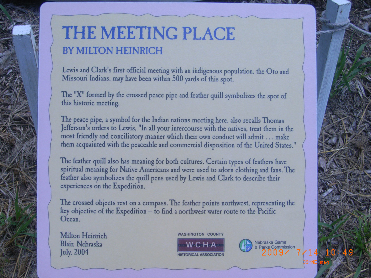
The Council was held
- Date Assessed: 2009-06-24
- File Name: RIMG0007.JPG
- Folder: C23JuneCam1
- Camera Direction: 160°
endeavor to make yourself acquainted...with...the nations
- Date Assessed: 2009-06-24
- File Name: RIMG0008.JPG
- Folder: C23JuneCam1
- Camera Direction: 143°
Steamboat Trace Trail, Brownville
Nebraska County, Nebraska: 40.39708167, -95.65340955
Lewis and Clark National Historic Trail
- Date Assessed: 2009-06-25
- File Name: RIMG0152.JPG
- Folder: C24JuneCam1
- Camera Direction: 329°
- Date Assessed: 2009-06-25
- File Name: RIMG0153.JPG
- Folder: C24JuneCam1
- Camera Direction: 190°
- Date Assessed: 2009-06-25
- File Name: RIMG0154.JPG
- Folder: C24JuneCam1
- Camera Direction: 201°
- Date Assessed: 2009-06-25
- File Name: RIMG0155.JPG
- Folder: C24JuneCam1
- Camera Direction: 201°
703 Trail, Big Nemaha River
Richardson County, Nebraska: 40.02560889, -95.38242129
'marked my name'
- Date Assessed: 2009-07-13
- File Name: RIMG0088.JPG
- Folder: C13JulyCam2
- Camera Direction: 154°
'marked my name'
- Date Assessed: 2009-07-13
- File Name: RIMG0089.JPG
- Folder: C13JulyCam2
- Camera Direction: 148°
- Date Assessed: 2009-07-13
- File Name: RIMG0090.JPG
- Folder: C13JulyCam2
- Camera Direction: 163°
Lewis and Clark Interpretive Center, Nebraska City
Otoe County, Nebraska: 40.6661326, -95.83093178
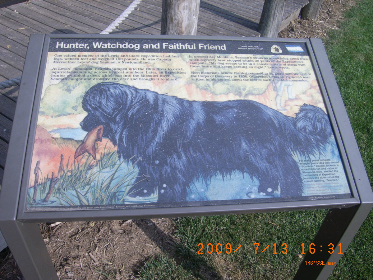
Hunter, Watchdog and Faithful Friend
- Date Assessed: 2009-07-13
- File Name: RIMG0113.JPG
- Folder: C13JulyCam2
- Camera Direction: 194°
- Date Assessed: 2009-07-13
- File Name: RIMG0114.JPG
- Folder: C13JulyCam2
- Camera Direction: 194°
- Date Assessed: 2009-07-13
- File Name: RIMG0115.JPG
- Folder: C13JulyCam2
- Camera Direction: 154°
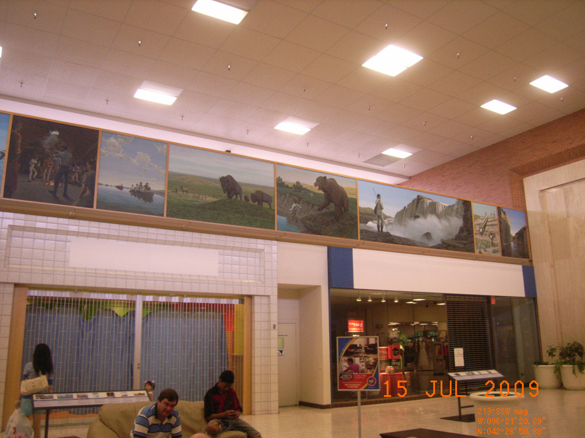
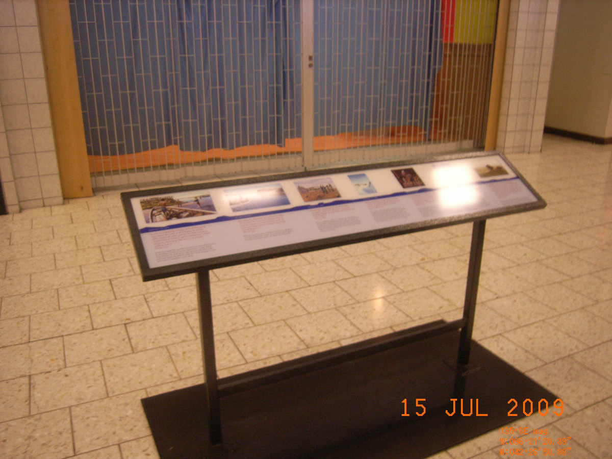
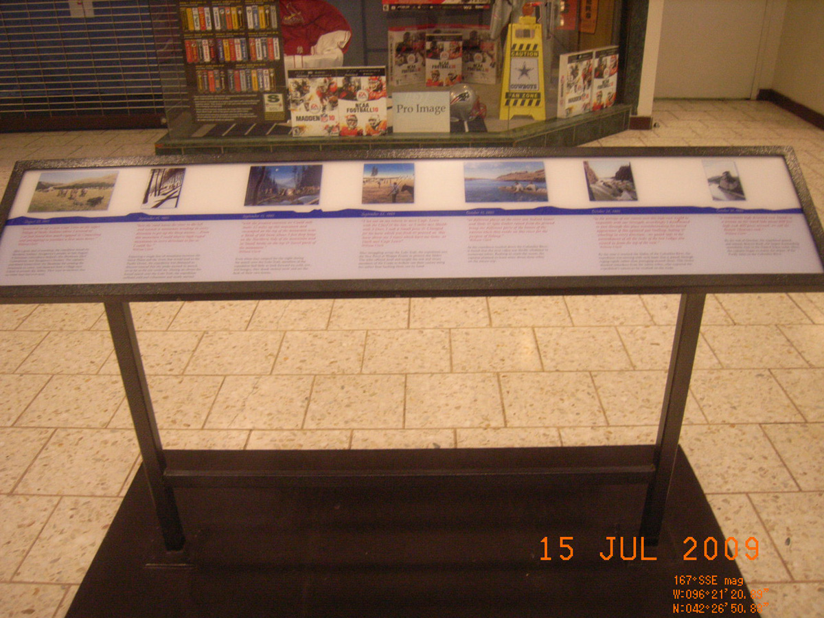
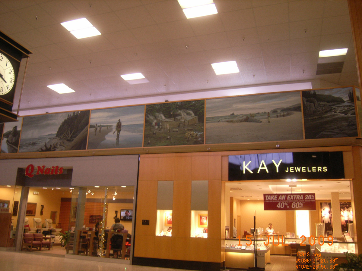
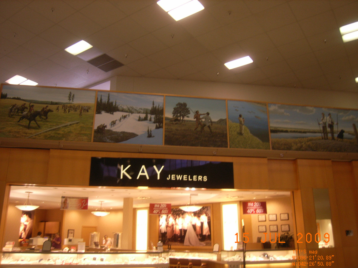
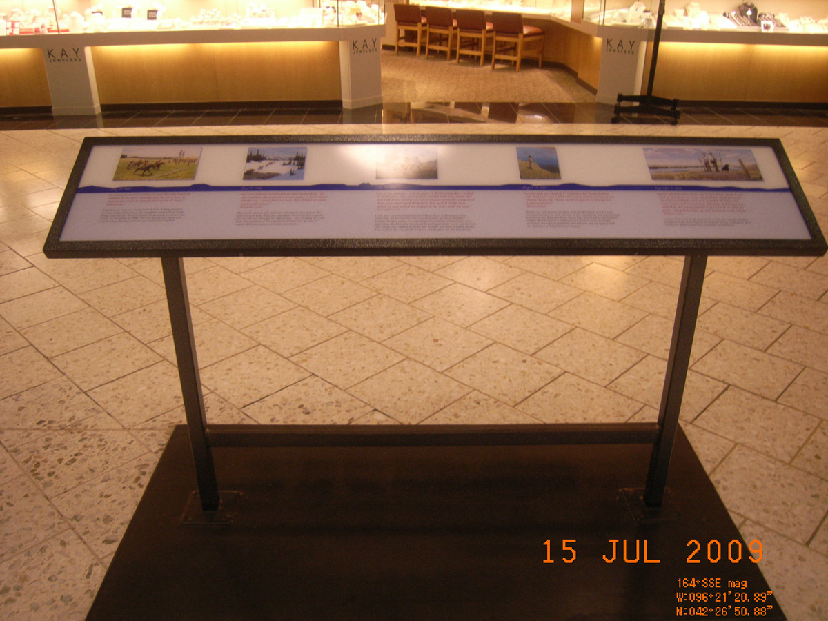
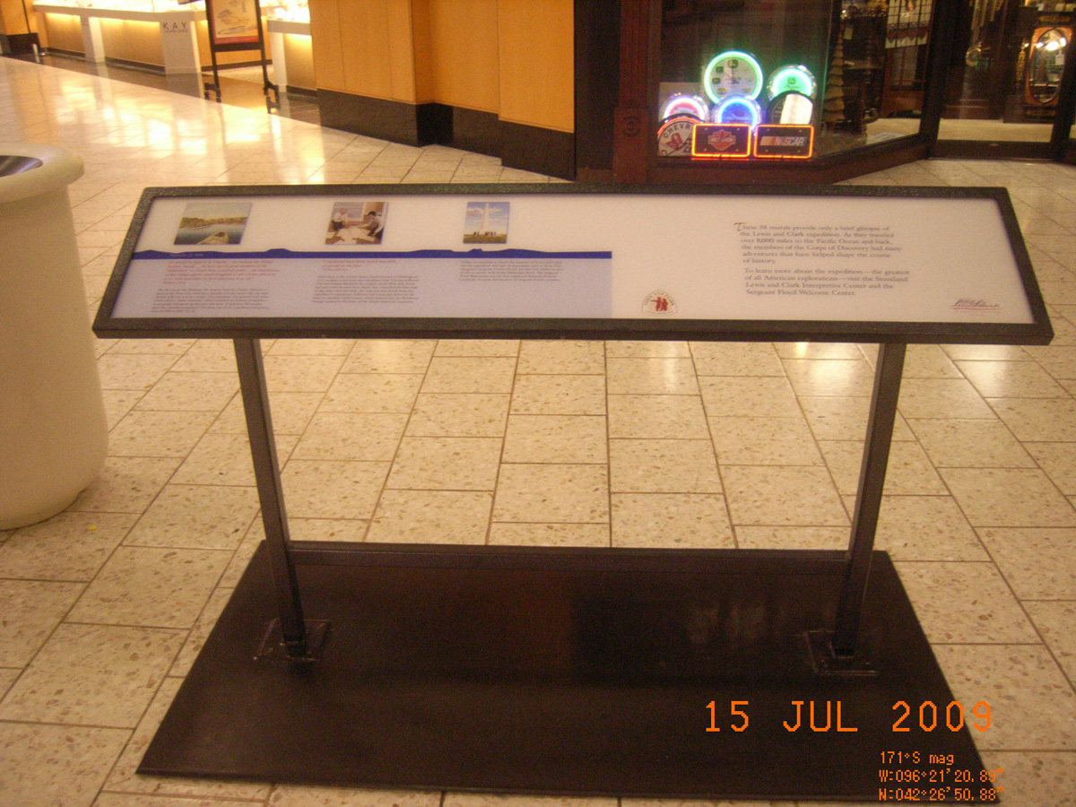
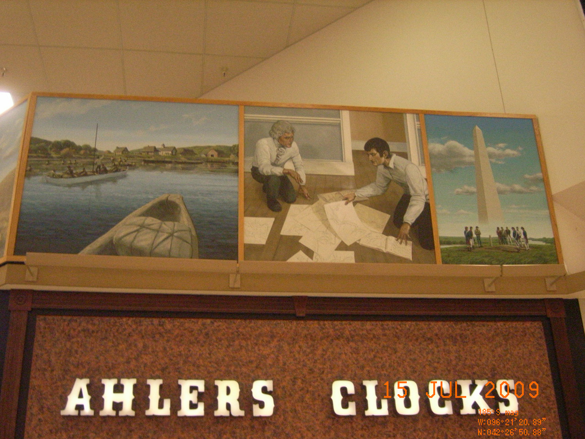
Southern Hills Mall, Sioux City
Woodbury County, Iowa: 42.4474213, -96.35560588
Note: This exhibit has been removed from the mall. The signs are being stored by the Lewis and Clark Trail Heritage Foundation until a place to exhibit them is found.
- Date Assessed: 2009-07-15
- File Name: RIMG0130.JPG
- Folder: C14JulyCam1
- Camera Direction: 0°
- Date Assessed: 2009-07-15
- File Name: RIMG0131.JPG
- Folder: C14JulyCam1
- Camera Direction: 0°
- Date Assessed: 2009-07-15
- File Name: RIMG0132.JPG
- Folder: C14JulyCam1
- Camera Direction: 0°
- Date Assessed: 2009-07-15
- File Name: RIMG0133.JPG
- Folder: C14JulyCam1
- Camera Direction: 0°
- Date Assessed: 2009-07-15
- File Name: RIMG0134.JPG
- Folder: C14JulyCam1
- Camera Direction: 110°
- Date Assessed: 2009-07-15
- File Name: RIMG0135.JPG
- Folder: C14JulyCam1
- Camera Direction: 109°
- Date Assessed: 2009-07-15
- File Name: RIMG0136.JPG
- Folder: C14JulyCam1
- Camera Direction: 108°
- Date Assessed: 2009-07-15
- File Name: RIMG0137.JPG
- Folder: C14JulyCam1
- Camera Direction: 108°
- Date Assessed: 2009-07-15
- File Name: RIMG0138.JPG
- Folder: C14JulyCam1
- Camera Direction: 255°
- Date Assessed: 2009-07-15
- File Name: RIMG0139.JPG
- Folder: C14JulyCam1
- Camera Direction: 281°
- Date Assessed: 2009-07-15
- File Name: RIMG0140.JPG
- Folder: C14JulyCam1
- Camera Direction: 58°
- Date Assessed: 2009-07-15
- File Name: RIMG0141.JPG
- Folder: C14JulyCam1
- Camera Direction: 53°
- Date Assessed: 2009-07-15
- File Name: RIMG0142.JPG
- Folder: C14JulyCam1
- Camera Direction: 62°
- Date Assessed: 2009-07-15
- File Name: RIMG0143.JPG
- Folder: C14JulyCam1
- Camera Direction: 38°
- Date Assessed: 2009-07-15
- File Name: RIMG0144.JPG
- Folder: C14JulyCam1
- Camera Direction: 38°
- Date Assessed: 2009-07-15
- File Name: RIMG0145.JPG
- Folder: C14JulyCam1
- Camera Direction: 38°
- Date Assessed: 2009-07-15
- File Name: RIMG0146.JPG
- Folder: C14JulyCam1
- Camera Direction: 359°
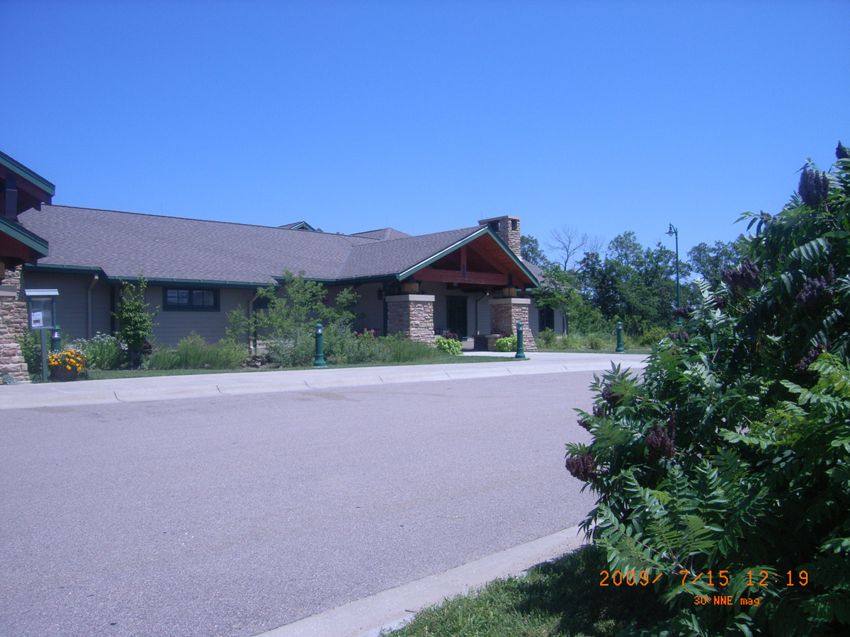
Ponca State Park
Dixon County, Nebraska: 42.59392313, -96.70957245
- Date Assessed: 2009-07-15
- File Name: RIMG0015.JPG
- Folder: C15JulyCam2
- Camera Direction: 360°
- Date Assessed: 2009-07-15
- File Name: RIMG0016.JPG
- Folder: C15JulyCam2
- Camera Direction: 8°
- Date Assessed: 2009-07-15
- File Name: RIMG0017.JPG
- Folder: C15JulyCam2
- Camera Direction: 11°
- Date Assessed: 2009-07-15
- File Name: RIMG0018.JPG
- Folder: C15JulyCam2
- Camera Direction: 190°
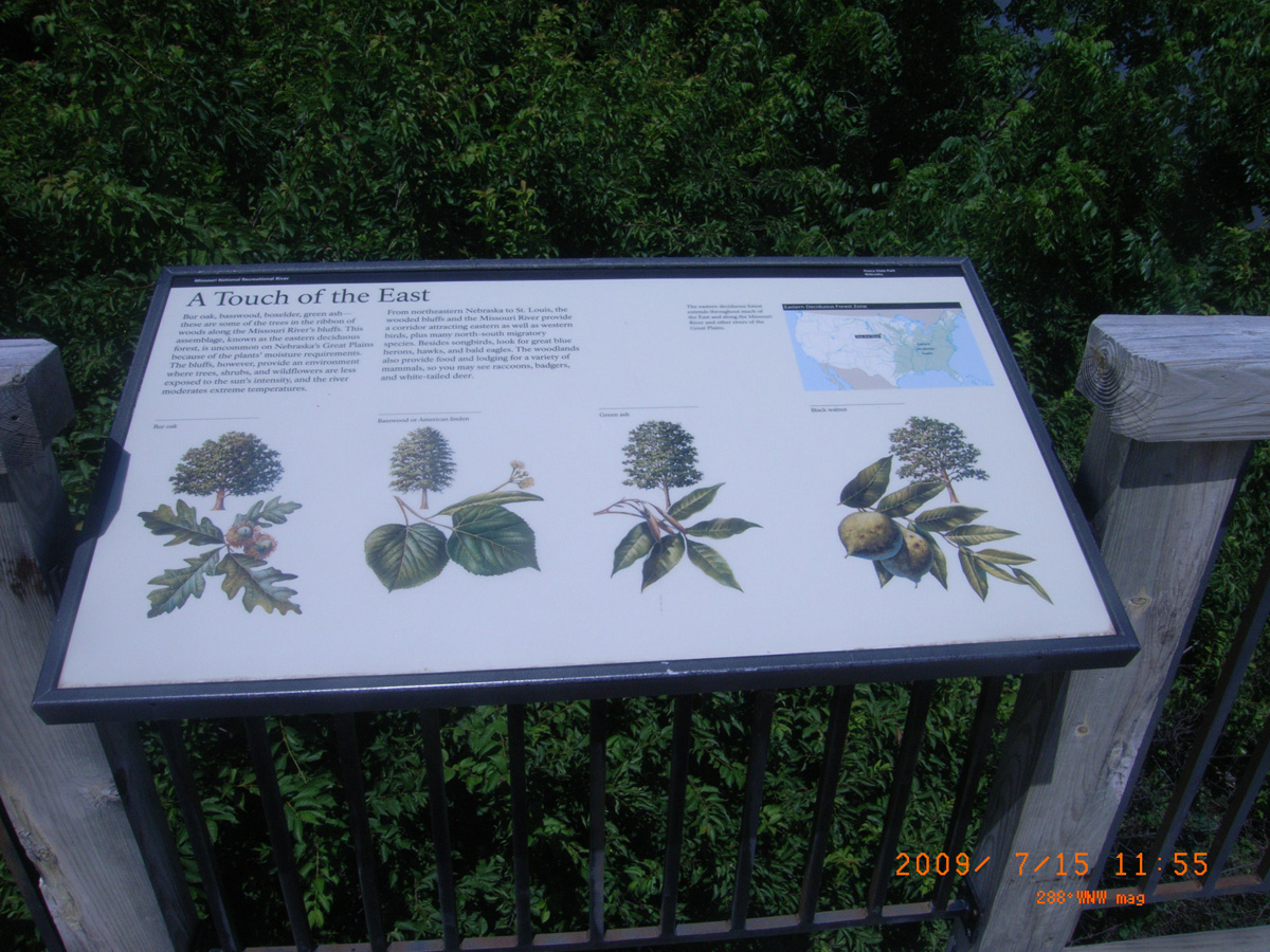
A Touch of the East
- Date Assessed: 2009-07-15
- File Name: RIMG0002.JPG
- Folder: C15JulyCam2
- Camera Direction: 100°
A Touch of the East
- Date Assessed: 2009-07-15
- File Name: RIMG0003.JPG
- Folder: C15JulyCam2
- Camera Direction: 100°
Up the Missouri
- Date Assessed: 2009-07-15
- File Name: RIMG0004.JPG
- Folder: C15JulyCam2
- Camera Direction: 104°
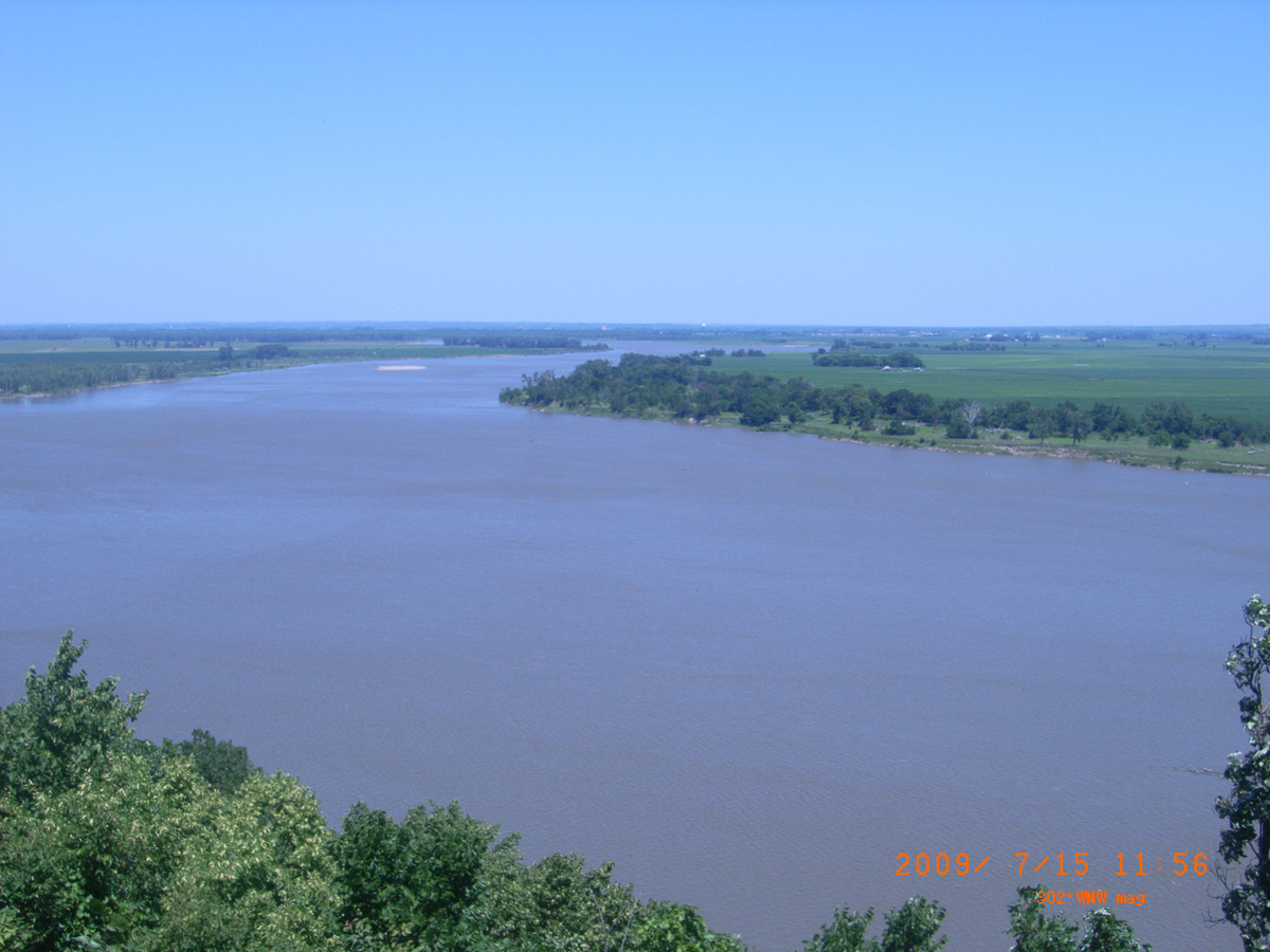
The Great Missouri River
- Date Assessed: 2009-07-15
- File Name: RIMG0005.JPG
- Folder: C15JulyCam2
- Camera Direction: 110°
Gass's Election
- Date Assessed: 2009-07-15
- File Name: RIMG0006.JPG
- Folder: C15JulyCam2
- Camera Direction: 109°
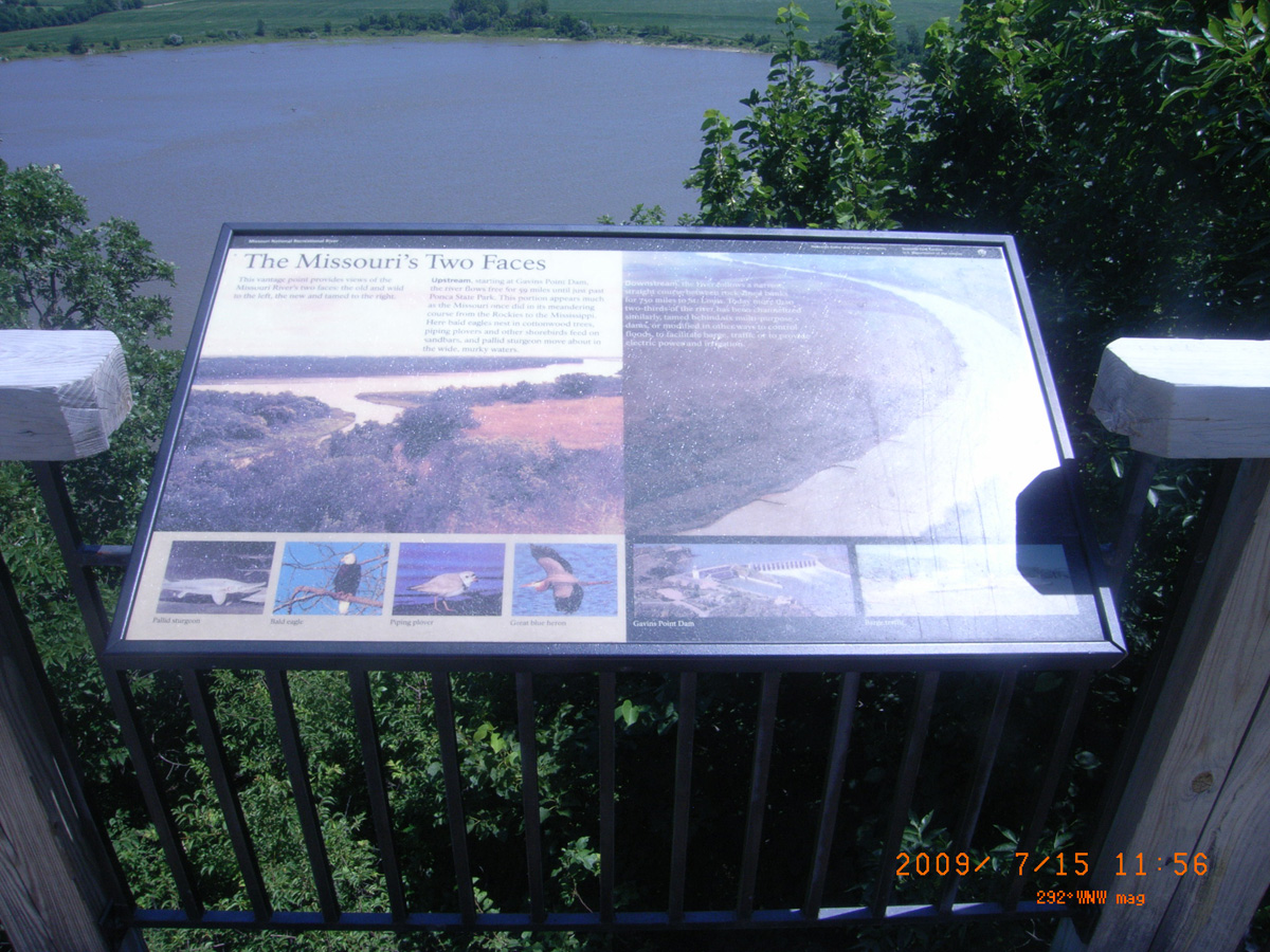
The Missouri's Two Faces
- Date Assessed: 2009-07-15
- File Name: RIMG0007.JPG
- Folder: C15JulyCam2
- Camera Direction: 109°
- Date Assessed: 2009-07-15
- File Name: RIMG0008.JPG
- Folder: C15JulyCam2
- Camera Direction: 260°
- Date Assessed: 2009-07-15
- File Name: RIMG0009.JPG
- Folder: C15JulyCam2
- Camera Direction: 260°
- Date Assessed: 2009-07-15
- File Name: RIMG0010.JPG
- Folder: C15JulyCam2
- Camera Direction: 96°
- Date Assessed: 2009-07-15
- File Name: RIMG0011.JPG
- Folder: C15JulyCam2
- Camera Direction: 96°
- Date Assessed: 2009-07-15
- File Name: RIMG0012.JPG
- Folder: C15JulyCam2
- Camera Direction: 96°
Corps of Discovery Welcome Center, South Yankton
Cedar County, Nebraska: 42.82822684, -97.40526162
- Date Assessed: 2009-07-16
- File Name: RIMG0001.JPG
- Folder: C16JulyCam2
- Camera Direction: 221°
The Great Missouri River
- Date Assessed: 2009-07-16
- File Name: RIMG0002.JPG
- Folder: C16JulyCam2
- Camera Direction: 218°
Historic Missouri Valley
- Date Assessed: 2009-07-16
- File Name: RIMG0003.JPG
- Folder: C16JulyCam2
- Camera Direction: 209°
Corps of Discovery Welcome Center
- Date Assessed: 2009-07-16
- File Name: RIMG0004.JPG
- Folder: C16JulyCam2
- Camera Direction: 208°
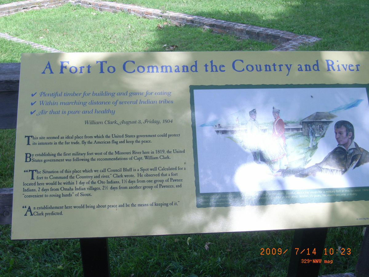
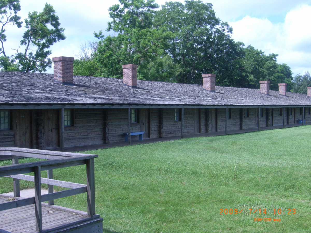
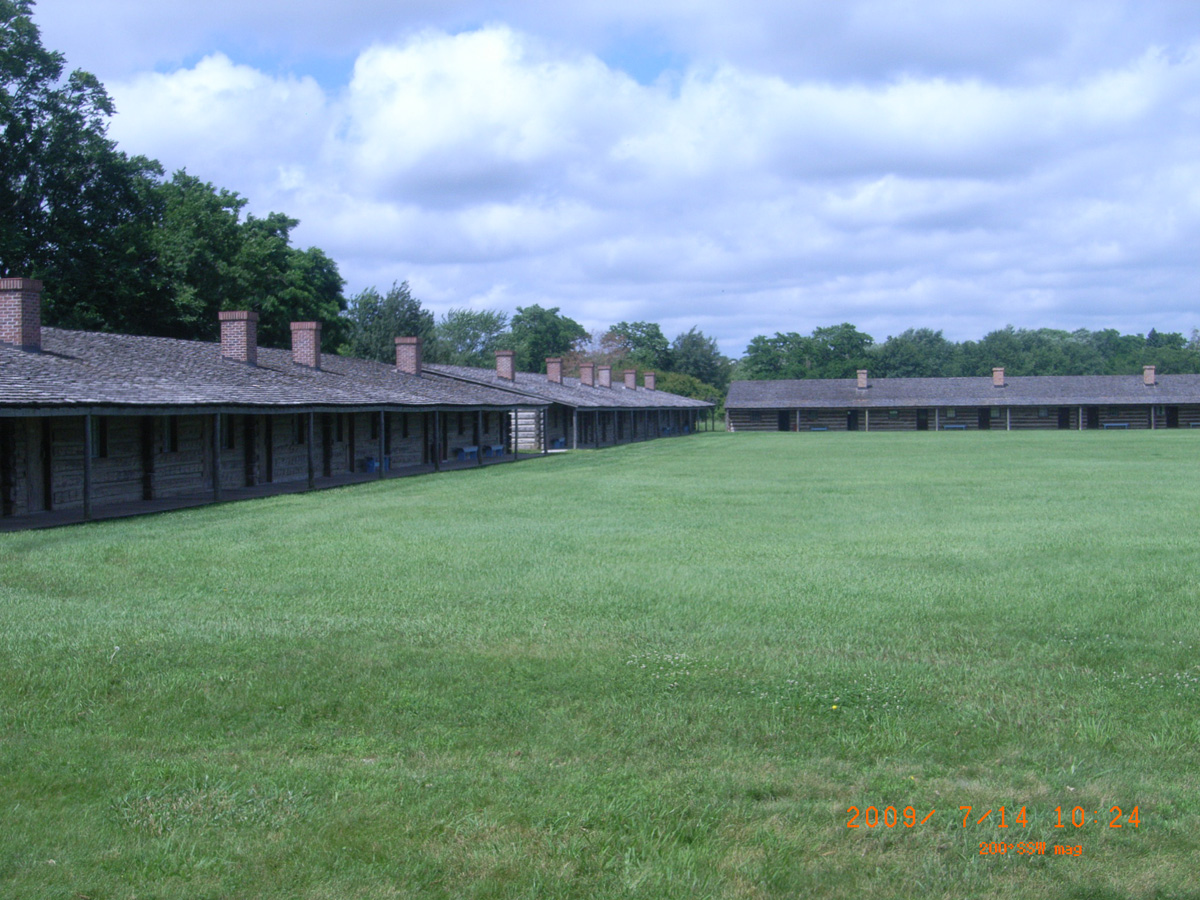
Western Historic Trails Center, Council Bluffs
Pottawattamie County, Iowa: 41.22748698, -95.90104687
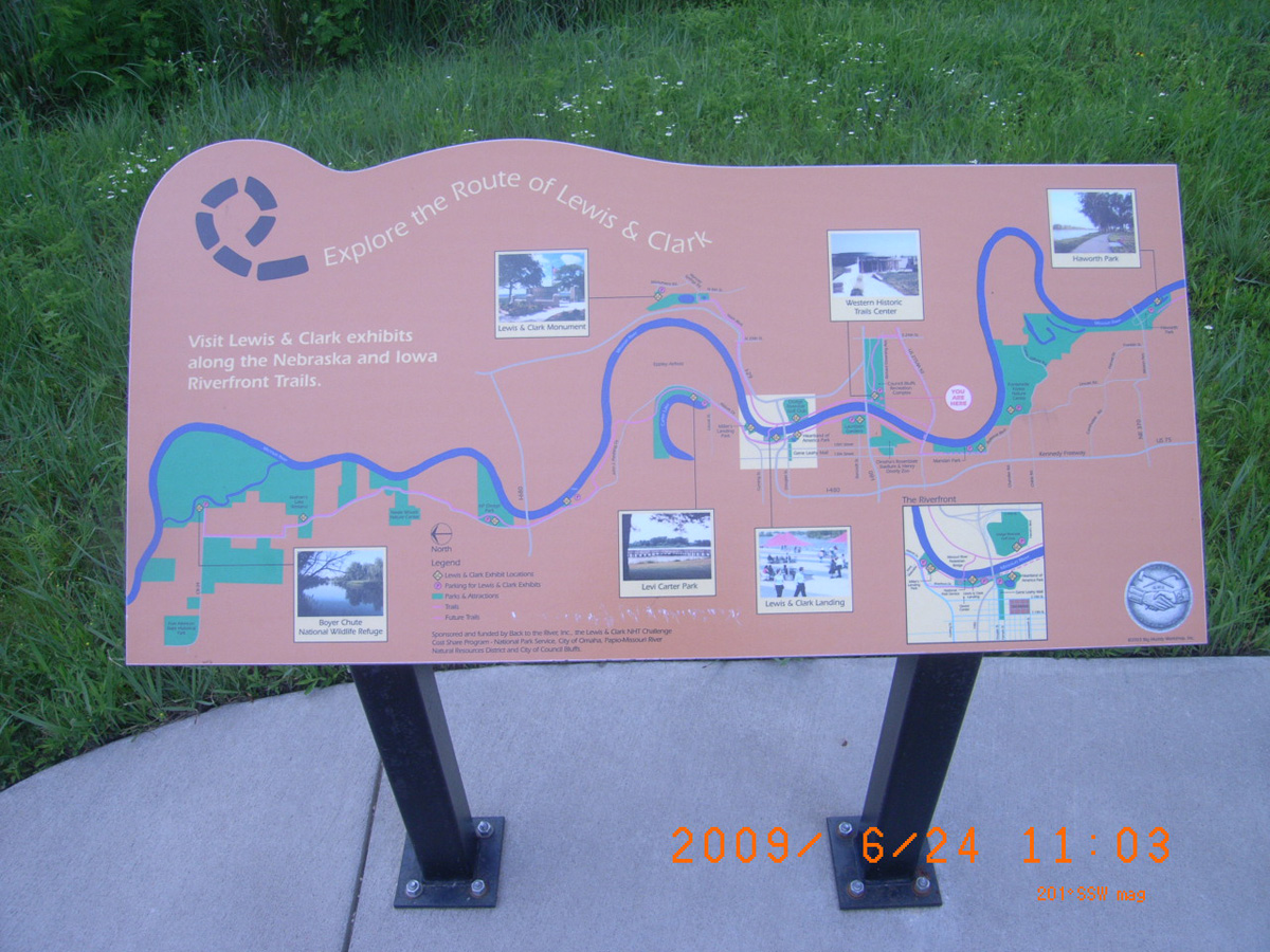
Explore the Route of Lewis & Clark
- Date Assessed: 2009-06-24
- File Name: RIMG0030.JPG
- Folder: C24JuneCam2
- Camera Direction: 149°
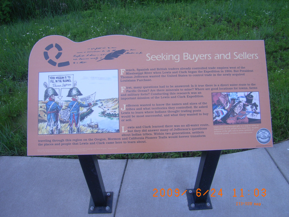
Seeking Buyers and Sellers
- Date Assessed: 2009-06-24
- File Name: RIMG0031.JPG
- Folder: C24JuneCam2
- Camera Direction: 195°
We Were All Busily Engaged
- Date Assessed: 2009-06-24
- File Name: RIMG0032.JPG
- Folder: C24JuneCam2
- Camera Direction: 185°
- Date Assessed: 2009-06-24
- File Name: RIMG0033.JPG
- Folder: C24JuneCam2
- Camera Direction: 182°
Lewis and Clark Park, near Council Bluffs
Pottawattamie County, Iowa: 41.30344191, -95.85836973
Anticipating an Indian Council
- Date Assessed: 2009-06-24
- File Name: RIMG0127.JPG
- Folder: C24JuneCam2
- Camera Direction: 178°
I-29 Rest Area, southbound, near Sergeant Bluff
Woodbury County, Iowa: 42.37506583, -96.35503149
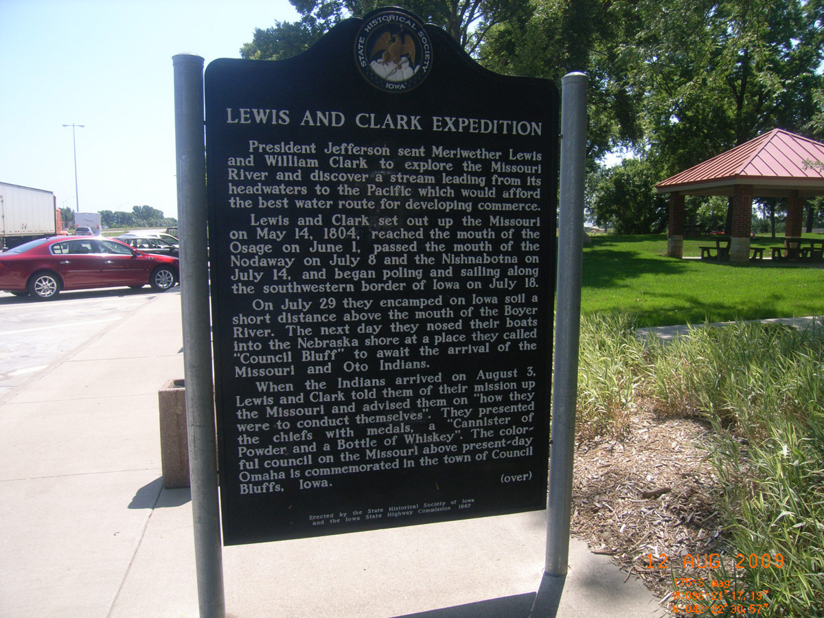
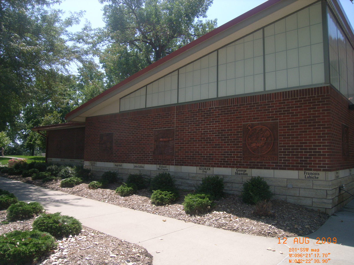
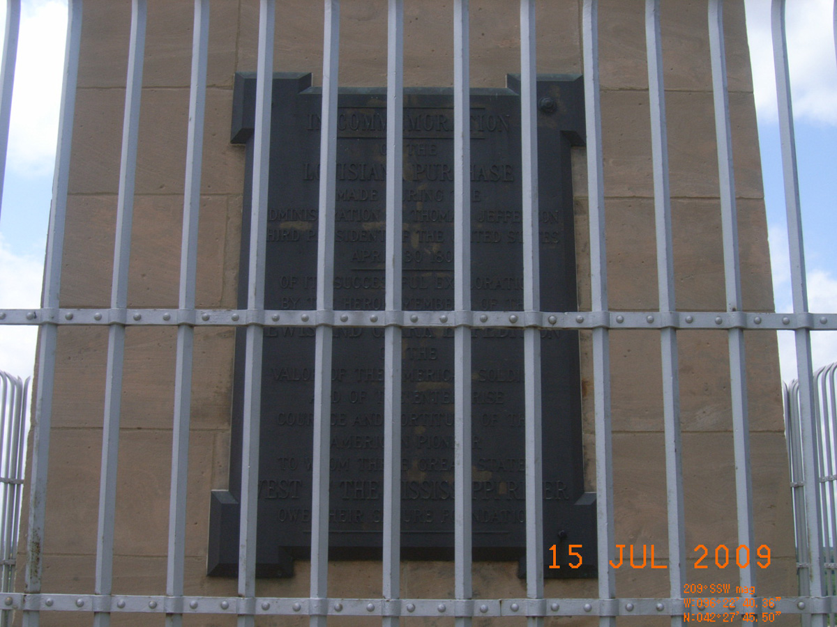
Lewis and Clark Expedition
- Date Assessed: 2009-08-12
- File Name: RIMG0097.JPG
- Folder: C11AugustCam1
- Camera Direction: 72°
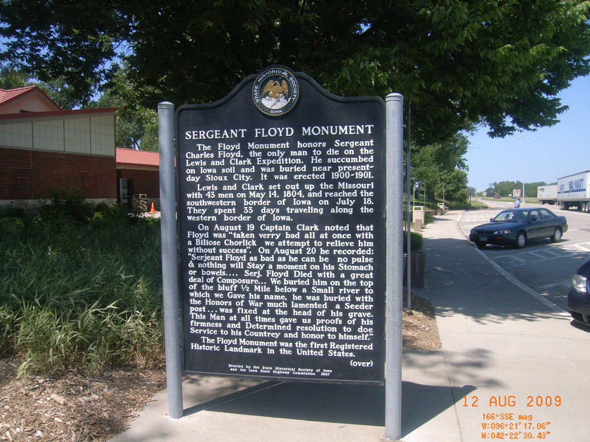
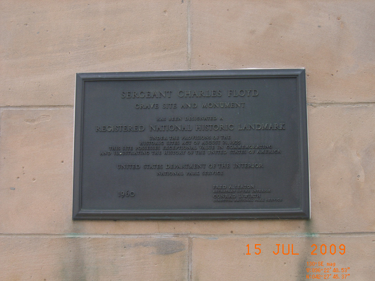
Sergeant Floyd Monument
- Date Assessed: 2009-08-12
- File Name: RIMG0098.JPG
- Folder: C11AugustCam1
- Camera Direction: 52°
April 16, 1804
- Date Assessed: 2009-08-12
- File Name: RIMG0099.JPG
- Folder: C11AugustCam1
- Camera Direction: 359°
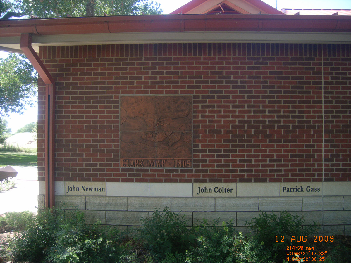
Clark Map 1805
- Date Assessed: 2009-08-12
- File Name: RIMG0100.JPG
- Folder: C11AugustCam1
- Camera Direction: 70°
Arikara Shield
- Date Assessed: 2009-08-12
- File Name: RIMG0101.JPG
- Folder: C11AugustCam1
- Camera Direction: 70°
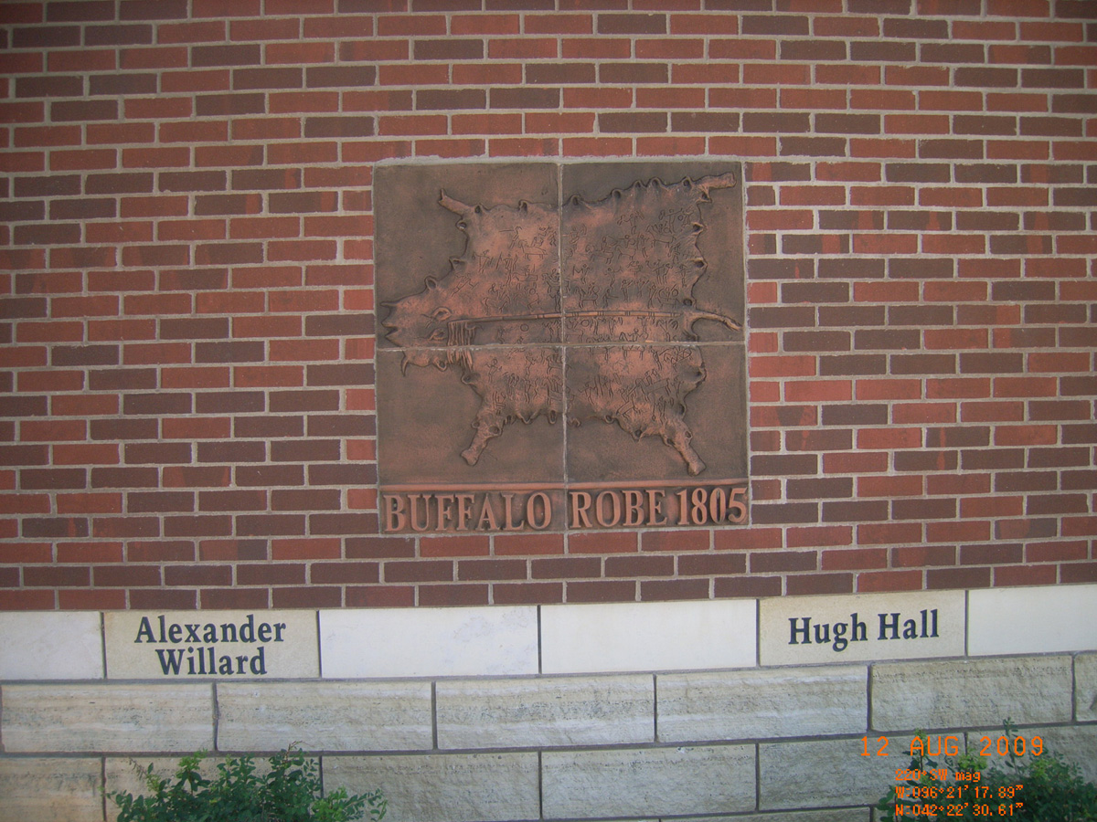
Buffalo Robe 1805
- Date Assessed: 2009-08-12
- File Name: RIMG0102.JPG
- Folder: C11AugustCam1
- Camera Direction: 67°
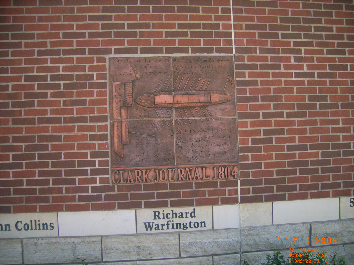
Clark Journal 1804
- Date Assessed: 2009-08-12
- File Name: RIMG0103.JPG
- Folder: C11AugustCam1
- Camera Direction: 67°
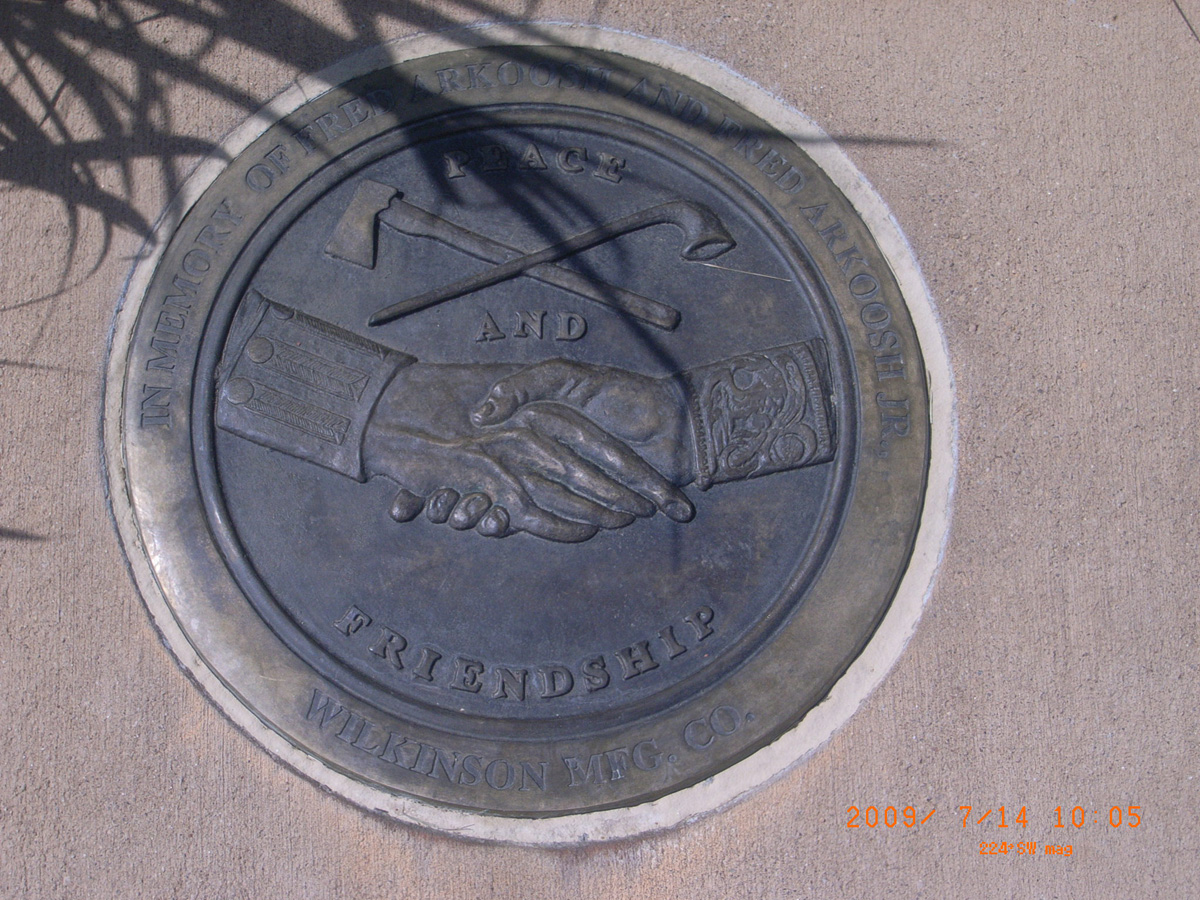
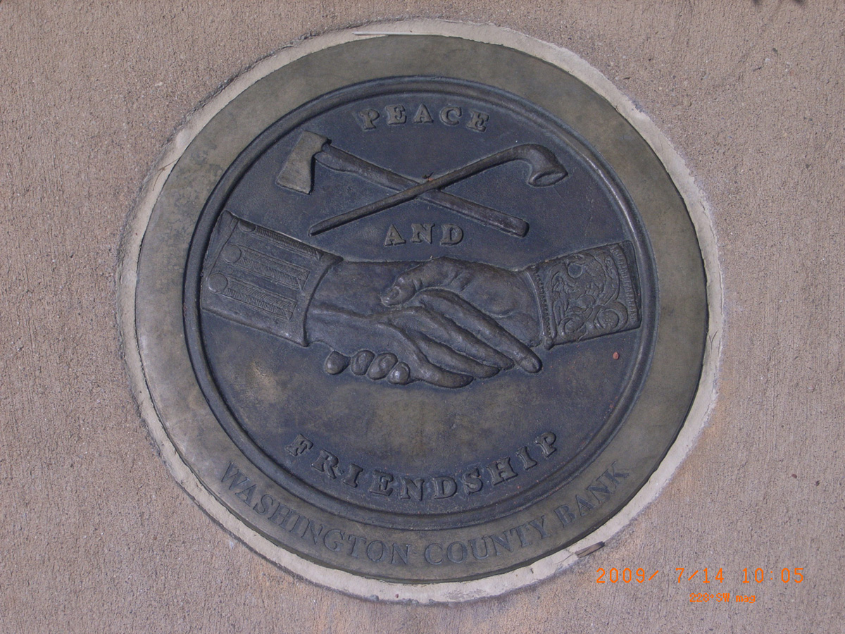
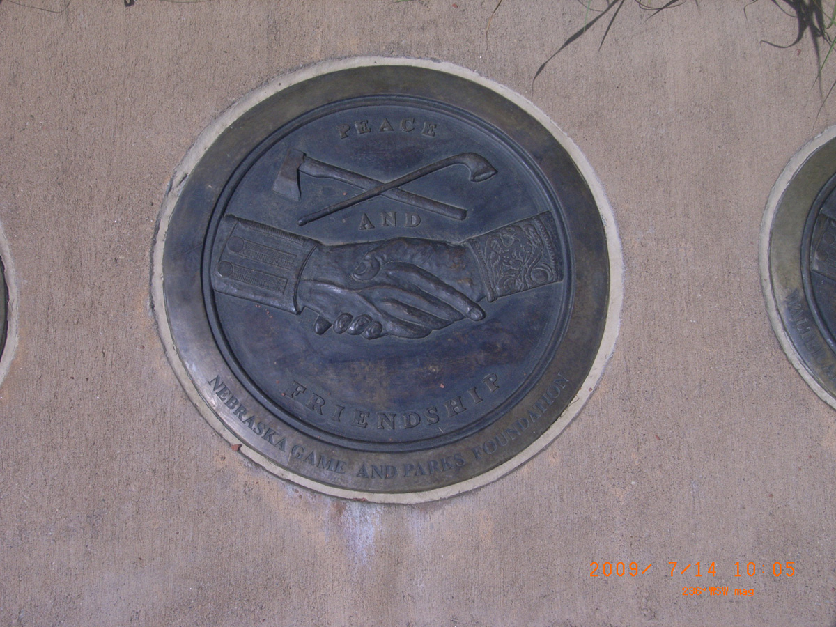
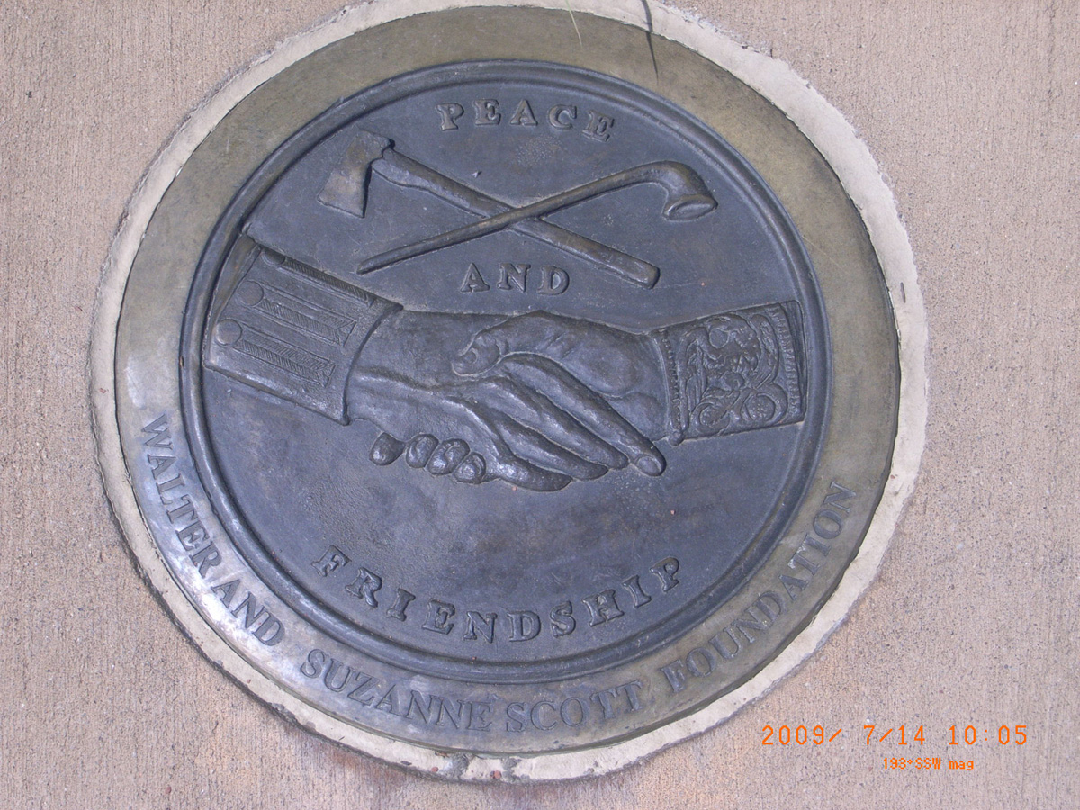
Corps of Discovery, Peace and Friendship
- Date Assessed: 2009-08-12
- File Name: RIMG0104.JPG
- Folder: C11AugustCam1
- Camera Direction: 312°
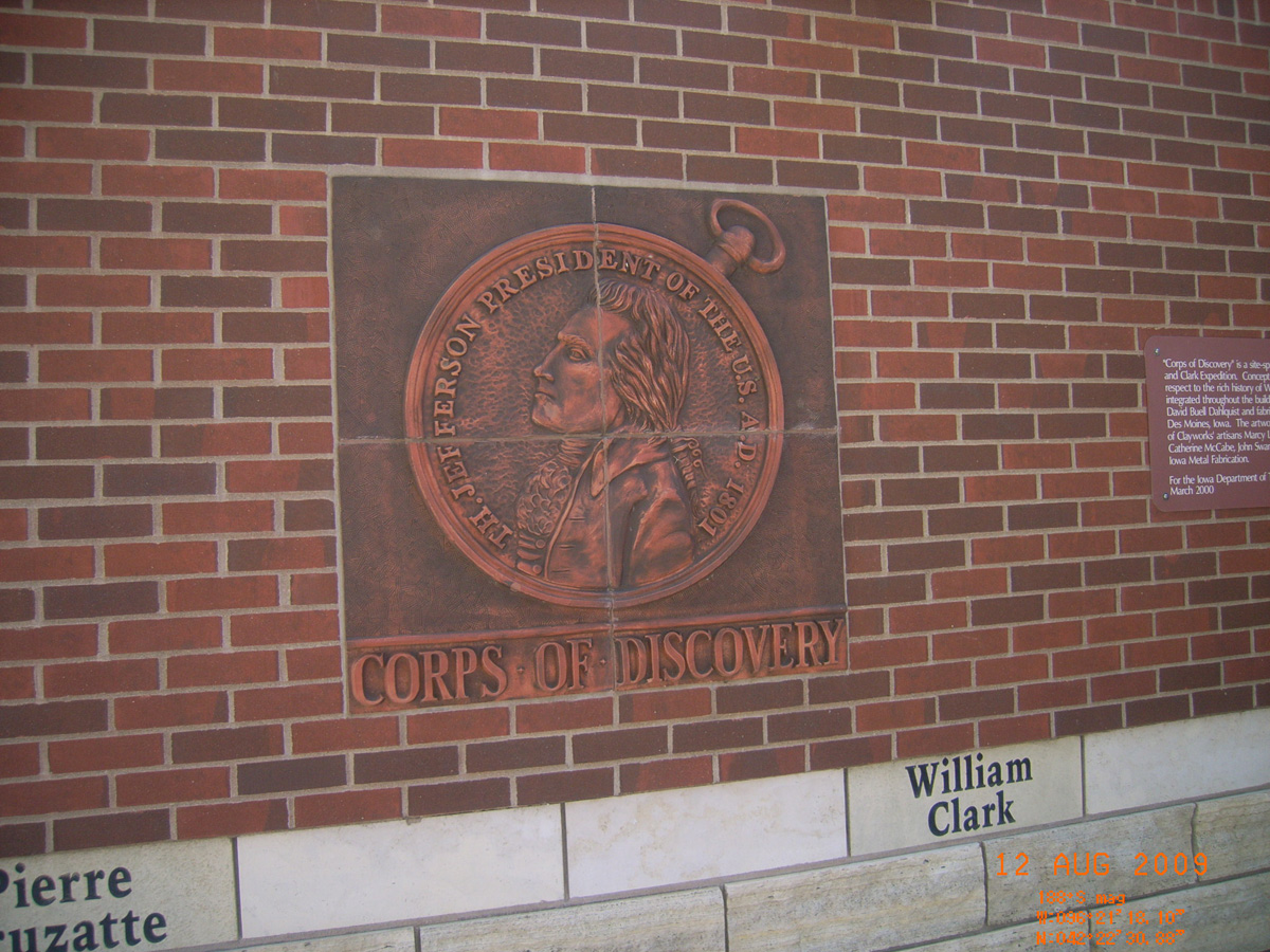
Corps of Discovery, Th. Jefferson President of the U.S. A.D. 1804
- Date Assessed: 2009-08-12
- File Name: RIMG0105.JPG
- Folder: C11AugustCam1
- Camera Direction: 358°
Lewis Journal 1806
- Date Assessed: 2009-08-12
- File Name: RIMG0106.JPG
- Folder: C11AugustCam1
- Camera Direction: 101°
- Date Assessed: 2009-08-12
- File Name: RIMG0107.JPG
- Folder: C11AugustCam1
- Camera Direction: 120°
- Date Assessed: 2009-08-12
- File Name: RIMG0108.JPG
- Folder: C11AugustCam1
- Camera Direction: 95°
Snyder Bend Park
Woodbury County, Iowa: 42.28203987, -96.33488196
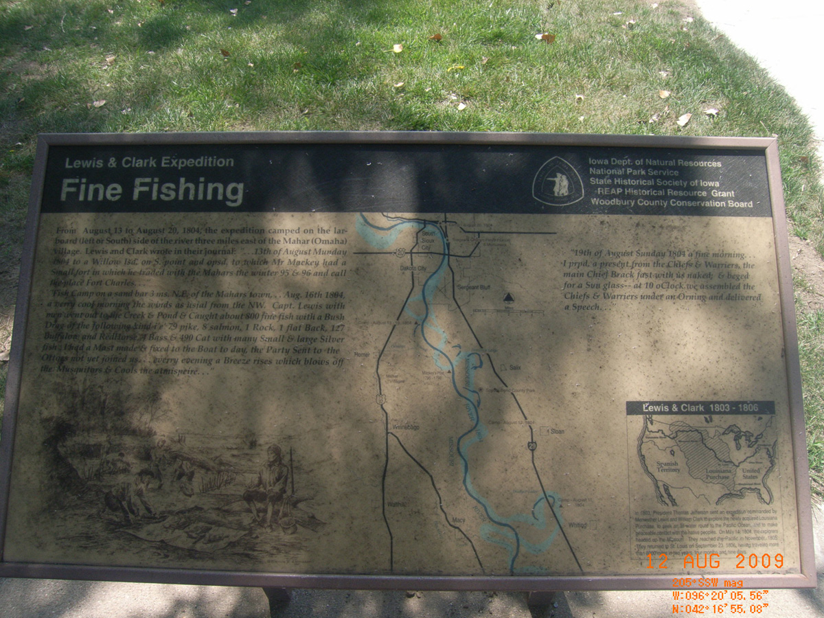
Fine Fishing
- Date Assessed: 2009-08-12
- File Name: RIMG0117.JPG
- Folder: C11AugustCam1
- Camera Direction: 107°
Fine Fishing
- Date Assessed: 2009-08-12
- File Name: RIMG0118.JPG
- Folder: C11AugustCam1
- Camera Direction: 84°
Lewis and Clark State Park, Blue Lake
Monona County, Iowa: 42.04303817, -96.16201352
The Lewis and Clark Expedition
- Date Assessed: 2009-07-14
- File Name: RIMG0073.JPG
- Folder: C14JulyCam1
- Camera Direction: 126°
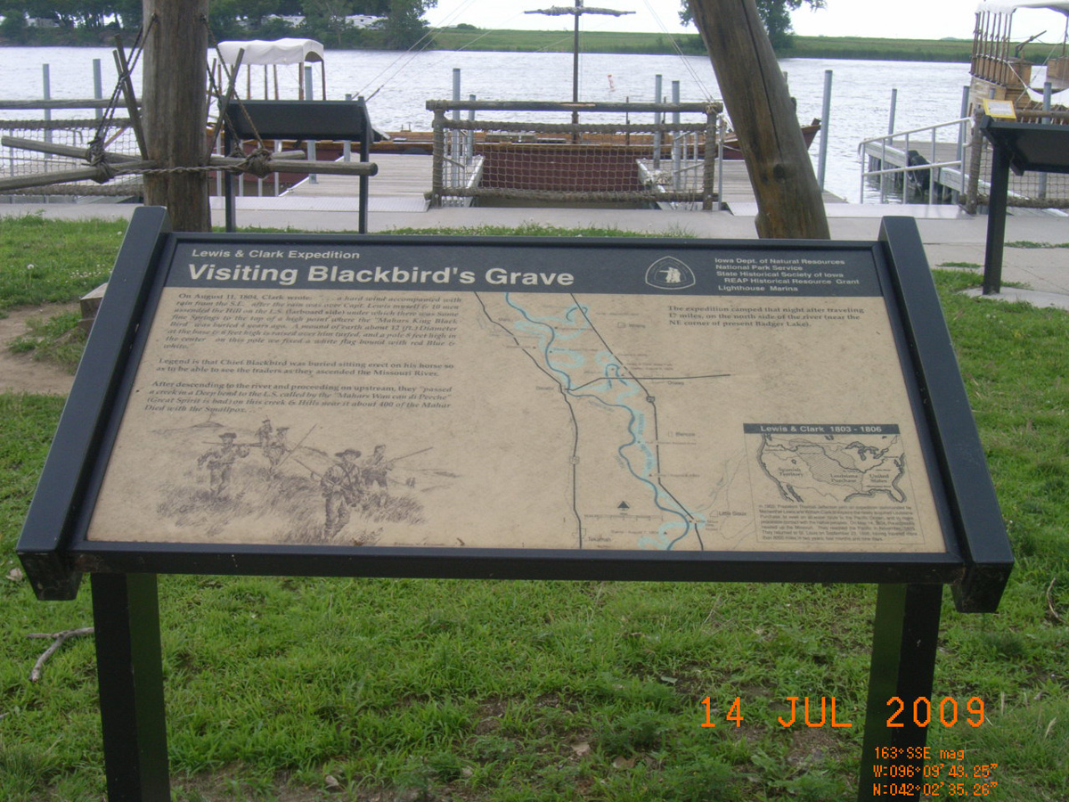
Visiting Blackbird's Grave
- Date Assessed: 2009-07-14
- File Name: RIMG0074.JPG
- Folder: C14JulyCam1
- Camera Direction: 121°
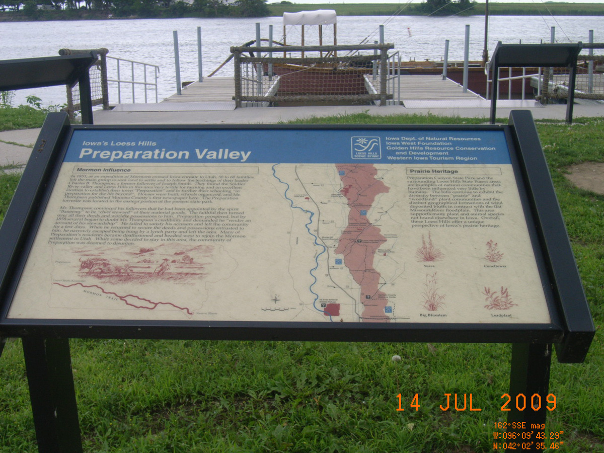
Iowa's Loess Hills: Preparation Valley
- Date Assessed: 2009-07-14
- File Name: RIMG0075.JPG
- Folder: C14JulyCam1
- Camera Direction: 123°
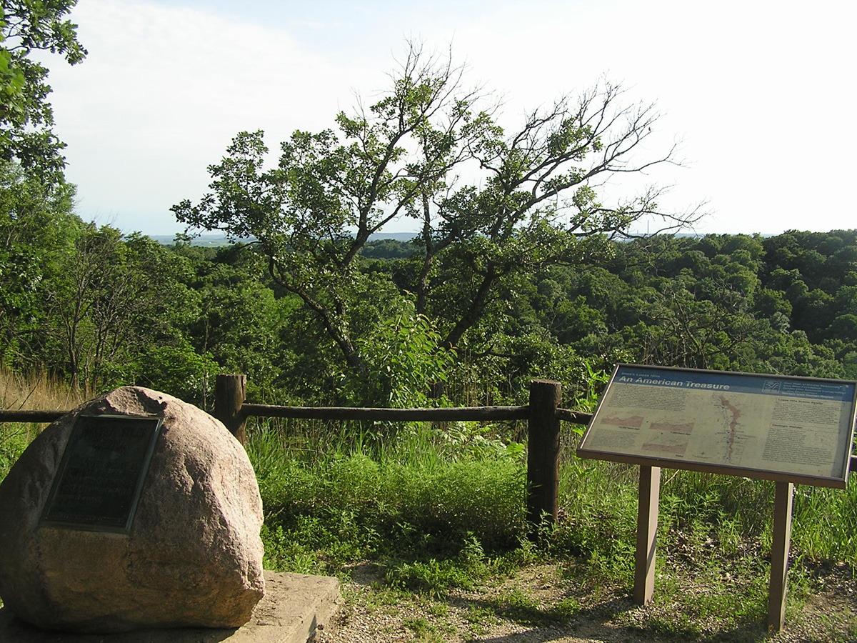
Iowa's Loess Hills: An American Treasure
- Date Assessed: 2009-07-14
- File Name: RIMG0076.JPG
- Folder: C14JulyCam1
- Camera Direction: 114°
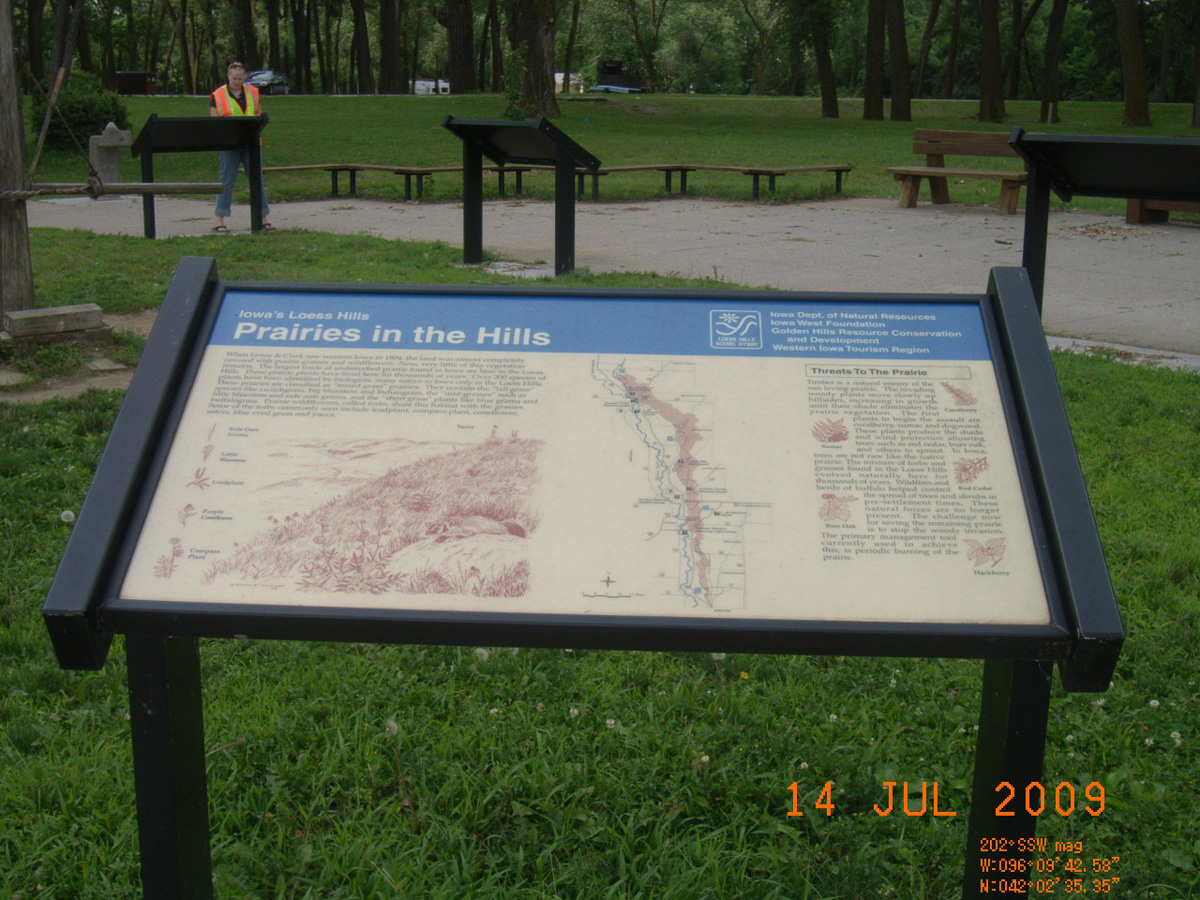
Iowa's Loess Hills: Prairies in the Hills
- Date Assessed: 2009-07-14
- File Name: RIMG0077.JPG
- Folder: C14JulyCam1
- Camera Direction: 114°
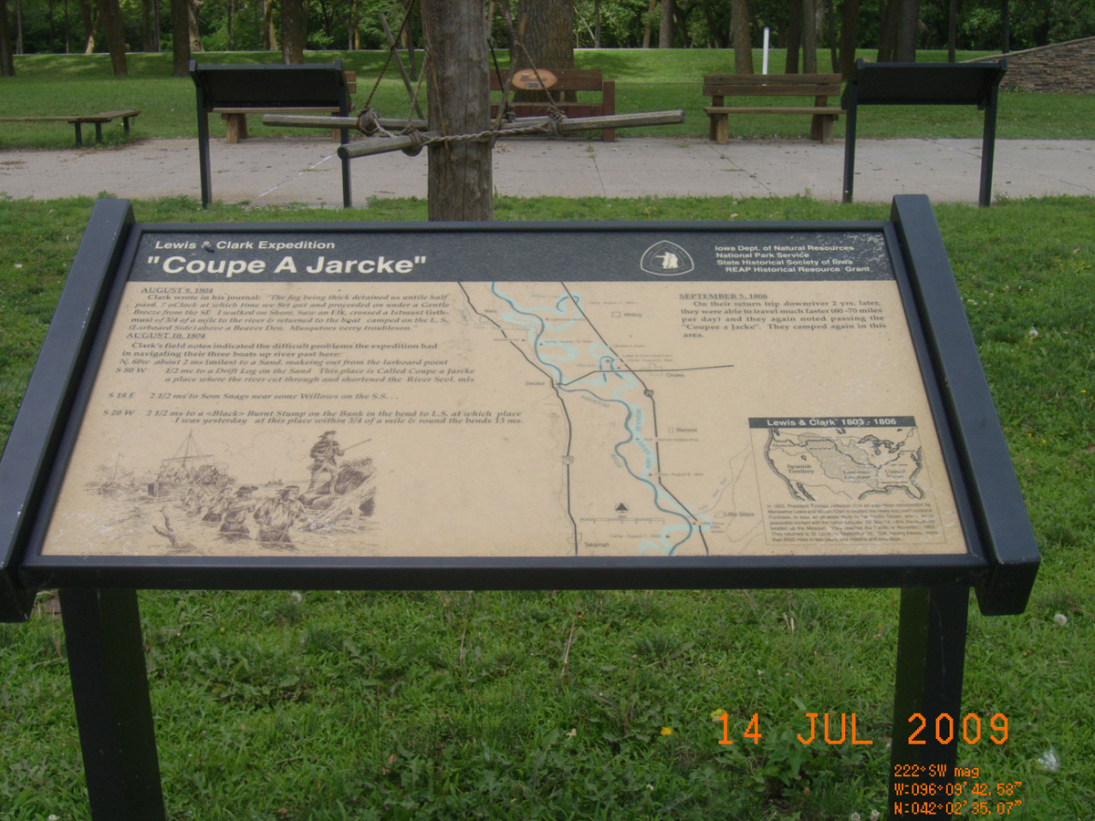
'Coupe A Jarcke'
- Date Assessed: 2009-07-14
- File Name: RIMG0078.JPG
- Folder: C14JulyCam1
- Camera Direction: 299°
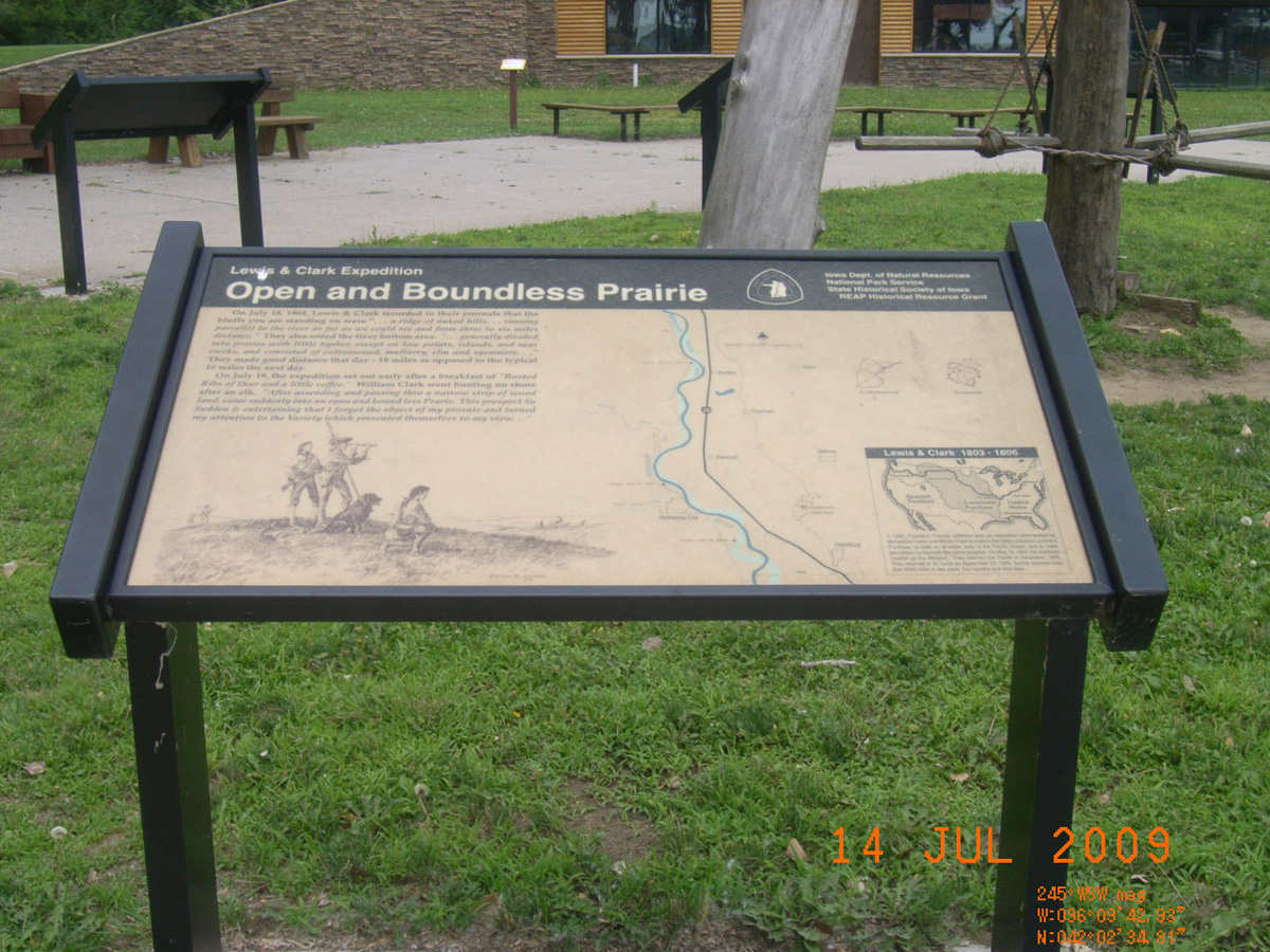
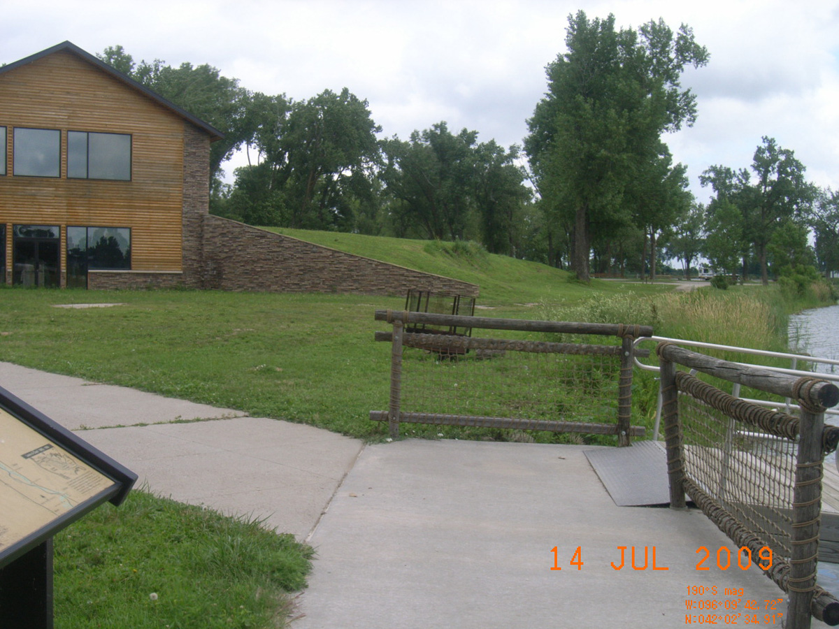
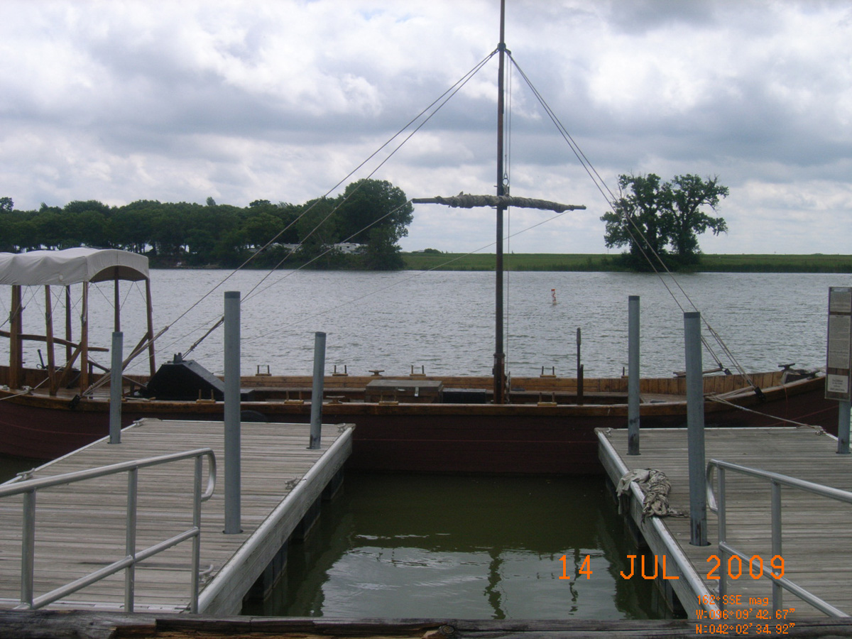
Open and Boundless Prairie
- Date Assessed: 2009-07-14
- File Name: RIMG0079.JPG
- Folder: C14JulyCam1
- Camera Direction: 41°
- Date Assessed: 2009-07-14
- File Name: RIMG0080.JPG
- Folder: C14JulyCam1
- Camera Direction: 357°
- Date Assessed: 2009-07-14
- File Name: RIMG0081.JPG
- Folder: C14JulyCam1
- Camera Direction: 87°
- Date Assessed: 2009-07-14
- File Name: RIMG0082.JPG
- Folder: C14JulyCam1
- Camera Direction: 84°
- Date Assessed: 2009-07-14
- File Name: RIMG0083.JPG
- Folder: C14JulyCam1
- Camera Direction: 178°
- Date Assessed: 2009-07-14
- File Name: RIMG0084.JPG
- Folder: C14JulyCam1
- Camera Direction: 242°
Sergeant Floyd's Monument, Sioux City
Woodbury County, Iowa: 42.46261699, -96.37755657
Lewis and Clark Expedition
- Date Assessed: 2009-07-15
- File Name: RIMG0119.JPG
- Folder: C14JulyCam1
- Camera Direction: 290°
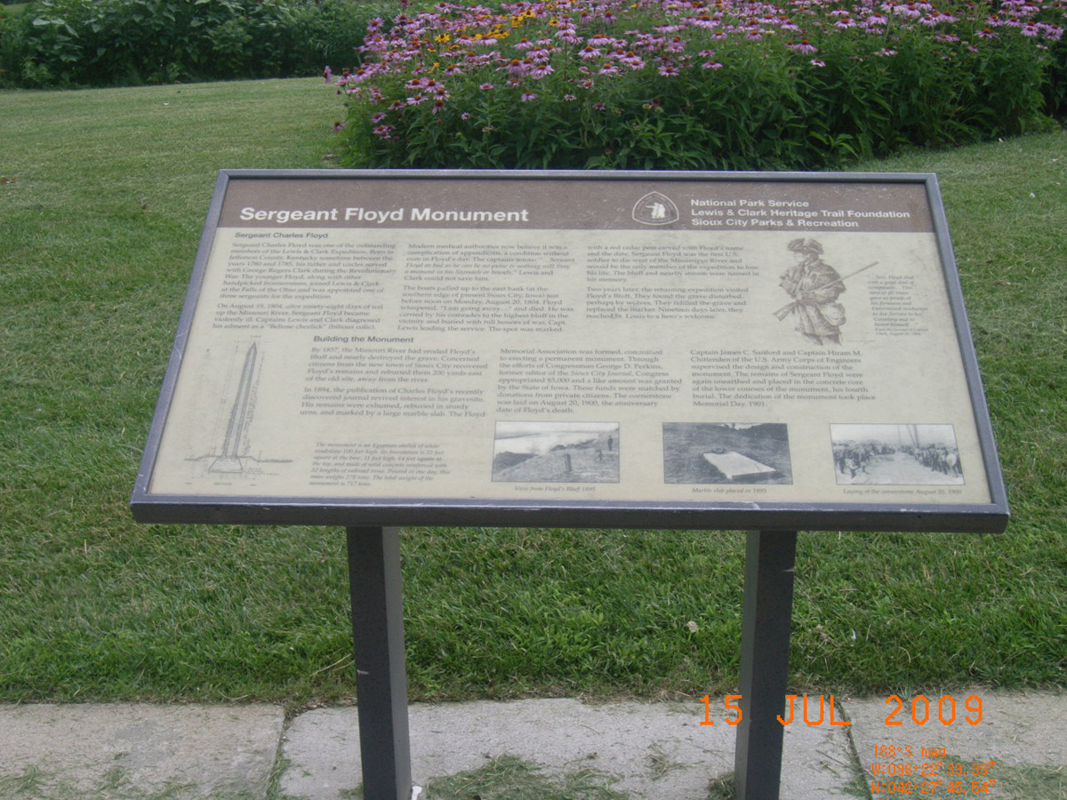
Sergeant Floyd Monument
- Date Assessed: 2009-07-15
- File Name: RIMG0120.JPG
- Folder: C14JulyCam1
- Camera Direction: 357°
The Death of Sergeant Floyd
- Date Assessed: 2009-07-15
- File Name: RIMG0121.JPG
- Folder: C14JulyCam1
- Camera Direction: 89°
Sergeant Floyd Grave Site and Monument
- Date Assessed: 2009-07-15
- File Name: RIMG0122.JPG
- Folder: C14JulyCam1
- Camera Direction: 121°
- Date Assessed: 2009-07-15
- File Name: RIMG0123.JPG
- Folder: C14JulyCam1
- Camera Direction: 83°
- Date Assessed: 2009-07-15
- File Name: RIMG0124.JPG
- Folder: C14JulyCam1
- Camera Direction: 100°
Waubonsie State Park
Fremont County, Iowa: 40.67544966, -95.69093099
An American Treasure
- Date Assessed: 0000-00-00
- File Name: RIMG0167.JPG
- Folder: C24JuneCam2
- Camera Direction: 25°
An American Treasure
- Date Assessed: 0000-00-00
- File Name: RIMG0168.JPG
- Folder: C24JuneCam2
- Camera Direction: 78°
Open and Boundless Prairie
- Date Assessed: 0000-00-00
- File Name: RIMG0171.JPG
- Folder: C24JuneCam2
- Camera Direction: 79°
Wynot City Park
Cedar County, Nebraska: 42.73944185, -97.16918528
Where is Private Shannon?
- Date Assessed: 2009-07-15
- File Name: RIMG0033.JPG
- Folder: C15JulyCam2
- Camera Direction: 172°
Where is Private Shannon?
- Date Assessed: 2009-07-15
- File Name: RIMG0034.JPG
- Folder: C15JulyCam2
- Camera Direction: 172°
St. Helena
Cedar County, Nebraska: 42.81015638, -97.24893078
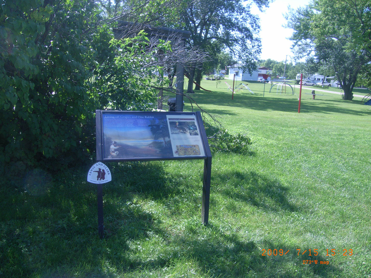
Living off Grapes and One Rabbit
- Date Assessed: 2009-07-15
- File Name: RIMG0047.JPG
- Folder: C15JulyCam2
- Camera Direction: 99°
- Date Assessed: 2009-07-15
- File Name: RIMG0048.JPG
- Folder: C15JulyCam2
- Camera Direction: 122°
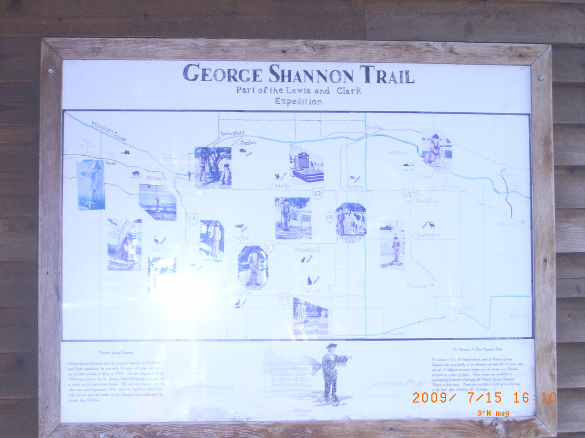
George Shannon Trail, Lindy
Knox County, Nebraska: 42.73425212, -97.7411532
Lewis and Clark Campsite, September 2, 1804
- Date Assessed: 2009-07-15
- File Name: RIMG0061.JPG
- Folder: C15JulyCam2
- Camera Direction: 117°
George Shannon Trail
- Date Assessed: 2009-07-15
- File Name: RIMG0062.JPG
- Folder: C15JulyCam2
- Camera Direction: 159°
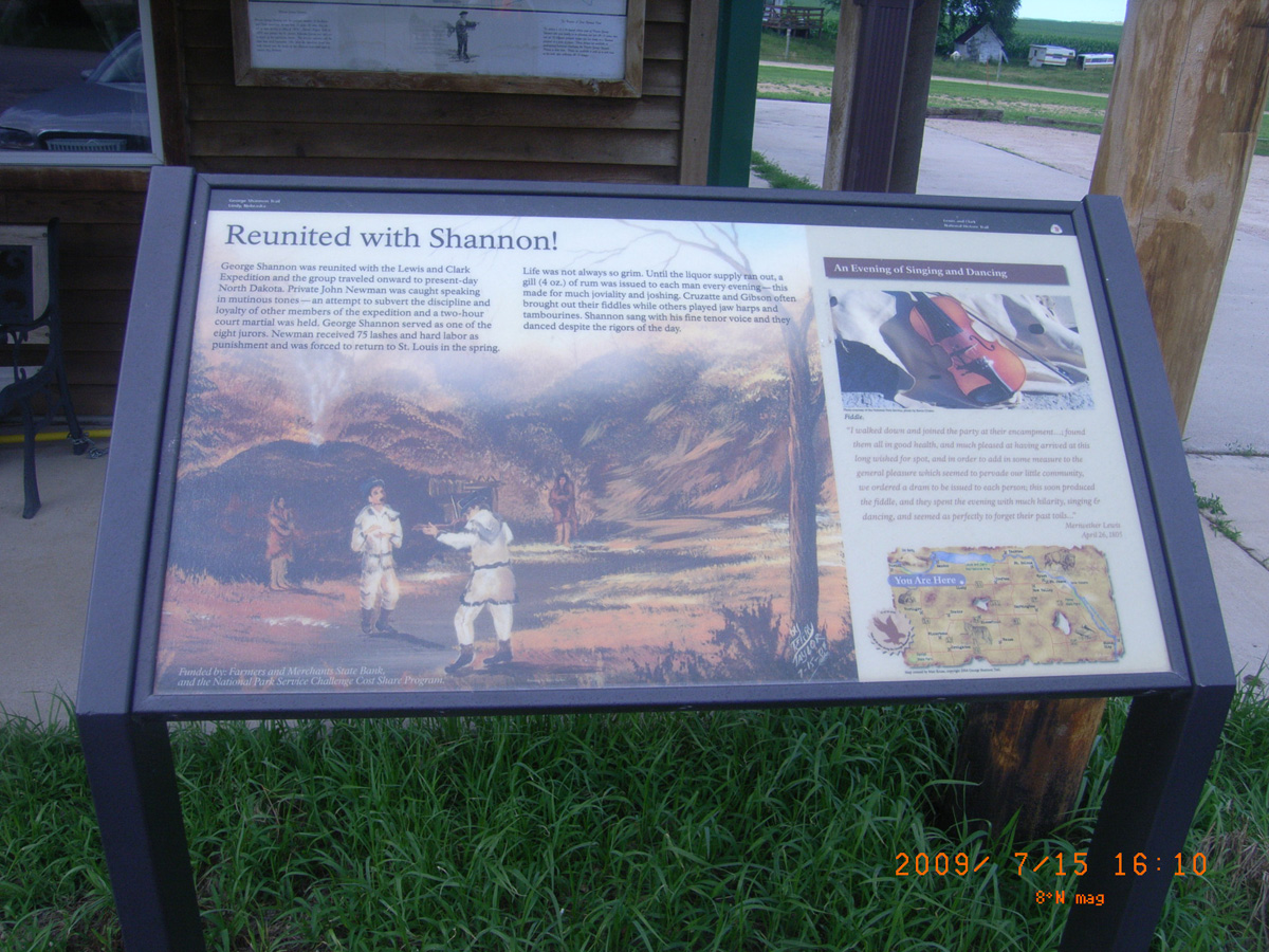
Reunited with Shannon!
- Date Assessed: 2009-07-15
- File Name: RIMG0063.JPG
- Folder: C15JulyCam2
- Camera Direction: 159°
Ohiya Casino
Knox County, Nebraska: 42.74783524, -97.92998035
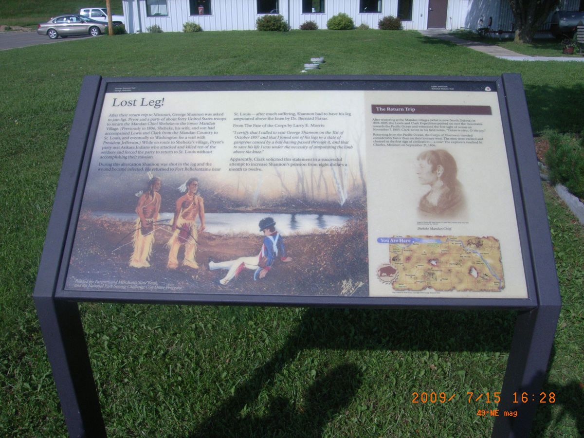
Lost Leg!
- Date Assessed: 2009-07-15
- File Name: RIMG0070.JPG
- Folder: C15JulyCam2
- Camera Direction: 159°
- Date Assessed: 2009-07-15
- File Name: RIMG0071.JPG
- Folder: C15JulyCam2
- Camera Direction: 103°
Ohiya Casino
- Date Assessed: 2009-07-15
- File Name: RIMG0072.JPG
- Folder: C15JulyCam2
- Camera Direction: 125°
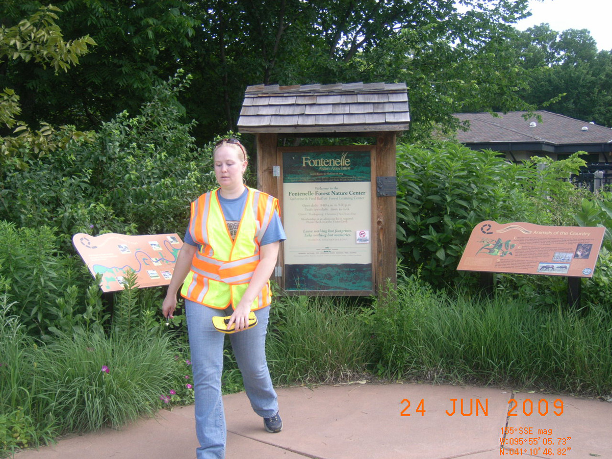
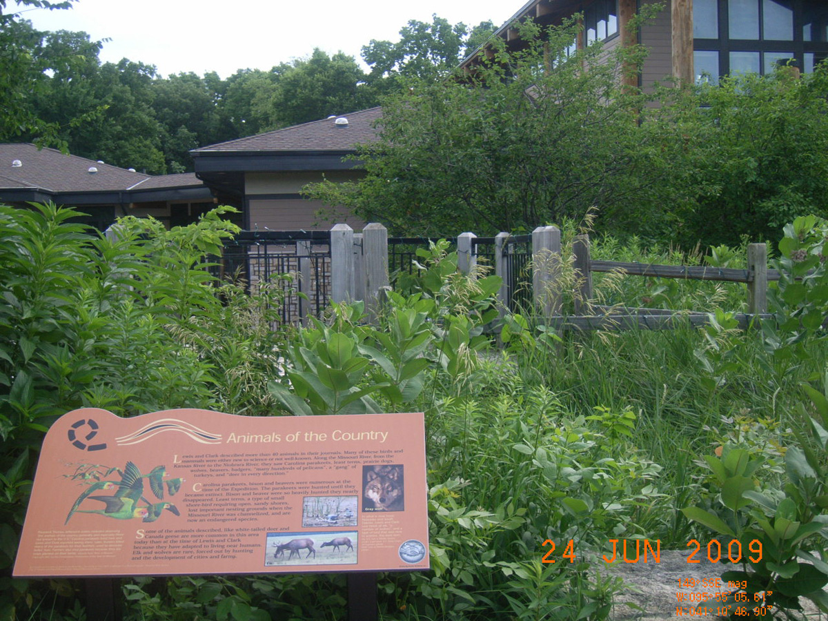
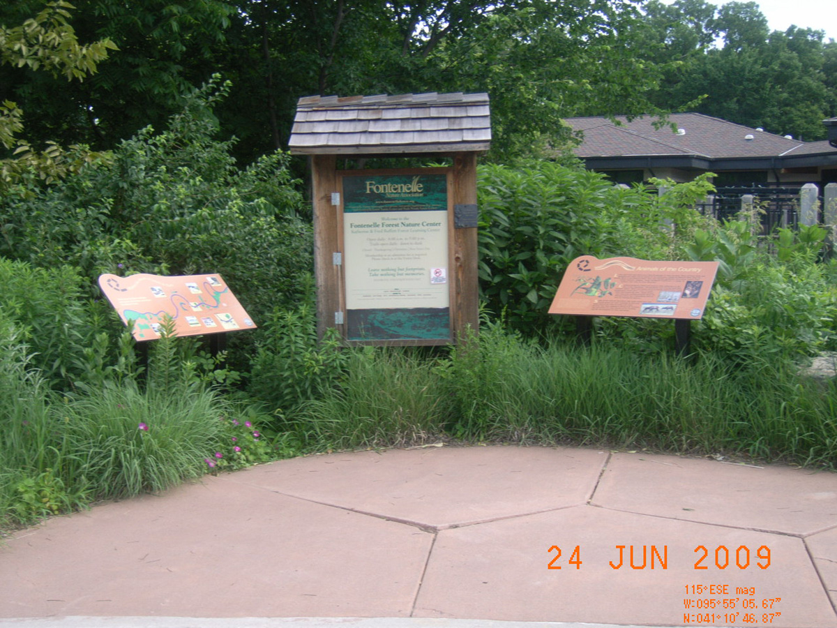
Fontenelle Forest Nature Center
Sarpy County, Nebraska: 41.17972156, -95.9182236
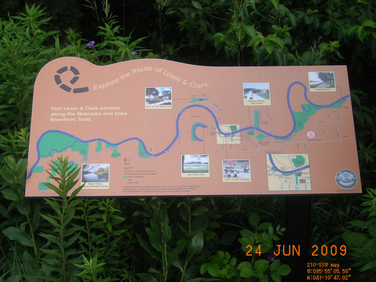
Explore the Route of Lewis & Clark
- Date Assessed: 2009-06-24
- File Name: RIMG0046.JPG
- Folder: C24JuneCam1
- Camera Direction: 178°
Animals of the Country
- Date Assessed: 2009-06-24
- File Name: RIMG0048.JPG
- Folder: C24JuneCam1
- Camera Direction: 143°
Fontenelle Forest Nature Center
- Date Assessed: 2009-06-24
- File Name: RIMG0049.JPG
- Folder: C24JuneCam1
- Camera Direction: 218°
- Date Assessed: 2009-06-24
- File Name: RIMG0054.JPG
- Folder: C24JuneCam1
- Camera Direction: 207°
Animals of the Country
- Date Assessed: 2009-06-24
- File Name: RIMG0056.JPG
- Folder: C24JuneCam1
- Camera Direction: 202°
- Date Assessed: 2009-06-24
- File Name: RIMG0059.JPG
- Folder: C24JuneCam1
- Camera Direction: 167°
Schilling Wildlife Management Area, Mouth of the Platte
Cass County, Nebraska: 41.04985792, -95.87907608
Crossing the Mouth of the Platte
- Date Assessed: 2009-06-24
- File Name: RIMG0095.JPG
- Folder: C24JuneCam1
- Camera Direction: 185°
The Lewis and Clark Expedition
- Date Assessed: 2009-06-24
- File Name: RIMG0096.JPG
- Folder: C24JuneCam1
- Camera Direction: 187°
- Date Assessed: 2009-06-24
- File Name: RIMG0097.JPG
- Folder: C24JuneCam1
- Camera Direction: 212°
- Date Assessed: 2009-06-24
- File Name: RIMG0098.JPG
- Folder: C24JuneCam1
- Camera Direction: 130°
- Date Assessed: 2009-06-24
- File Name: RIMG0099.JPG
- Folder: C24JuneCam1
- Camera Direction: 208°
- Date Assessed: 2009-06-24
- File Name: RIMG0100.JPG
- Folder: C24JuneCam1
- Camera Direction: 168°
- Date Assessed: 2009-06-24
- File Name: RIMG0101.JPG
- Folder: C24JuneCam1
- Camera Direction: 148°
- Date Assessed: 2009-06-24
- File Name: RIMG0102.JPG
- Folder: C24JuneCam1
- Camera Direction: 154°
- Date Assessed: 2009-06-24
- File Name: RIMG0103.JPG
- Folder: C24JuneCam1
- Camera Direction: 154°
- Date Assessed: 2009-06-24
- File Name: RIMG0104.JPG
- Folder: C24JuneCam1
- Camera Direction: 174°
- Date Assessed: 2009-06-24
- File Name: RIMG0105.JPG
- Folder: C24JuneCam1
- Camera Direction: 129°
Umonhon (Omaha) Village, HW 75
Burt County, Nebraska: 42.04220905, -96.28383183
Promoting A Missouri River Revival
- Date Assessed: 2009-07-14
- File Name: RIMG0093.JPG
- Folder: C14JulyCam2
- Camera Direction: 343°
Up the Missouri River
- Date Assessed: 2009-07-14
- File Name: RIMG0094.JPG
- Folder: C14JulyCam2
- Camera Direction: 5°
Umonhon (Omaha) Earthlodges
- Date Assessed: 2009-07-14
- File Name: RIMG0095.JPG
- Folder: C14JulyCam2
- Camera Direction: 5°
'Against the Current' - The Umonhon (Omaha)
- Date Assessed: 2009-07-14
- File Name: RIMG0096.JPG
- Folder: C14JulyCam2
- Camera Direction: 0°
Umonhon (Omaha) Contributions
- Date Assessed: 2009-07-14
- File Name: RIMG0097.JPG
- Folder: C14JulyCam2
- Camera Direction: 93°
- Date Assessed: 2009-07-14
- File Name: RIMG0098.JPG
- Folder: C14JulyCam2
- Camera Direction: 199°
Elk Creek, HW 20, near Jackson
Dakota County, Nebraska: 42.45234233, -96.59120114
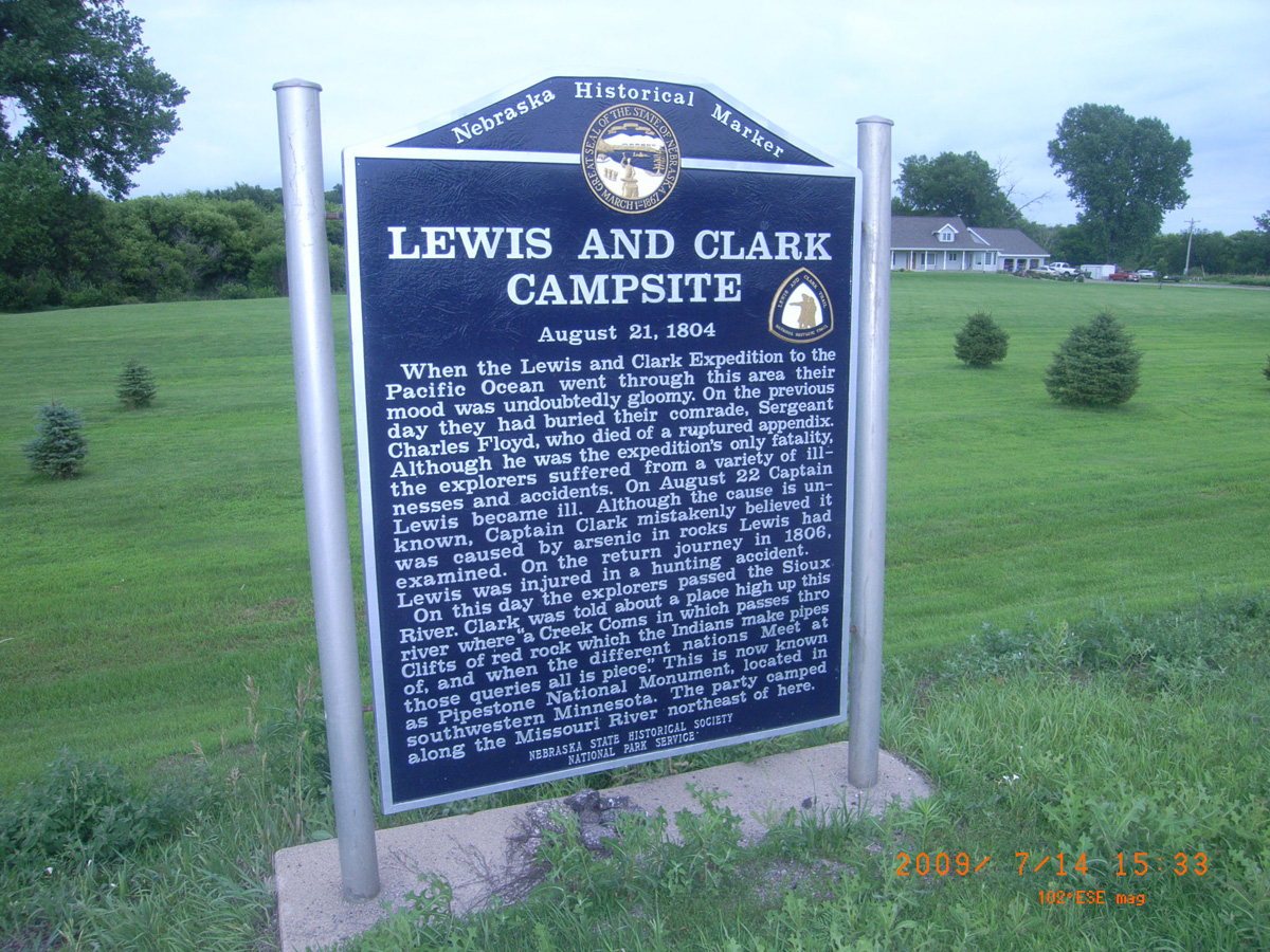
Lewis and Clark Campsite, August 21, 1804
- Date Assessed: 2009-07-14
- File Name: RIMG0124.JPG
- Folder: C14JulyCam2
- Camera Direction: 225°
Highway 12 near Newcastle
Dixon County, Nebraska: 42.66406666, -96.93256928
Lewis and Clark Campsite, August 23, 24, and 25, 1804
- Date Assessed: 2009-07-15
- File Name: RIMG0019.JPG
- Folder: C15JulyCam2
- Camera Direction: 130°
Near Elk Point
Dixon County, Nebraska: 42.65861938, -96.75019155
The Great Missouri River
- Date Assessed: 2009-08-11
- File Name: RIMG0103.JPG
- Folder: C11AugustCam2
- Camera Direction: 264°
Camping with Lewis & Clark
- Date Assessed: 2009-08-11
- File Name: RIMG0104.JPG
- Folder: C11AugustCam2
- Camera Direction: 264°
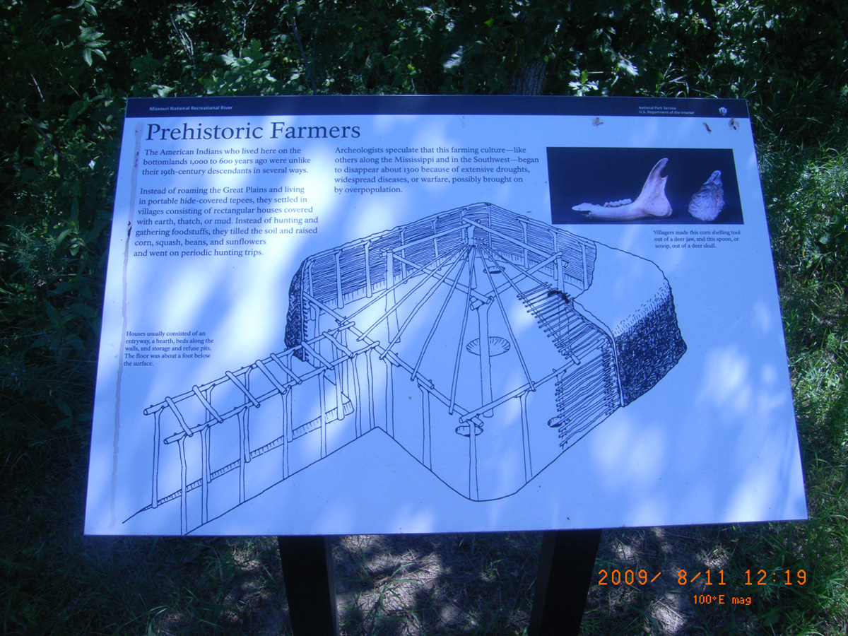
Prehistoric Farmers
- Date Assessed: 2009-08-11
- File Name: RIMG0105.JPG
- Folder: C11AugustCam2
- Camera Direction: 264°
Lewis and Clark as Naturalists
- Date Assessed: 2009-08-11
- File Name: RIMG0106.JPG
- Folder: C11AugustCam2
- Camera Direction: 165°
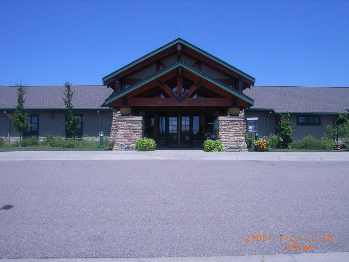
Lewis & Clark Visitor Center, Gavins Point Dam
Cedar County, Nebraska: 42.84900375, -97.47764038
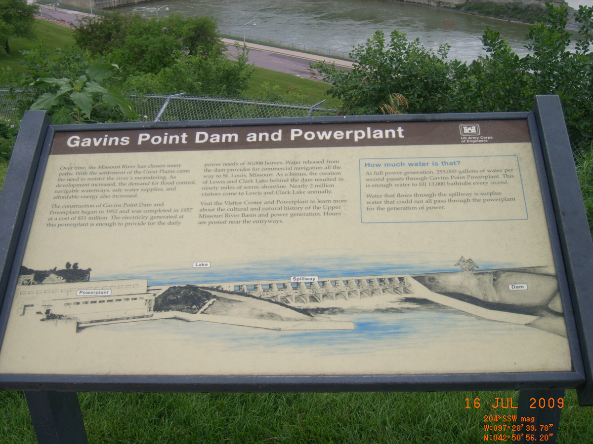
Gavins Point Dam and Powerplant
- Date Assessed: 2009-07-16
- File Name: RIMG0004.JPG
- Folder: C16JulyCam1
- Camera Direction: 225°
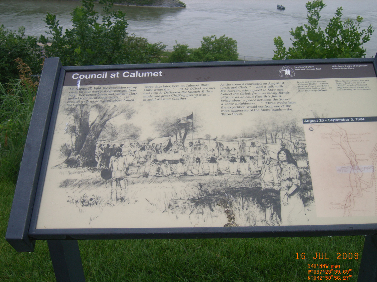
Council at Calumet
- Date Assessed: 2009-07-16
- File Name: RIMG0005.JPG
- Folder: C16JulyCam1
- Camera Direction: 214°
Up the Missouri
- Date Assessed: 2009-07-16
- File Name: RIMG0006.JPG
- Folder: C16JulyCam1
- Camera Direction: 218°
The Lewis and Clark Expedition
- Date Assessed: 2009-07-16
- File Name: RIMG0007.JPG
- Folder: C16JulyCam1
- Camera Direction: 237°