An archive of research on historic trails and roads
Lewis and Clark Trail Inventory
Idaho Sites
To see the map in fullscreen view, in the map's upper-right corner, click the ![]() button.
button.
The data for this map was collected by the National Park Service, Lewis and Clark National Historic Trail, mainly in the year 2009. If you have updates, please contact us: editor@trailresearch.org.
Idaho Signs, Statues, and Markers
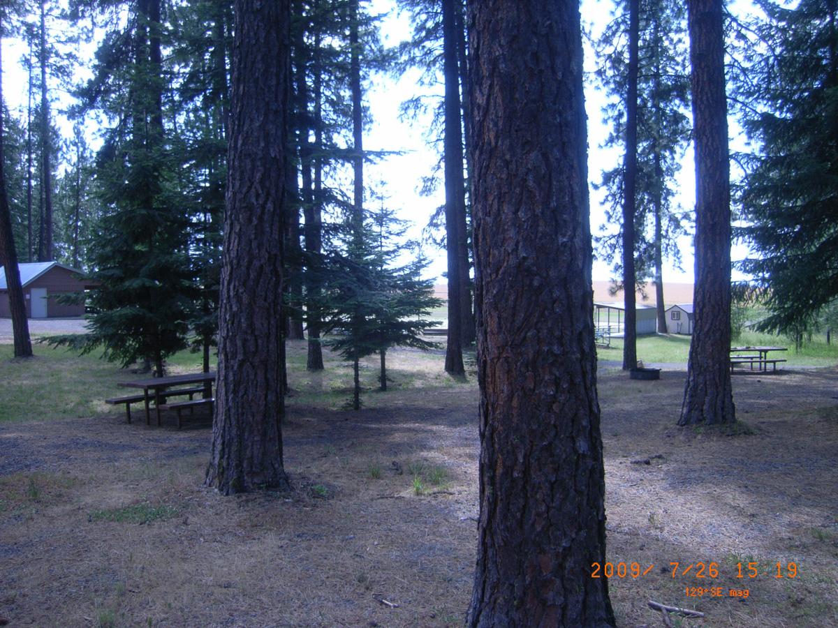
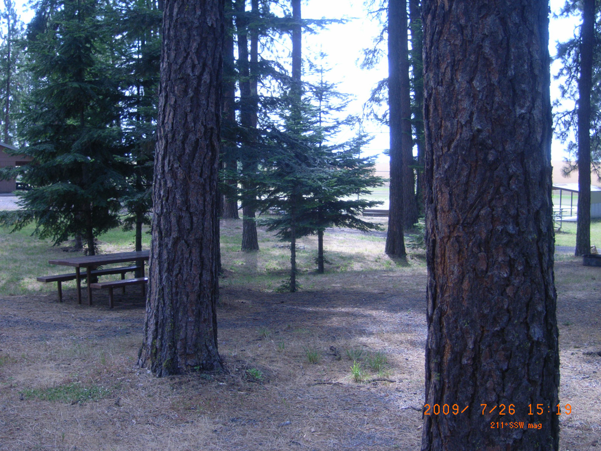
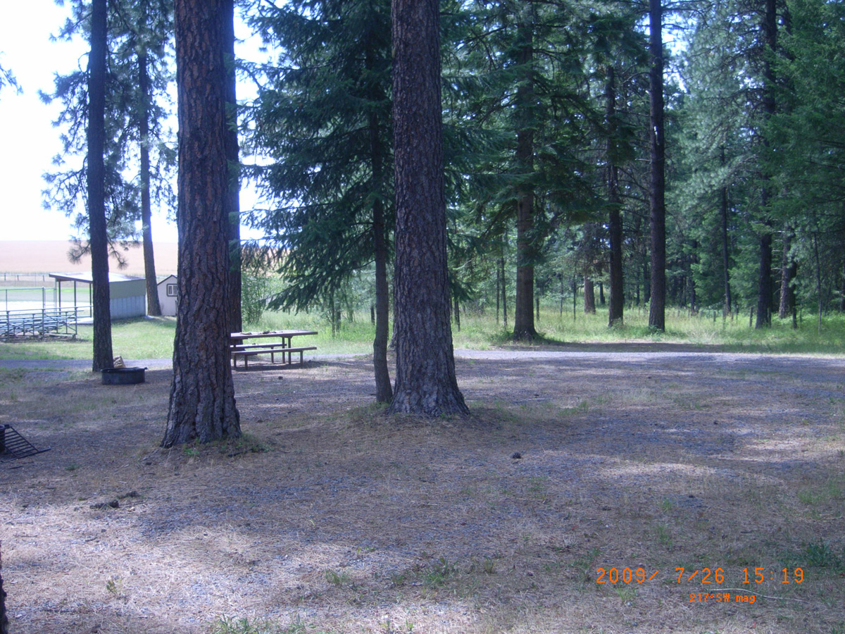
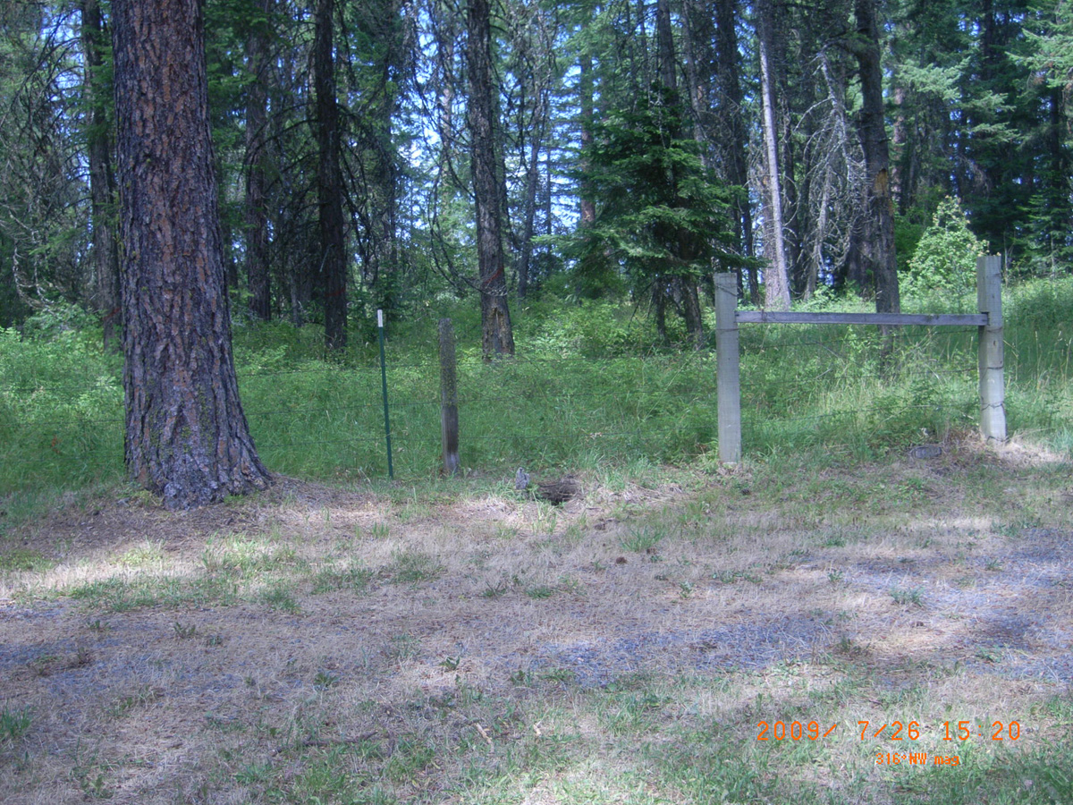
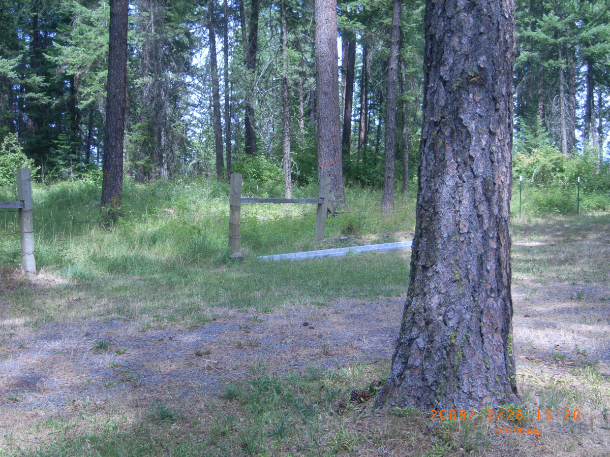
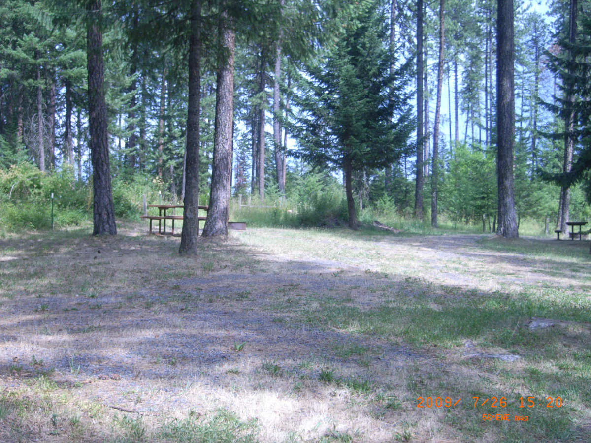
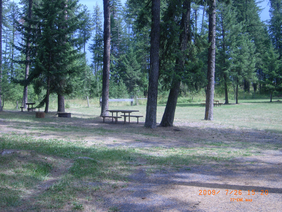
East Kamiah Nez Perce National Historic Park
Idaho County, Idaho: 46.21075354, -116.0057914
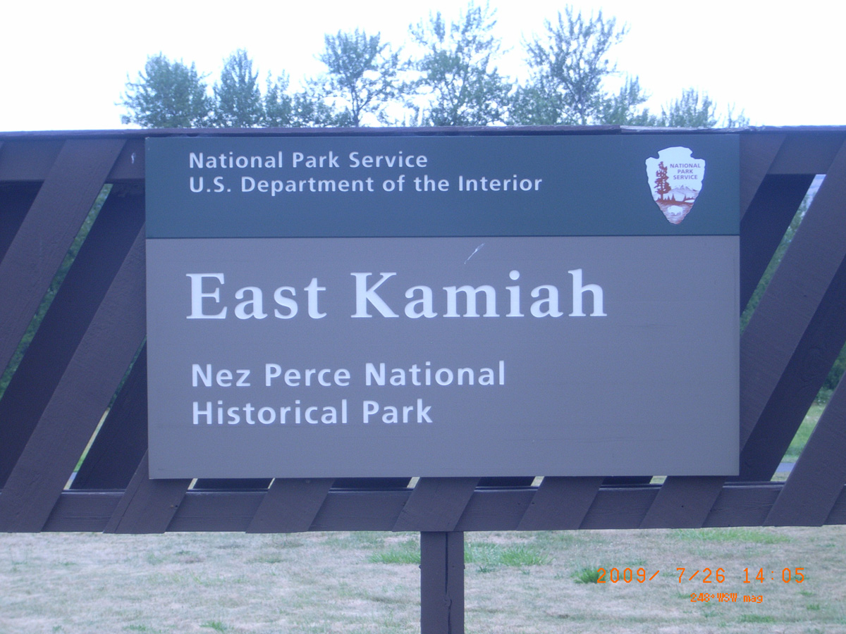
East Kamiah Nez Perce National Historical Park
- Date Assessed: 2009-07-26
- File Name: RIMG0012.JPG
- Folder: C26JulyCam2
- Camera Direction: 56°
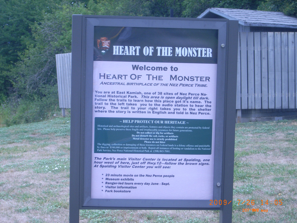
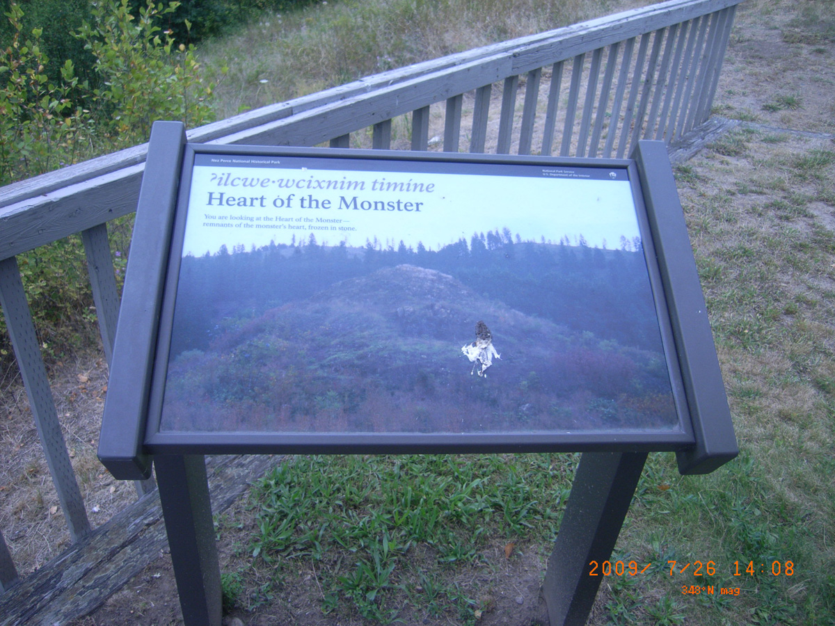
Heart of the Monster
- Date Assessed: 2009-07-26
- File Name: RIMG0013.JPG
- Folder: C26JulyCam2
- Camera Direction: 167°
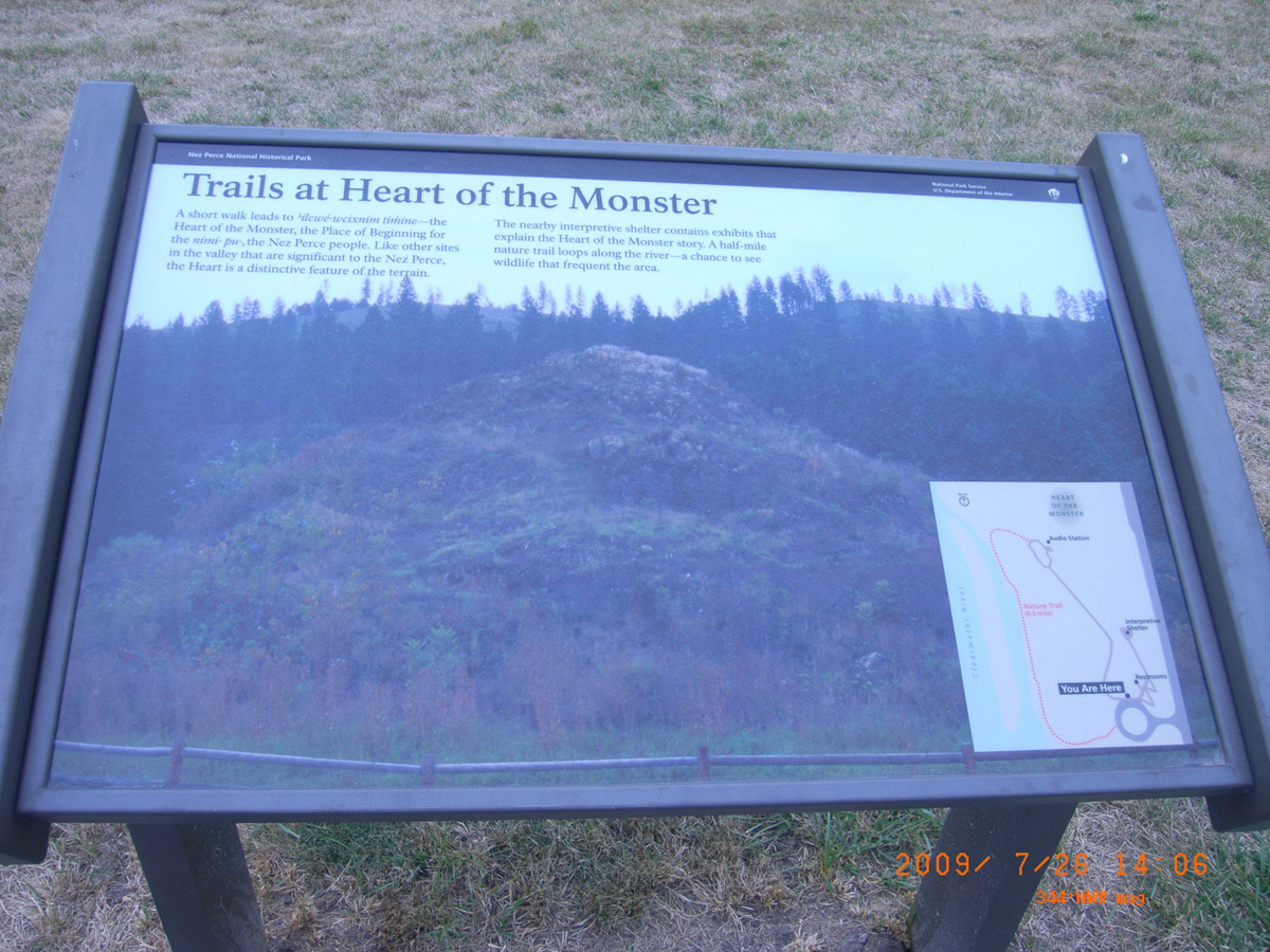
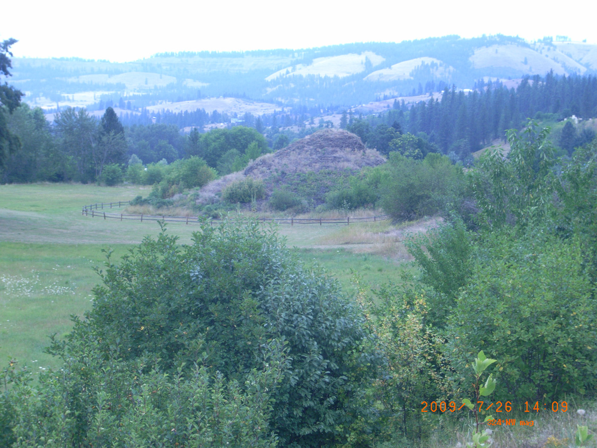
Trails at Heart of the Monster
- Date Assessed: 2009-07-26
- File Name: RIMG0014.JPG
- Folder: C26JulyCam2
- Camera Direction: 226°
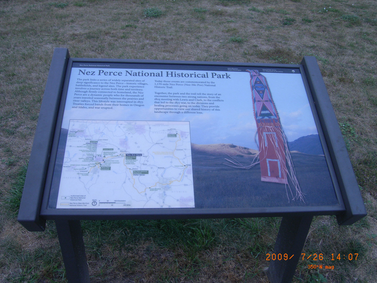
Nez Perce National Historical Park
- Date Assessed: 2009-07-26
- File Name: RIMG0015.JPG
- Folder: C26JulyCam2
- Camera Direction: 308°
Heart of the Monster
- Date Assessed: 2009-07-26
- File Name: RIMG0016.JPG
- Folder: C26JulyCam2
- Camera Direction: 300°
- Date Assessed: 2009-07-26
- File Name: RIMG0017.JPG
- Folder: C26JulyCam2
- Camera Direction: 304°
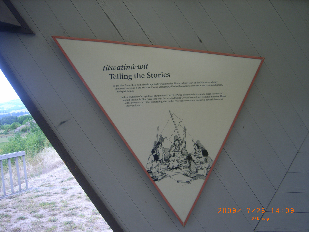
Telling the Stories
- Date Assessed: 2009-07-26
- File Name: RIMG0018.JPG
- Folder: C26JulyCam2
- Camera Direction: 49°
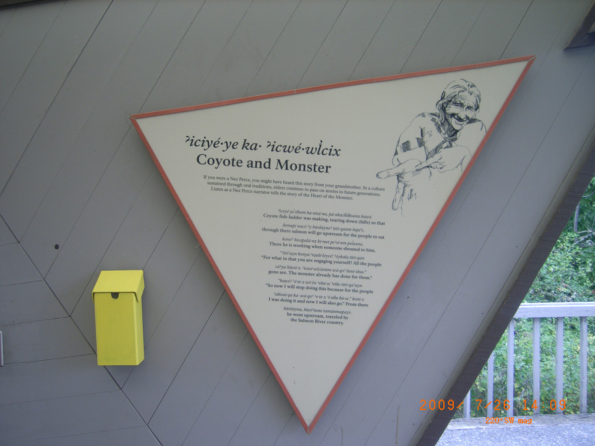
Coyote and Monster
- Date Assessed: 2009-07-26
- File Name: RIMG0019.JPG
- Folder: C26JulyCam2
- Camera Direction: 49°
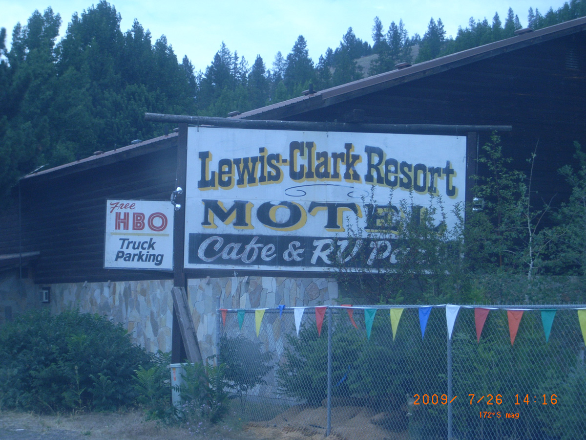
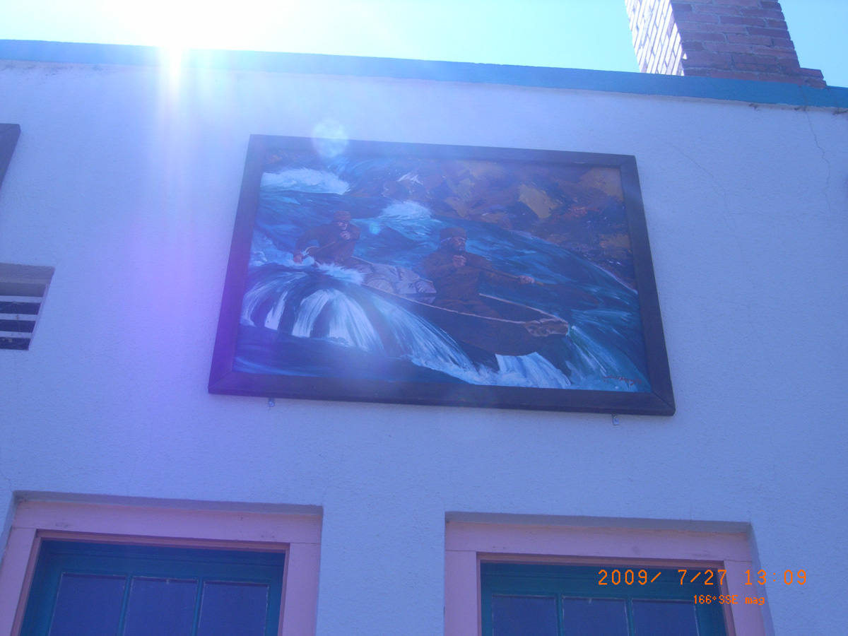
Lewis-Clark Resort Motel
- Date Assessed: 2009-07-26
- File Name: RIMG0020.JPG
- Folder: C26JulyCam2
- Camera Direction: 205°
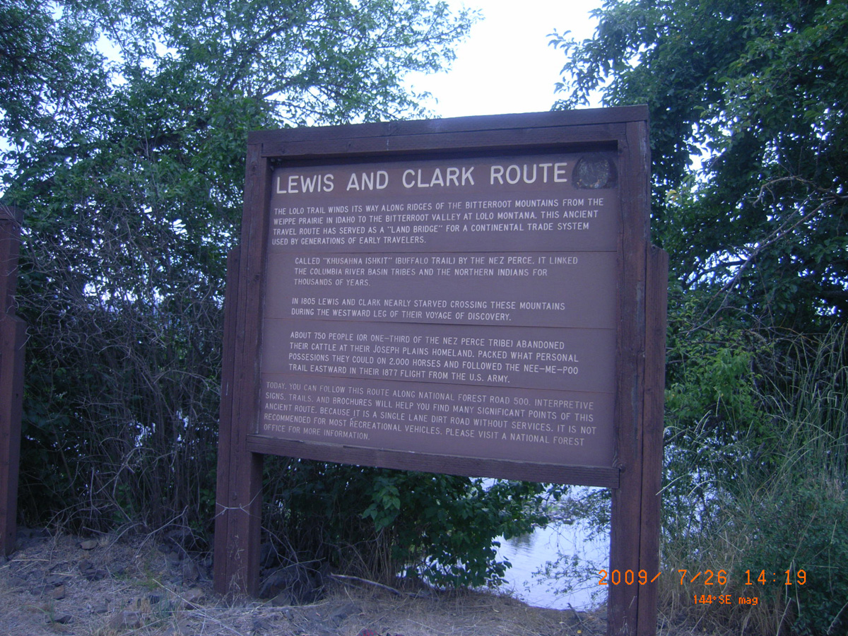
Lewis and Clark Route
- Date Assessed: 2009-07-26
- File Name: RIMG0021.JPG
- Folder: C26JulyCam2
- Camera Direction: 35°
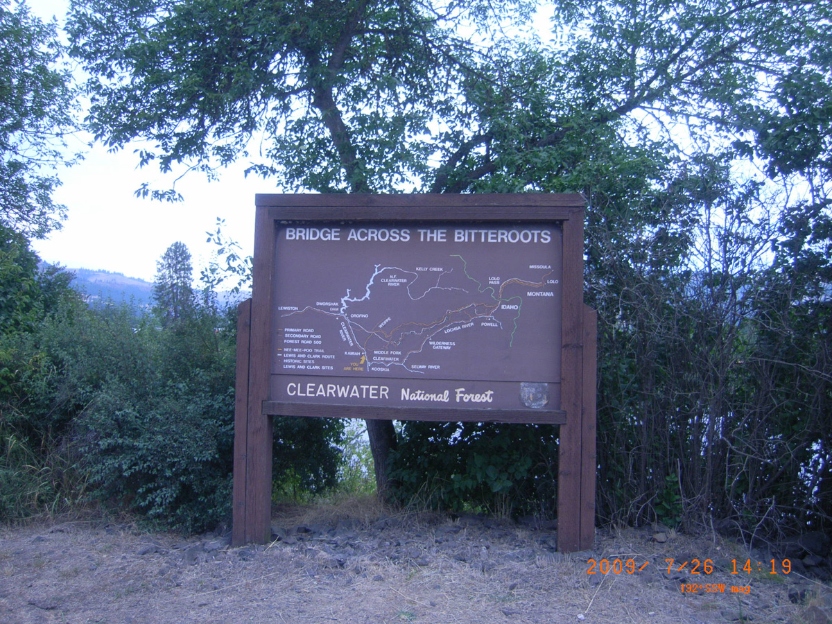
Bridge Across the Bitterroots
- Date Assessed: 2009-07-26
- File Name: RIMG0022.JPG
- Folder: C26JulyCam2
- Camera Direction: 34°
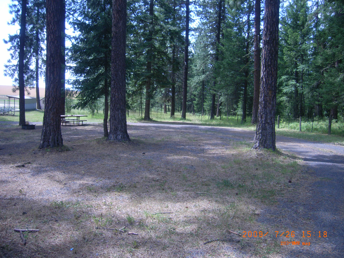
Fraser Park, Weippe Prairie
Clearwater County, Idaho: 46.38800762, -116.0471647
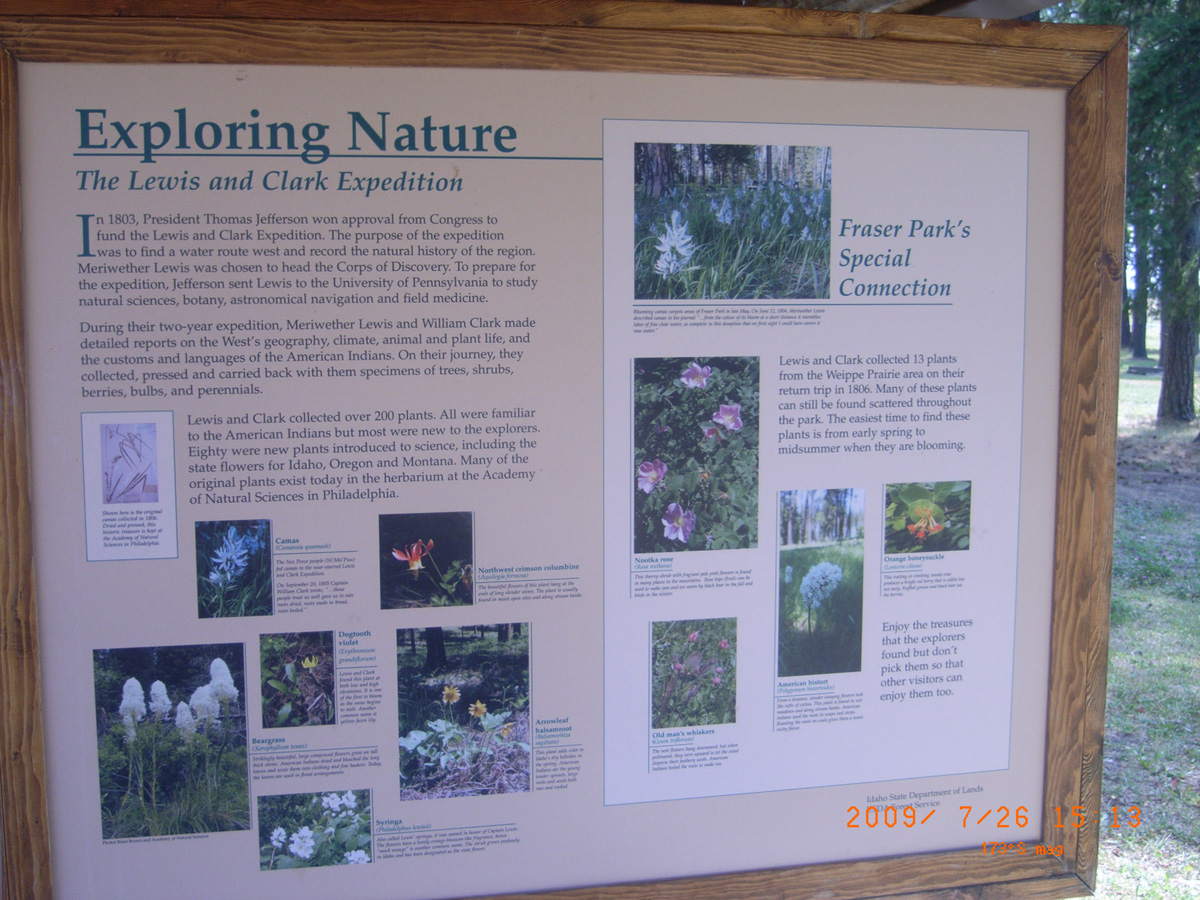
Exploring Nature: The Lewis and Clark Expedition
- Date Assessed: 2009-07-26
- File Name: RIMG0031.JPG
- Folder: C26JulyCam2
- Camera Direction: 34°
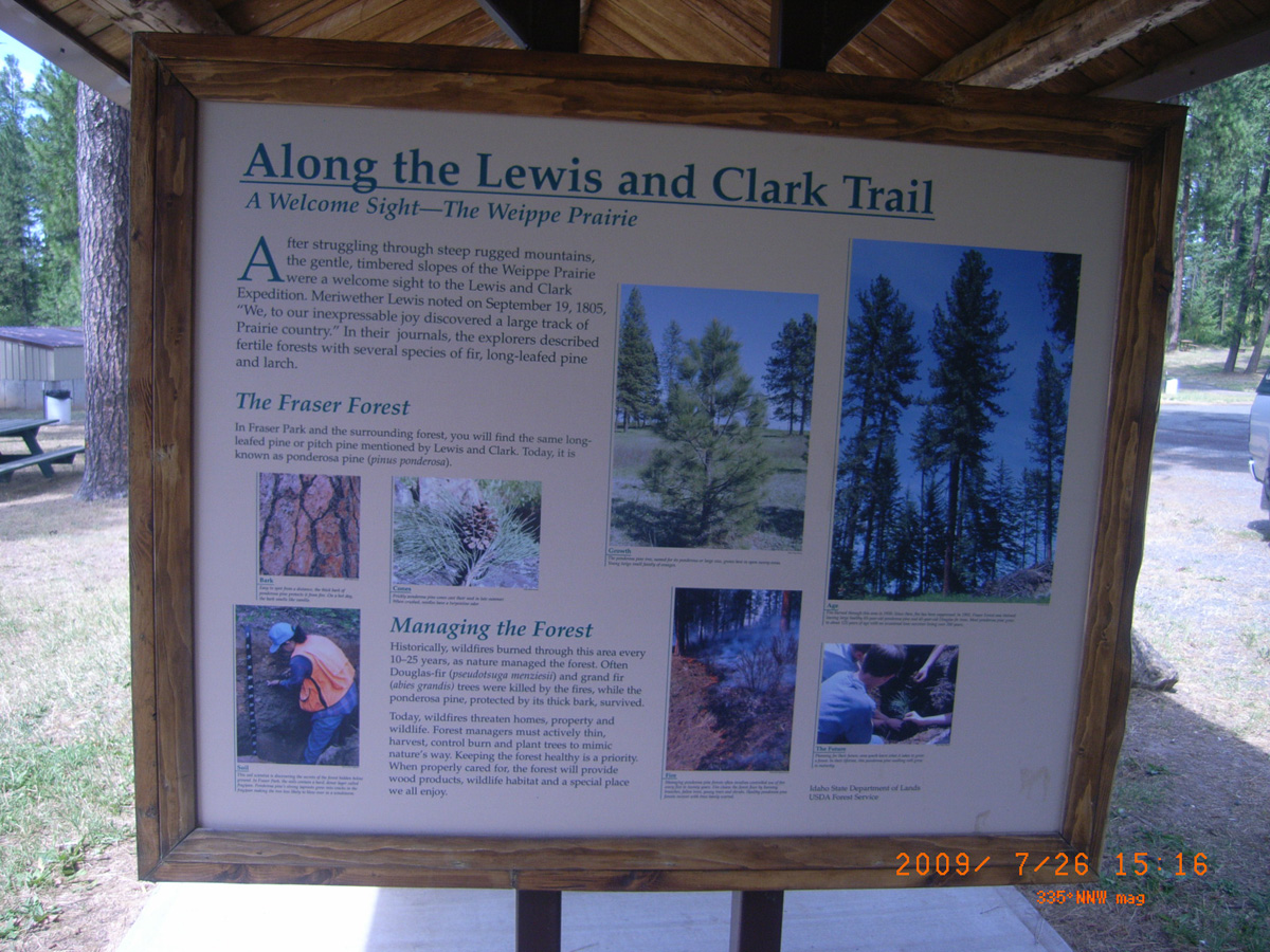
Along the Lewis and Clark Trail
- Date Assessed: 2009-07-26
- File Name: RIMG0032.JPG
- Folder: C26JulyCam2
- Camera Direction: 114°
- Date Assessed: 2009-07-26
- File Name: RIMG0033.JPG
- Folder: C26JulyCam2
- Camera Direction: 114°
- Date Assessed: 2009-07-26
- File Name: RIMG0034.JPG
- Folder: C26JulyCam2
- Camera Direction: 303°
- Date Assessed: 2009-07-26
- File Name: RIMG0035.JPG
- Folder: C26JulyCam2
- Camera Direction: 34°
- Date Assessed: 2009-07-26
- File Name: RIMG0036.JPG
- Folder: C26JulyCam2
- Camera Direction: 18°
- Date Assessed: 2009-07-26
- File Name: RIMG0037.JPG
- Folder: C26JulyCam2
- Camera Direction: 323°
- Date Assessed: 2009-07-26
- File Name: RIMG0038.JPG
- Folder: C26JulyCam2
- Camera Direction: 71°
- Date Assessed: 2009-07-26
- File Name: RIMG0039.JPG
- Folder: C26JulyCam2
- Camera Direction: 71°
- Date Assessed: 2009-07-26
- File Name: RIMG0040.JPG
- Folder: C26JulyCam2
- Camera Direction: 71°
- Date Assessed: 2009-07-26
- File Name: RIMG0041.JPG
- Folder: C26JulyCam2
- Camera Direction: 83°
- Date Assessed: 2009-07-26
- File Name: RIMG0042.JPG
- Folder: C26JulyCam2
- Camera Direction: 95°
- Date Assessed: 2009-07-26
- File Name: RIMG0043.JPG
- Folder: C26JulyCam2
- Camera Direction: 57°

- Date Assessed: 2009-07-26
- File Name: RIMG0044.JPG
- Folder: C26JulyCam2
- Camera Direction: 57°
- Date Assessed: 2009-07-26
- File Name: RIMG0045.JPG
- Folder: C26JulyCam2
- Camera Direction: 228°
- Date Assessed: 2009-07-26
- File Name: RIMG0046.JPG
- Folder: C26JulyCam2
- Camera Direction: 248°
- Date Assessed: 2009-07-26
- File Name: RIMG0047.JPG
- Folder: C26JulyCam2
- Camera Direction: 250°
- Date Assessed: 2009-07-26
- File Name: RIMG0048.JPG
- Folder: C26JulyCam2
- Camera Direction: 253°
- Date Assessed: 2009-07-26
- File Name: RIMG0049.JPG
- Folder: C26JulyCam2
- Camera Direction: 230°
- Date Assessed: 2009-07-26
- File Name: RIMG0050.JPG
- Folder: C26JulyCam2
- Camera Direction: 230°
- Date Assessed: 2009-07-26
- File Name: RIMG0051.JPG
- Folder: C26JulyCam2
- Camera Direction: 230°
- Date Assessed: 2009-07-26
- File Name: RIMG0052.JPG
- Folder: C26JulyCam2
- Camera Direction: 123°
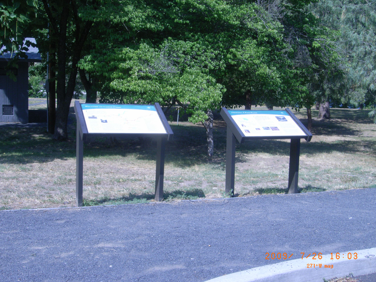
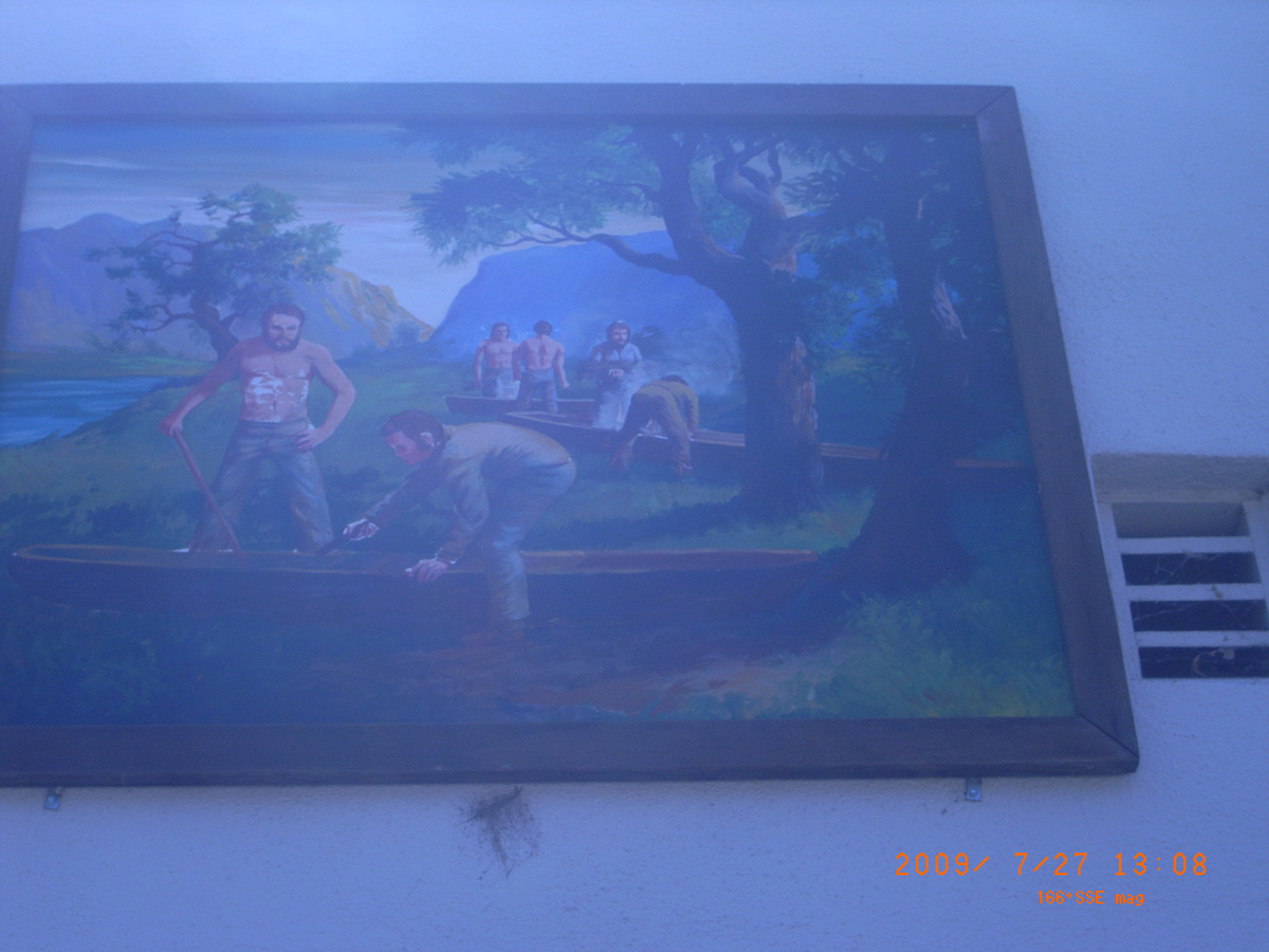
Canoe Camp, Riverside (Orofino)
Clearwater County, Idaho: 46.50091493, -116.3313457
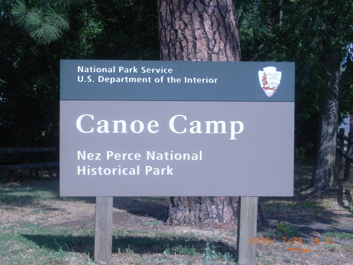
Canoe Camp Nez Perce National Historic Park
- Date Assessed: 2009-07-26
- File Name: RIMG0055.JPG
- Folder: C26JulyCam2
- Camera Direction: 301°
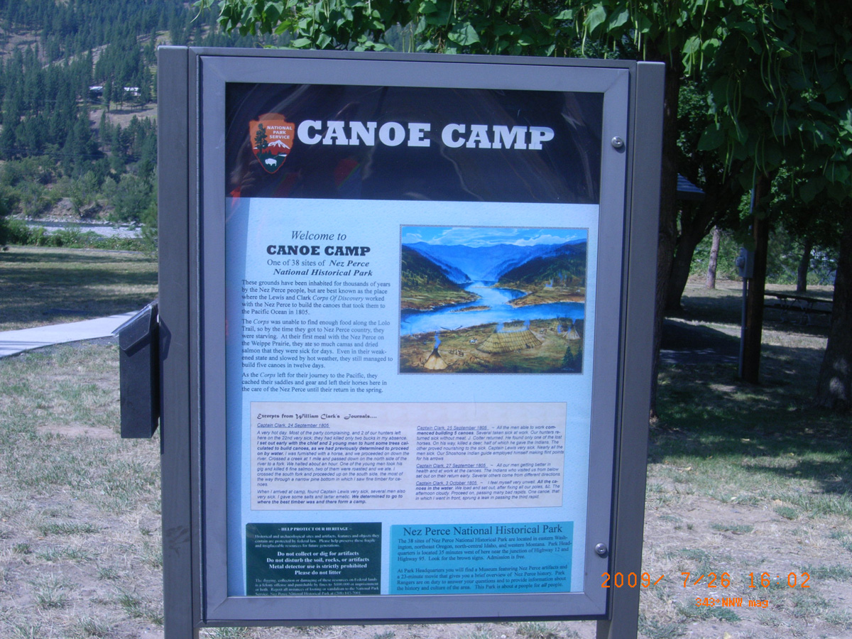
Canoe Camp
- Date Assessed: 2009-07-26
- File Name: RIMG0056.JPG
- Folder: C26JulyCam2
- Camera Direction: 301°
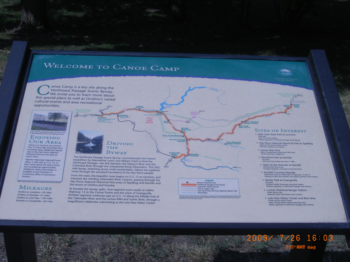
Welcome to Canoe Camp
- Date Assessed: 2009-07-26
- File Name: RIMG0057.JPG
- Folder: C26JulyCam2
- Camera Direction: 294°
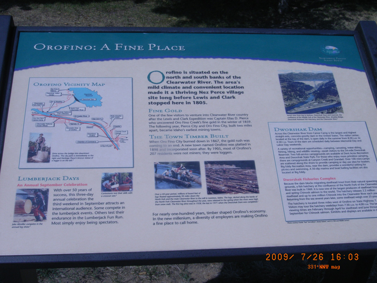
Orofino: A Fine Place
- Date Assessed: 2009-07-26
- File Name: RIMG0058.JPG
- Folder: C26JulyCam2
- Camera Direction: 359°
- Date Assessed: 2009-07-26
- File Name: RIMG0059.JPG
- Folder: C26JulyCam2
- Camera Direction: 103°
Pioneer Park, Lewiston
Nez Perce County, Idaho: 46.41937089, -117.0262427
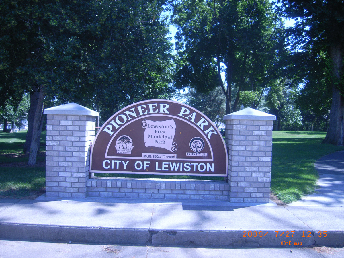
Pioneer Park: City of Lewiston
- Date Assessed: 2009-07-27
- File Name: RIMG0009.JPG
- Folder: C27JulyCam2
- Camera Direction: 218°
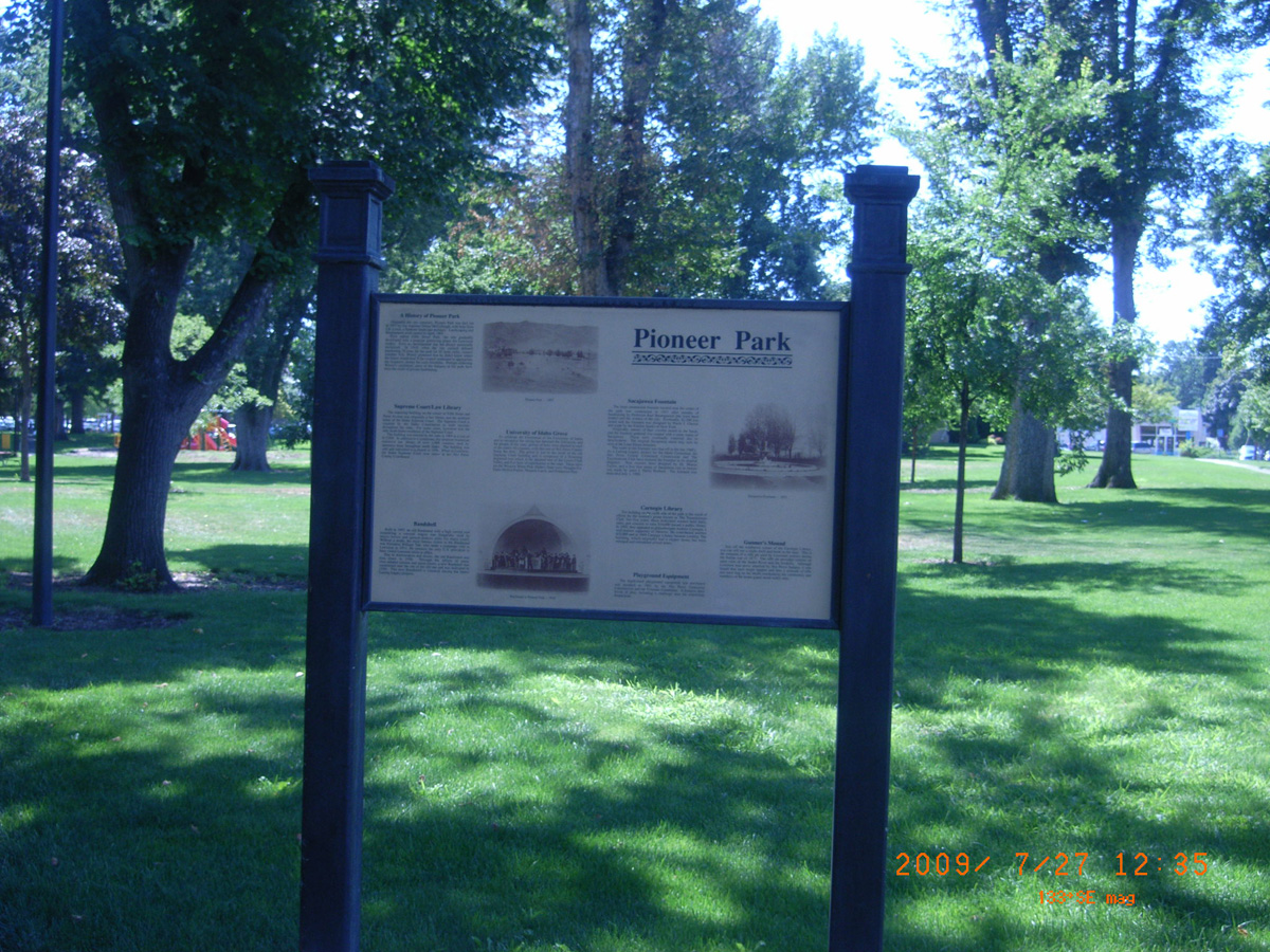
Pioneer Park
- Date Assessed: 2009-07-27
- File Name: RIMG0010.JPG
- Folder: C27JulyCam2
- Camera Direction: 226°
- Date Assessed: 2009-07-27
- File Name: RIMG0011.JPG
- Folder: C27JulyCam2
- Camera Direction: 219°
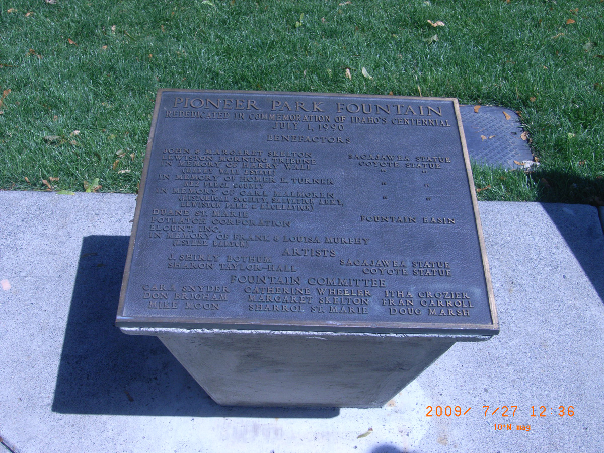
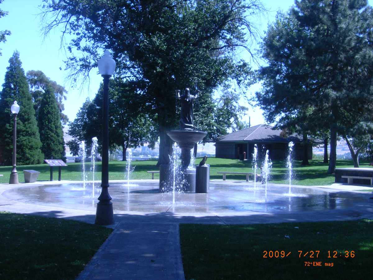
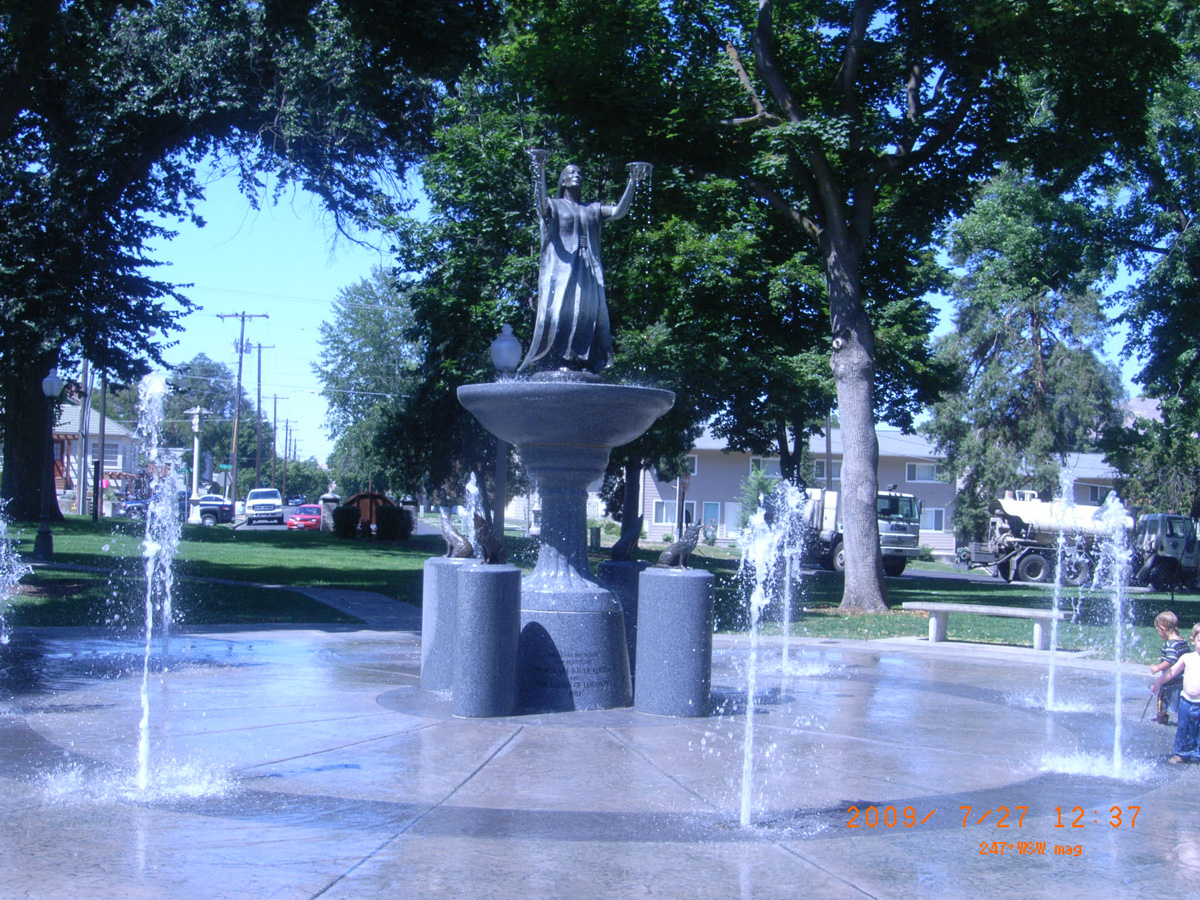
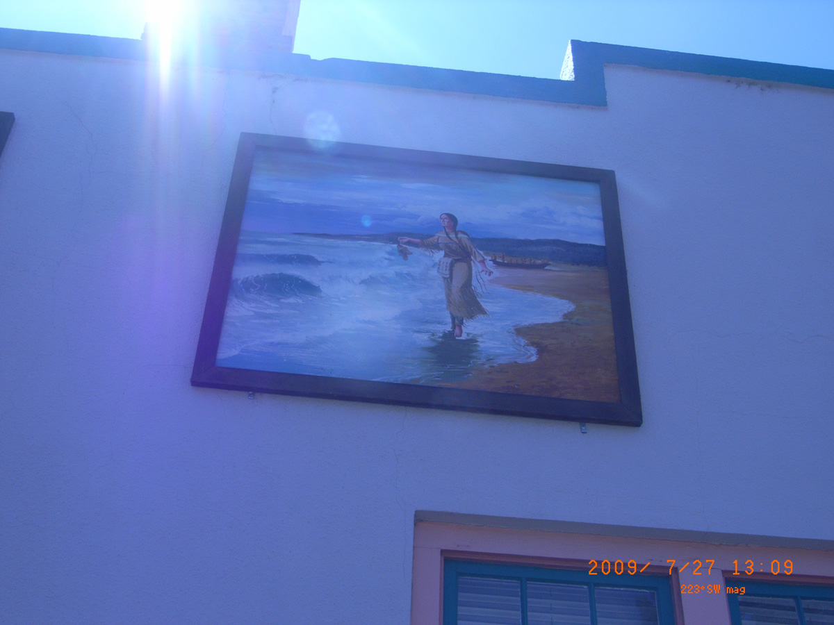
Pioneer Park Fountain
- Date Assessed: 2009-07-27
- File Name: RIMG0012.JPG
- Folder: C27JulyCam2
- Camera Direction: 216°
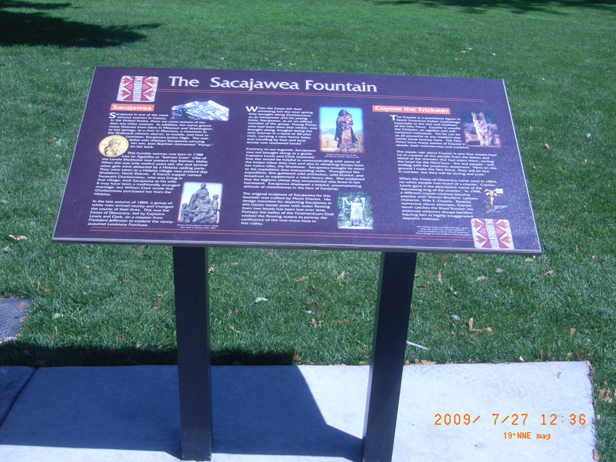
The Sacajawea Fountain
- Date Assessed: 2009-07-27
- File Name: RIMG0013.JPG
- Folder: C27JulyCam2
- Camera Direction: 274°
- Date Assessed: 2009-07-27
- File Name: RIMG0014.JPG
- Folder: C27JulyCam2
- Camera Direction: 214°
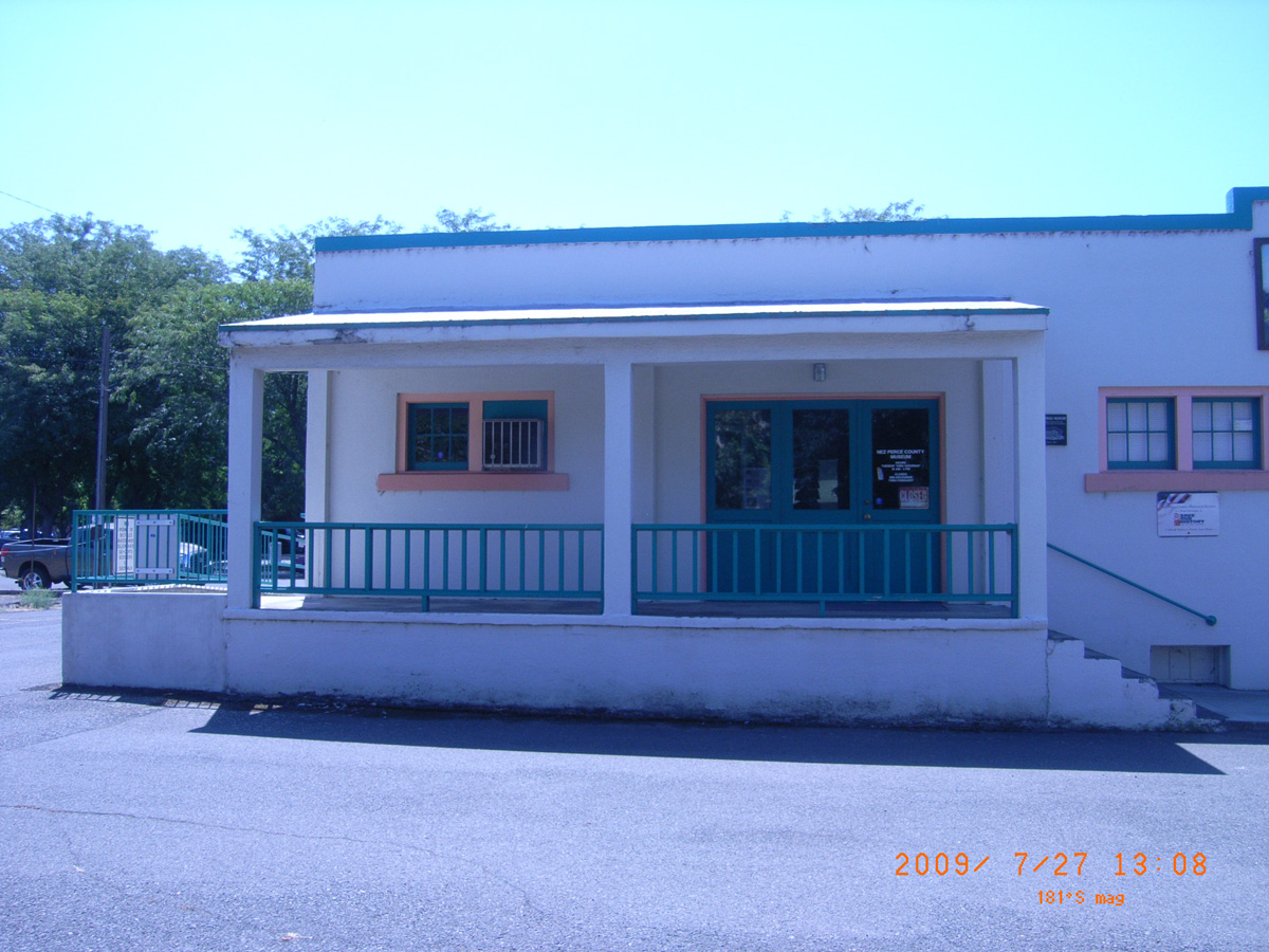
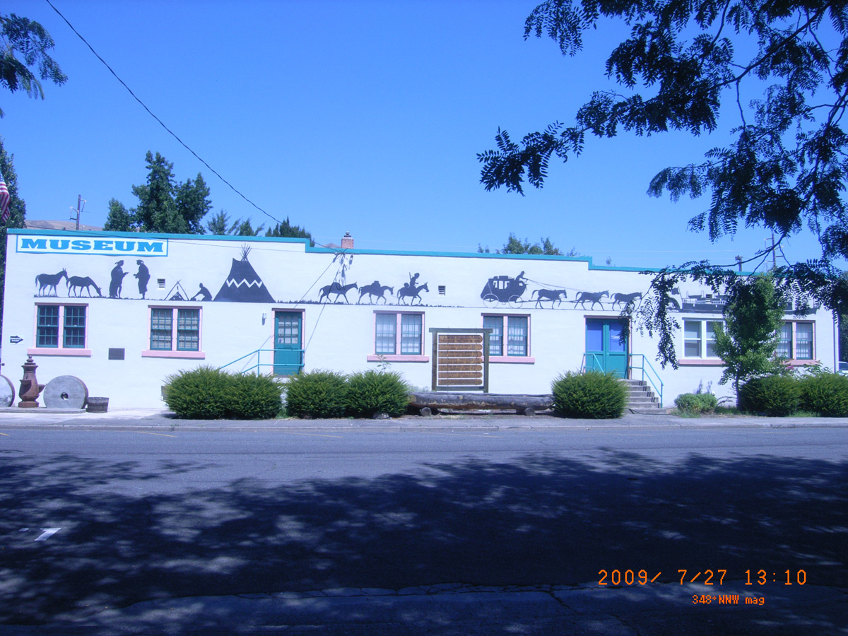
Luna House Museum, Lewiston
Nez Perce County, Idaho: 46.42297275, -117.0289462
- Date Assessed: 2009-07-27
- File Name: RIMG0019.JPG
- Folder: C27JulyCam2
- Camera Direction: 181°
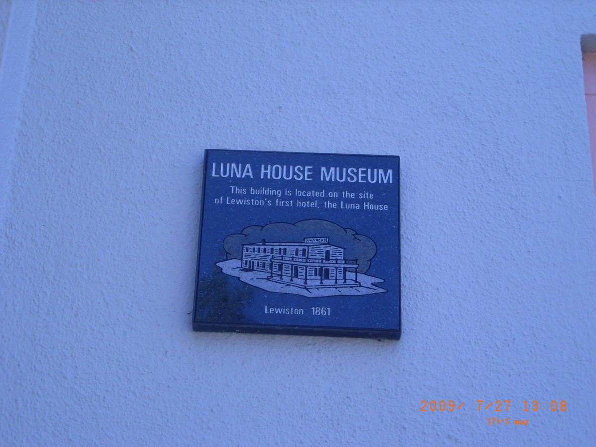
Luna House Museum
- Date Assessed: 2009-07-27
- File Name: RIMG0020.JPG
- Folder: C27JulyCam2
- Camera Direction: 183°
- Date Assessed: 2009-07-27
- File Name: RIMG0021.JPG
- Folder: C27JulyCam2
- Camera Direction: 196°
- Date Assessed: 2009-07-27
- File Name: RIMG0022.JPG
- Folder: C27JulyCam2
- Camera Direction: 195°
- Date Assessed: 2009-07-27
- File Name: RIMG0023.JPG
- Folder: C27JulyCam2
- Camera Direction: 209°
- Date Assessed: 2009-07-27
- File Name: RIMG0024.JPG
- Folder: C27JulyCam2
- Camera Direction: 222°
- Date Assessed: 2009-07-27
- File Name: RIMG0025.JPG
- Folder: C27JulyCam2
- Camera Direction: 222°
- Date Assessed: 2009-07-27
- File Name: RIMG0026.JPG
- Folder: C27JulyCam2
- Camera Direction: 222°
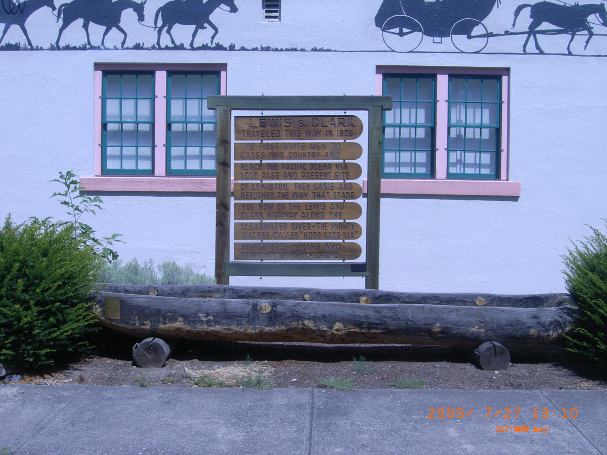
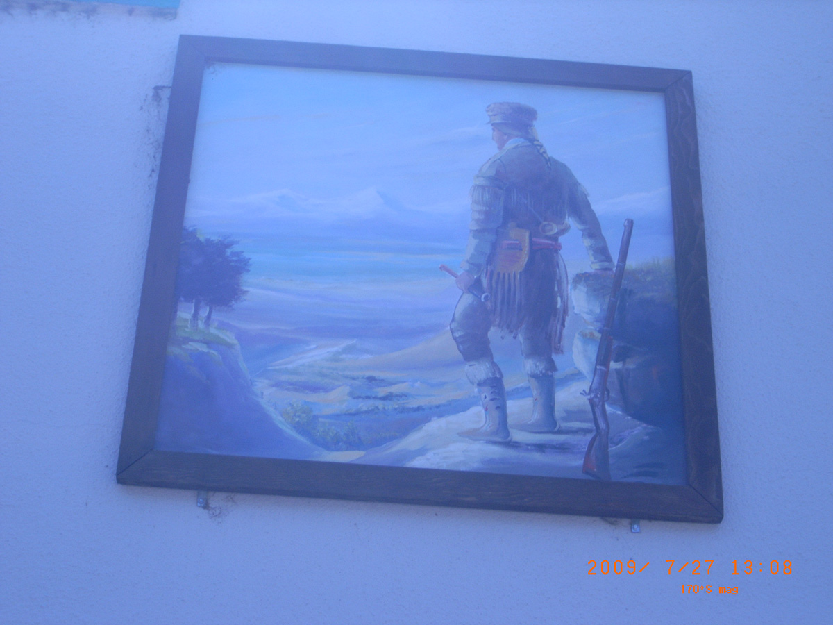
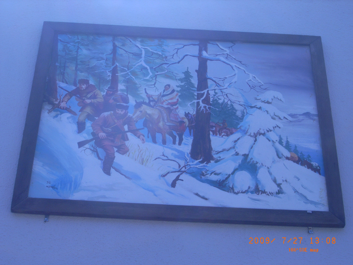
Lewis & Clark Traveled This Way in 1805
- Date Assessed: 2009-07-27
- File Name: RIMG0027.JPG
- Folder: C27JulyCam2
- Camera Direction: 152°
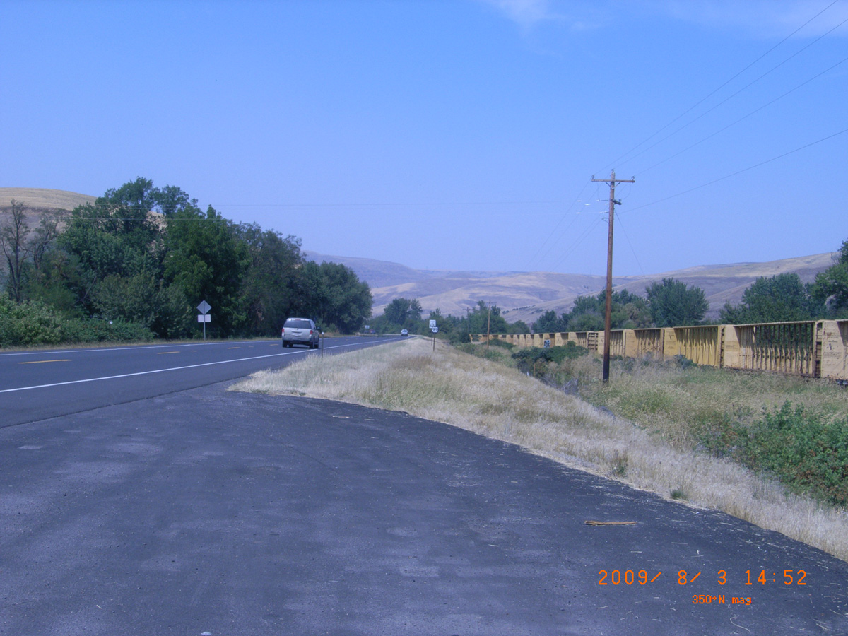
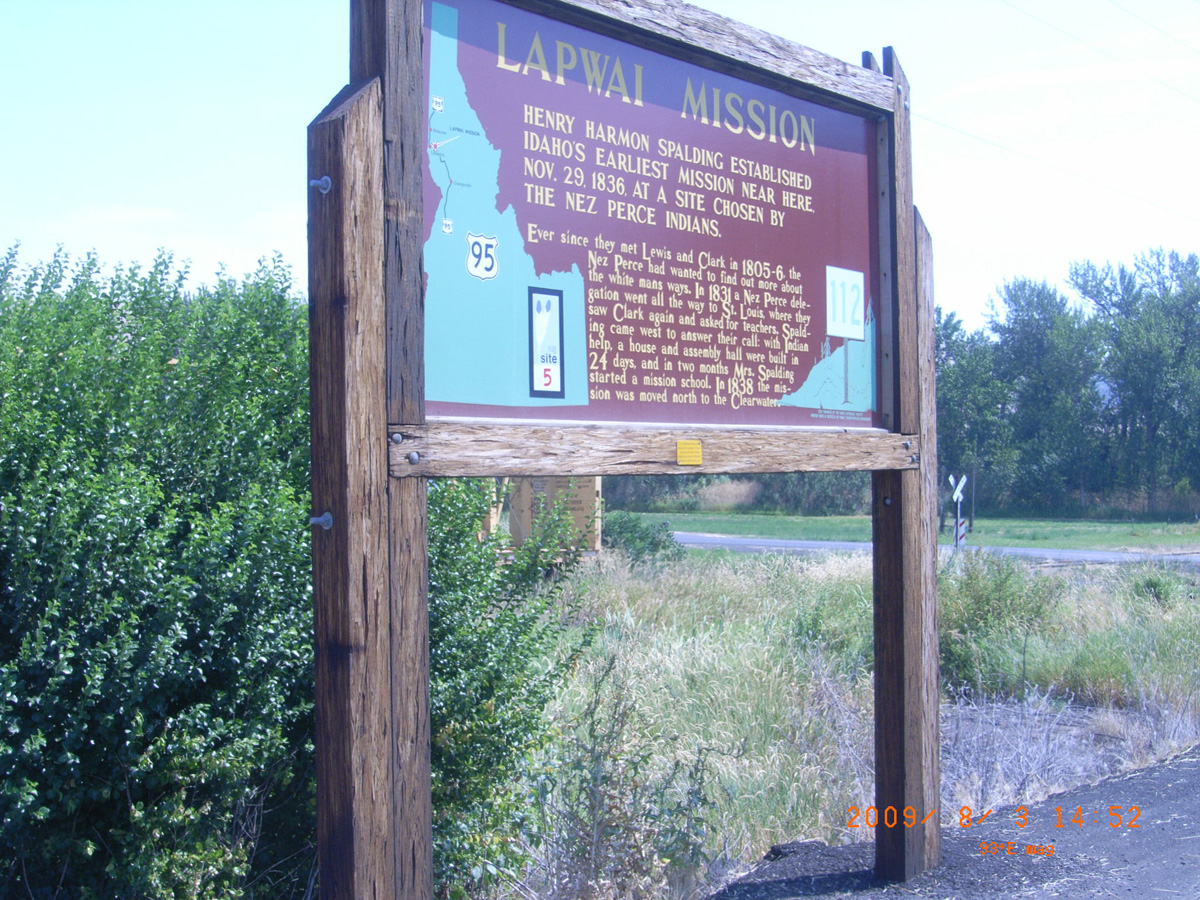
Lapwai Mission
Nez Perce County, Idaho: 46.41722339, -116.8026672
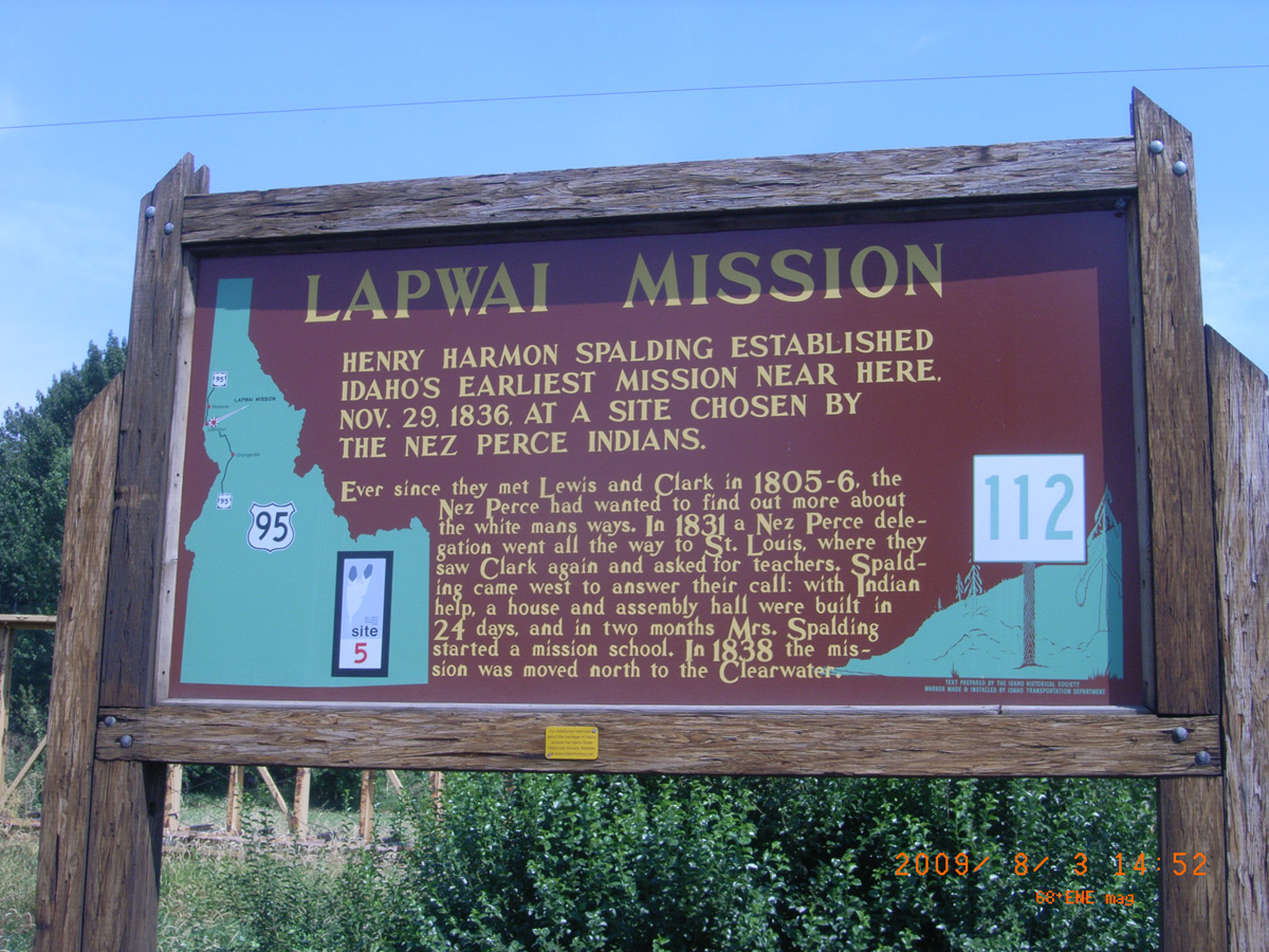
Lapwai Mission
- Date Assessed: 2009-08-03
- File Name: RIMG0001.JPG
- Folder: C03AugustCam2
- Camera Direction: 335°
- Date Assessed: 2009-08-03
- File Name: RIMG0002.JPG
- Folder: C03AugustCam2
- Camera Direction: 15°
- Date Assessed: 2009-08-03
- File Name: RIMG0003.JPG
- Folder: C03AugustCam2
- Camera Direction: 52°
- Date Assessed: 2009-08-03
- File Name: RIMG0004.JPG
- Folder: C03AugustCam2
- Camera Direction: 49°
Lapwai Mission
- Date Assessed: 2009-08-03
- File Name: RIMG0005.JPG
- Folder: C03AugustCam2
- Camera Direction: 49°
- Date Assessed: 2009-08-03
- File Name: RIMG0006.JPG
- Folder: C03AugustCam2
- Camera Direction: 49°
Pheasant Camp
Idaho County, Idaho: 46.28872035, -115.7588812
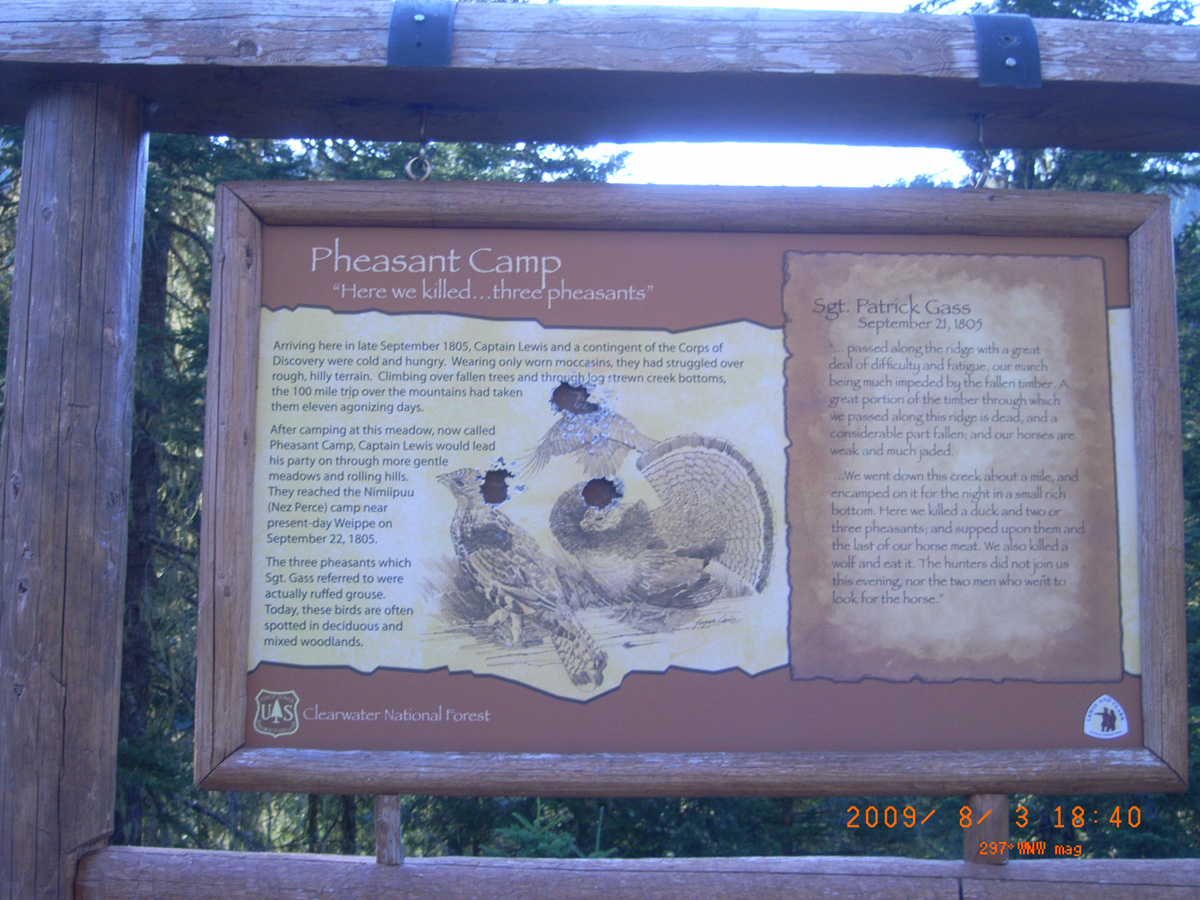
Pheasant Camp
- Date Assessed: 2009-08-03
- File Name: RIMG0019.JPG
- Folder: C03AugustCam2
- Camera Direction: 49°
Lewis and Clark Grove
Idaho County, Idaho: 46.29810725, -115.7129889
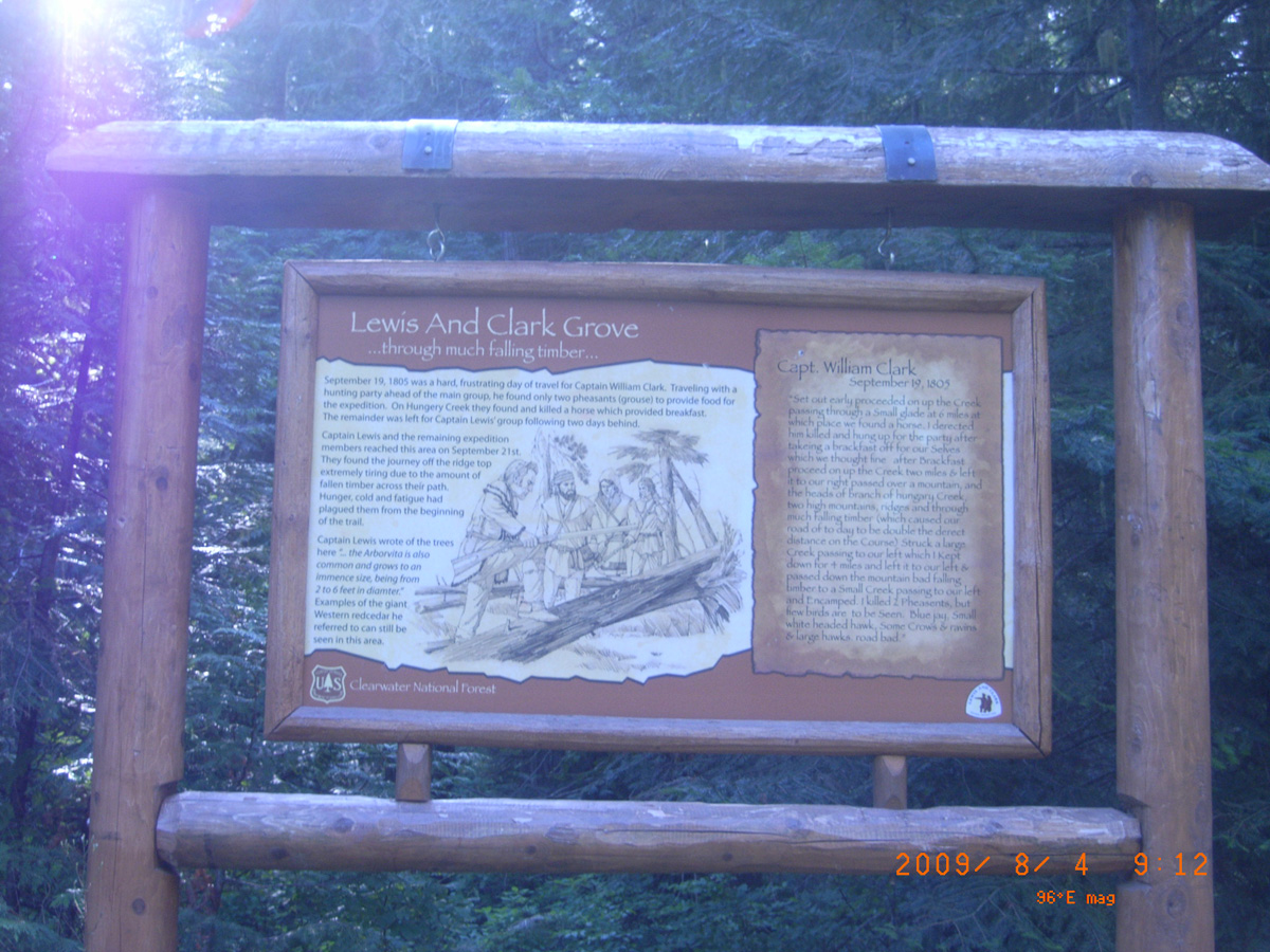
Lewis and Clark Grove
- Date Assessed: 2009-08-04
- File Name: RIMG0020.JPG
- Folder: C04AugustCam2
- Camera Direction: 155°
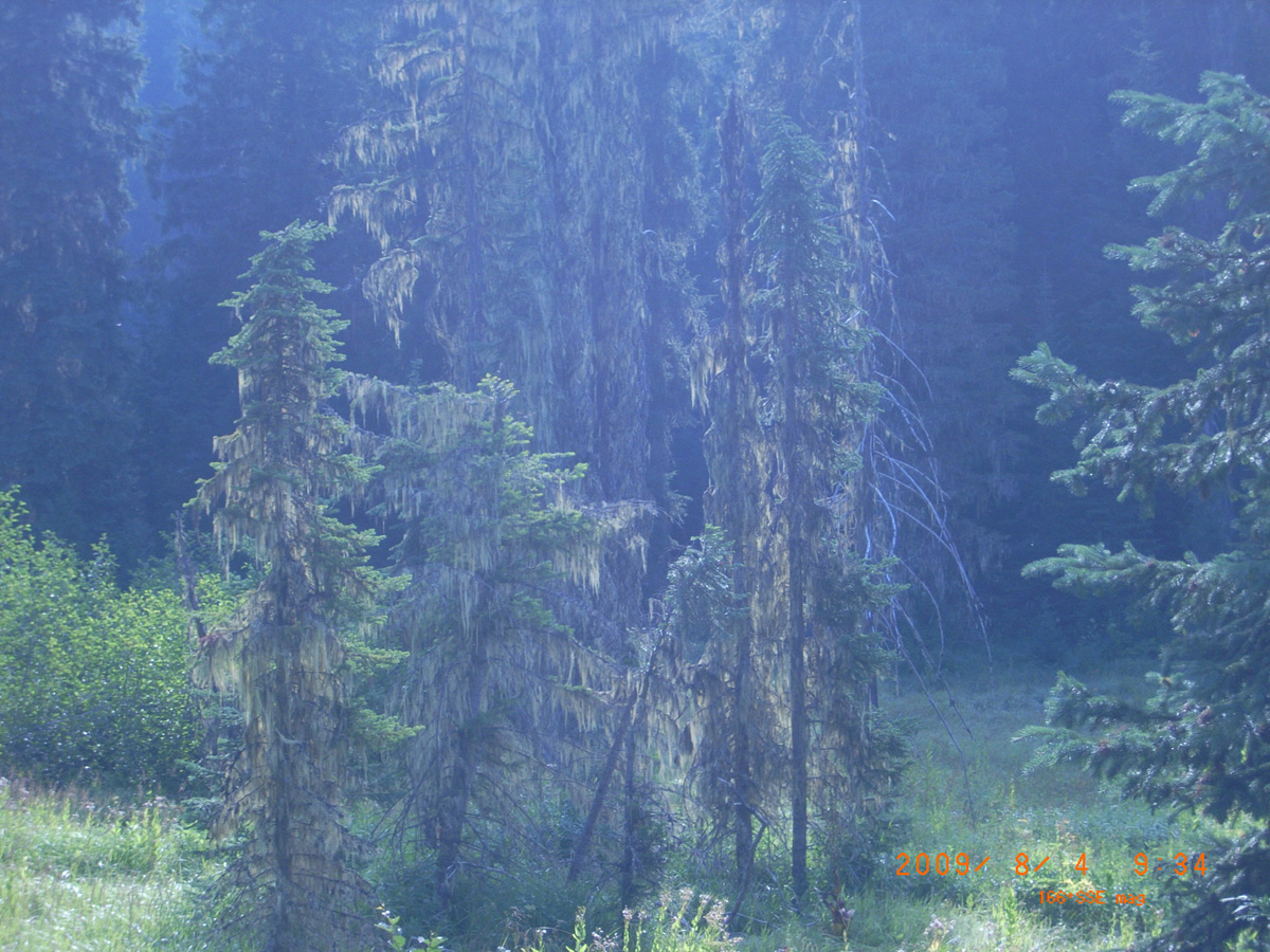
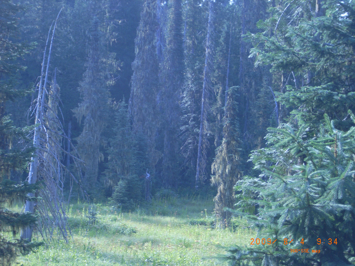
Small Prairie Camp, Lolo Motorway
Idaho County, Idaho: 46.28474405, -115.662893
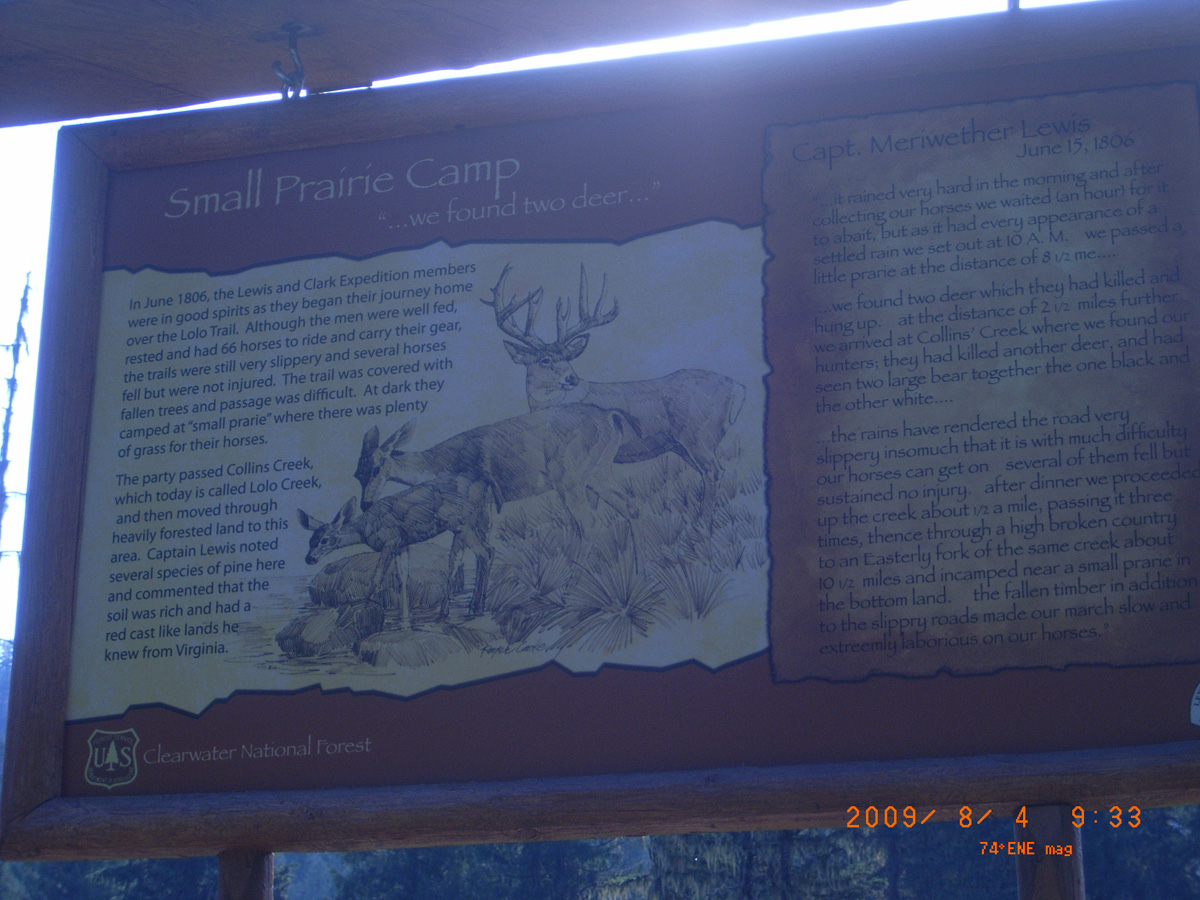
Small Prairie Camp
- Date Assessed: 2009-08-04
- File Name: RIMG0021.JPG
- Folder: C04AugustCam2
- Camera Direction: 44°
- Date Assessed: 2009-08-04
- File Name: RIMG0022.JPG
- Folder: C04AugustCam2
- Camera Direction: 77°
- Date Assessed: 2009-08-04
- File Name: RIMG0023.JPG
- Folder: C04AugustCam2
- Camera Direction: 38°
- Date Assessed: 2009-08-04
- File Name: RIMG0024.JPG
- Folder: C04AugustCam2
- Camera Direction: 38°
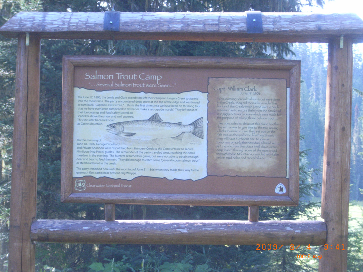
Salmon Trout Camp
- Date Assessed: 2009-08-04
- File Name: RIMG0025.JPG
- Folder: C04AugustCam2
- Camera Direction: 289°
Full Stomach Camp, Lolo Motorway
Idaho County, Idaho: 46.32252256, -115.6172122
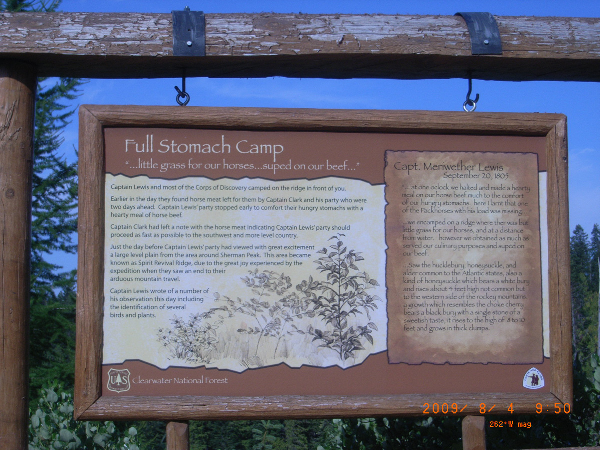
Full Stomach Camp
- Date Assessed: 2009-08-04
- File Name: RIMG0026.JPG
- Folder: C04AugustCam2
- Camera Direction: 289°
- Date Assessed: 2009-08-04
- File Name: RIMG0027.JPG
- Folder: C04AugustCam2
- Camera Direction: 0°
- Date Assessed: 2009-08-04
- File Name: RIMG0028.JPG
- Folder: C04AugustCam2
- Camera Direction: 77°
Canyon Junction, Lolo Motorway
Idaho County, Idaho: 46.32050135, -115.6026131
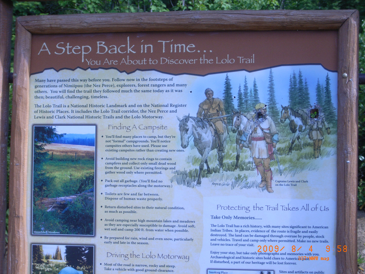
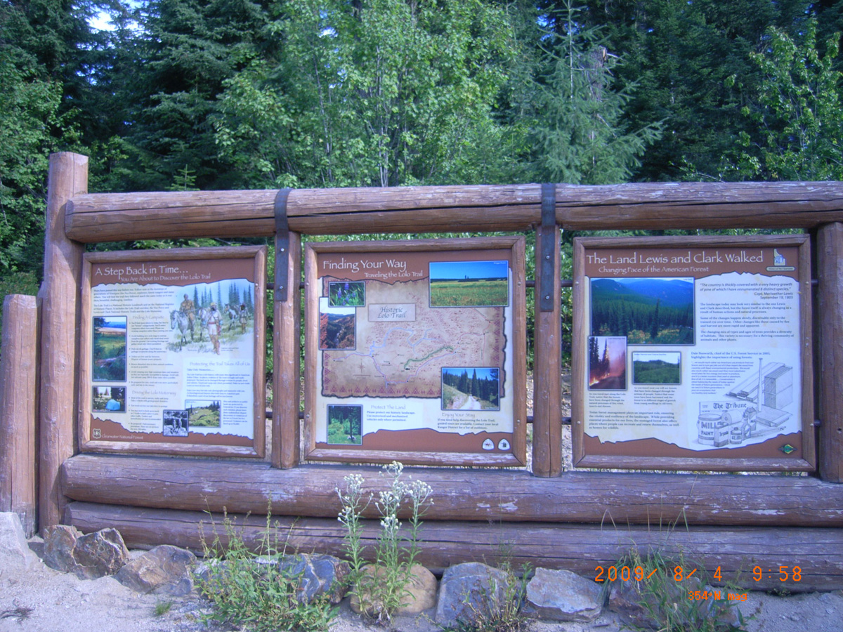
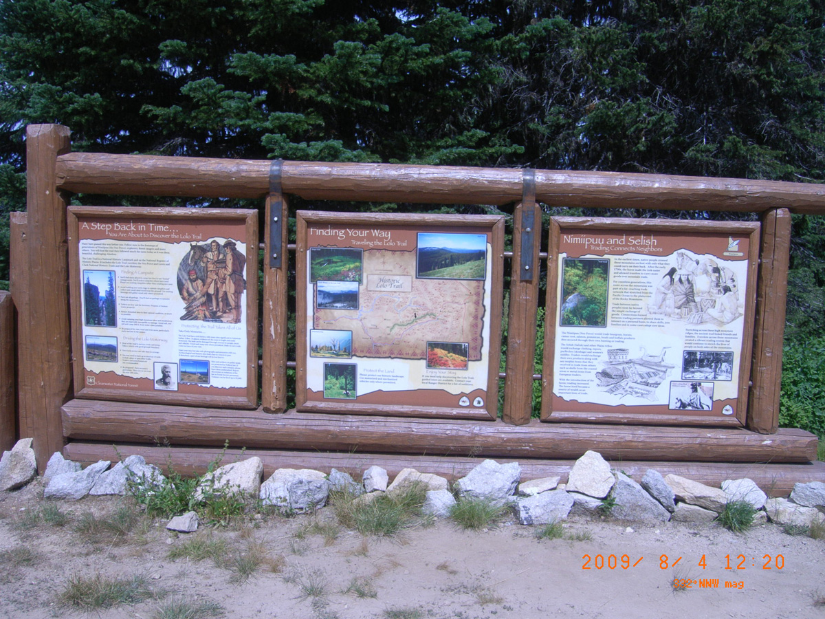
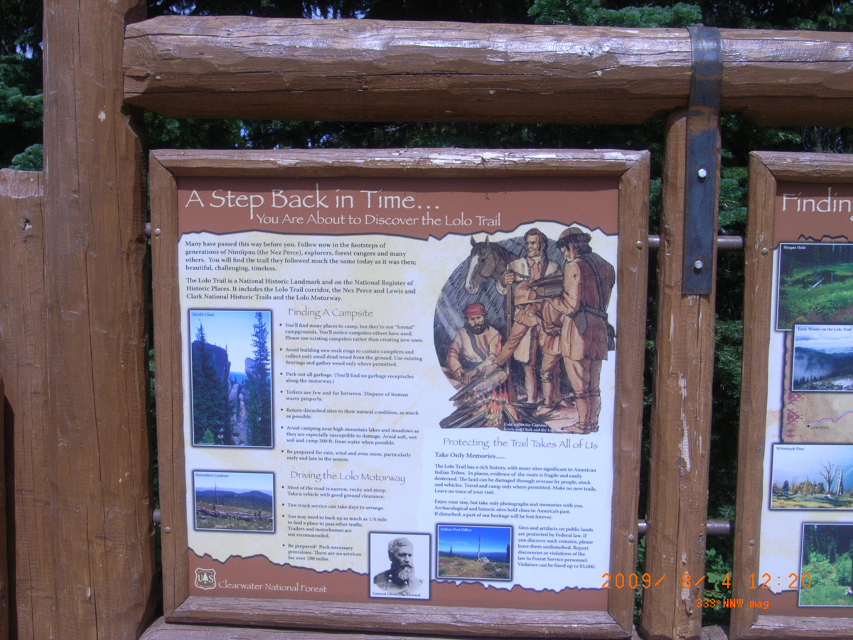
A Step Back in Time . . . You Are About to Discover the Lolo Trail
- Date Assessed: 2009-08-04
- File Name: RIMG0029.JPG
- Folder: C04AugustCam2
- Camera Direction: 84°
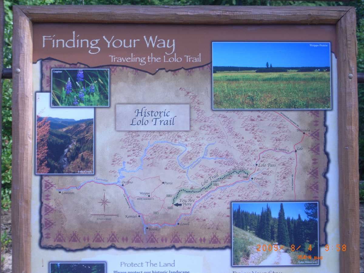
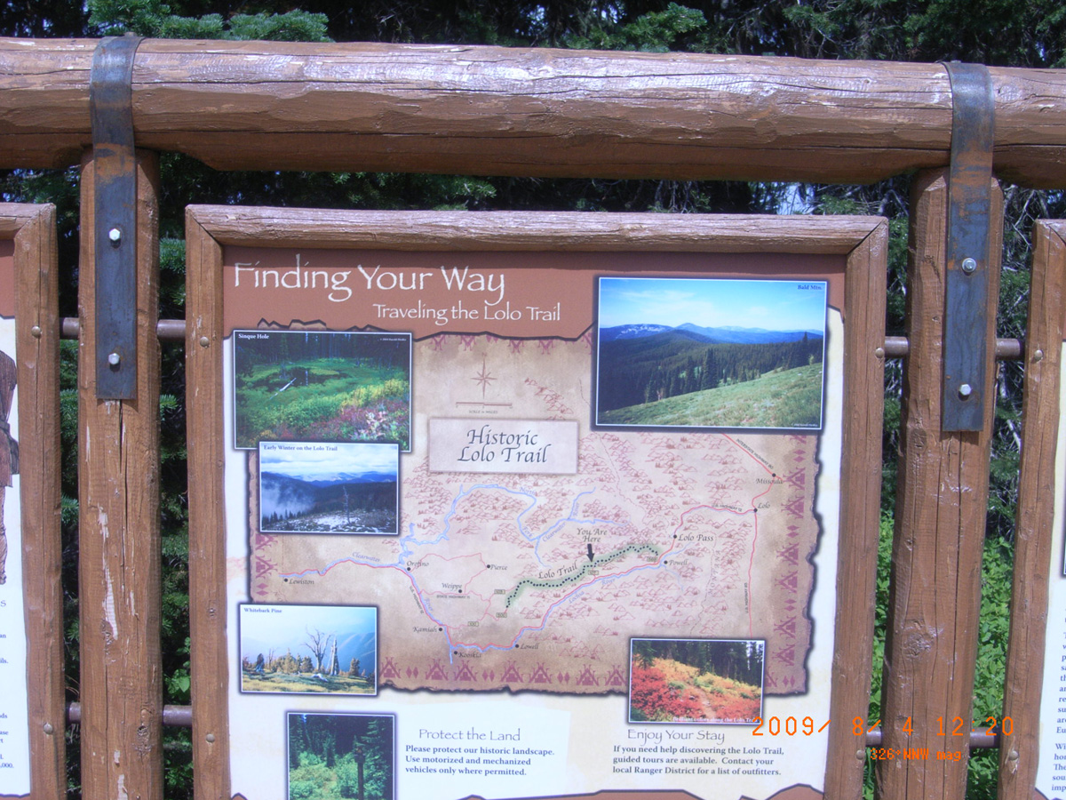
Finding Your Way: Traveling the Lolo Trail
- Date Assessed: 2009-08-04
- File Name: RIMG0030.JPG
- Folder: C04AugustCam2
- Camera Direction: 84°
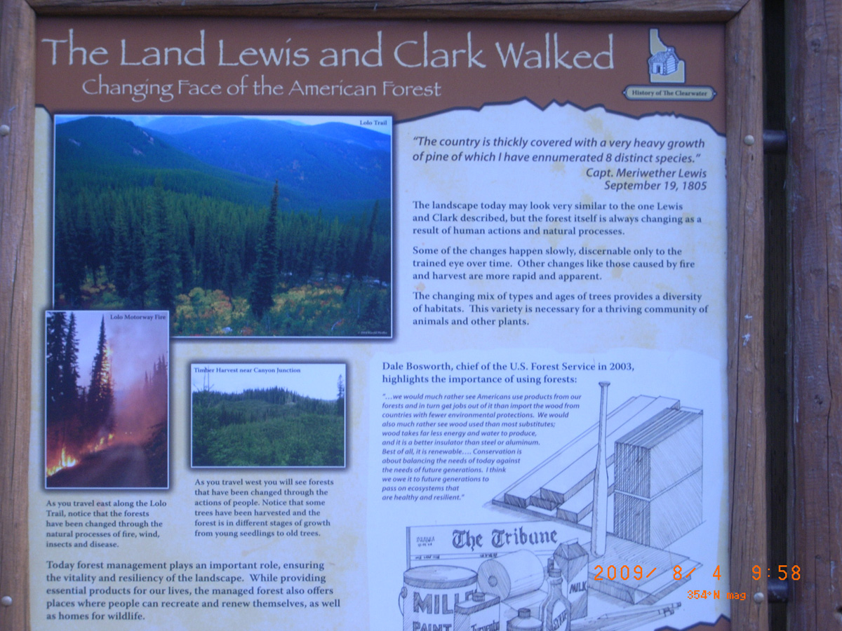
The Land Lewis and Clark Walked: Changing Face of the American Forest
- Date Assessed: 2009-08-04
- File Name: RIMG0031.JPG
- Folder: C04AugustCam2
- Camera Direction: 253°
- Date Assessed: 2009-08-04
- File Name: RIMG0032.JPG
- Folder: C04AugustCam2
- Camera Direction: 16°
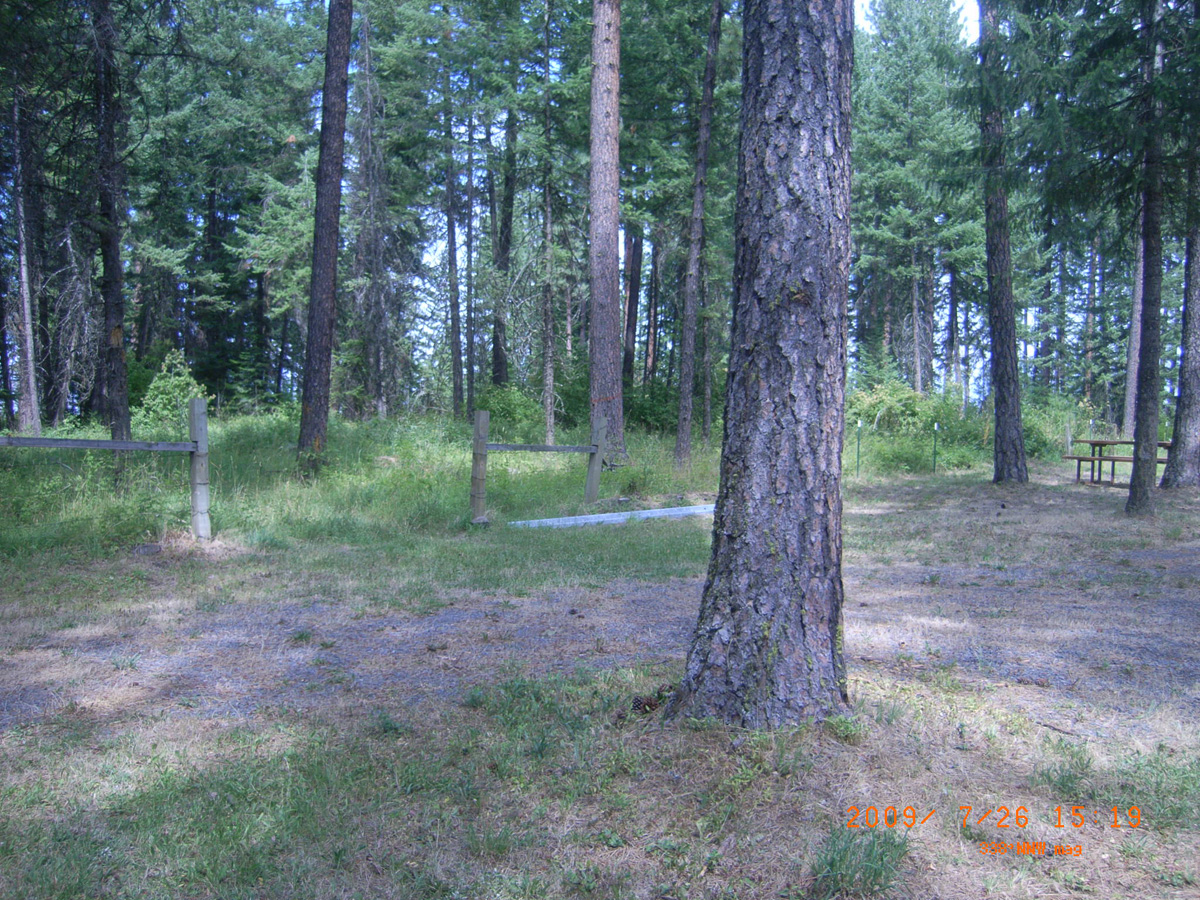
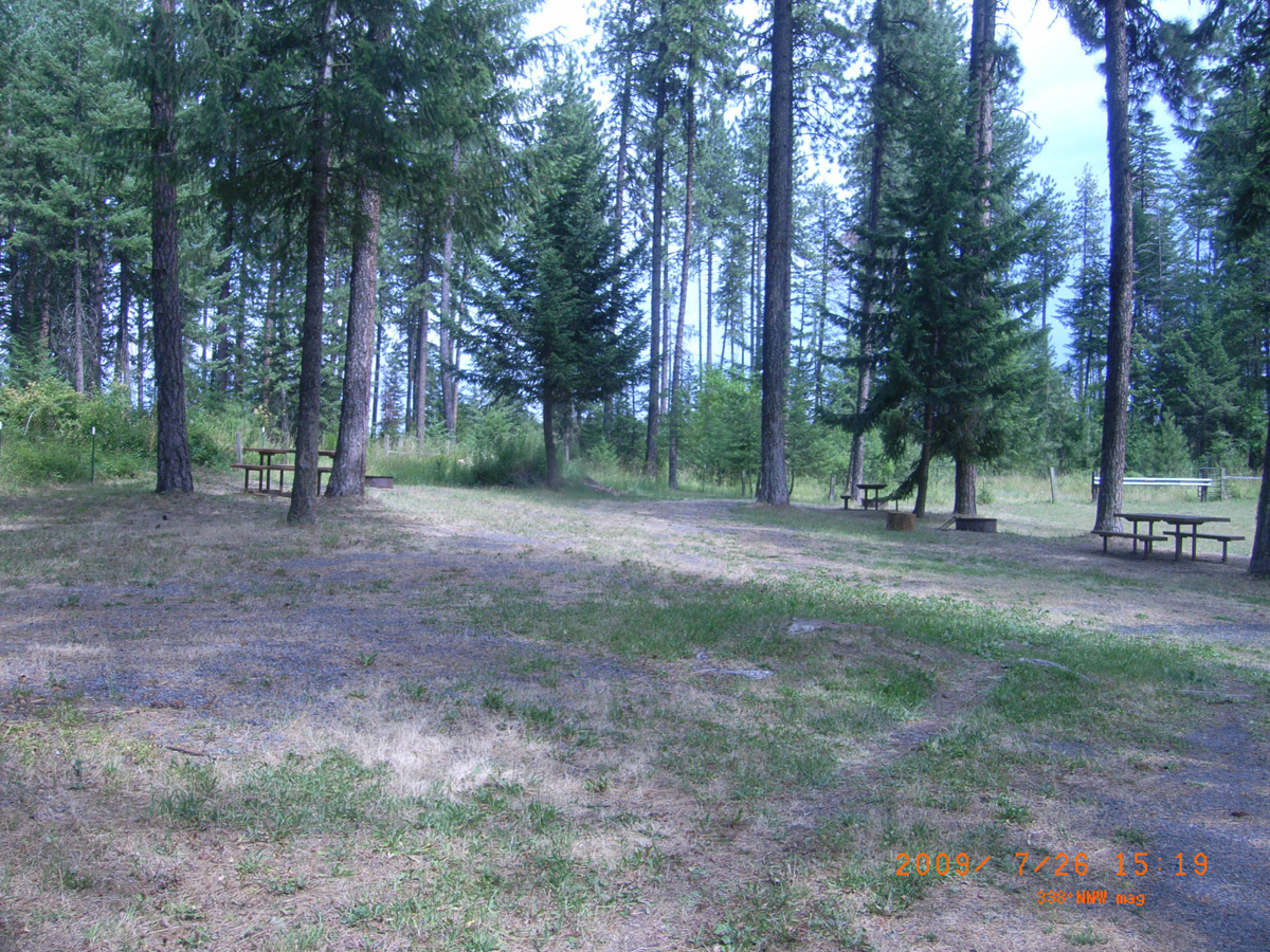
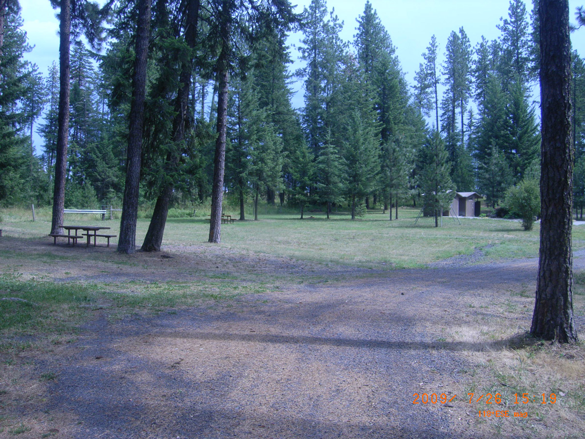
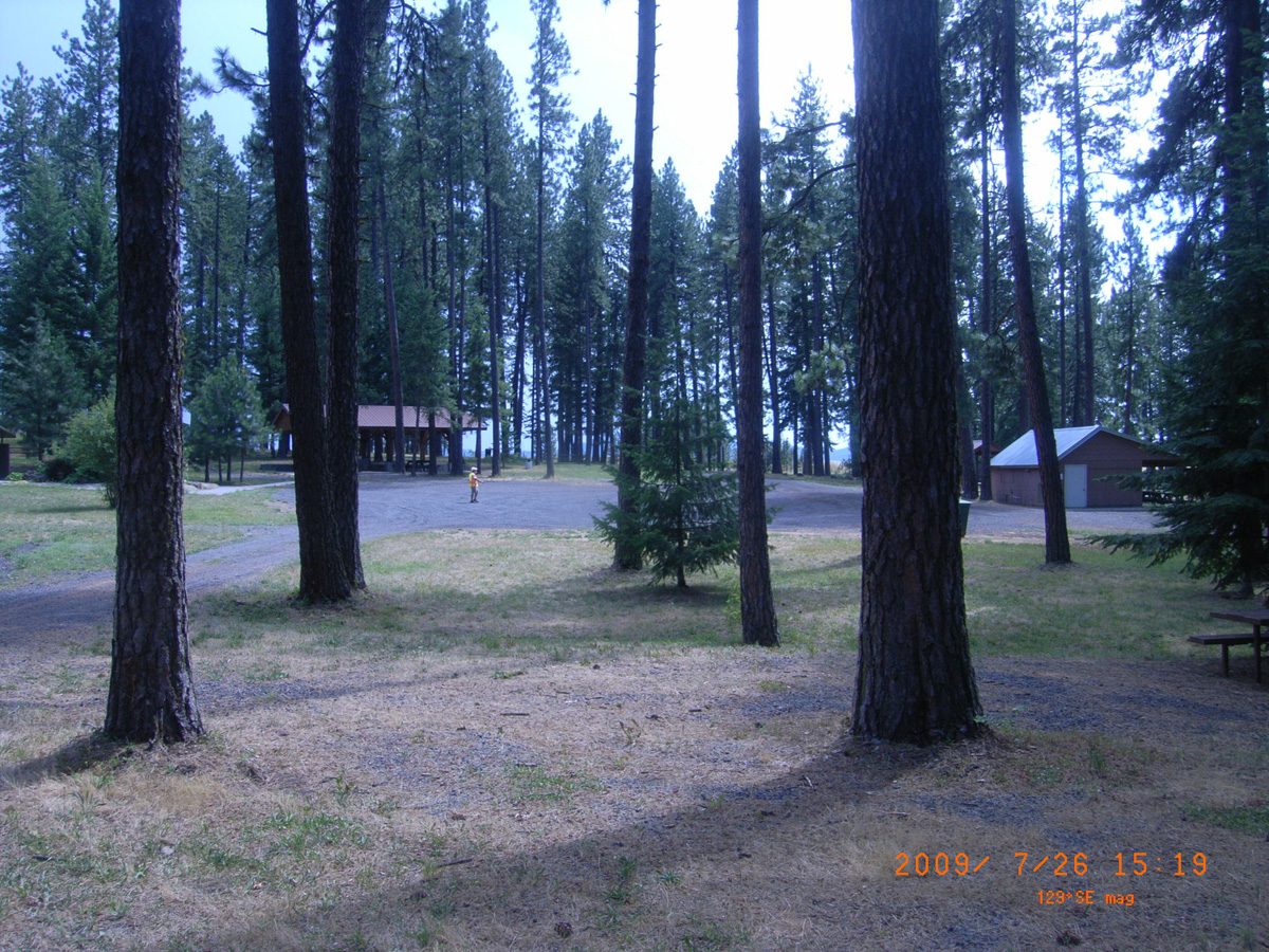
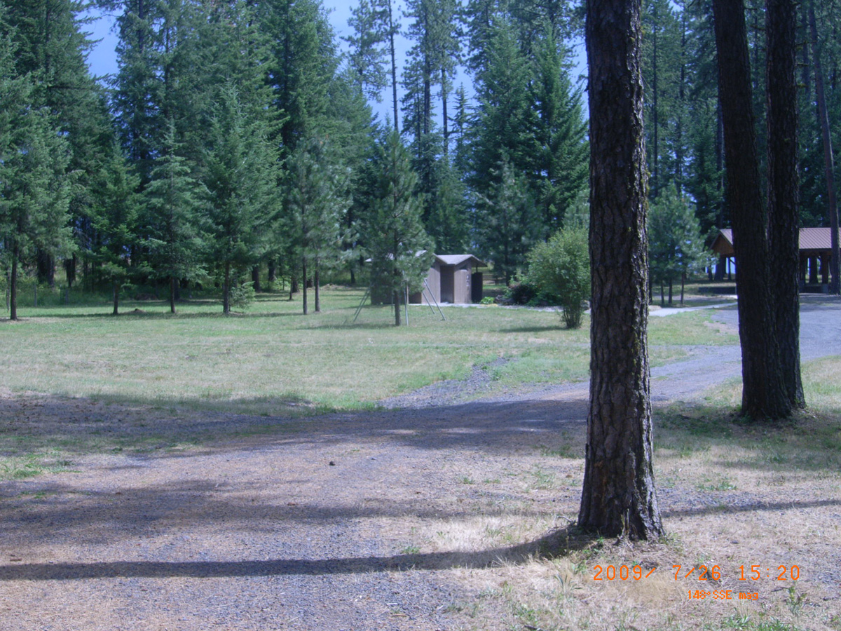
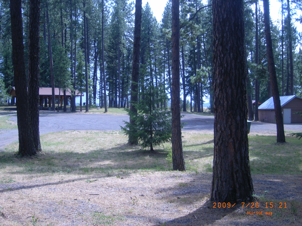
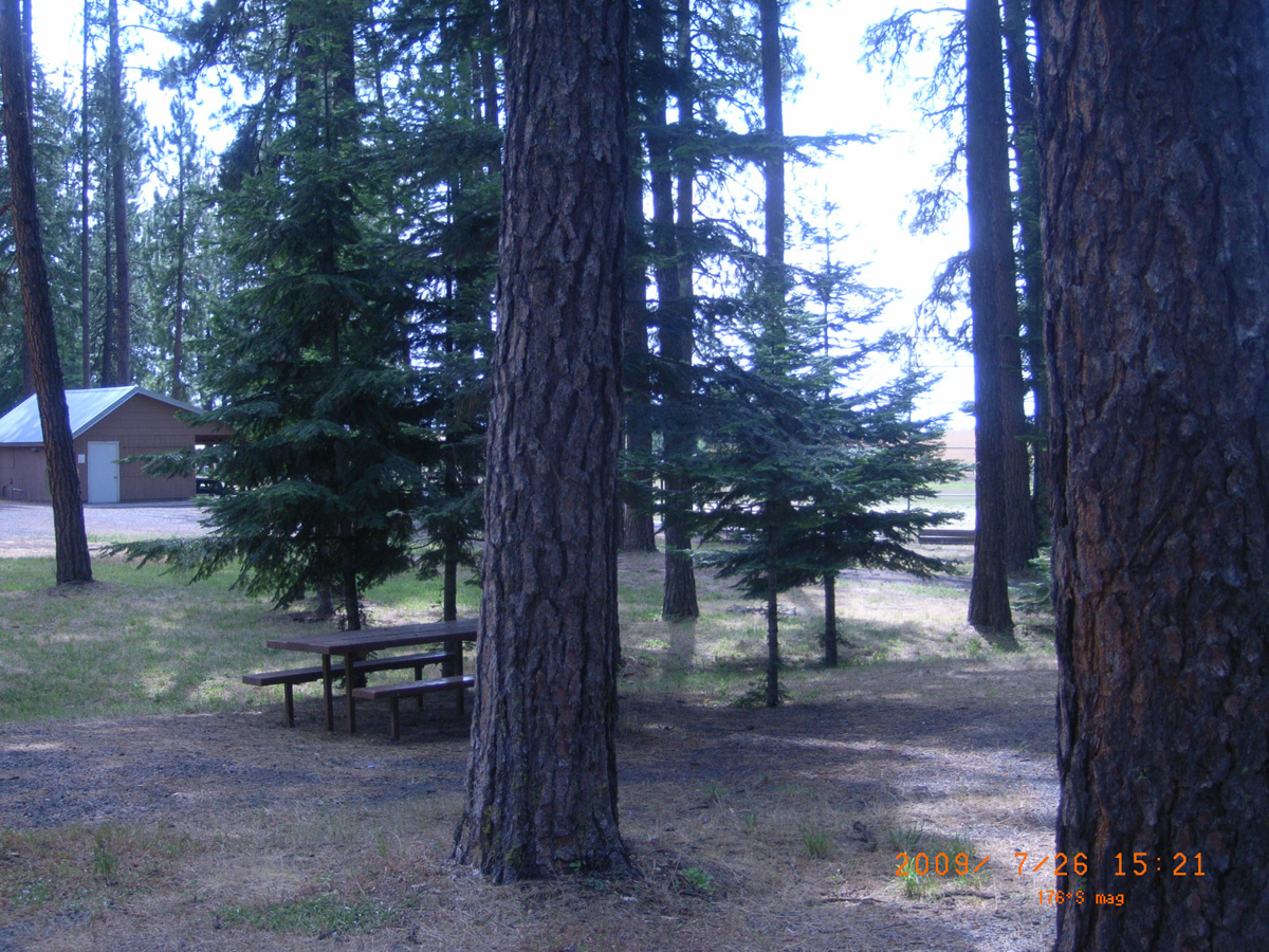
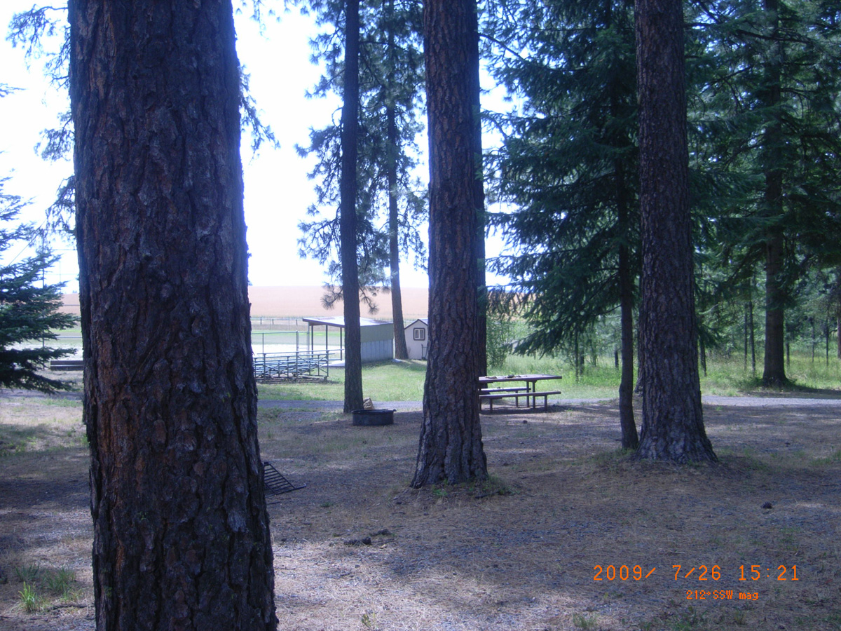
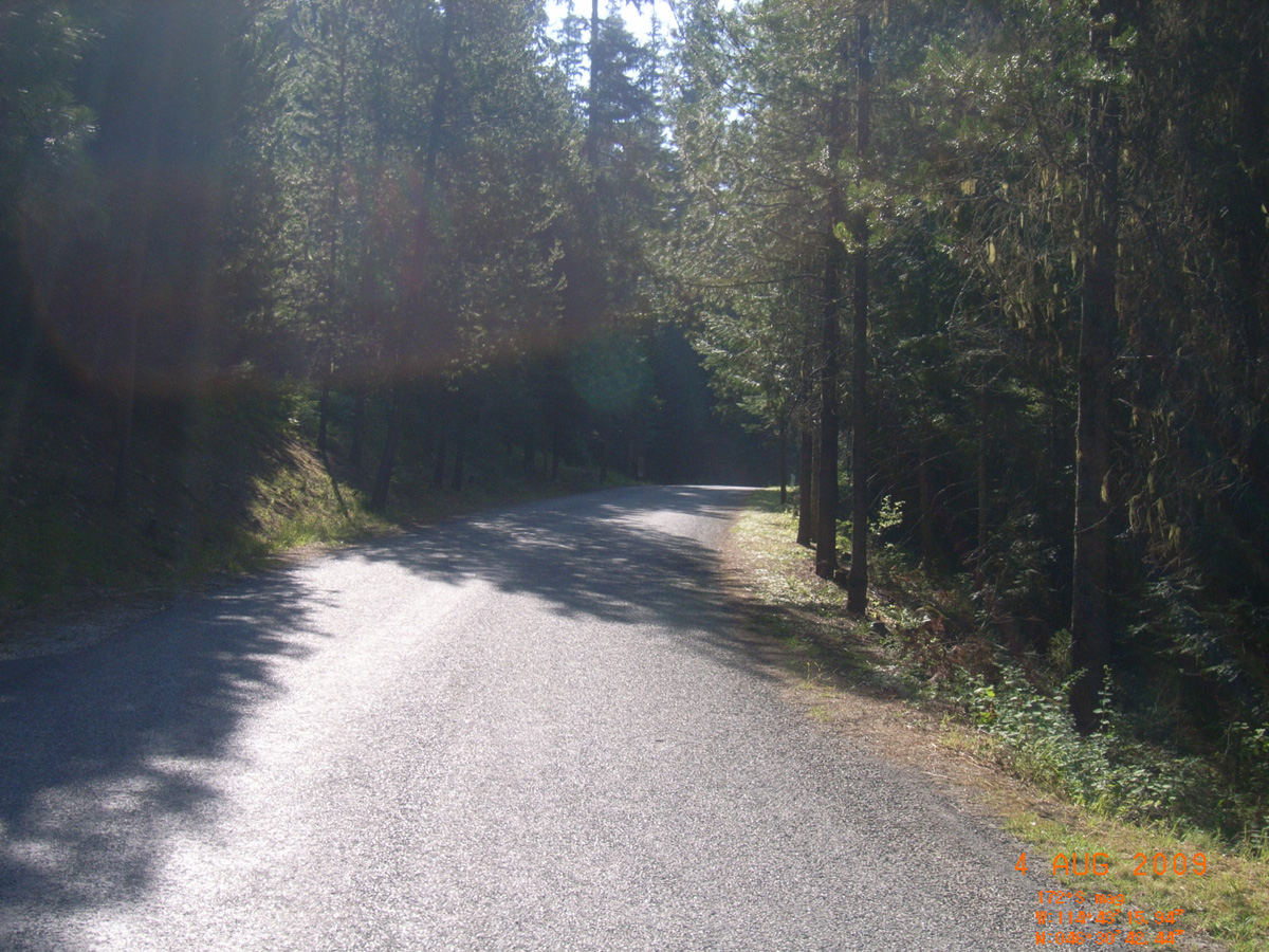
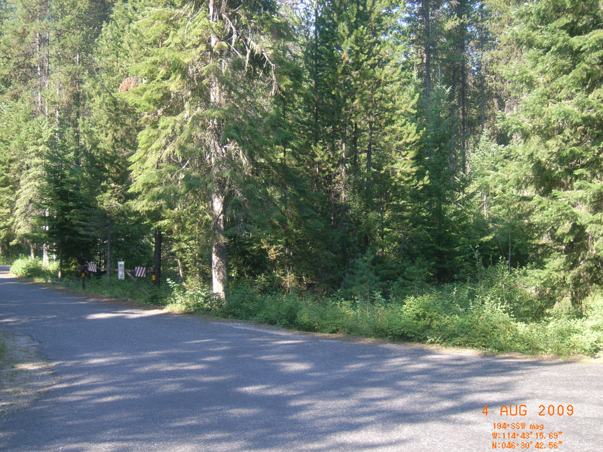
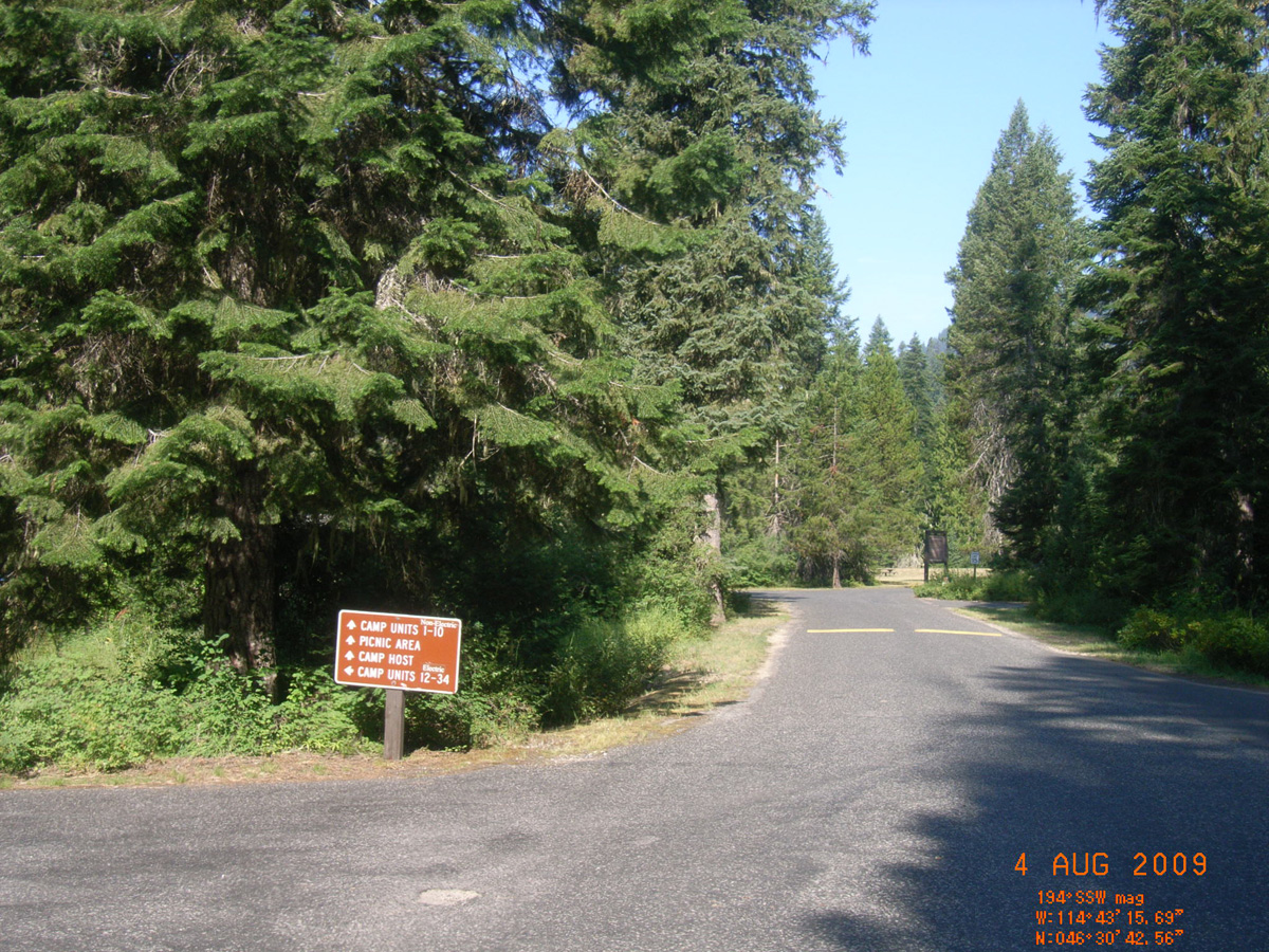
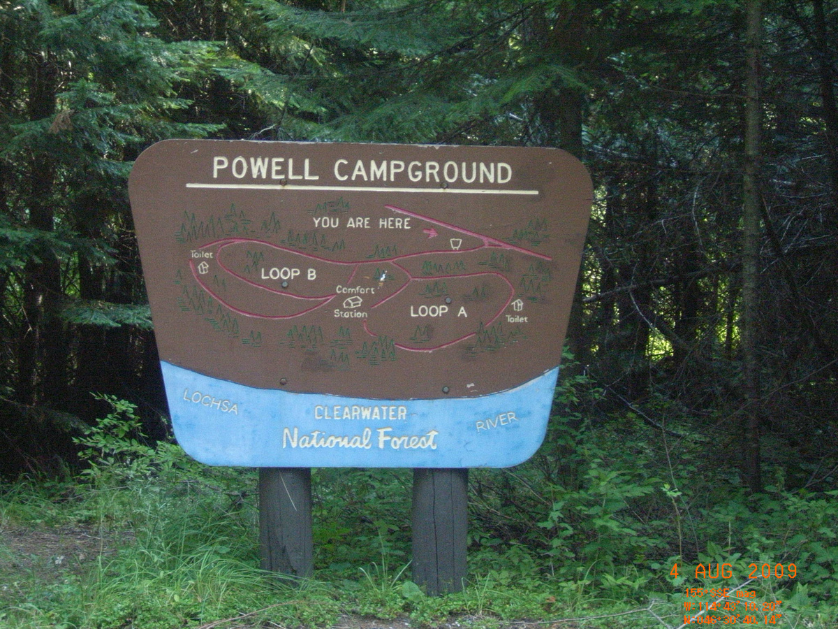
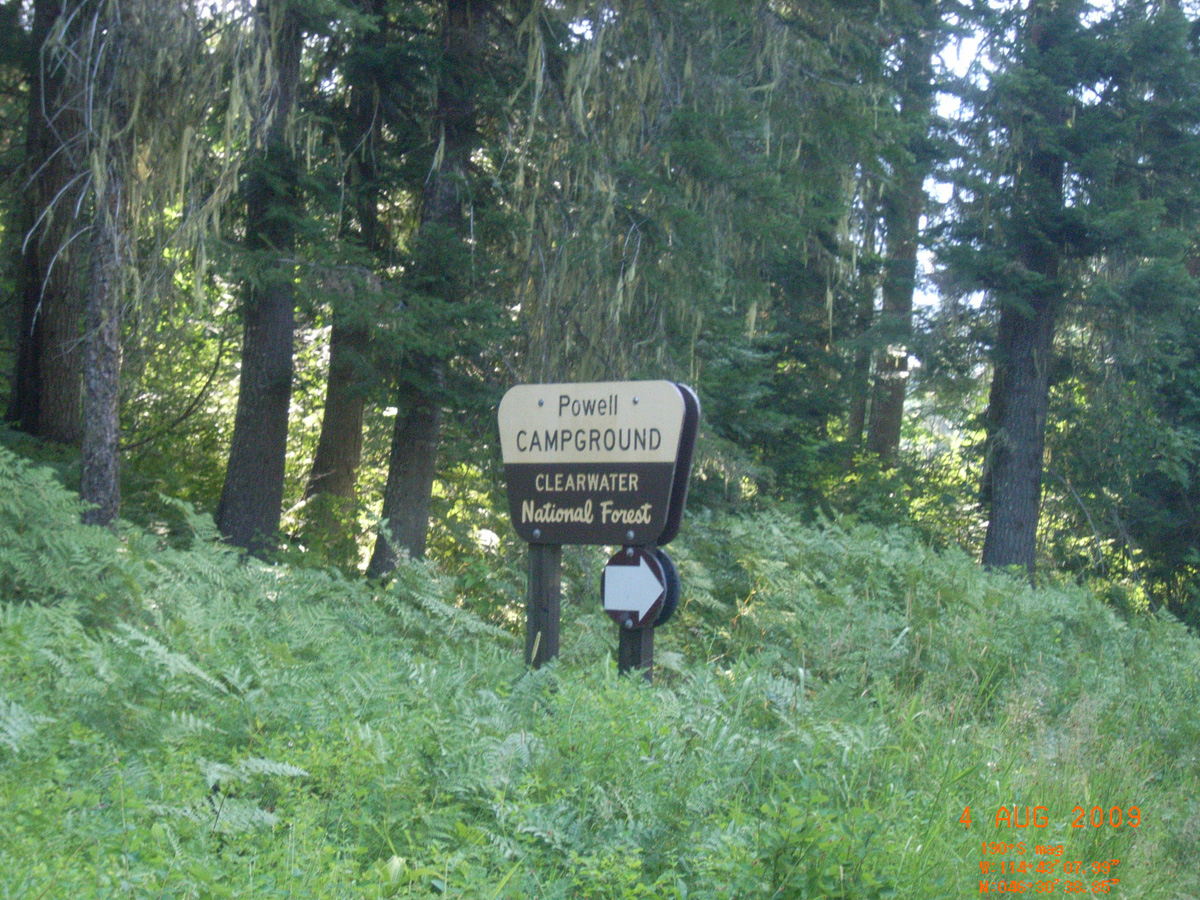
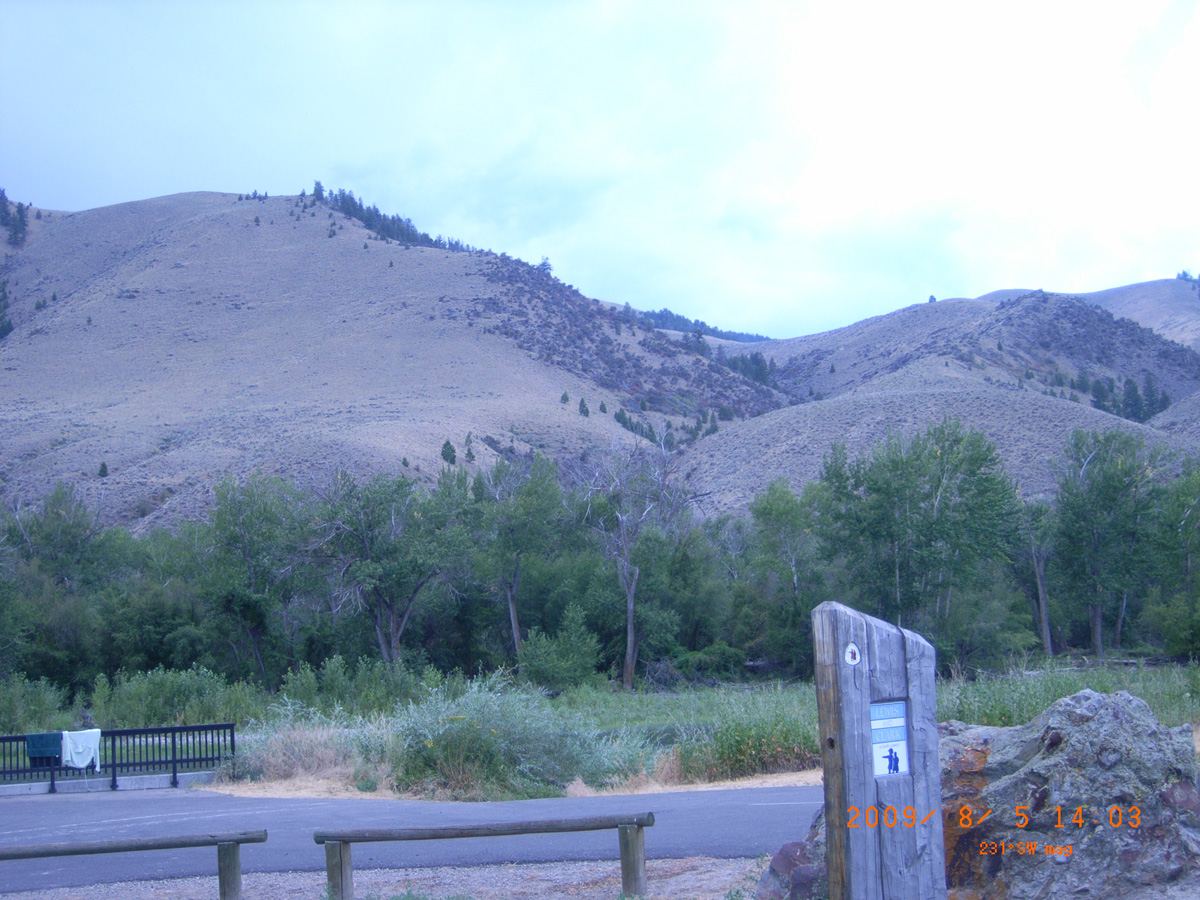
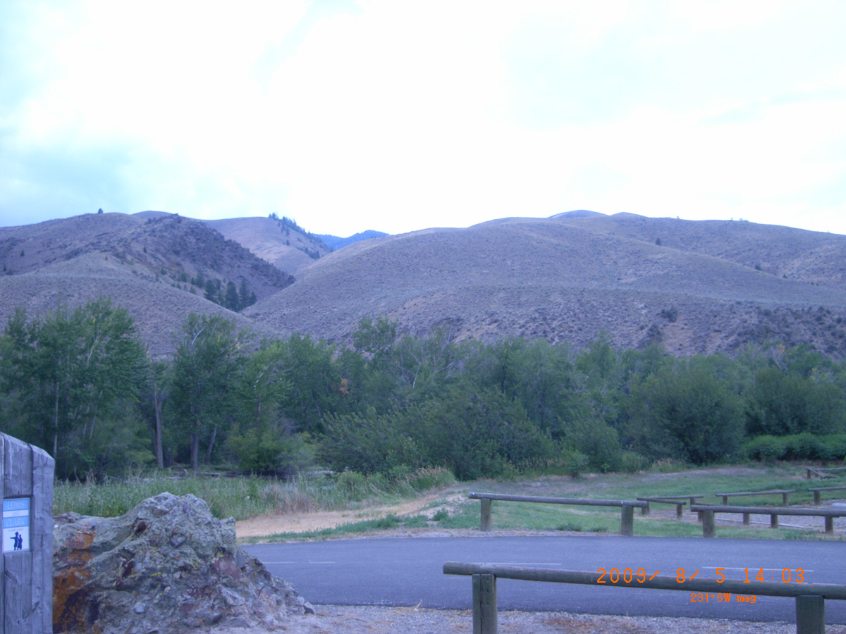
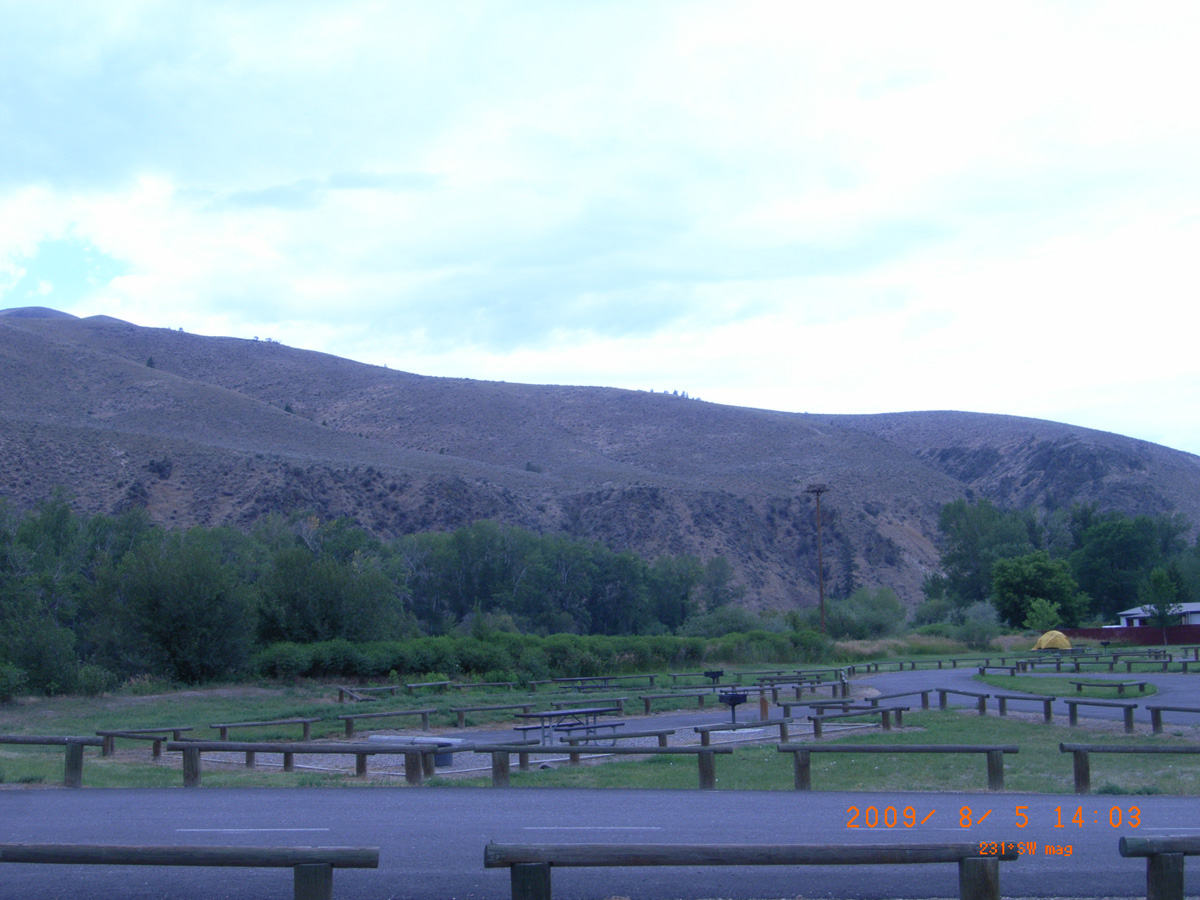
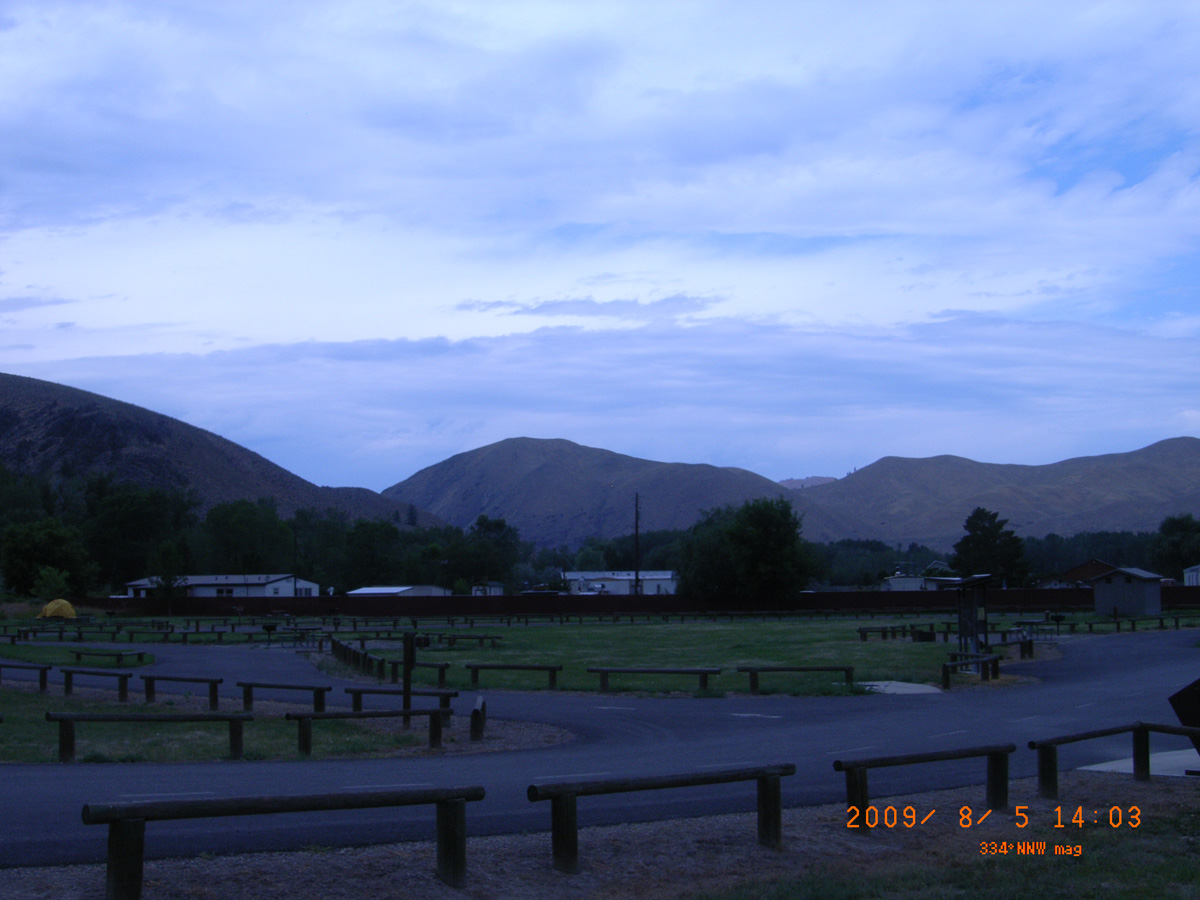
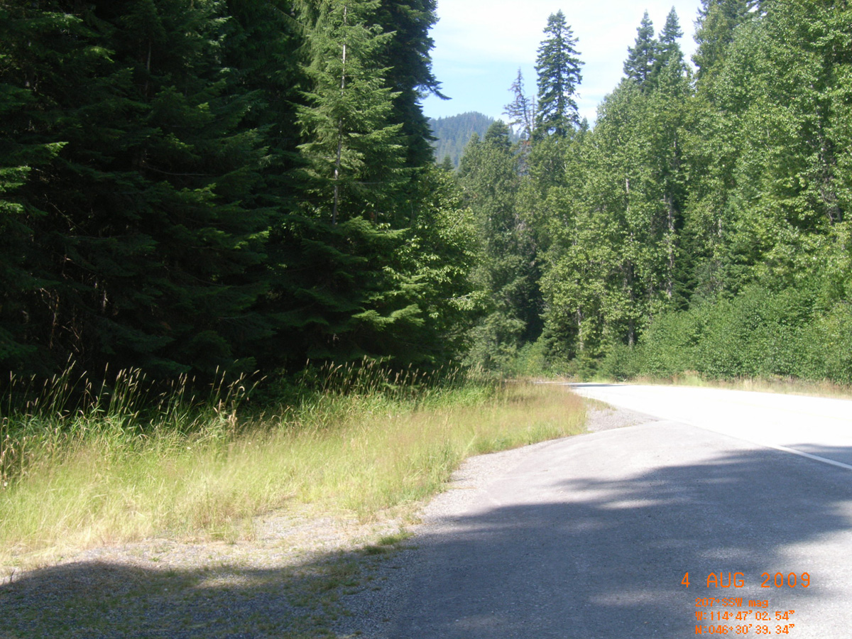
Powell Campground
Idaho County, Idaho: 46.51176973, -114.7207627
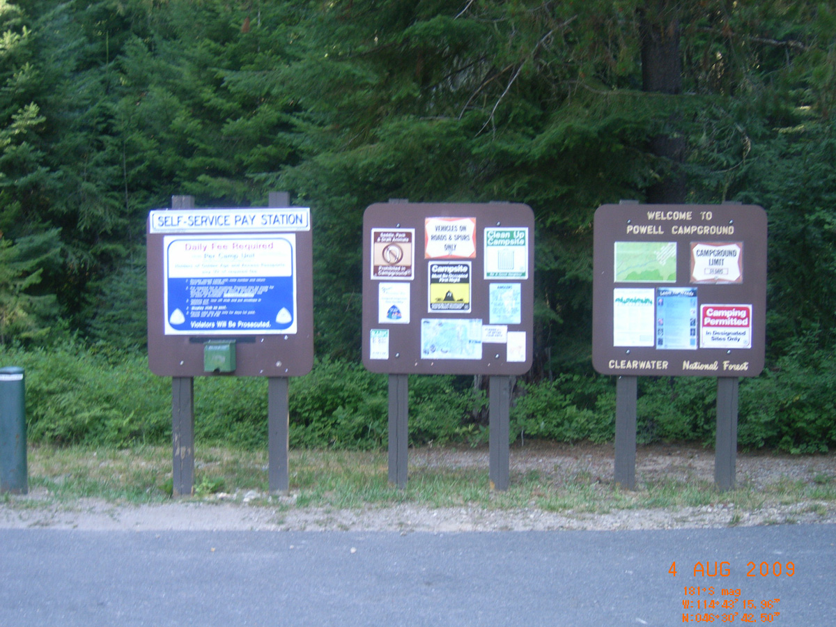
Welcome to Powell Campground
- Date Assessed: 2009-08-04
- File Name: RIMG0090.JPG
- Folder: C04AugustCam1
- Camera Direction: 31°
- Date Assessed: 2009-08-04
- File Name: RIMG0091.JPG
- Folder: C04AugustCam1
- Camera Direction: 70°
- Date Assessed: 2009-08-04
- File Name: RIMG0092.JPG
- Folder: C04AugustCam1
- Camera Direction: 62°
- Date Assessed: 2009-08-04
- File Name: RIMG0093.JPG
- Folder: C04AugustCam1
- Camera Direction: 158°
- Date Assessed: 2009-08-04
- File Name: RIMG0094.JPG
- Folder: C04AugustCam1
- Camera Direction: 158°
- Date Assessed: 2009-08-04
- File Name: RIMG0095.JPG
- Folder: C04AugustCam1
- Camera Direction: 158°
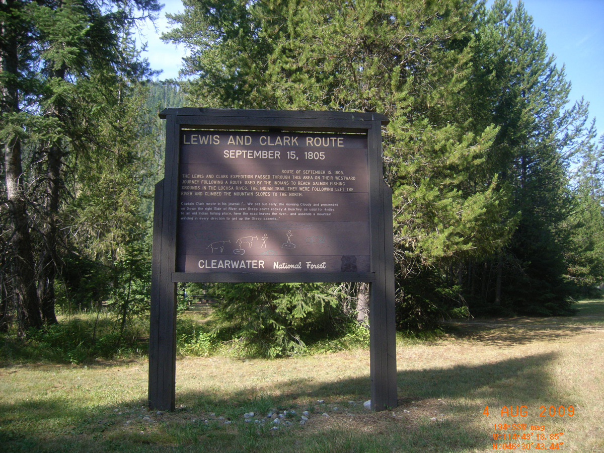
Lewis and Clark Route: September 15, 1805
- Date Assessed: 2009-08-04
- File Name: RIMG0096.JPG
- Folder: C04AugustCam1
- Camera Direction: 262°
Powell Campground
- Date Assessed: 2009-08-04
- File Name: RIMG0097.JPG
- Folder: C04AugustCam1
- Camera Direction: 266°
Powell Campground -->
- Date Assessed: 2009-08-04
- File Name: RIMG0098.JPG
- Folder: C04AugustCam1
- Camera Direction: 264°
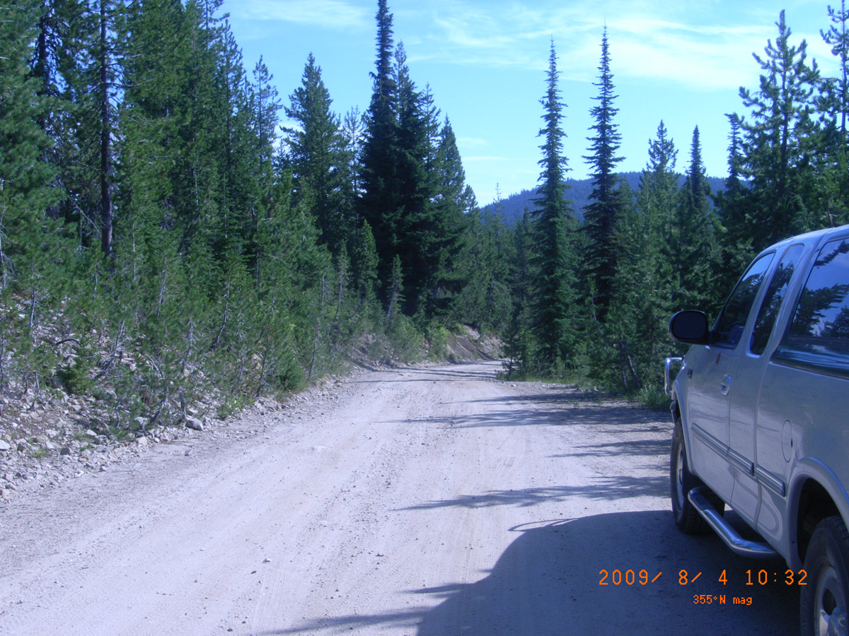
Hungery Creek overlook, Lolo Motorway
Idaho County, Idaho: 46.43189253, -115.5397127
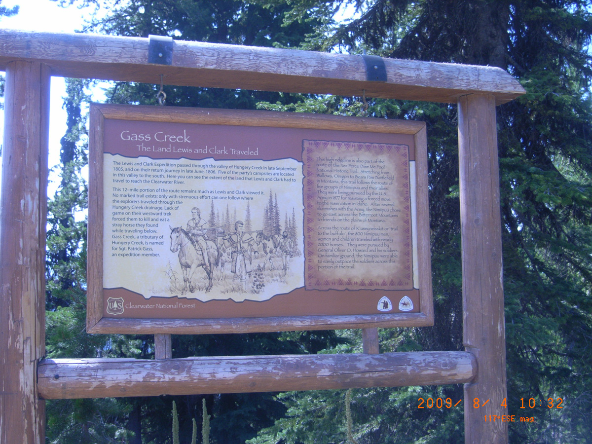
Gass Creek: The Land Lewis and Clark Traveled
- Date Assessed: 2009-08-04
- File Name: RIMG0033.JPG
- Folder: C04AugustCam2
- Camera Direction: 10°
- Date Assessed: 2009-08-04
- File Name: RIMG0034.JPG
- Folder: C04AugustCam2
- Camera Direction: 10°
- Date Assessed: 2009-08-04
- File Name: RIMG0035.JPG
- Folder: C04AugustCam2
- Camera Direction: 170°
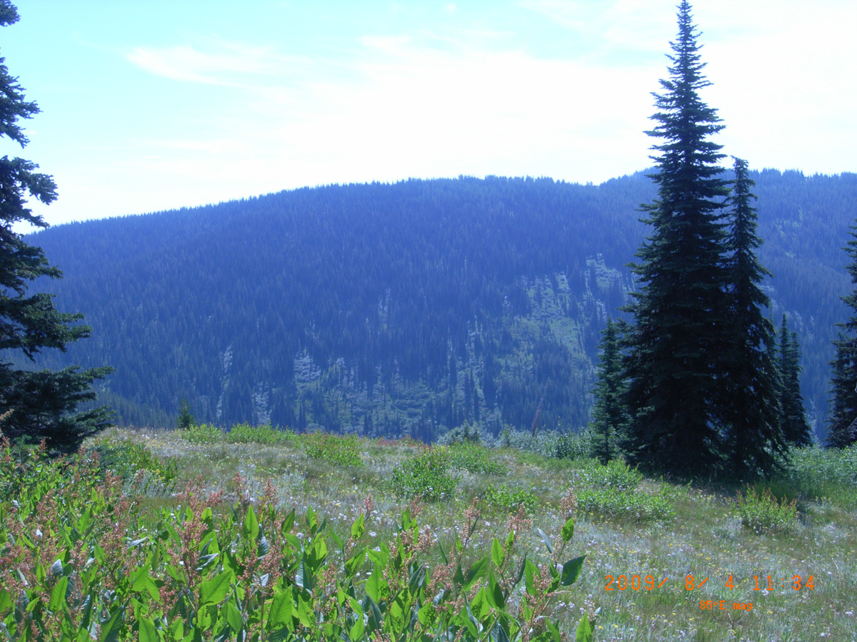
Bald Mountain, Lolo Motorway
Idaho County, Idaho: 46.45133554, -115.2408153
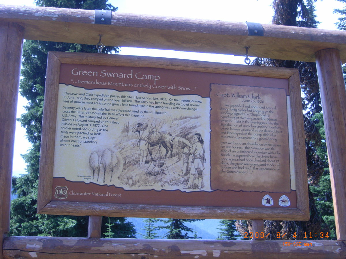
Green Swoard Camp: '...tremendious Mountains entirely Cover with Snow...'
- Date Assessed: 2009-08-04
- File Name: RIMG0036.JPG
- Folder: C04AugustCam2
- Camera Direction: 346°
- Date Assessed: 2009-08-04
- File Name: RIMG0037.JPG
- Folder: C04AugustCam2
- Camera Direction: 343°
- Date Assessed: 2009-08-04
- File Name: RIMG0038.JPG
- Folder: C04AugustCam2
- Camera Direction: 6°
- Date Assessed: 2009-08-04
- File Name: RIMG0039.JPG
- Folder: C04AugustCam2
- Camera Direction: 330°
Smoking Place
Idaho County, Idaho: 46.48364143, -115.1581594
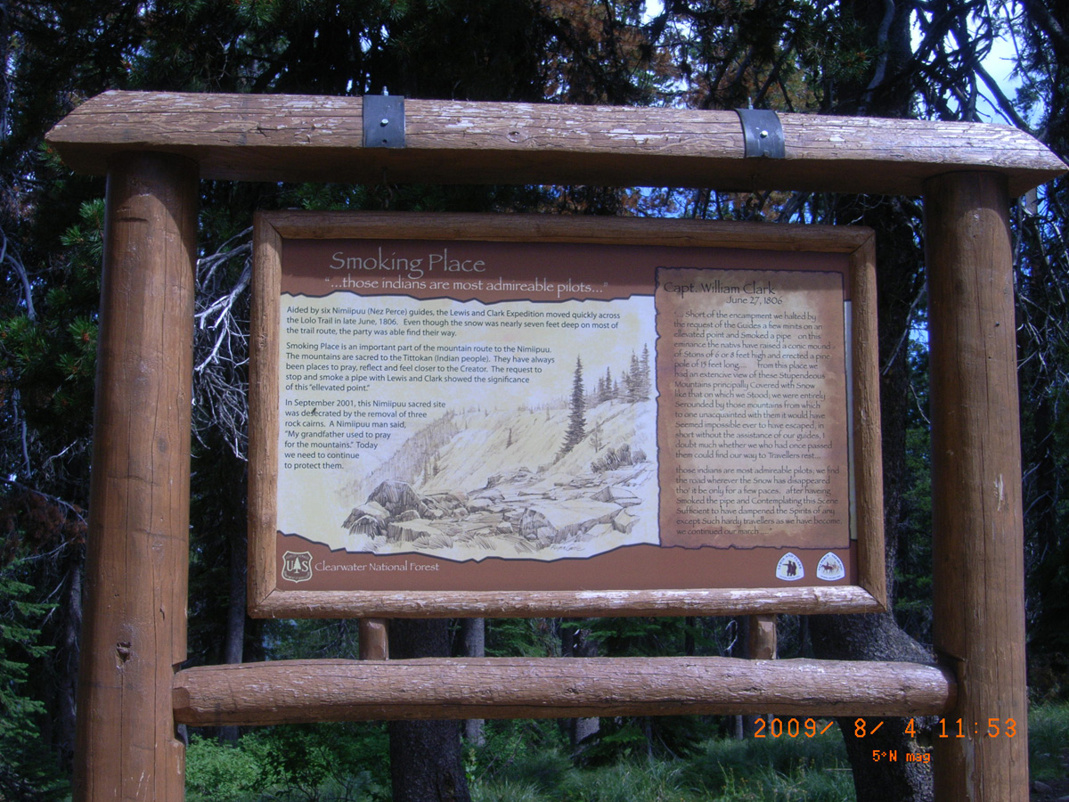
Smoking Place: '...those indians are most admireable pilots...'
- Date Assessed: 2009-08-04
- File Name: RIMG0040.JPG
- Folder: C04AugustCam2
- Camera Direction: 330°
- Date Assessed: 2009-08-04
- File Name: RIMG0044.JPG
- Folder: C04AugustCam2
- Camera Direction: 332°
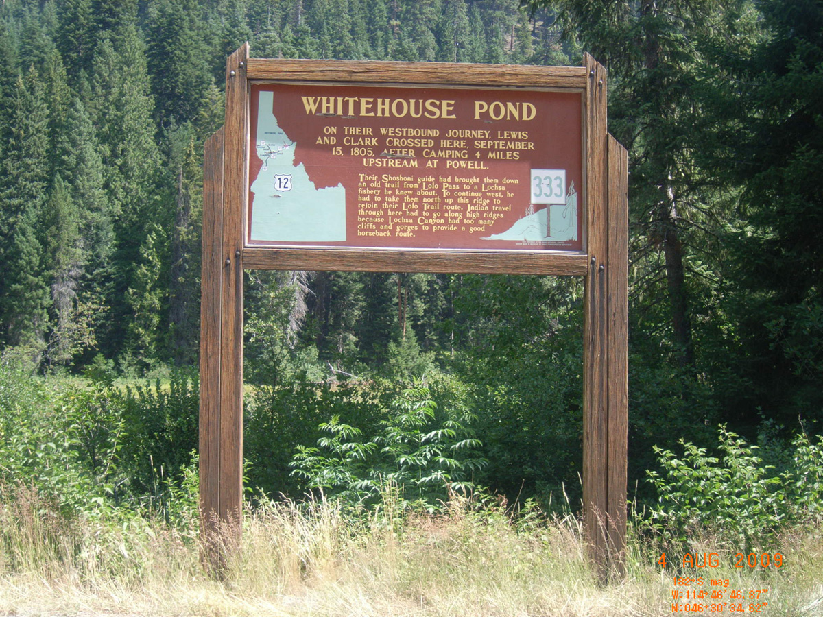
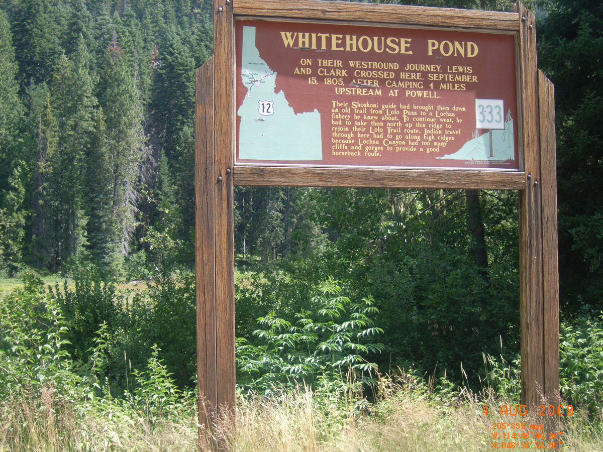
Whitehouse Pond, HW 12
Idaho County, Idaho: 46.50959279, -114.7796191
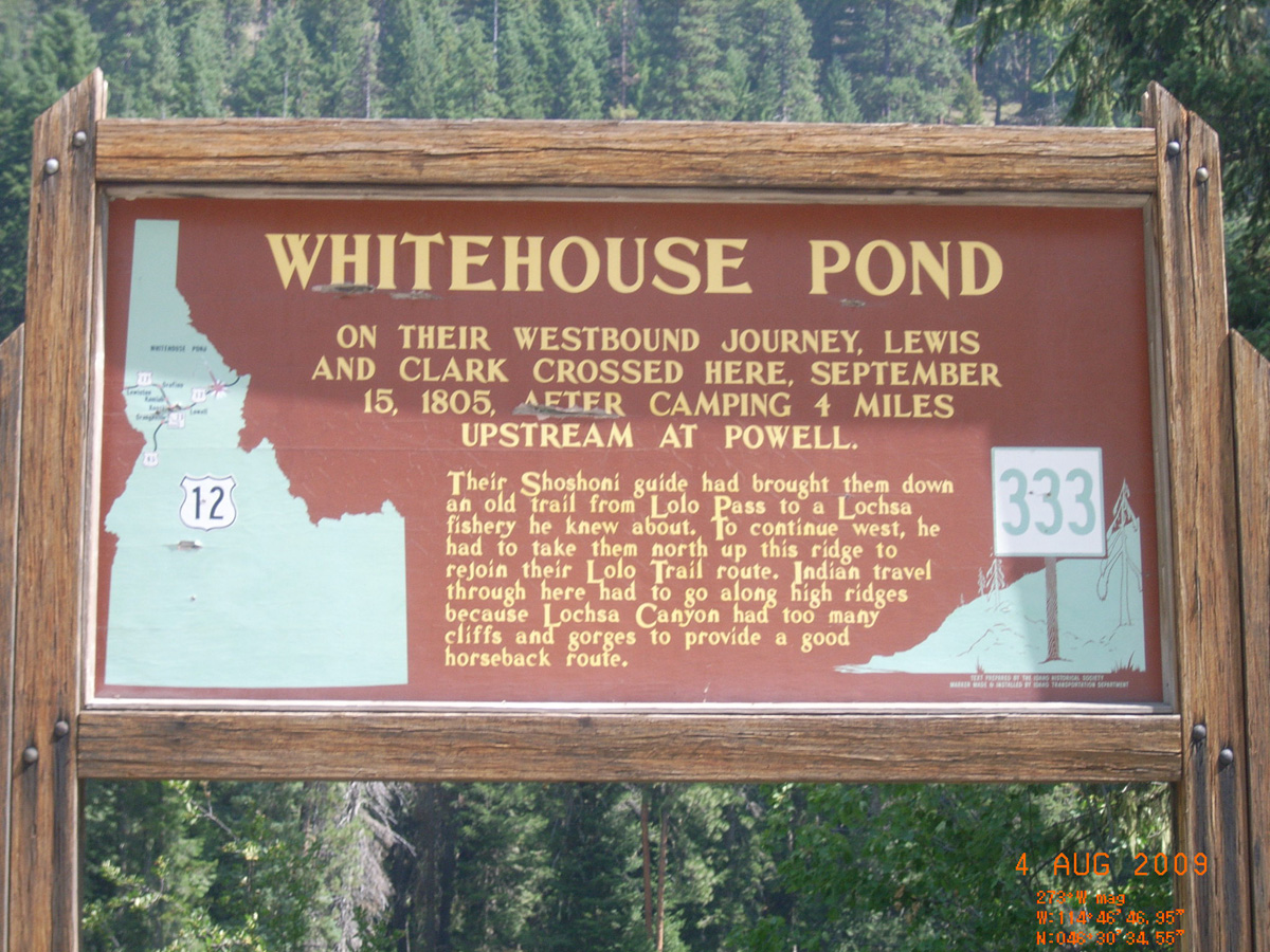
Whitehouse Pond
- Date Assessed: 2009-08-04
- File Name: RIMG0120.JPG
- Folder: C04AugustCam1
- Camera Direction: 332°
Whitehouse Pond
- Date Assessed: 2009-08-04
- File Name: RIMG0121.JPG
- Folder: C04AugustCam1
- Camera Direction: 174°
- Date Assessed: 2009-08-04
- File Name: RIMG0122.JPG
- Folder: C04AugustCam1
- Camera Direction: 174°
- Date Assessed: 2009-08-04
- File Name: RIMG0123.JPG
- Folder: C04AugustCam1
- Camera Direction: 144°
- Date Assessed: 2009-08-04
- File Name: RIMG0124.JPG
- Folder: C04AugustCam1
- Camera Direction: 308°
Whitehouse Pond
- Date Assessed: 2009-08-04
- File Name: RIMG0125.JPG
- Folder: C04AugustCam1
- Camera Direction: 301°
- Date Assessed: 2009-08-04
- File Name: RIMG0126.JPG
- Folder: C04AugustCam1
- Camera Direction: 333°
- Date Assessed: 2009-08-04
- File Name: RIMG0127.JPG
- Folder: C04AugustCam1
- Camera Direction: 333°
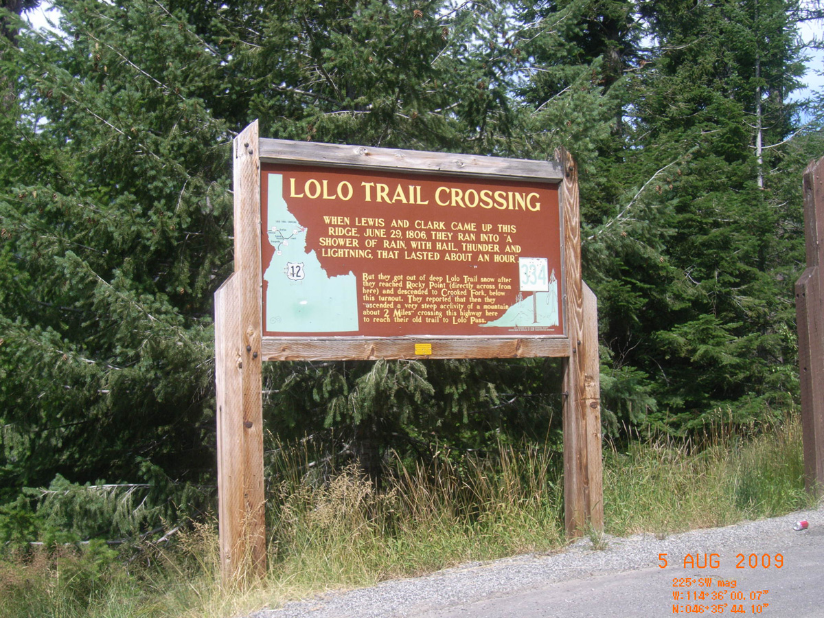
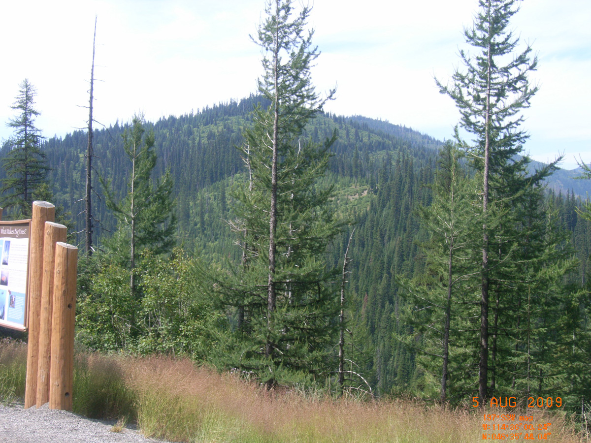
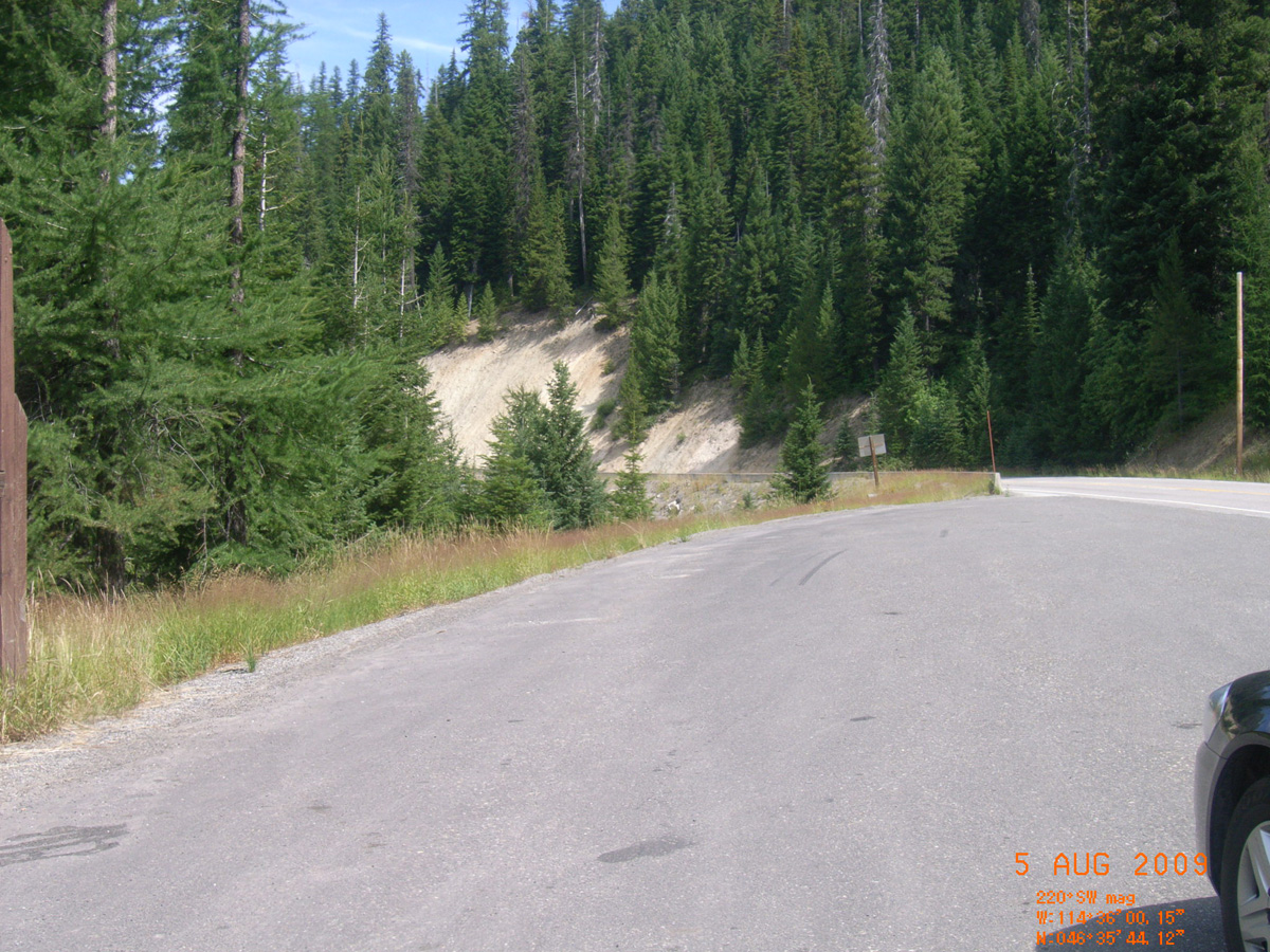
Lolo Trail Crossing, HW 12
Idaho County, Idaho: 46.59563971, -114.6000248
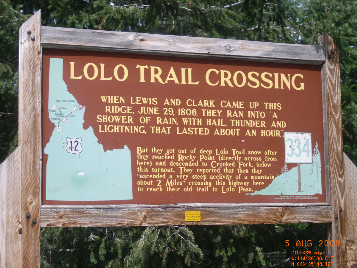
Lolo Trail Crossing
- Date Assessed: 2009-08-05
- File Name: RIMG0134.JPG
- Folder: C04AugustCam1
- Camera Direction: 173°
Lolo Trail Crossing
- Date Assessed: 2009-08-05
- File Name: RIMG0135.JPG
- Folder: C04AugustCam1
- Camera Direction: 174°
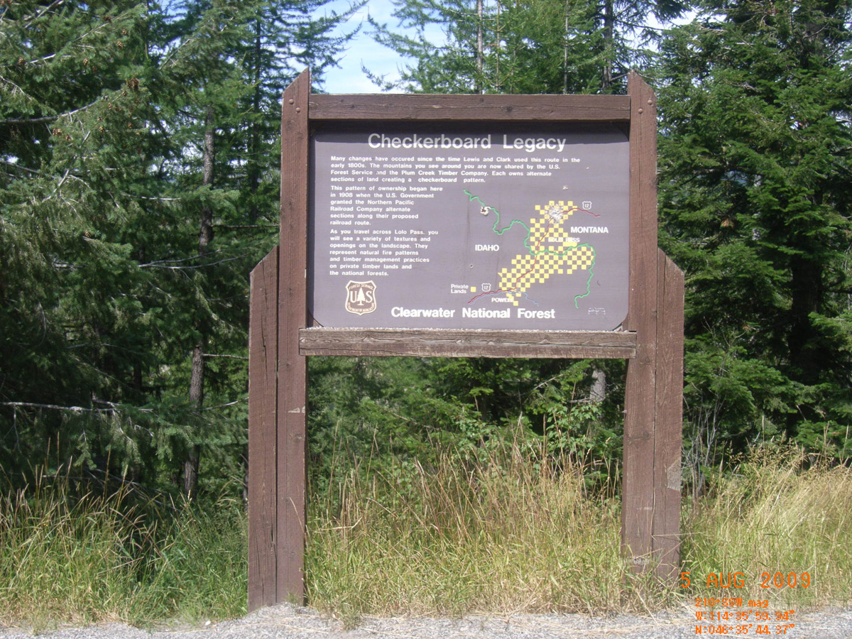
Checkerboard Legacy
- Date Assessed: 2009-08-05
- File Name: RIMG0136.JPG
- Folder: C04AugustCam1
- Camera Direction: 200°
- Date Assessed: 2009-08-05
- File Name: RIMG0137.JPG
- Folder: C04AugustCam1
- Camera Direction: 202°
- Date Assessed: 2009-08-05
- File Name: RIMG0138.JPG
- Folder: C04AugustCam1
- Camera Direction: 202°
- Date Assessed: 2009-08-05
- File Name: RIMG0139.JPG
- Folder: C04AugustCam1
- Camera Direction: 44°
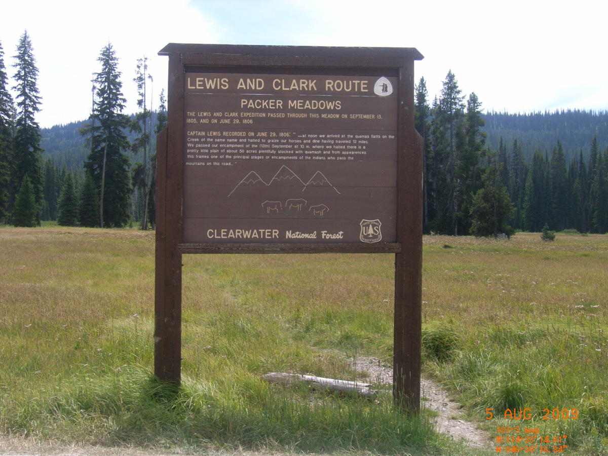
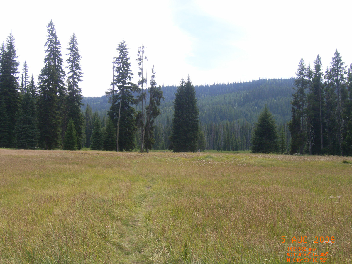
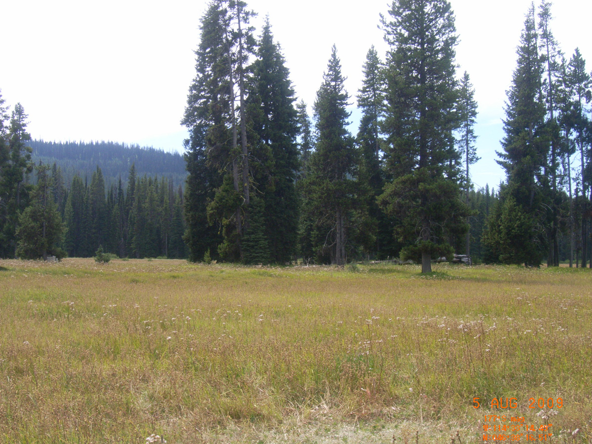
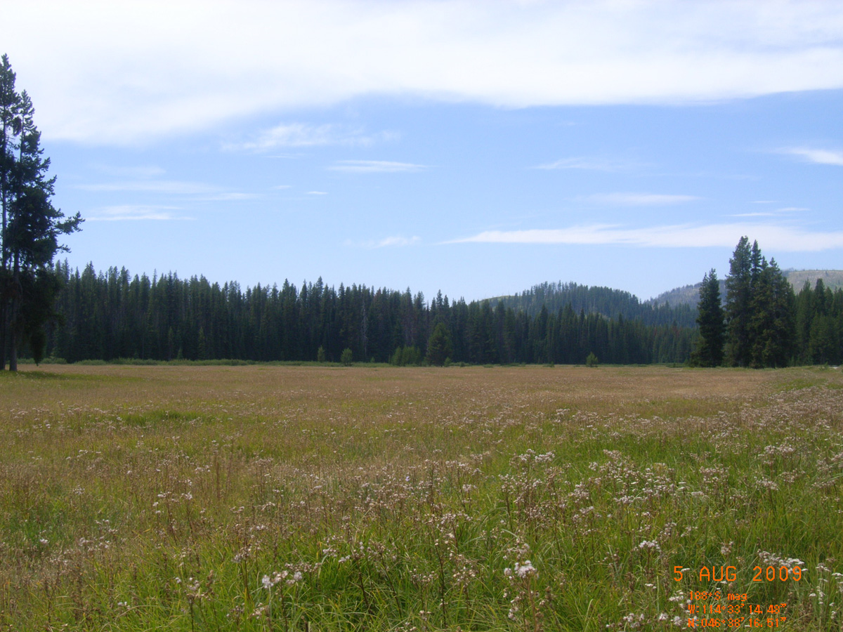
Packer Meadows
Idaho County, Idaho: 46.63795546, -114.5540406
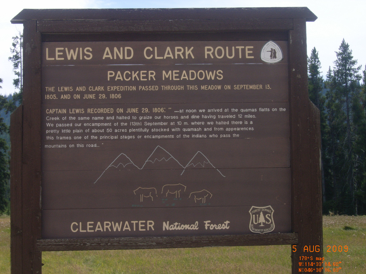
Lewis and Clark Route: Packer Meadows
- Date Assessed: 2009-08-05
- File Name: RIMG0150.JPG
- Folder: C04AugustCam1
- Camera Direction: 152°
Lewis and Clark Route: Packer Meadows
- Date Assessed: 2009-08-05
- File Name: RIMG0151.JPG
- Folder: C04AugustCam1
- Camera Direction: 164°
- Date Assessed: 2009-08-05
- File Name: RIMG0152.JPG
- Folder: C04AugustCam1
- Camera Direction: 152°
- Date Assessed: 2009-08-05
- File Name: RIMG0153.JPG
- Folder: C04AugustCam1
- Camera Direction: 106°
- Date Assessed: 2009-08-05
- File Name: RIMG0154.JPG
- Folder: C04AugustCam1
- Camera Direction: 237°
- Date Assessed: 2009-08-05
- File Name: RIMG0155.JPG
- Folder: C04AugustCam1
- Camera Direction: 162°
- Date Assessed: 2009-08-05
- File Name: RIMG0156.JPG
- Folder: C04AugustCam1
- Camera Direction: 147°
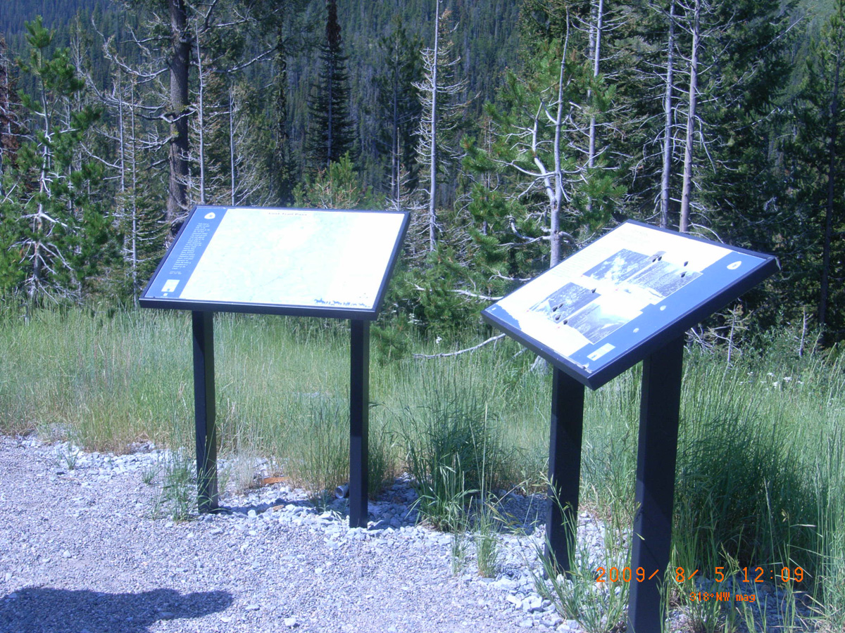
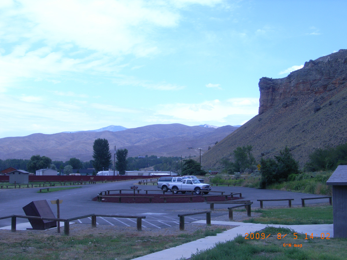
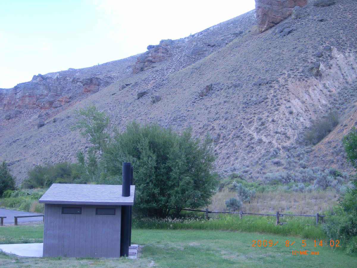
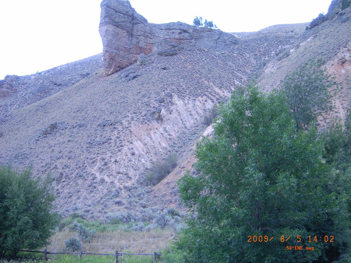
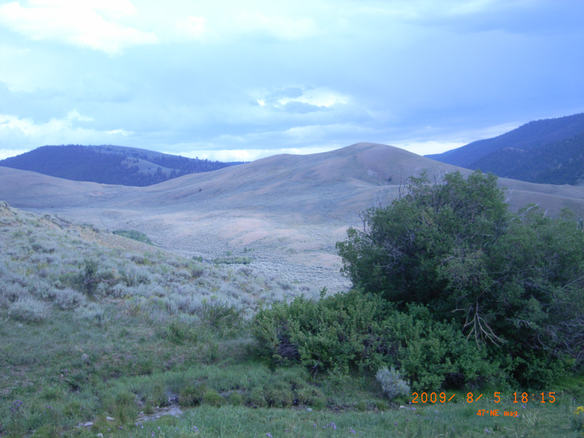
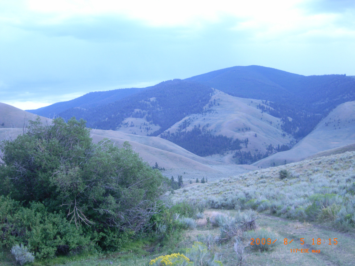
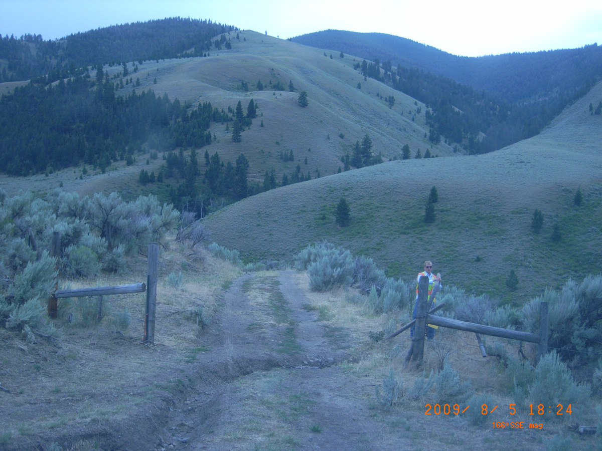
Lost Trail Pass, HW 93 below summit
Lemhi County, Idaho: 45.68292777, -113.9445095
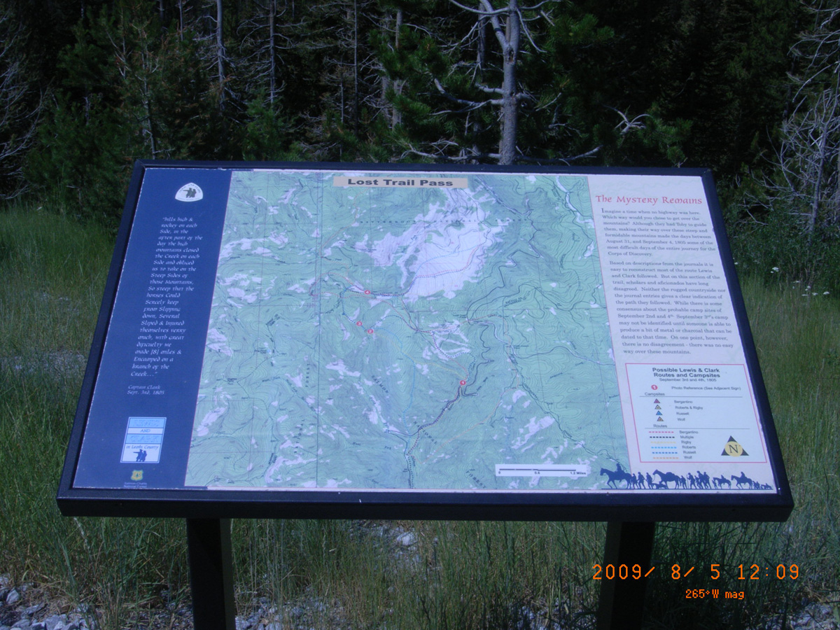
Lost Trail Pass
- Date Assessed: 2009-08-05
- File Name: RIMG0039.JPG
- Folder: C05AugustCam2
- Camera Direction: 180°
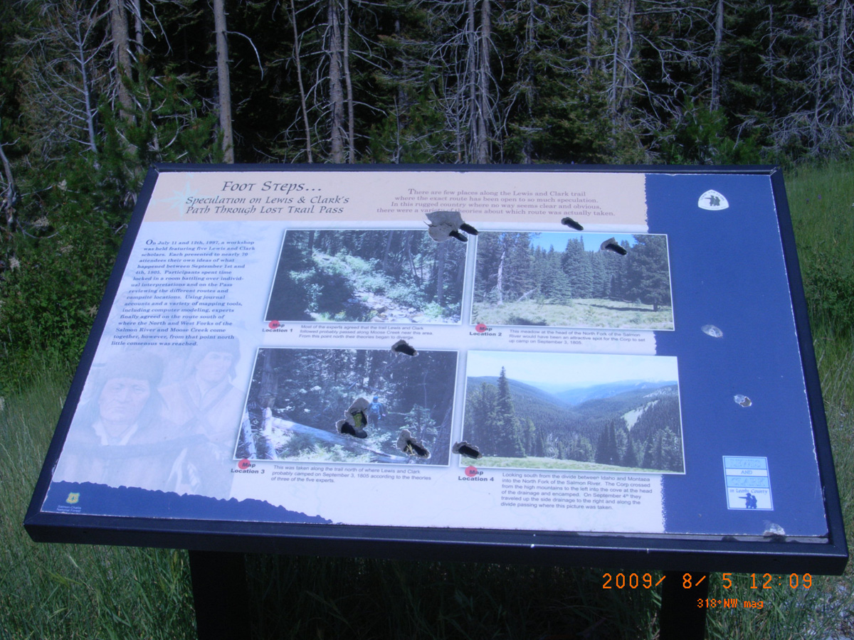
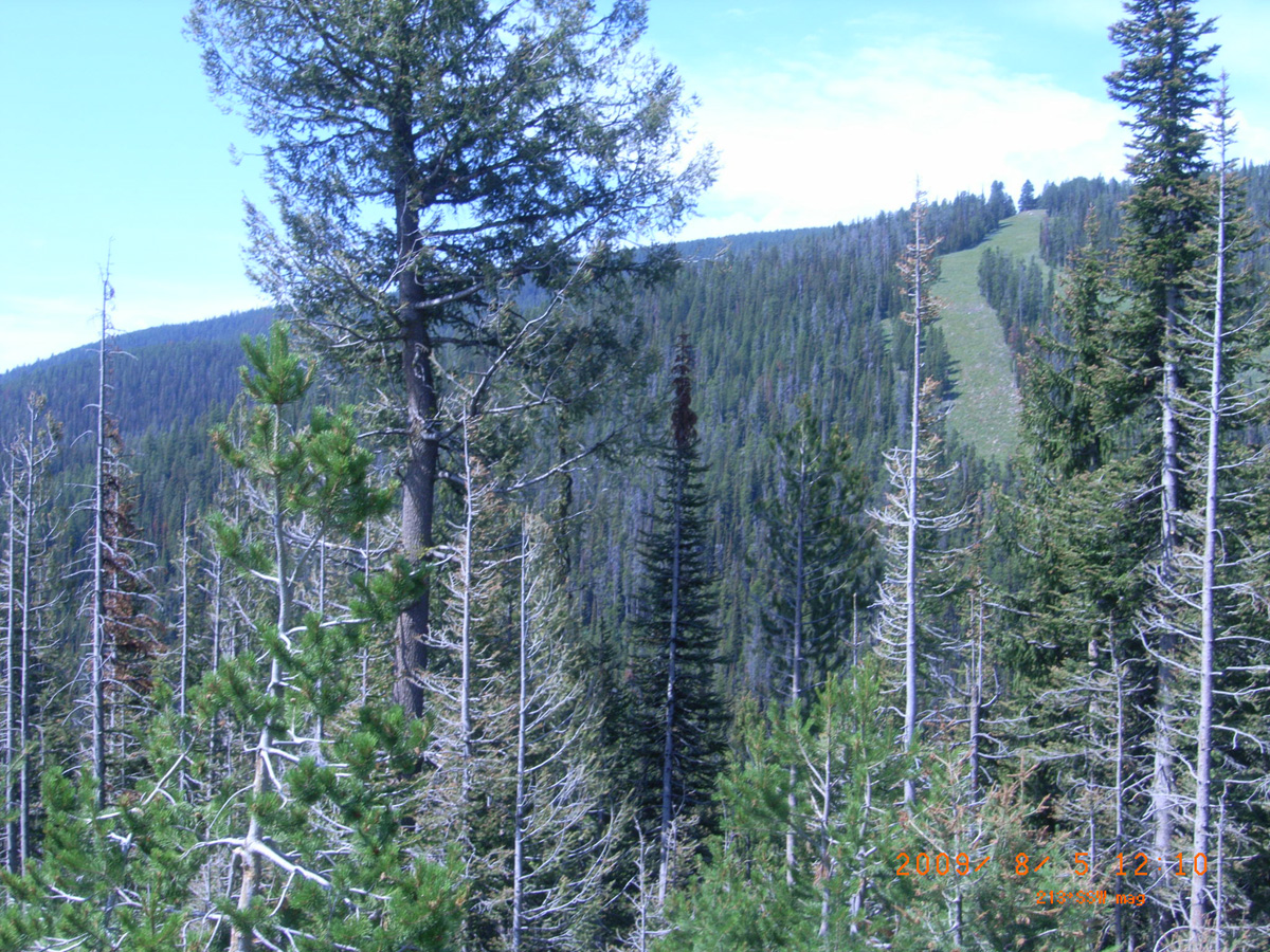
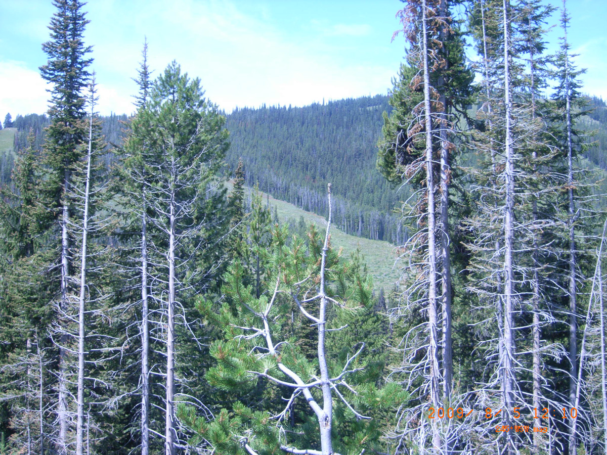
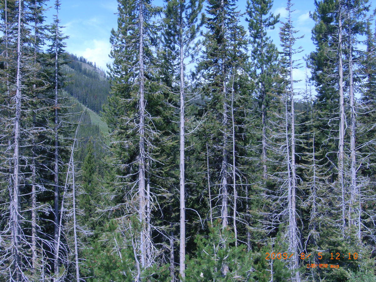
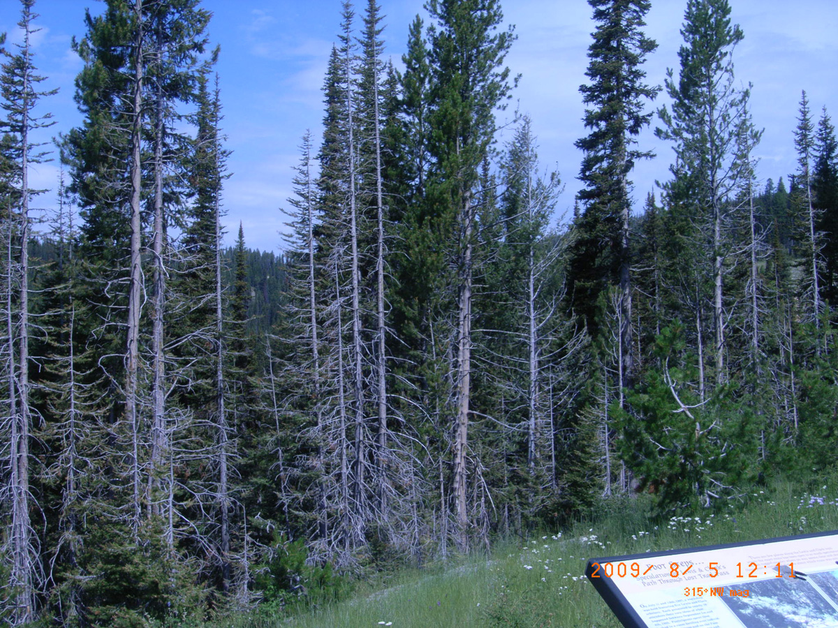
Foot Steps...Speculation on Lewis & Clark's Path Through Lost Trail Pass
- Date Assessed: 2009-08-05
- File Name: RIMG0040.JPG
- Folder: C05AugustCam2
- Camera Direction: 216°
- Date Assessed: 2009-08-05
- File Name: RIMG0041.JPG
- Folder: C05AugustCam2
- Camera Direction: 174°
- Date Assessed: 2009-08-05
- File Name: RIMG0042.JPG
- Folder: C05AugustCam2
- Camera Direction: 193°
- Date Assessed: 2009-08-05
- File Name: RIMG0043.JPG
- Folder: C05AugustCam2
- Camera Direction: 184°
- Date Assessed: 2009-08-05
- File Name: RIMG0044.JPG
- Folder: C05AugustCam2
- Camera Direction: 209°
- Date Assessed: 2009-08-05
- File Name: RIMG0045.JPG
- Folder: C05AugustCam2
- Camera Direction: 176°
- Date Assessed: 2009-08-05
- File Name: RIMG0046.JPG
- Folder: C05AugustCam2
- Camera Direction: 152°
- Date Assessed: 2009-08-05
- File Name: RIMG0047.JPG
- Folder: C05AugustCam2
- Camera Direction: 176°
- Date Assessed: 2009-08-05
- File Name: RIMG0048.JPG
- Folder: C05AugustCam2
- Camera Direction: 183°
- Date Assessed: 2009-08-05
- File Name: RIMG0049.JPG
- Folder: C05AugustCam2
- Camera Direction: 342°
Lost Trail Pass near North Fork Salmon River crossing
Lemhi County, Idaho: 45.65974308, -113.9759477
Lewis and Clark
- Date Assessed: 2009-08-05
- File Name: RIMG0050.JPG
- Folder: C05AugustCam2
- Camera Direction: 179°
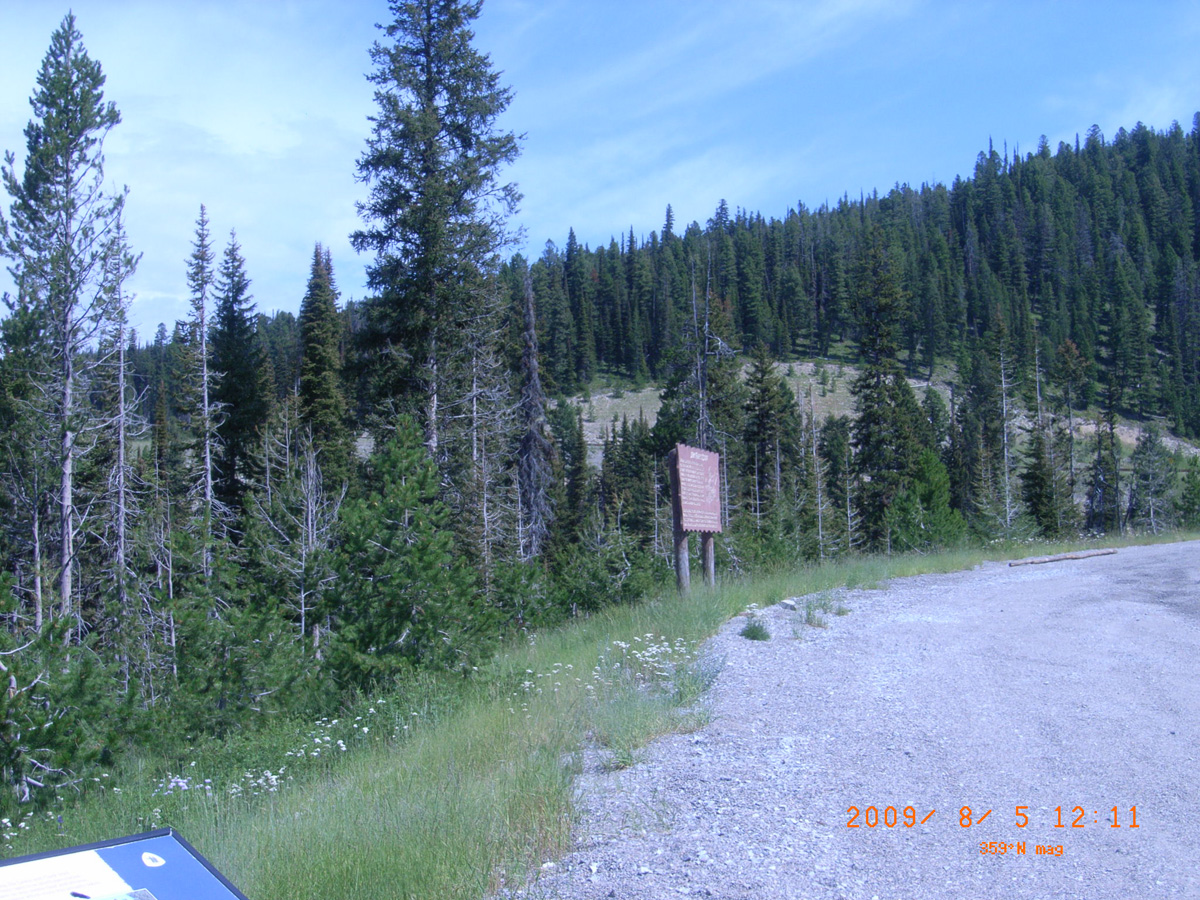
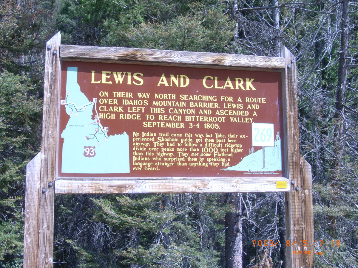
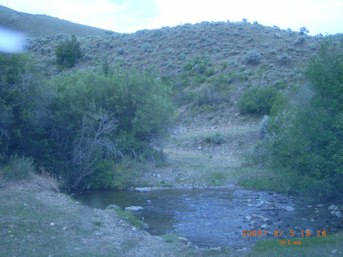
Deep Creek, HW 93
Lemhi County, Idaho: 45.59275299, -113.9639799
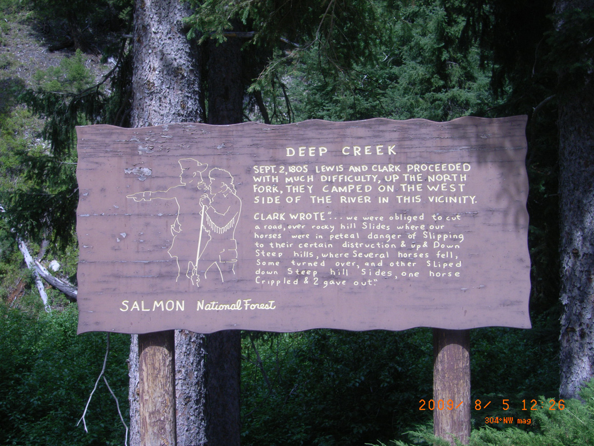
Deep Creek
- Date Assessed: 2009-08-05
- File Name: RIMG0051.JPG
- Folder: C05AugustCam2
- Camera Direction: 207°
- Date Assessed: 2009-08-05
- File Name: RIMG0052.JPG
- Folder: C05AugustCam2
- Camera Direction: 185°
Salmon and North Fork Salmon confluence, Salmon River Rd.
Lemhi County, Idaho: 45.40711144, -113.9962415
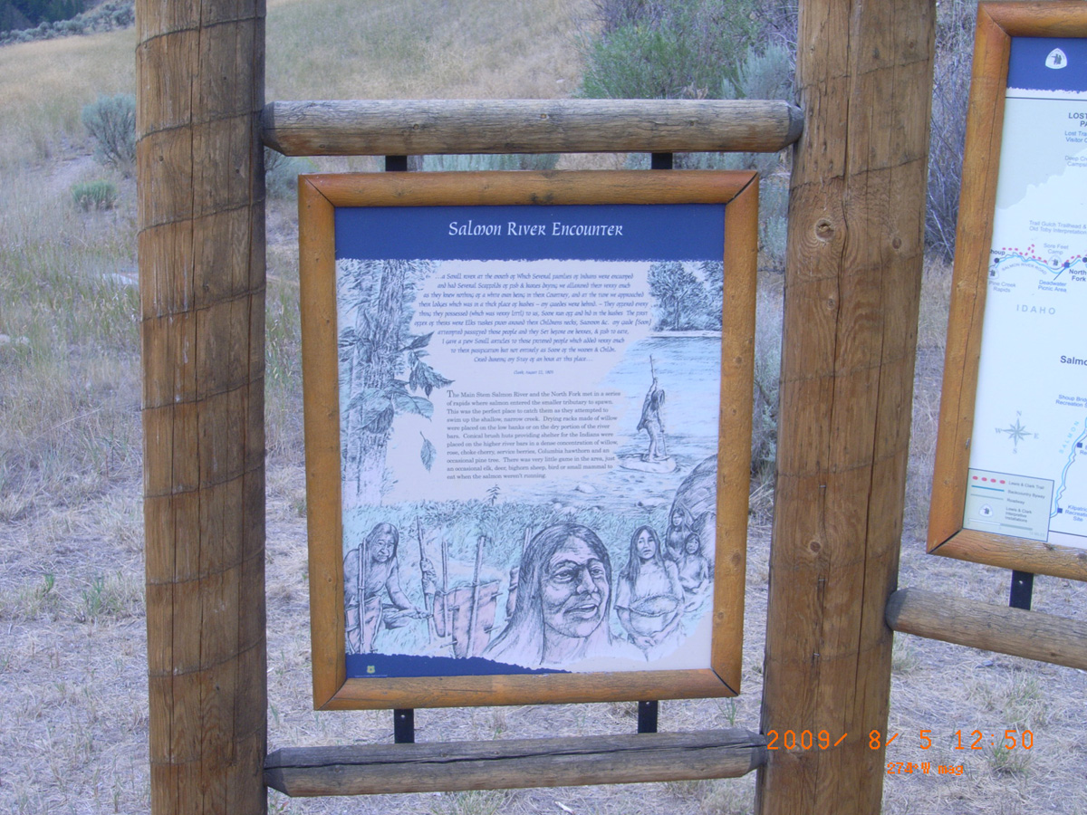
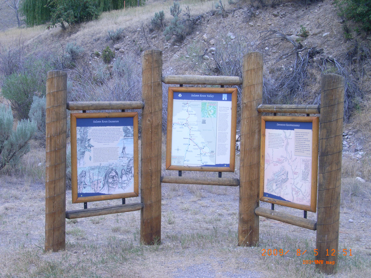
Salmon River Encounter
- Date Assessed: 2009-08-05
- File Name: RIMG0065.JPG
- Folder: C05AugustCam2
- Camera Direction: 21°
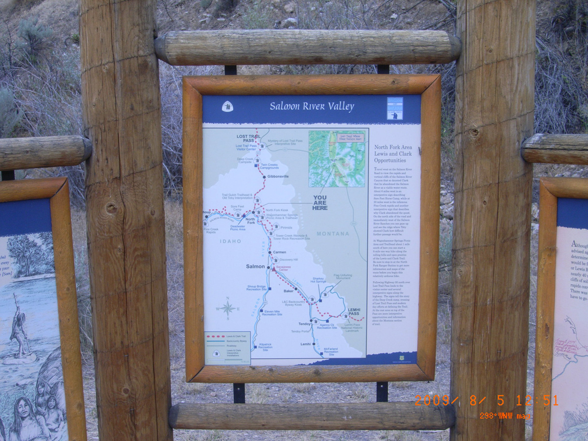
Salmon River Valley
- Date Assessed: 2009-08-05
- File Name: RIMG0066.JPG
- Folder: C05AugustCam2
- Camera Direction: 170°
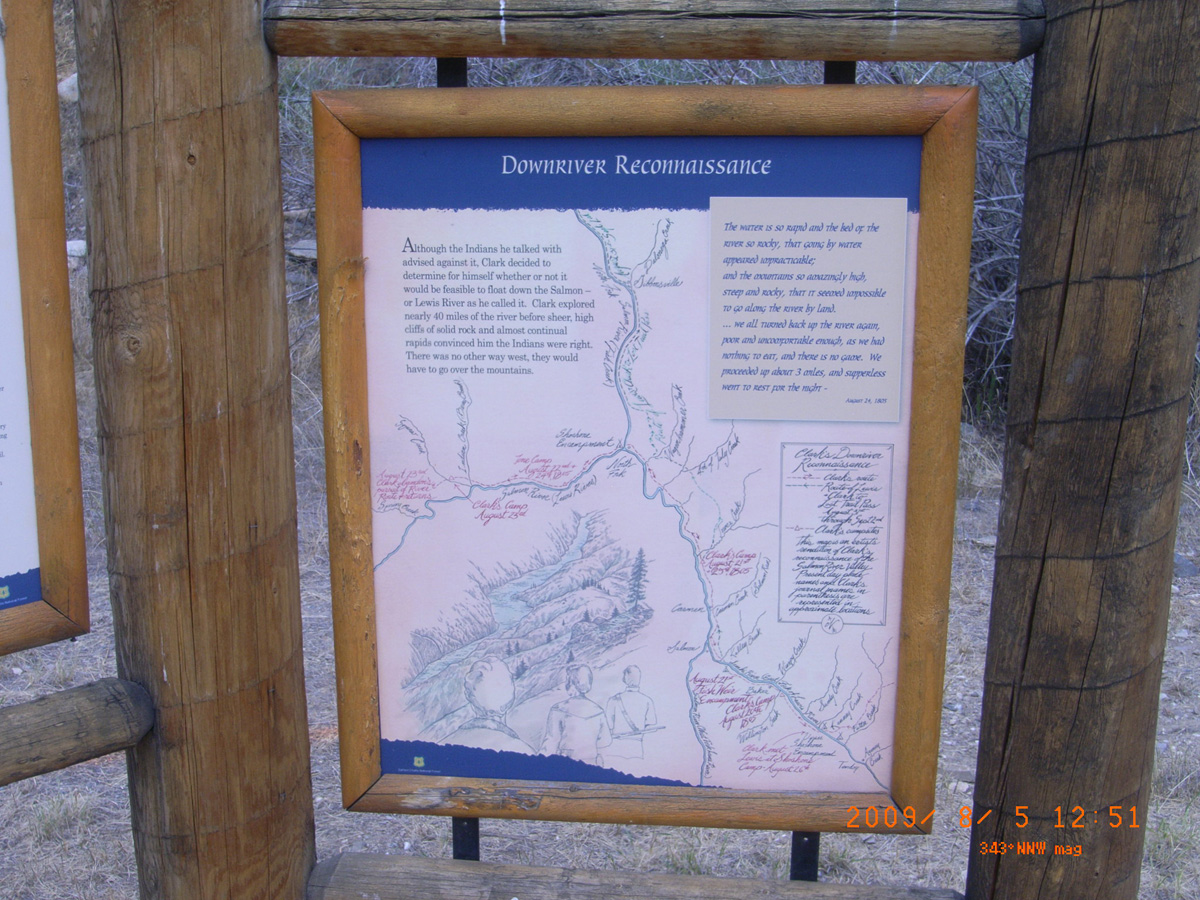
Downriver Reconnaissance
- Date Assessed: 2009-08-05
- File Name: RIMG0067.JPG
- Folder: C05AugustCam2
- Camera Direction: 169°
- Date Assessed: 2009-08-05
- File Name: RIMG0068.JPG
- Folder: C05AugustCam2
- Camera Direction: 170°
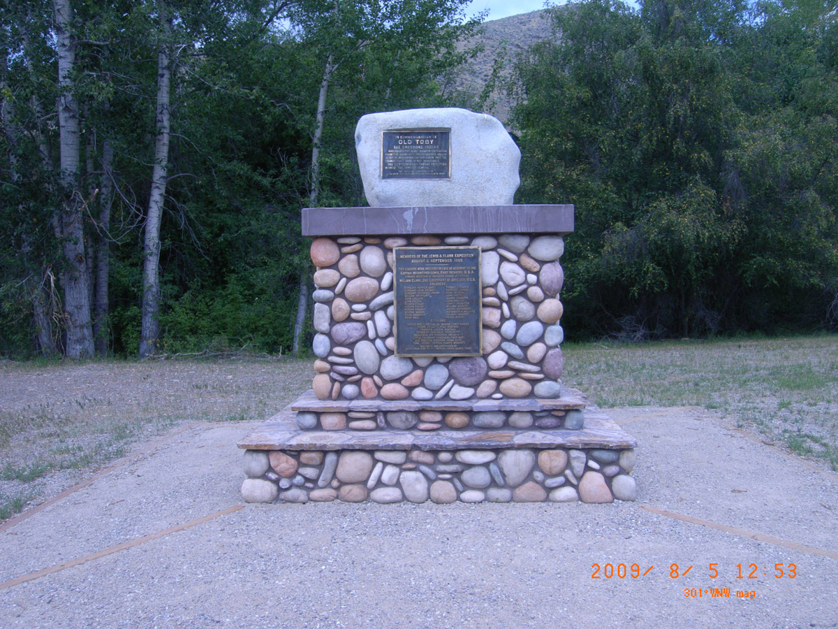
In Commemoration of Old Toby
- Date Assessed: 2009-08-05
- File Name: RIMG0069.JPG
- Folder: C05AugustCam2
- Camera Direction: 196°
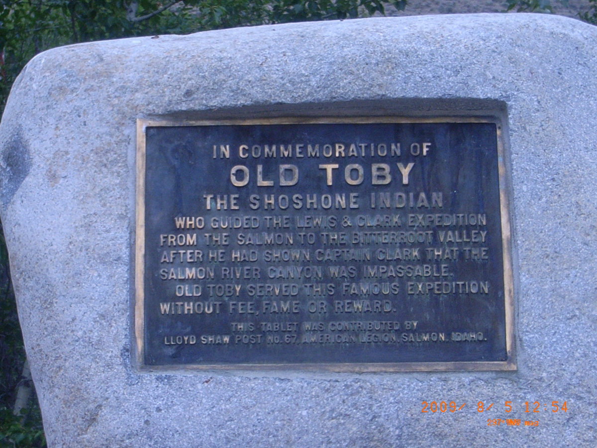
In Commemoration of Old Toby
- Date Assessed: 2009-08-05
- File Name: RIMG0070.JPG
- Folder: C05AugustCam2
- Camera Direction: 196°
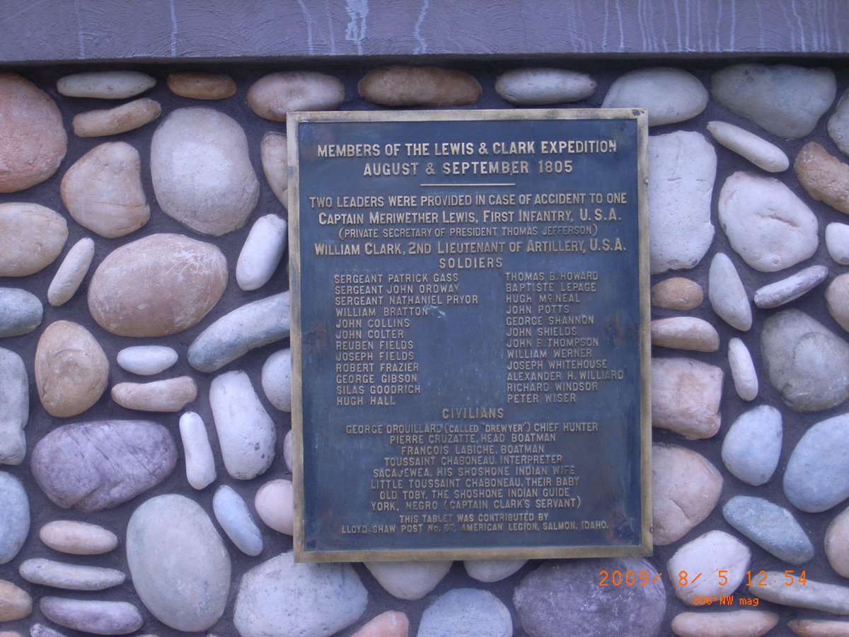
Members of the Lewis & Clark Expedition August & September 1805
- Date Assessed: 2009-08-05
- File Name: RIMG0071.JPG
- Folder: C05AugustCam2
- Camera Direction: 150°
Salmon and North Fork Salmon confluence, HW 93
Lemhi County, Idaho: 45.40469237, -113.991651
Lewis and Clark
- Date Assessed: 2009-08-05
- File Name: RIMG0072.JPG
- Folder: C05AugustCam2
- Camera Direction: 165°
Lewis and Clark
- Date Assessed: 2009-08-05
- File Name: RIMG0073.JPG
- Folder: C05AugustCam2
- Camera Direction: 164°
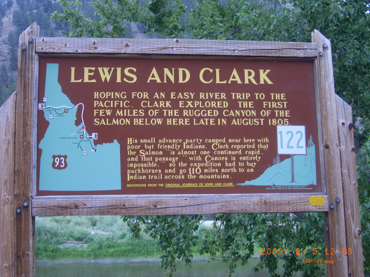
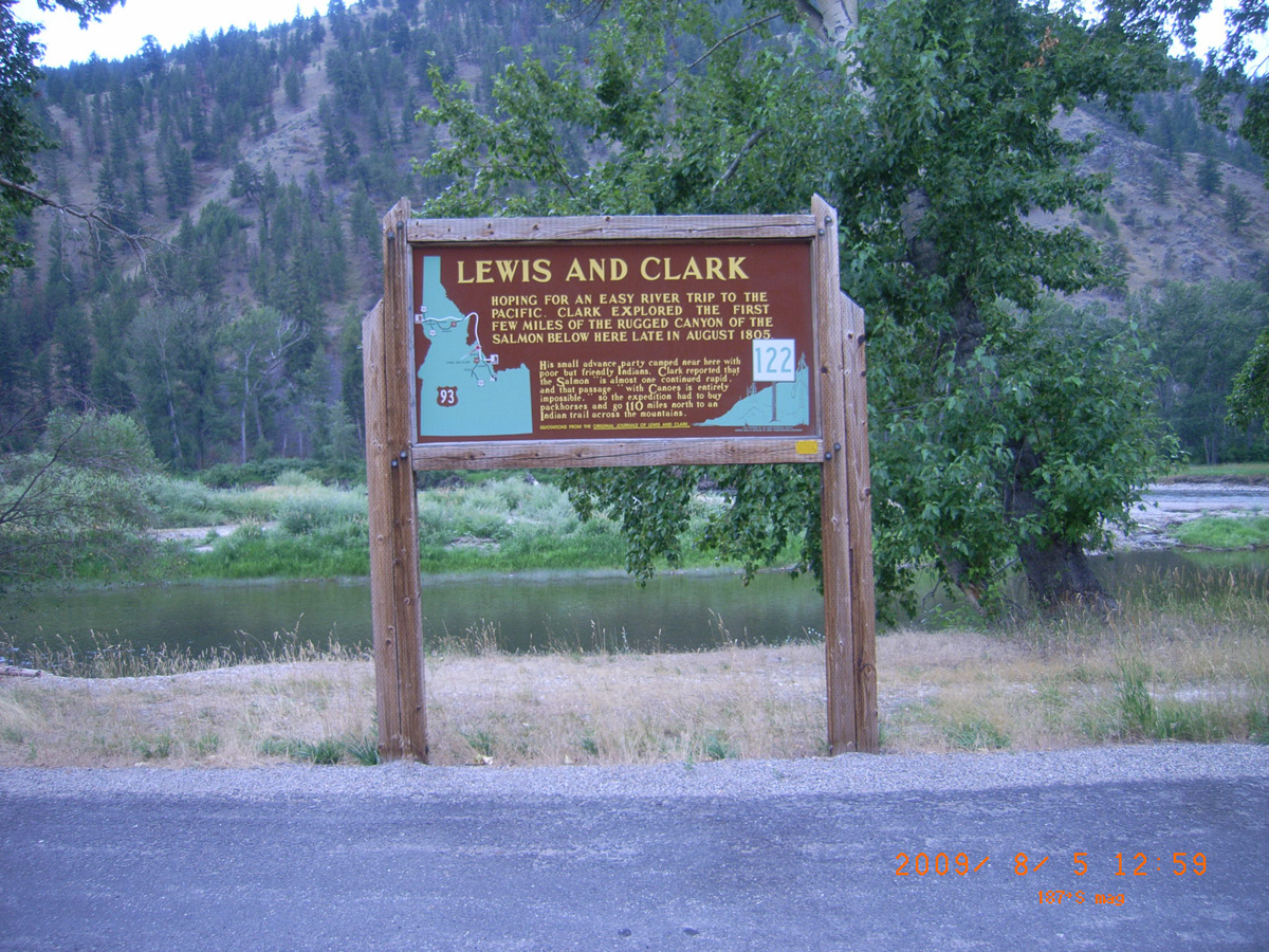
Tower Rock Recreation Site
Lemhi County, Idaho: 45.312331, -113.906025
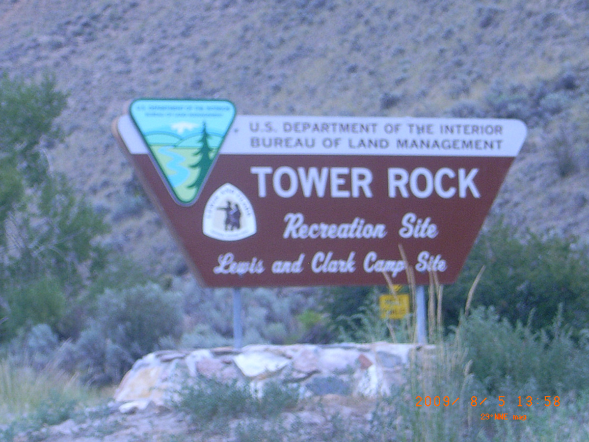
Tower Rock Recreation Site
- Date Assessed: 2009-08-05
- File Name: RIMG0080.JPG
- Folder: C05AugustCam2
- Camera Direction: 154°
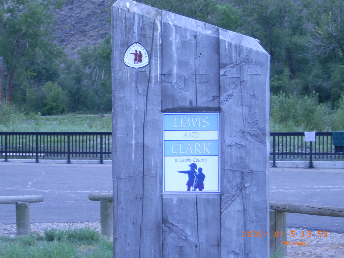
Lewis and Clark in Lemhi County
- Date Assessed: 2009-08-05
- File Name: RIMG0081.JPG
- Folder: C05AugustCam2
- Camera Direction: 208°
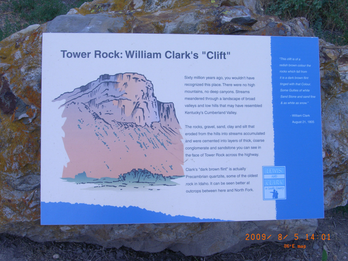
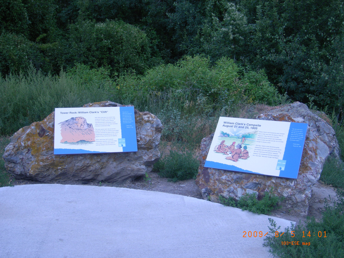
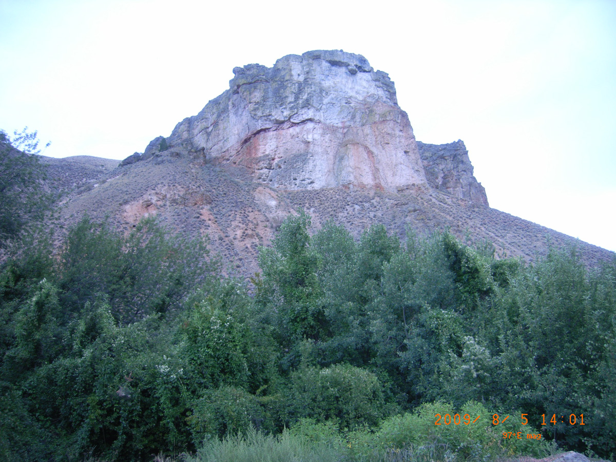
Tower Rock: William Clark's 'Clift'
- Date Assessed: 2009-08-05
- File Name: RIMG0082.JPG
- Folder: C05AugustCam2
- Camera Direction: 207°
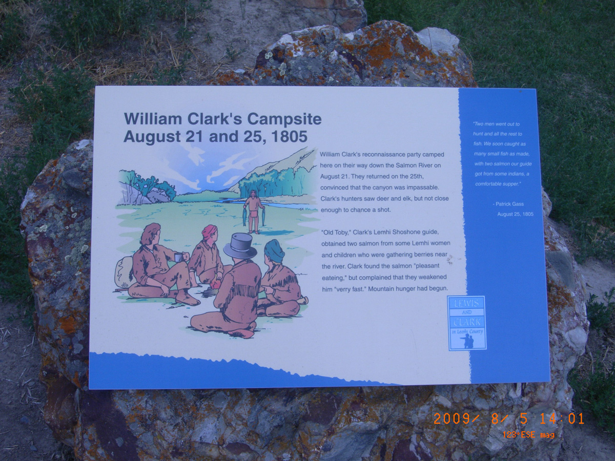
William Clark's Campsite August 21 and 25, 1805
- Date Assessed: 2009-08-05
- File Name: RIMG0083.JPG
- Folder: C05AugustCam2
- Camera Direction: 151°
- Date Assessed: 2009-08-05
- File Name: RIMG0084.JPG
- Folder: C05AugustCam2
- Camera Direction: 179°
- Date Assessed: 2009-08-05
- File Name: RIMG0085.JPG
- Folder: C05AugustCam2
- Camera Direction: 180°
- Date Assessed: 2009-08-05
- File Name: RIMG0086.JPG
- Folder: C05AugustCam2
- Camera Direction: 177°
- Date Assessed: 2009-08-05
- File Name: RIMG0087.JPG
- Folder: C05AugustCam2
- Camera Direction: 208°
- Date Assessed: 2009-08-05
- File Name: RIMG0088.JPG
- Folder: C05AugustCam2
- Camera Direction: 185°
- Date Assessed: 2009-08-05
- File Name: RIMG0089.JPG
- Folder: C05AugustCam2
- Camera Direction: 154°
- Date Assessed: 2009-08-05
- File Name: RIMG0090.JPG
- Folder: C05AugustCam2
- Camera Direction: 177°
- Date Assessed: 2009-08-05
- File Name: RIMG0091.JPG
- Folder: C05AugustCam2
- Camera Direction: 177°
- Date Assessed: 2009-08-05
- File Name: RIMG0092.JPG
- Folder: C05AugustCam2
- Camera Direction: 175°
- Date Assessed: 2009-08-05
- File Name: RIMG0093.JPG
- Folder: C05AugustCam2
- Camera Direction: 176°
- Date Assessed: 2009-08-05
- File Name: RIMG0094.JPG
- Folder: C05AugustCam2
- Camera Direction: 176°
- Date Assessed: 2009-08-05
- File Name: RIMG0095.JPG
- Folder: C05AugustCam2
- Camera Direction: 82°
- Date Assessed: 2009-08-05
- File Name: RIMG0096.JPG
- Folder: C05AugustCam2
- Camera Direction: 154°
- Date Assessed: 2009-08-05
- File Name: RIMG0097.JPG
- Folder: C05AugustCam2
- Camera Direction: 353°
- Date Assessed: 2009-08-05
- File Name: RIMG0098.JPG
- Folder: C05AugustCam2
- Camera Direction: 353°
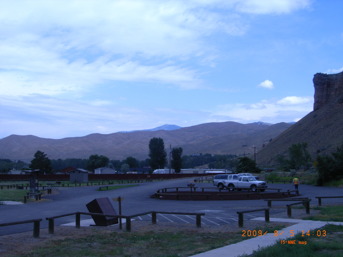
Withington Creek Camp, Lemhi valley
Lemhi County, Idaho: 45.092083, -113.723556
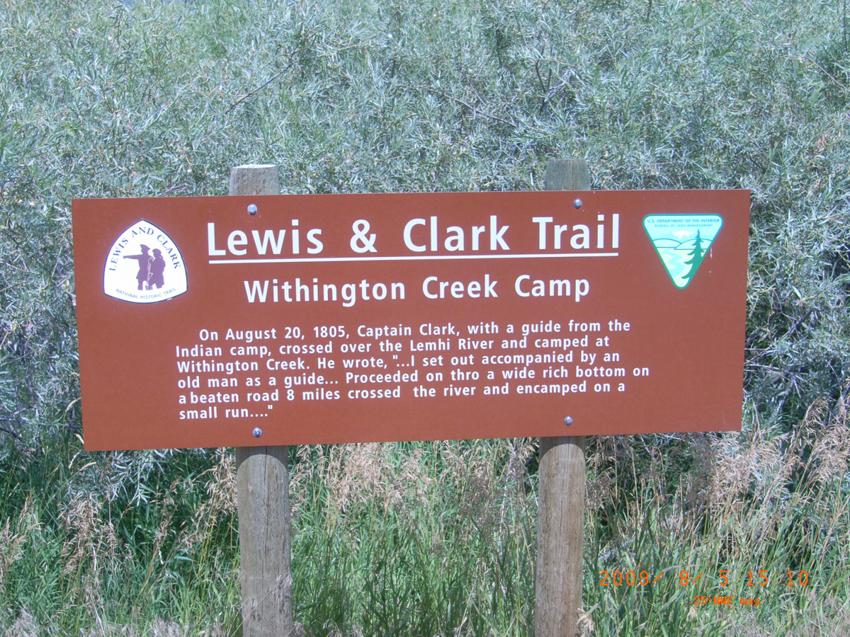
Lewis & Clark Trail: Withington Creek Camp
- Date Assessed: 2009-08-05
- File Name: RIMG0113.JPG
- Folder: C05AugustCam2
- Camera Direction: 197°
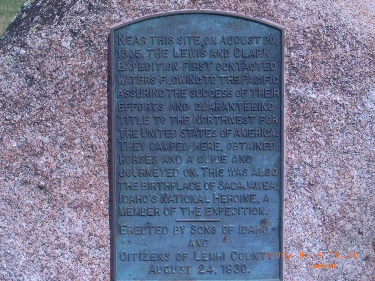
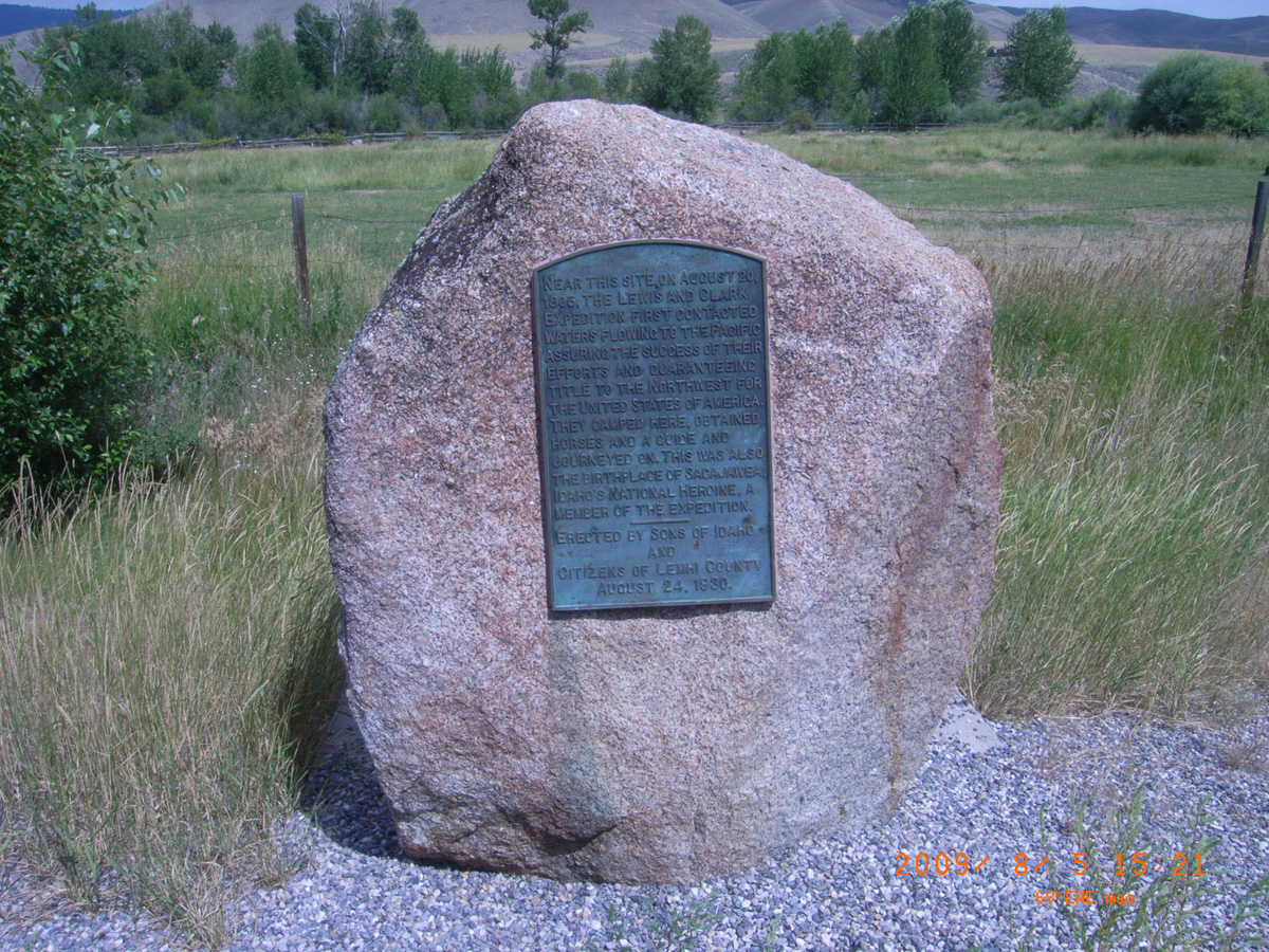
Near this site, on August 20, 1805 . . .
- Date Assessed: 2009-08-05
- File Name: RIMG0116.JPG
- Folder: C05AugustCam2
- Camera Direction: 210°
Near this site, on August 20, 1805 . . .
- Date Assessed: 2009-08-05
- File Name: RIMG0117.JPG
- Folder: C05AugustCam2
- Camera Direction: 157°
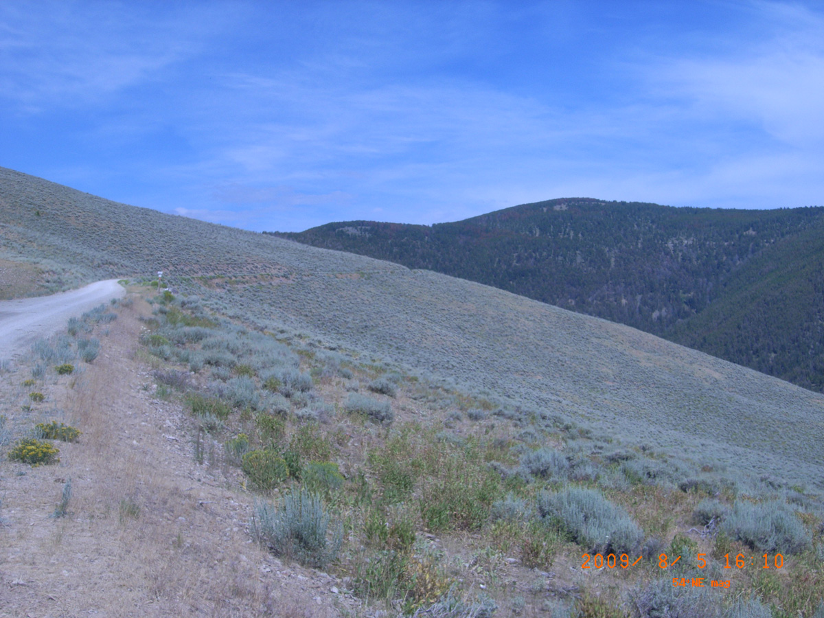
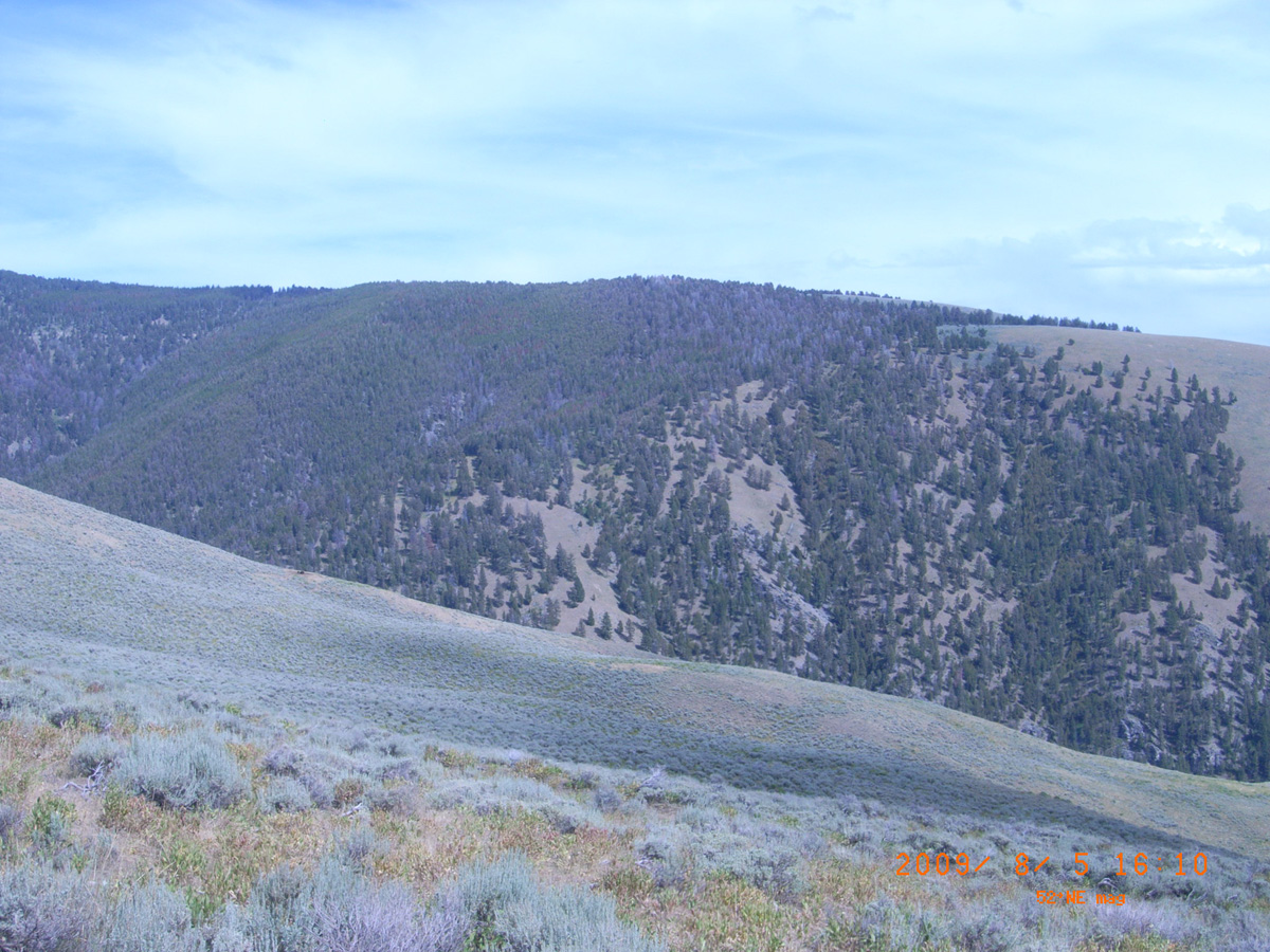
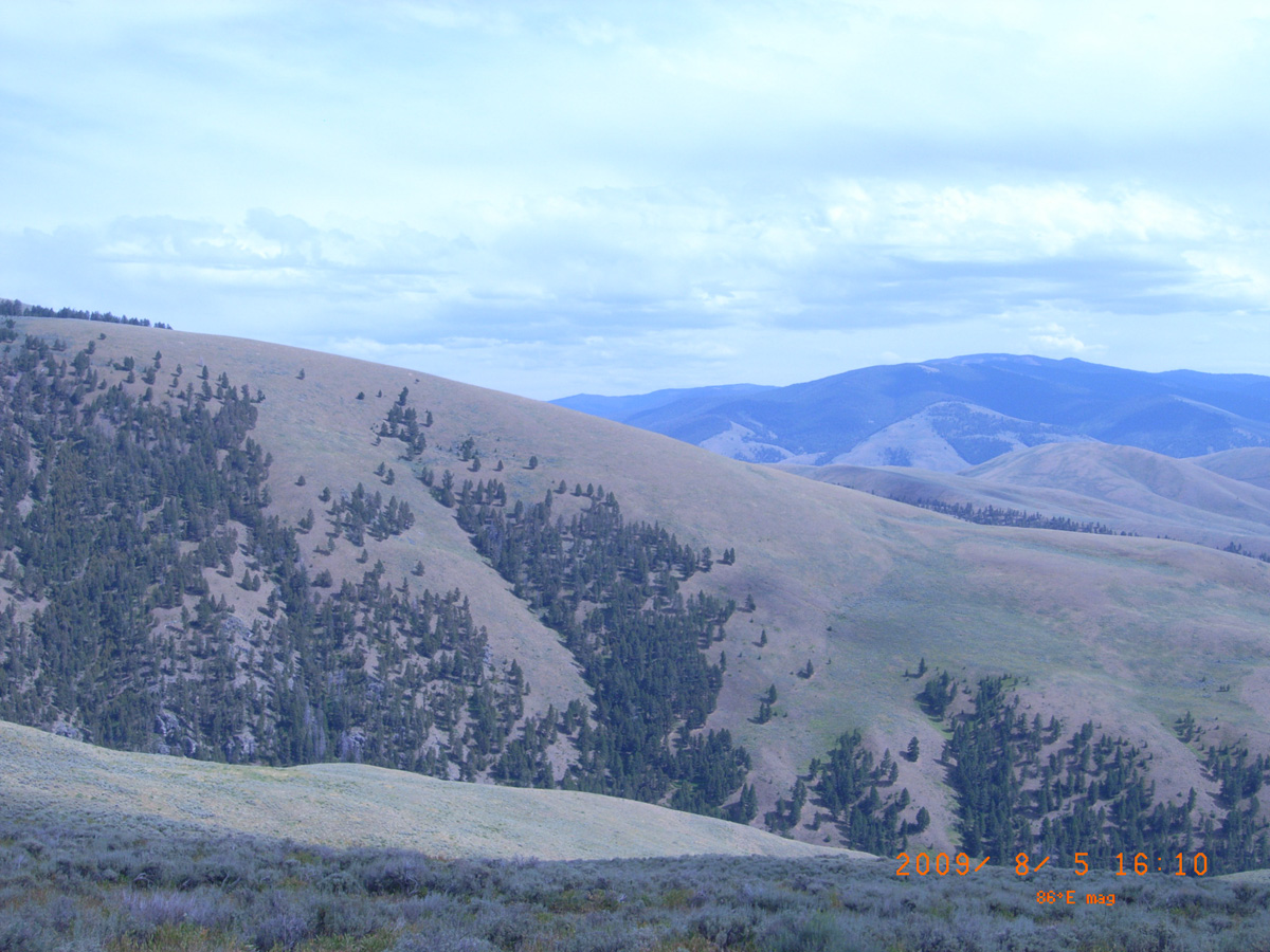
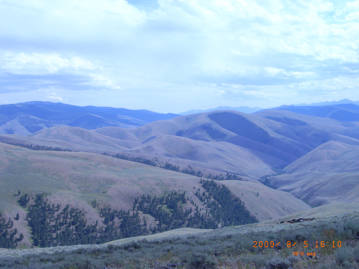
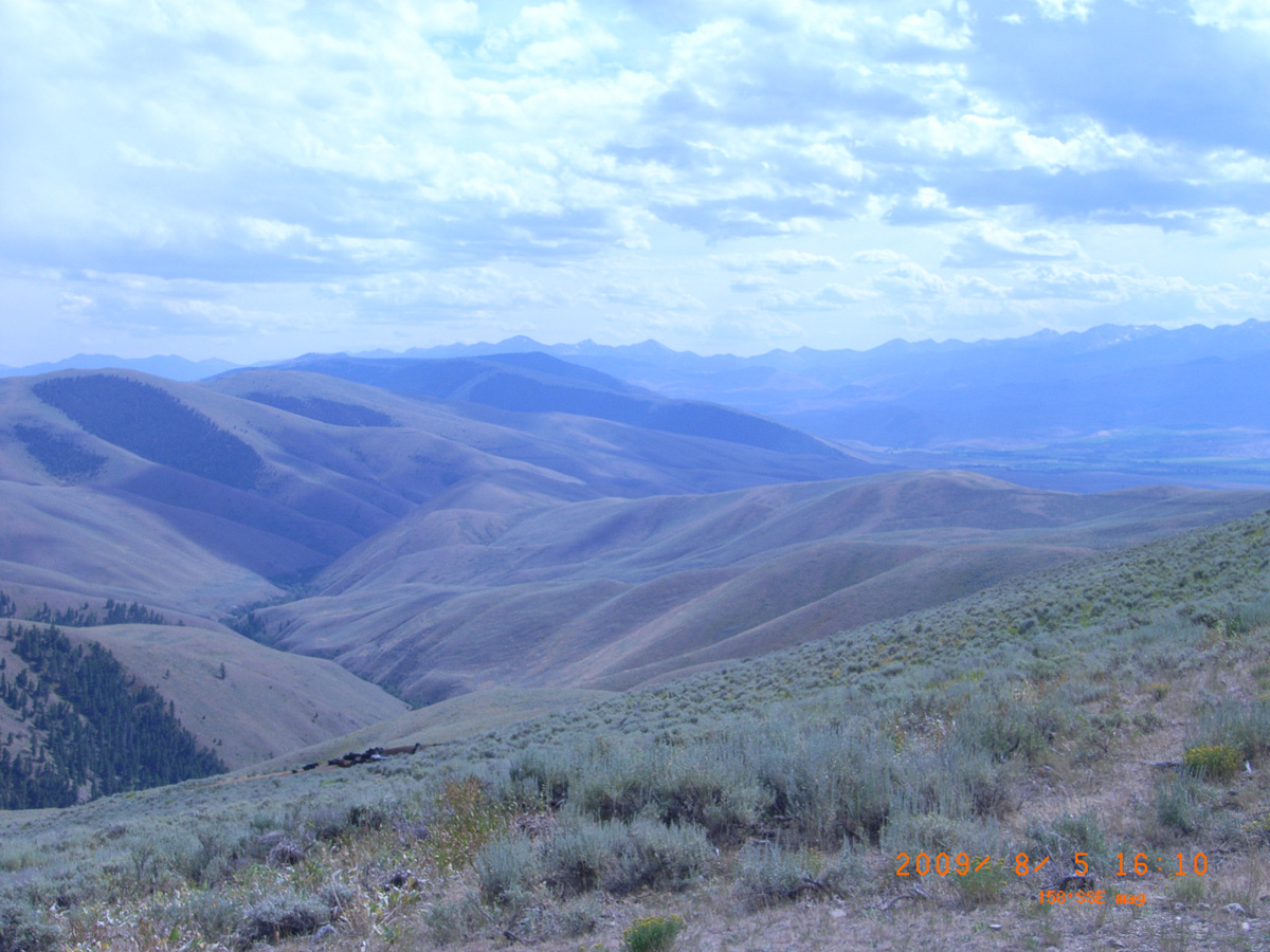
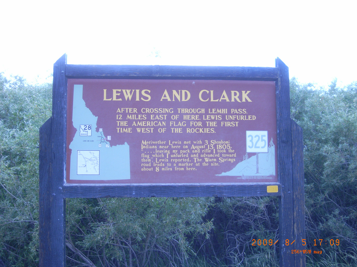
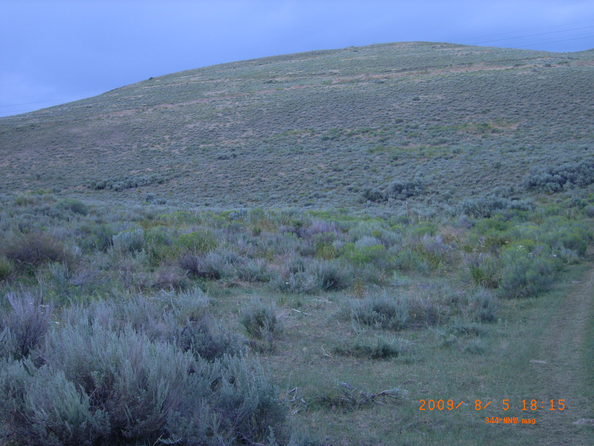
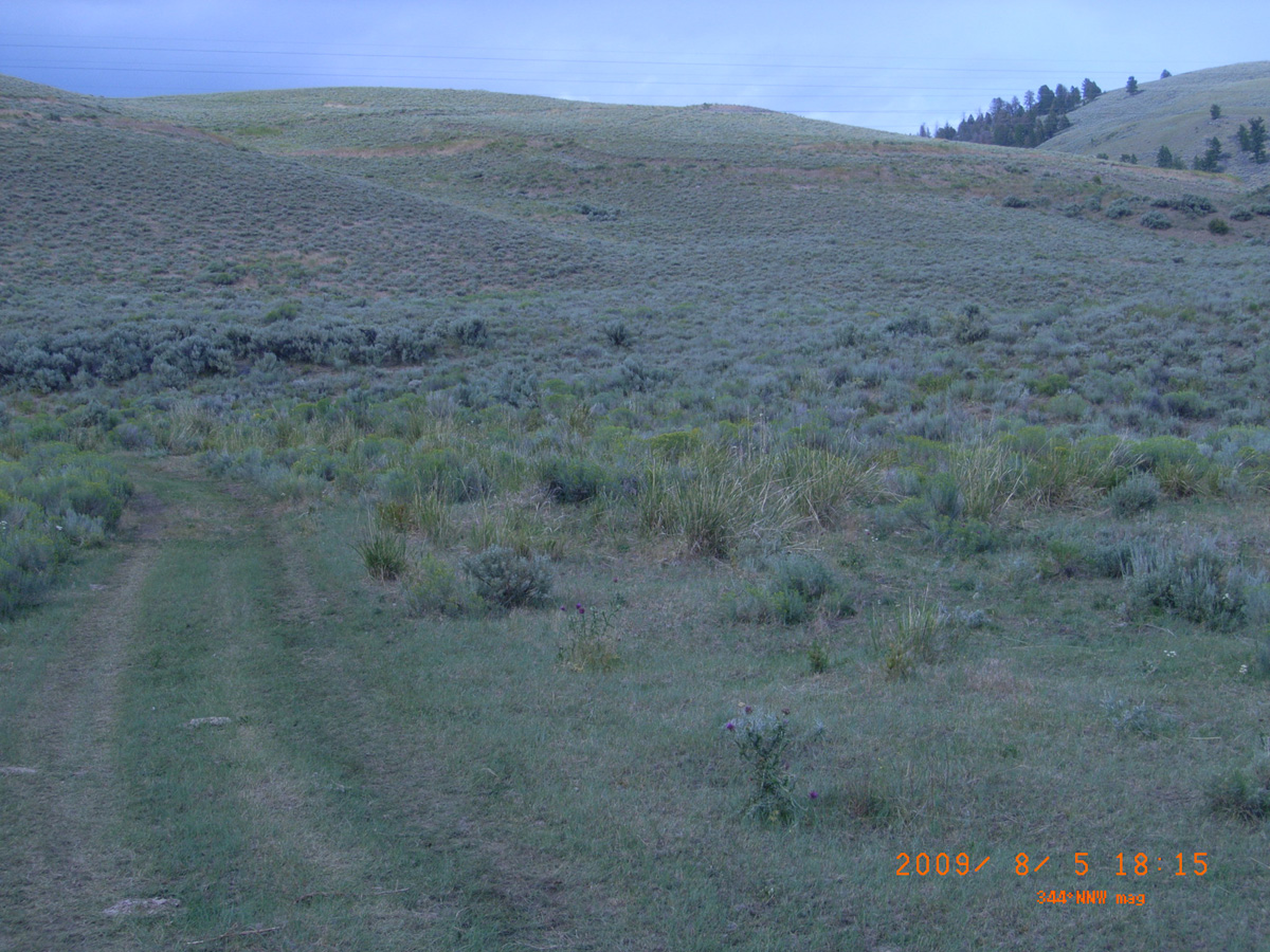
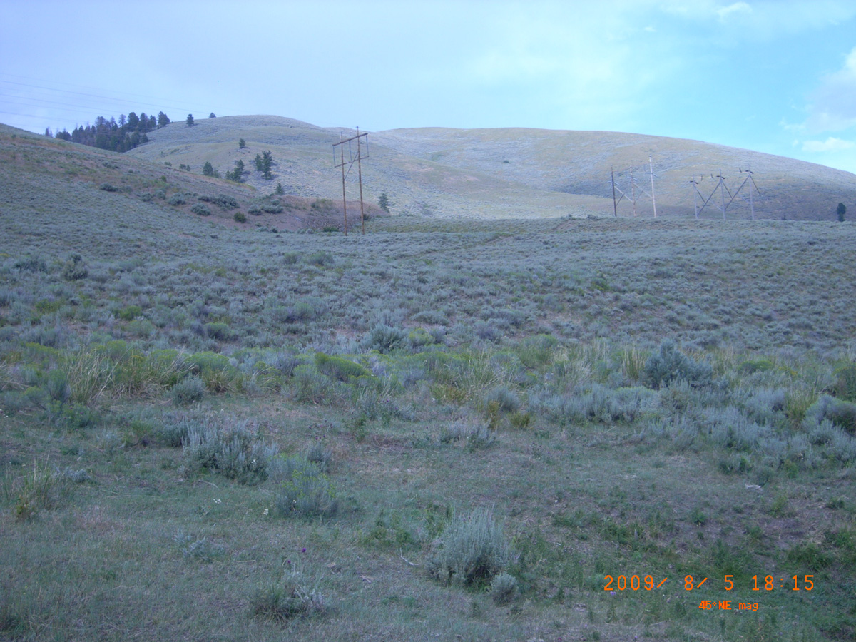
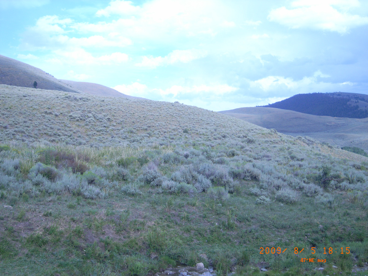
Lewis and Clark Backcountry Byway (Lemhi Pass)
Lemhi County, Idaho: 44.999617, -113.641458
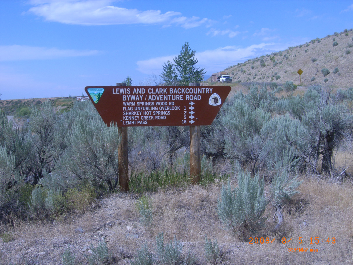
Lewis and Clark Backcountry Byway/Adventure Road
- Date Assessed: 2009-08-05
- File Name: RIMG0135.JPG
- Folder: C05AugustCam2
- Camera Direction: 139°
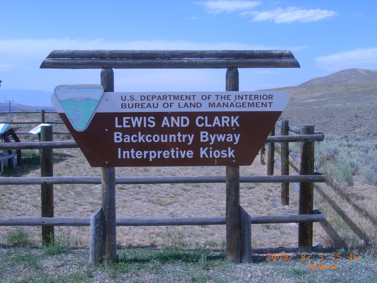
Lewis and Clark Backcountry Byway Interpretive Kiosk
- Date Assessed: 2009-08-05
- File Name: RIMG0136.JPG
- Folder: C05AugustCam2
- Camera Direction: 137°
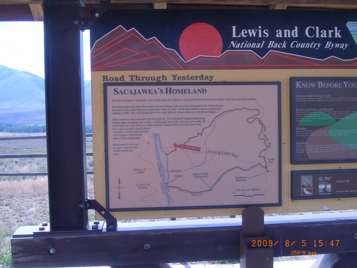
Road Through Yesterday
- Date Assessed: 2009-08-05
- File Name: RIMG0137.JPG
- Folder: C05AugustCam2
- Camera Direction: 155°
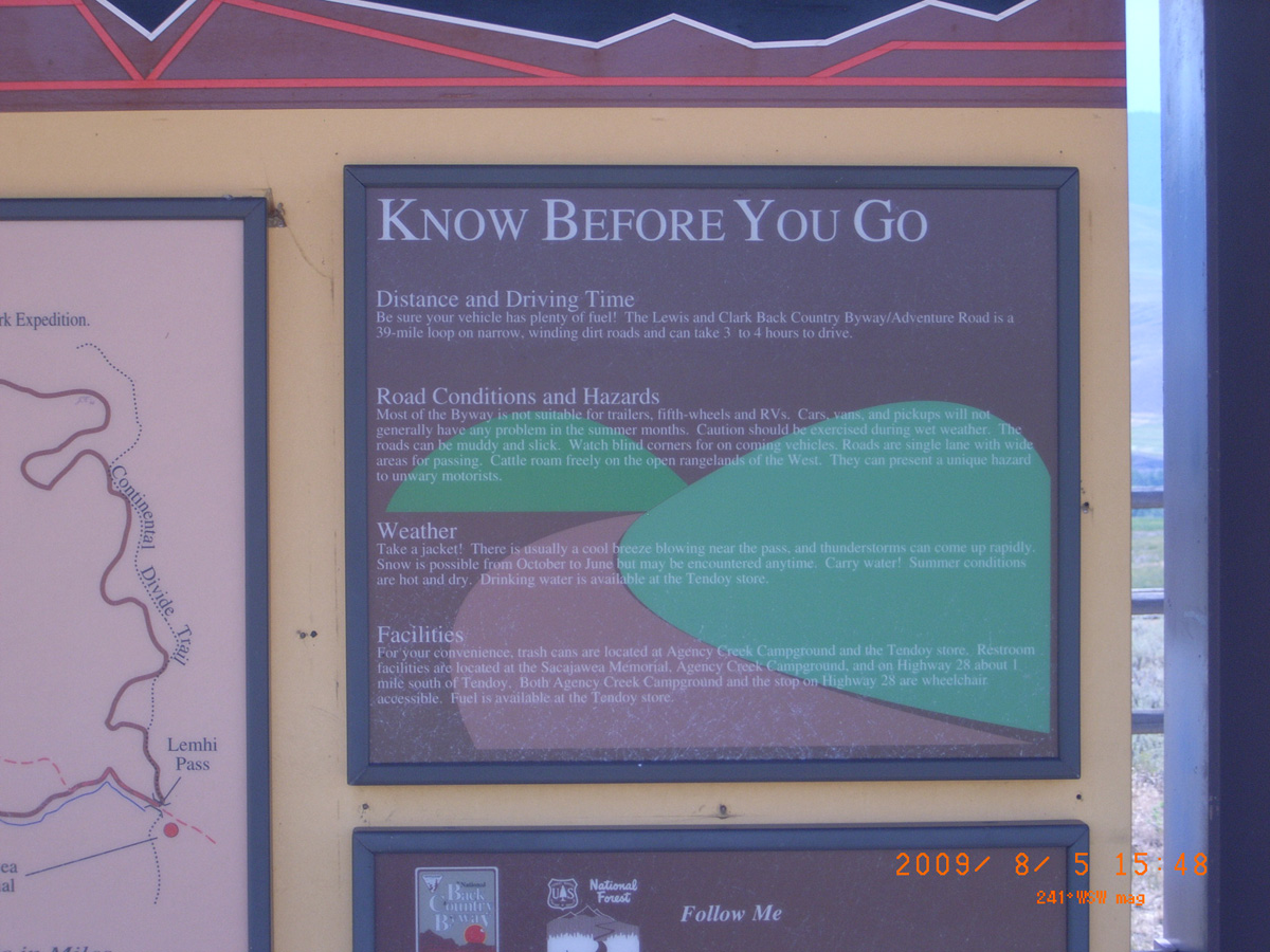
Know Before You Go
- Date Assessed: 2009-08-05
- File Name: RIMG0138.JPG
- Folder: C05AugustCam2
- Camera Direction: 160°
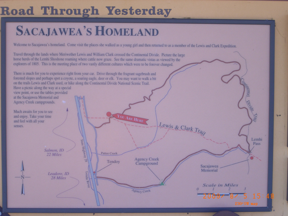
Sacajawea's Homeland
- Date Assessed: 2009-08-05
- File Name: RIMG0139.JPG
- Folder: C05AugustCam2
- Camera Direction: 197°
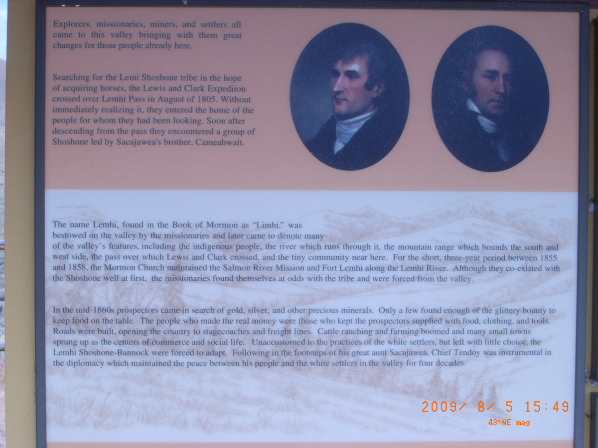
Explorers, missionaries, miners, and settlers all came . . .
- Date Assessed: 2009-08-05
- File Name: RIMG0140.JPG
- Folder: C05AugustCam2
- Camera Direction: 349°
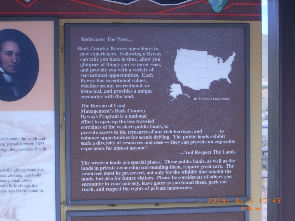
Rediscover the West . . .
- Date Assessed: 2009-08-05
- File Name: RIMG0141.JPG
- Folder: C05AugustCam2
- Camera Direction: 175°
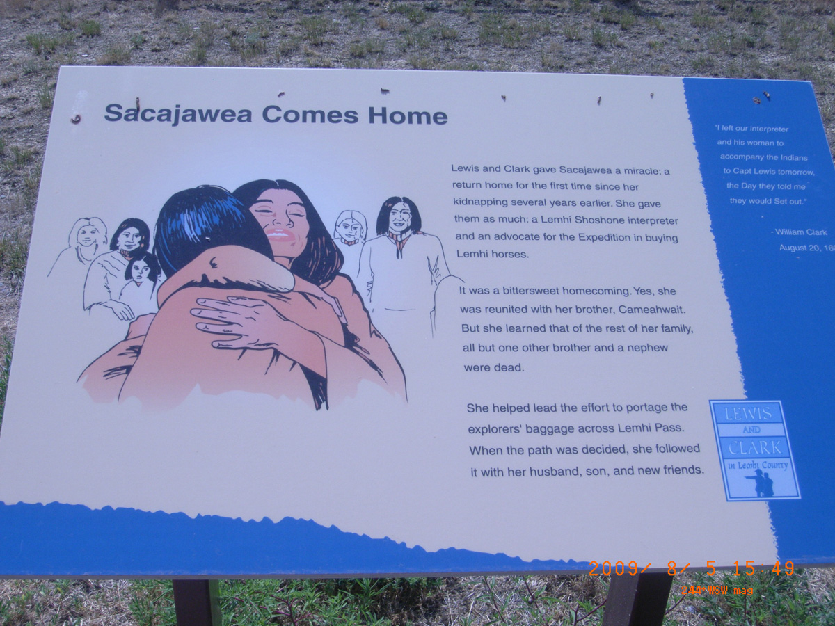
Sacajawea Comes Home
- Date Assessed: 2009-08-05
- File Name: RIMG0142.JPG
- Folder: C05AugustCam2
- Camera Direction: 172°
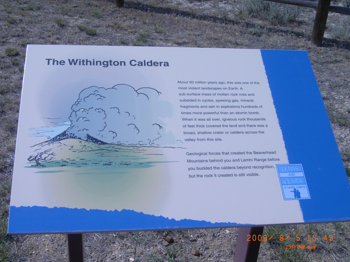
The Withington Caldera
- Date Assessed: 2009-08-05
- File Name: RIMG0143.JPG
- Folder: C05AugustCam2
- Camera Direction: 189°
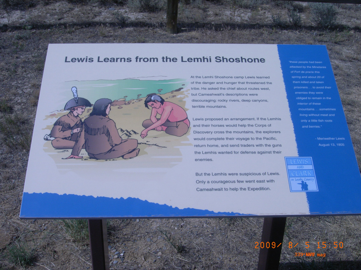
Lewis Learns from the Lemhi Shoshone
- Date Assessed: 2009-08-05
- File Name: RIMG0144.JPG
- Folder: C05AugustCam2
- Camera Direction: 154°
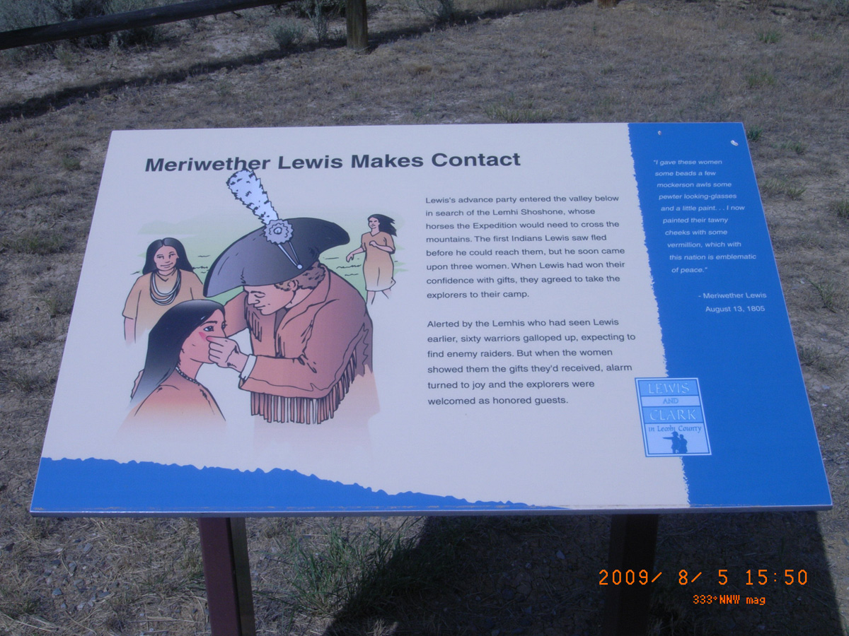
Meriwether Lewis Makes Contact
- Date Assessed: 2009-08-05
- File Name: RIMG0145.JPG
- Folder: C05AugustCam2
- Camera Direction: 179°
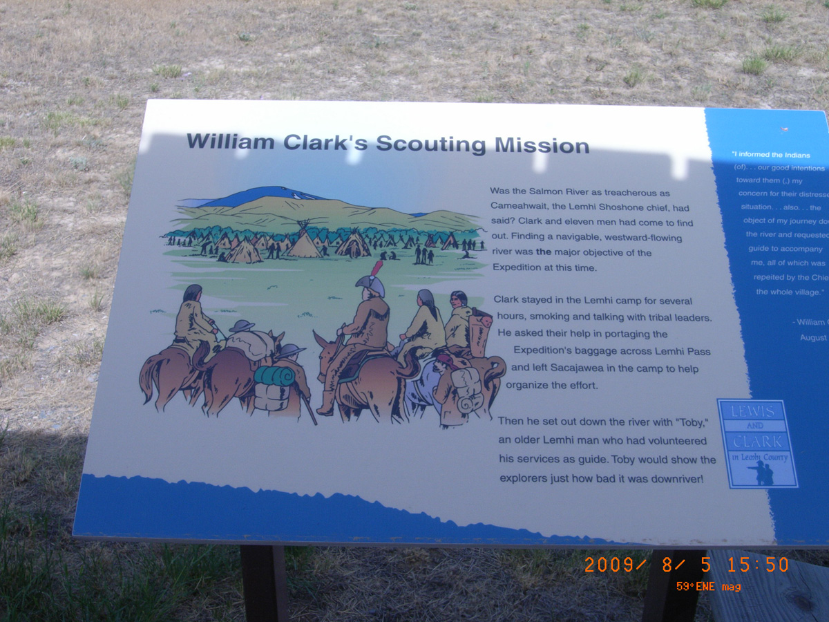
William Clark's Scouting Mission
- Date Assessed: 2009-08-05
- File Name: RIMG0146.JPG
- Folder: C05AugustCam2
- Camera Direction: 179°
- Date Assessed: 2009-08-05
- File Name: RIMG0147.JPG
- Folder: C05AugustCam2
- Camera Direction: 169°
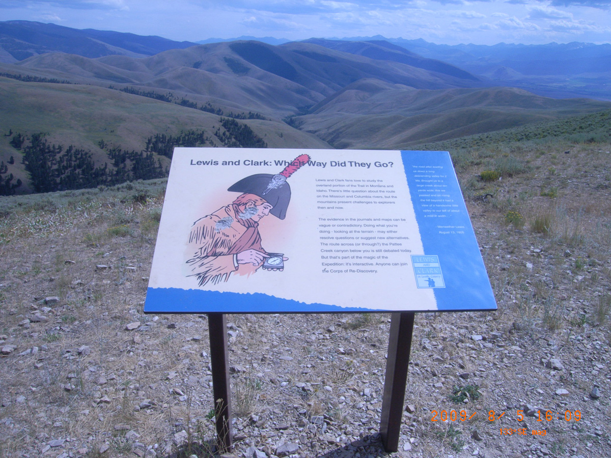
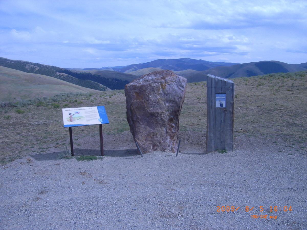
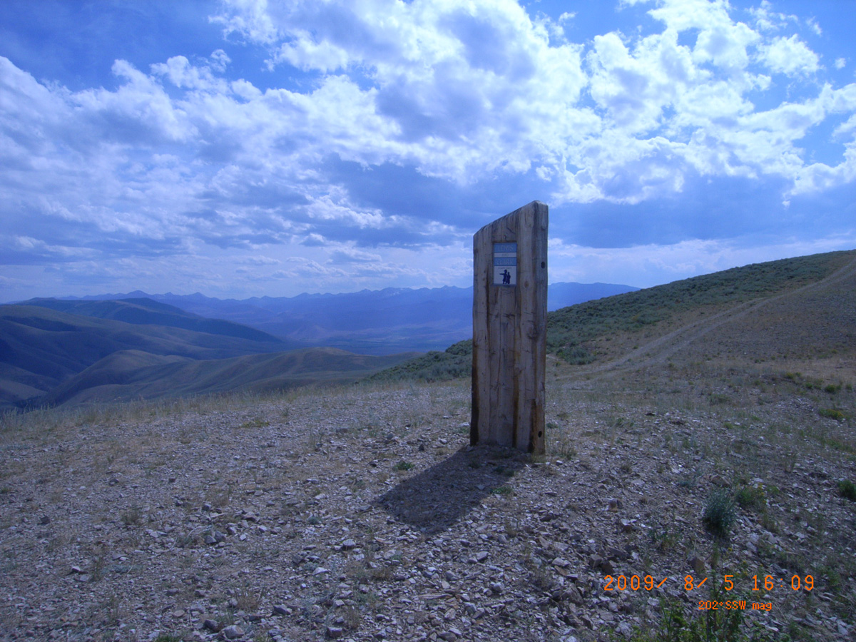
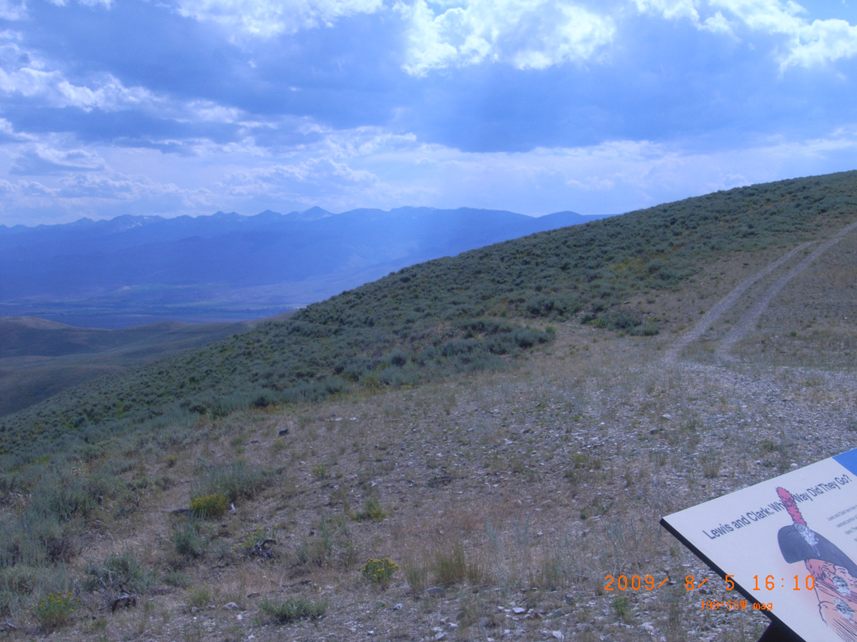
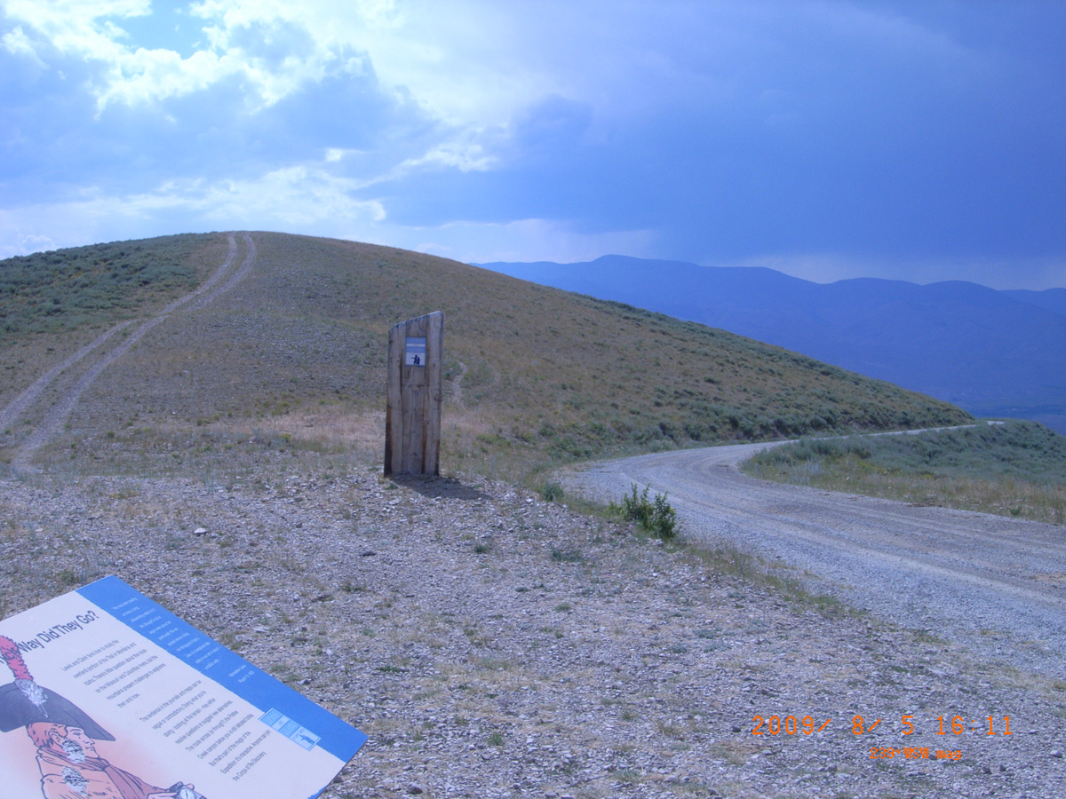
Lewis and Clark: Which Way Did They Go?
- Date Assessed: 2009-08-05
- File Name: RIMG0148.JPG
- Folder: C05AugustCam2
- Camera Direction: 165°
- Date Assessed: 2009-08-05
- File Name: RIMG0149.JPG
- Folder: C05AugustCam2
- Camera Direction: 164°
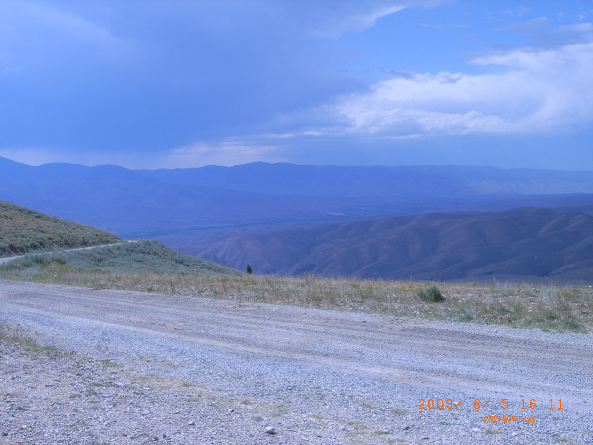
- Date Assessed: 2009-08-05
- File Name: RIMG0150.JPG
- Folder: C05AugustCam2
- Camera Direction: 211°
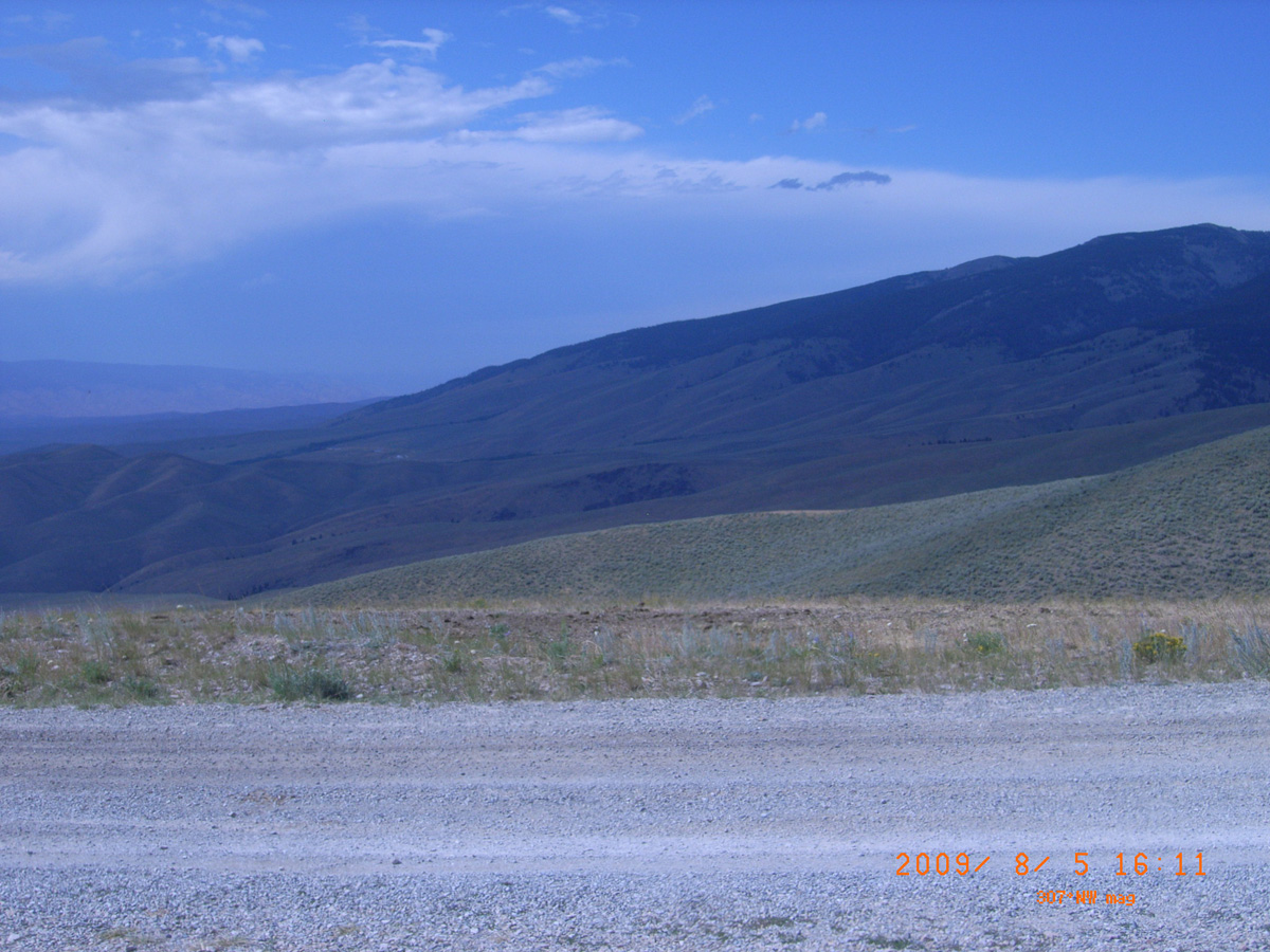
- Date Assessed: 2009-08-05
- File Name: RIMG0151.JPG
- Folder: C05AugustCam2
- Camera Direction: 203°
- Date Assessed: 2009-08-05
- File Name: RIMG0152.JPG
- Folder: C05AugustCam2
- Camera Direction: 149°
- Date Assessed: 2009-08-05
- File Name: RIMG0153.JPG
- Folder: C05AugustCam2
- Camera Direction: 181°
- Date Assessed: 2009-08-05
- File Name: RIMG0154.JPG
- Folder: C05AugustCam2
- Camera Direction: 186°
- Date Assessed: 2009-08-05
- File Name: RIMG0155.JPG
- Folder: C05AugustCam2
- Camera Direction: 177°
- Date Assessed: 2009-08-05
- File Name: RIMG0156.JPG
- Folder: C05AugustCam2
- Camera Direction: 209°
- Date Assessed: 2009-08-05
- File Name: RIMG0157.JPG
- Folder: C05AugustCam2
- Camera Direction: 170°
- Date Assessed: 2009-08-05
- File Name: RIMG0158.JPG
- Folder: C05AugustCam2
- Camera Direction: 168°
- Date Assessed: 2009-08-05
- File Name: RIMG0159.JPG
- Folder: C05AugustCam2
- Camera Direction: 178°
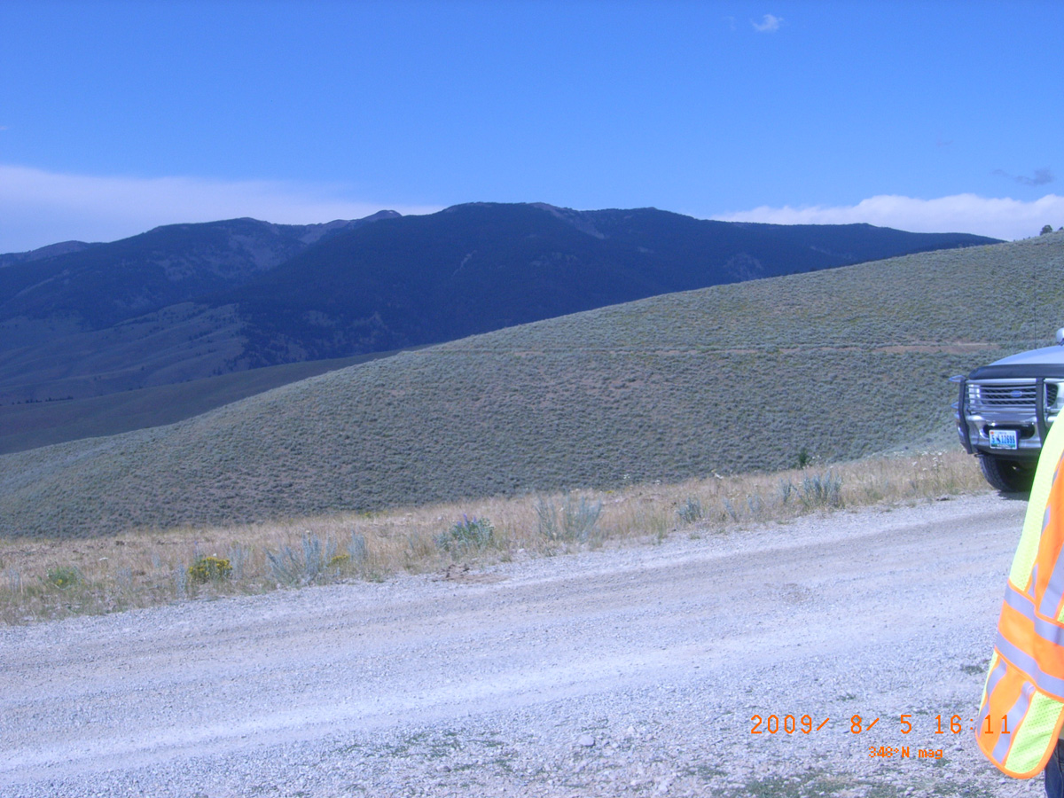
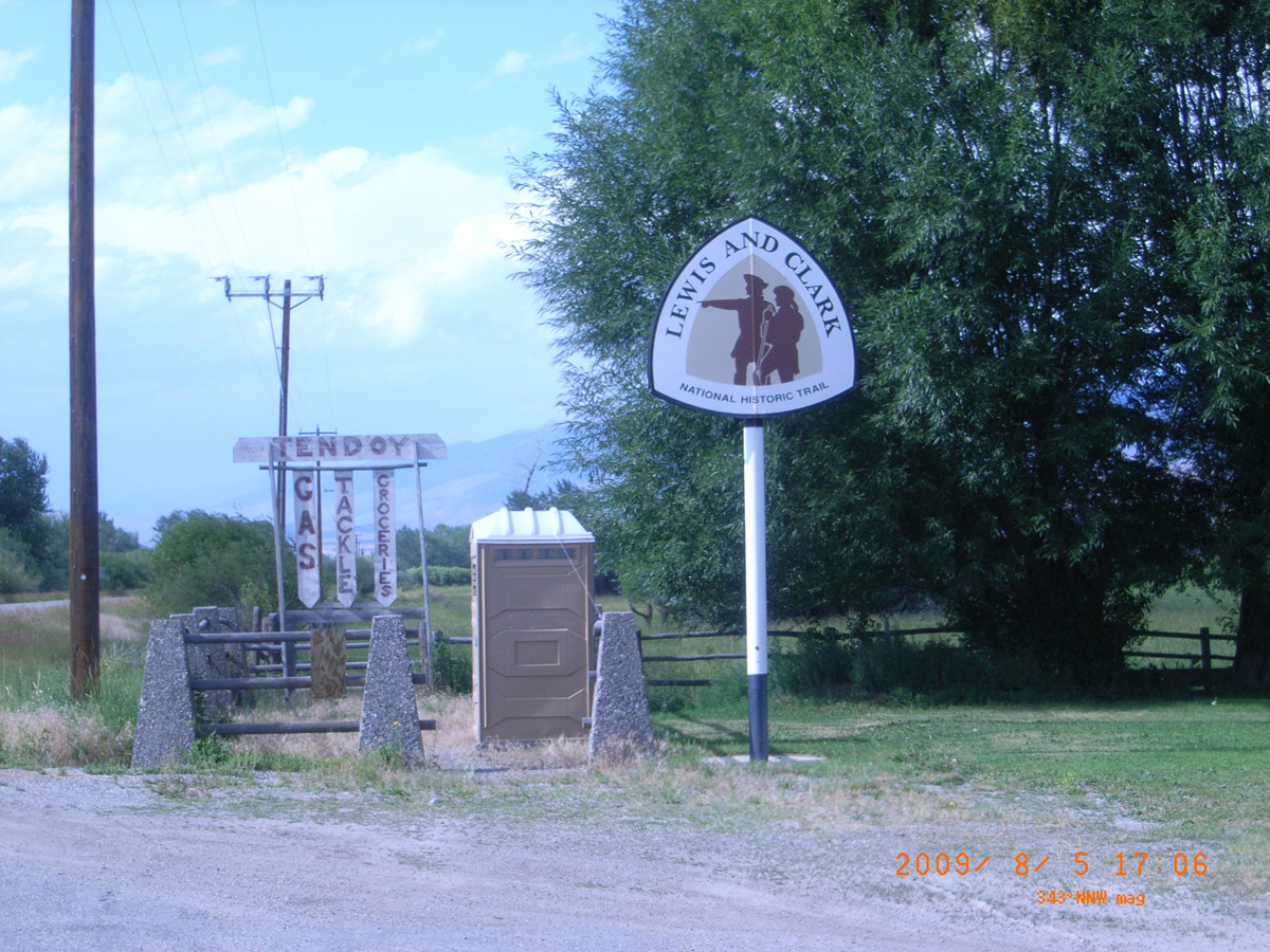
Tendoy
Lemhi County, Idaho: 44.959964, -113.644256
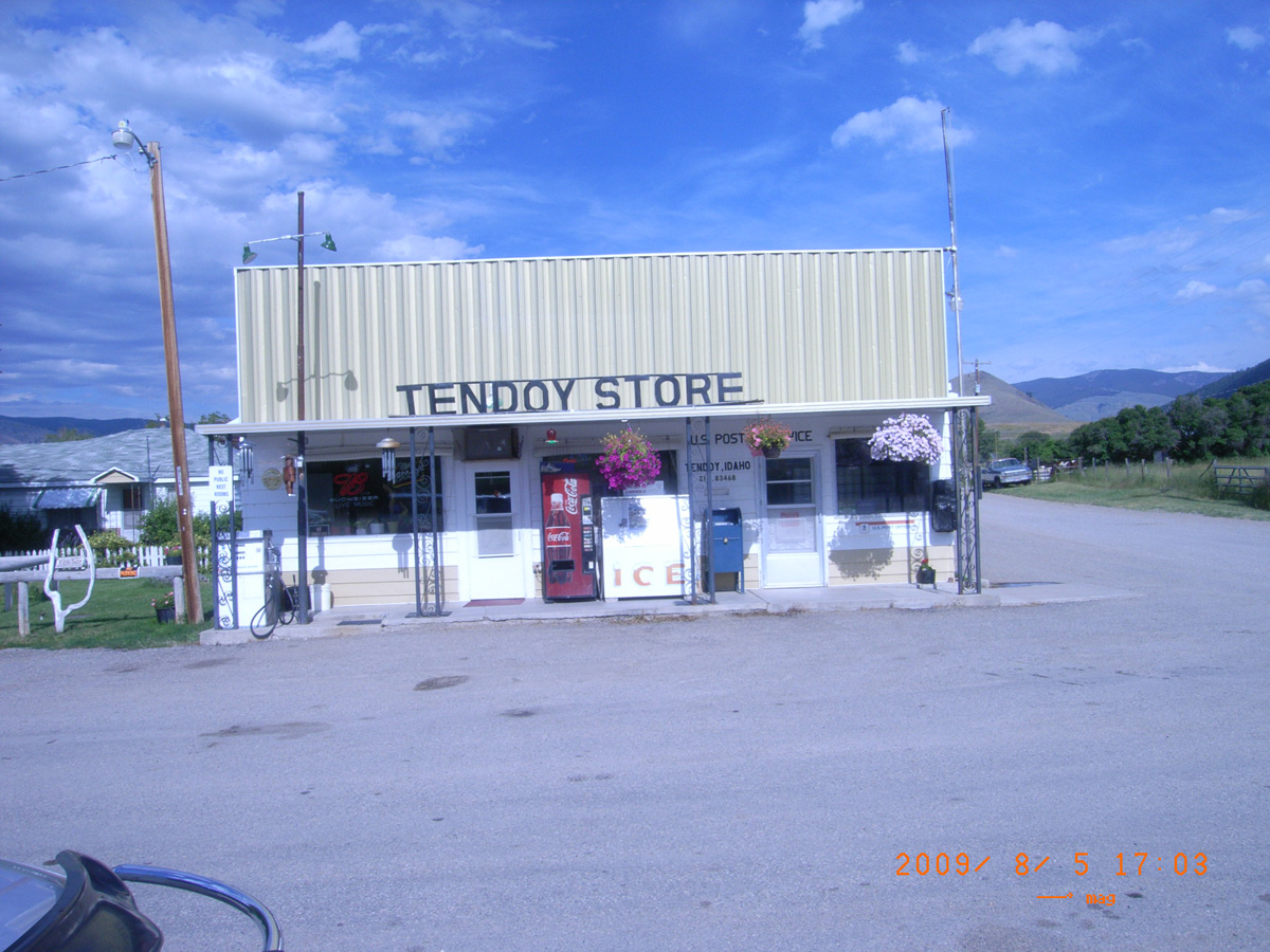
Tendoy Store
- Date Assessed: 2009-08-05
- File Name: RIMG0160.JPG
- Folder: C05AugustCam2
- Camera Direction: 178°
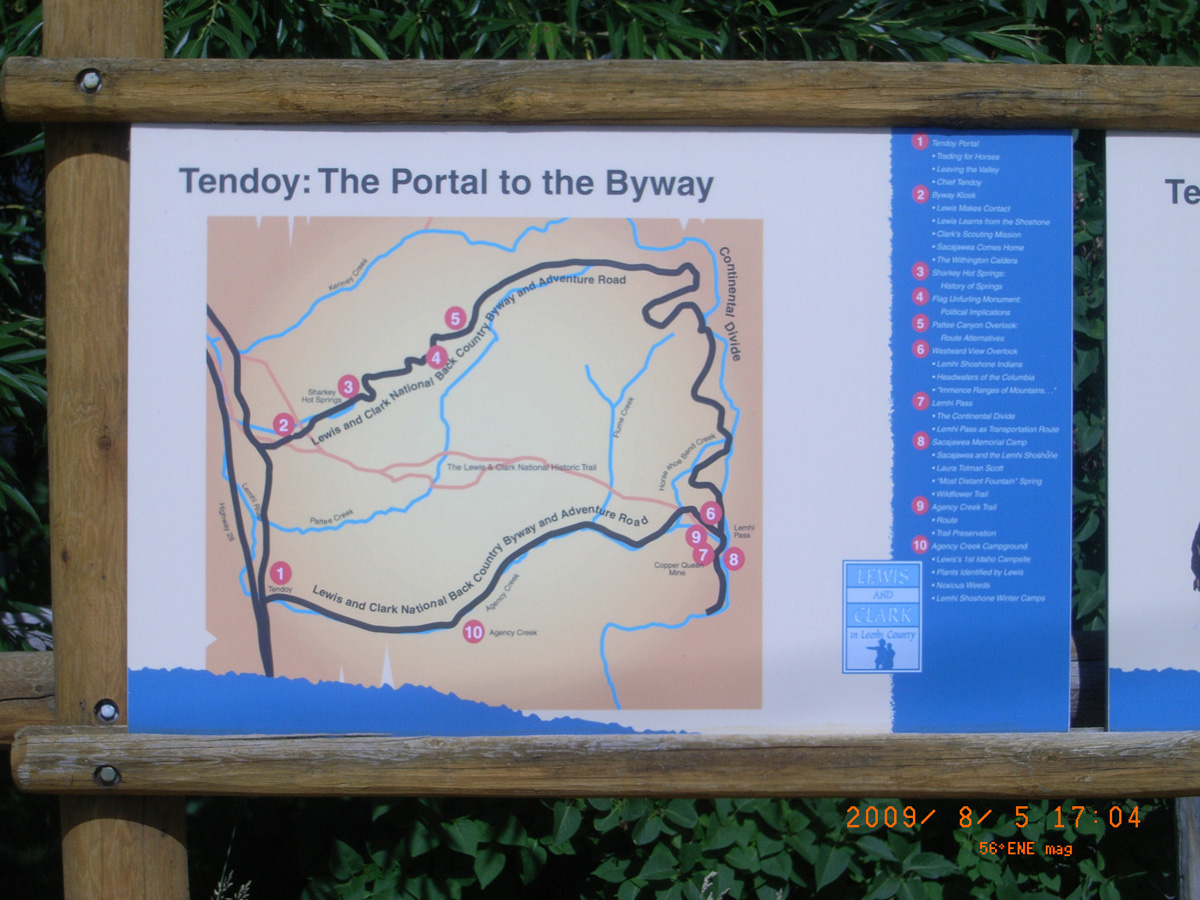
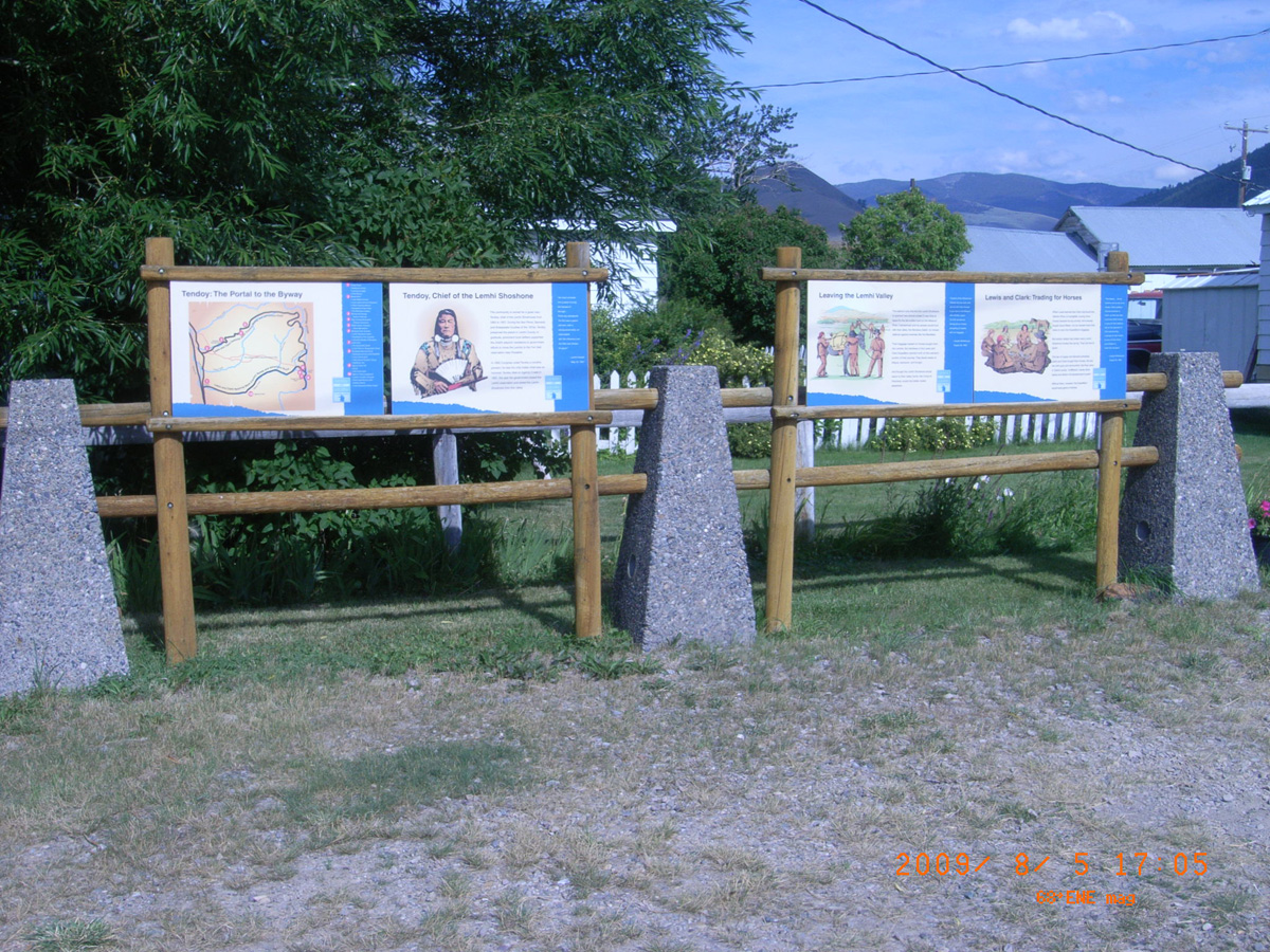
Tendoy: The Portal to the Byway
- Date Assessed: 2009-08-05
- File Name: RIMG0161.JPG
- Folder: C05AugustCam2
- Camera Direction: 155°
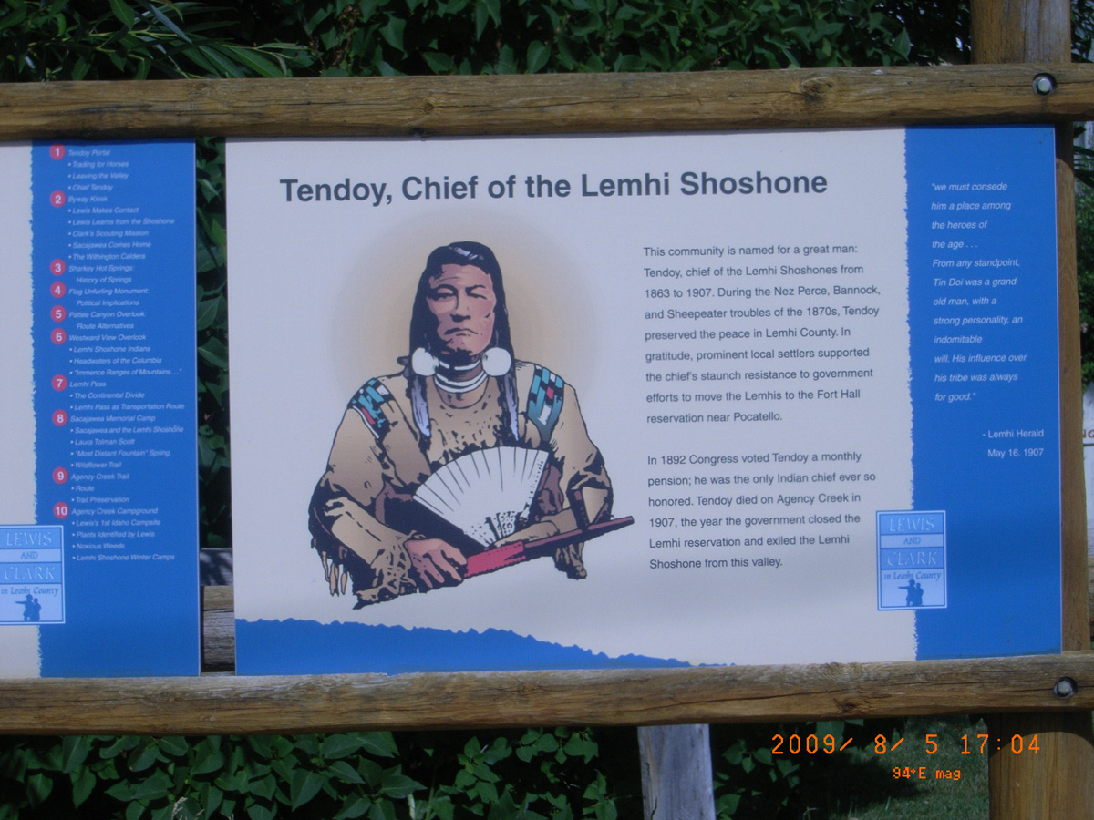
Tendoy, Chief of the Lemhi Shoshone
- Date Assessed: 2009-08-05
- File Name: RIMG0162.JPG
- Folder: C05AugustCam2
- Camera Direction: 177°
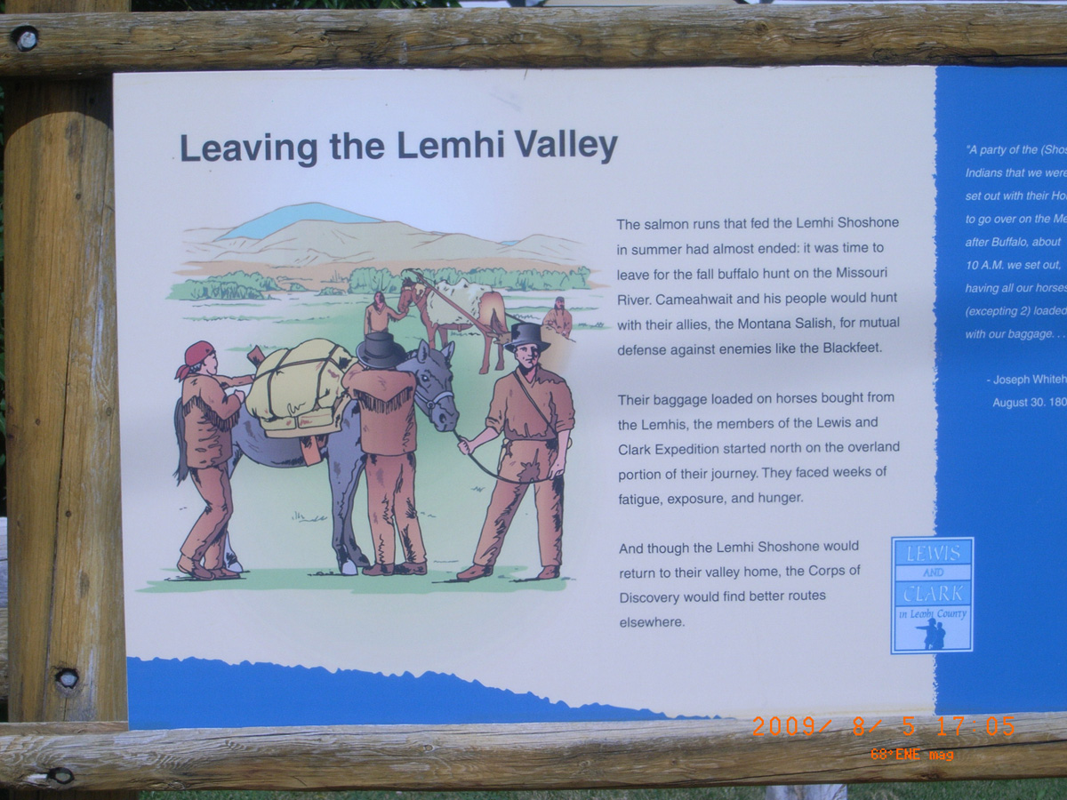
Leaving the Lemhi Valley
- Date Assessed: 2009-08-05
- File Name: RIMG0163.JPG
- Folder: C05AugustCam2
- Camera Direction: 212°
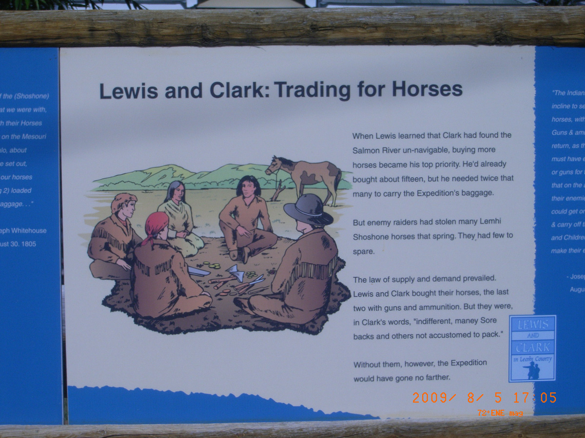
Lewis and Clark: Trading for Horses
- Date Assessed: 2009-08-05
- File Name: RIMG0164.JPG
- Folder: C05AugustCam2
- Camera Direction: 154°
- Date Assessed: 2009-08-05
- File Name: RIMG0165.JPG
- Folder: C05AugustCam2
- Camera Direction: 148°
- Date Assessed: 2009-08-05
- File Name: RIMG0166.JPG
- Folder: C05AugustCam2
- Camera Direction: 151°
Lewis and Clark
- Date Assessed: 2009-08-05
- File Name: RIMG0167.JPG
- Folder: C05AugustCam2
- Camera Direction: 204°
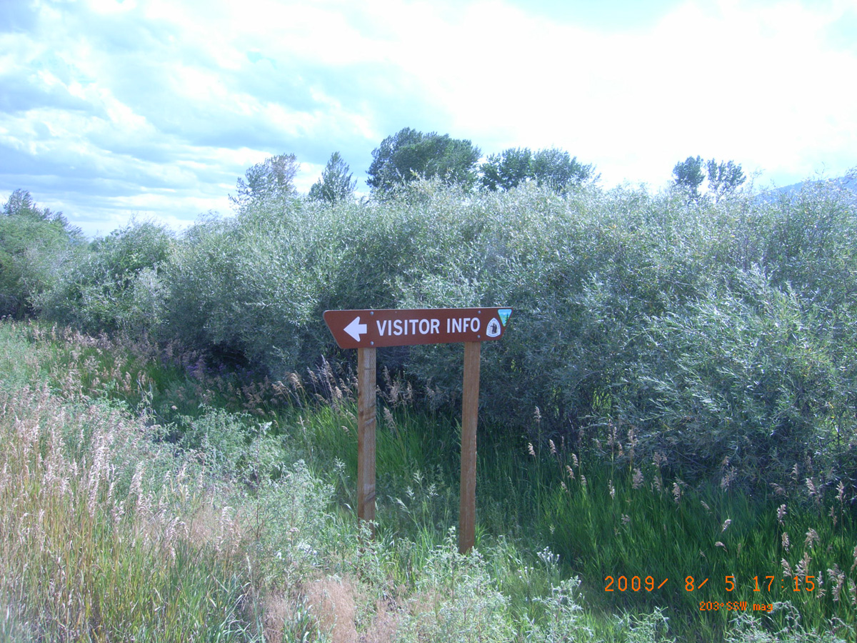
<-- Visitor Info
- Date Assessed: 2009-08-05
- File Name: RIMG0168.JPG
- Folder: C05AugustCam2
- Camera Direction: 184°
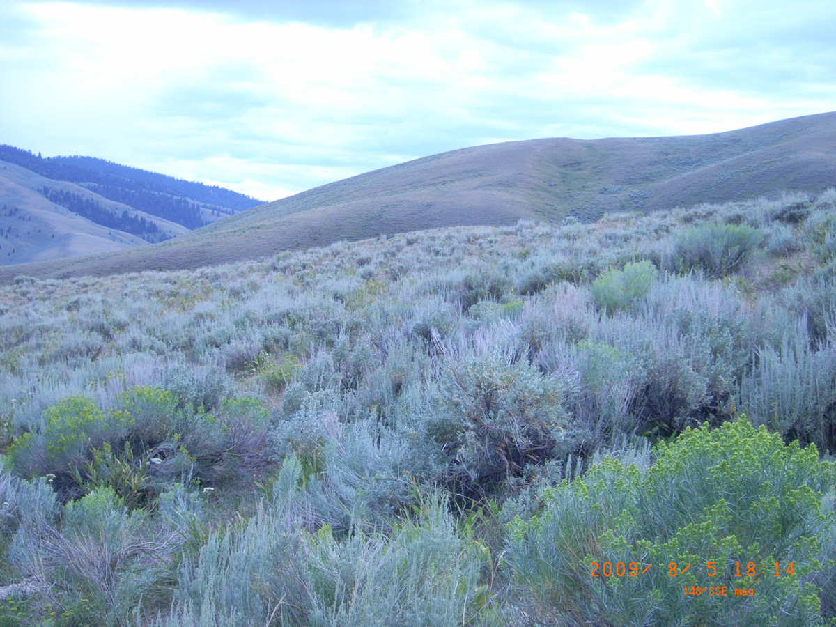
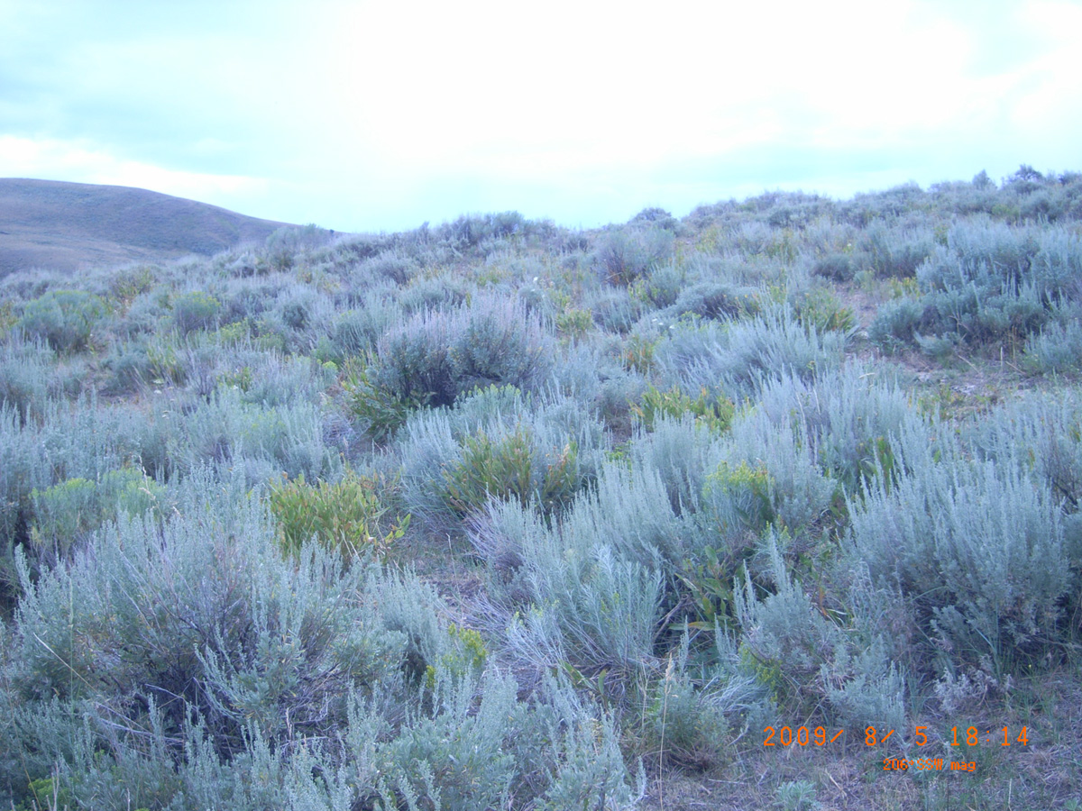
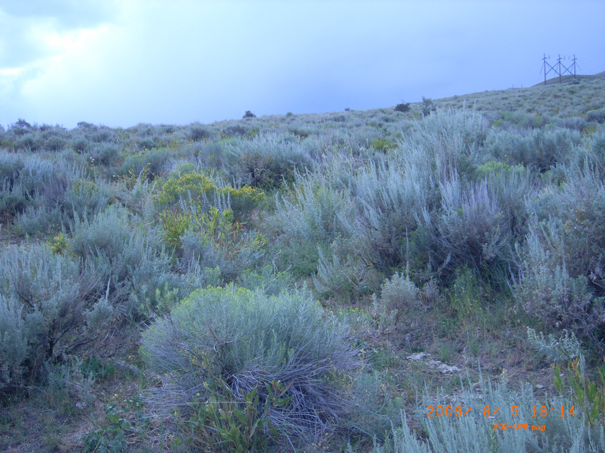
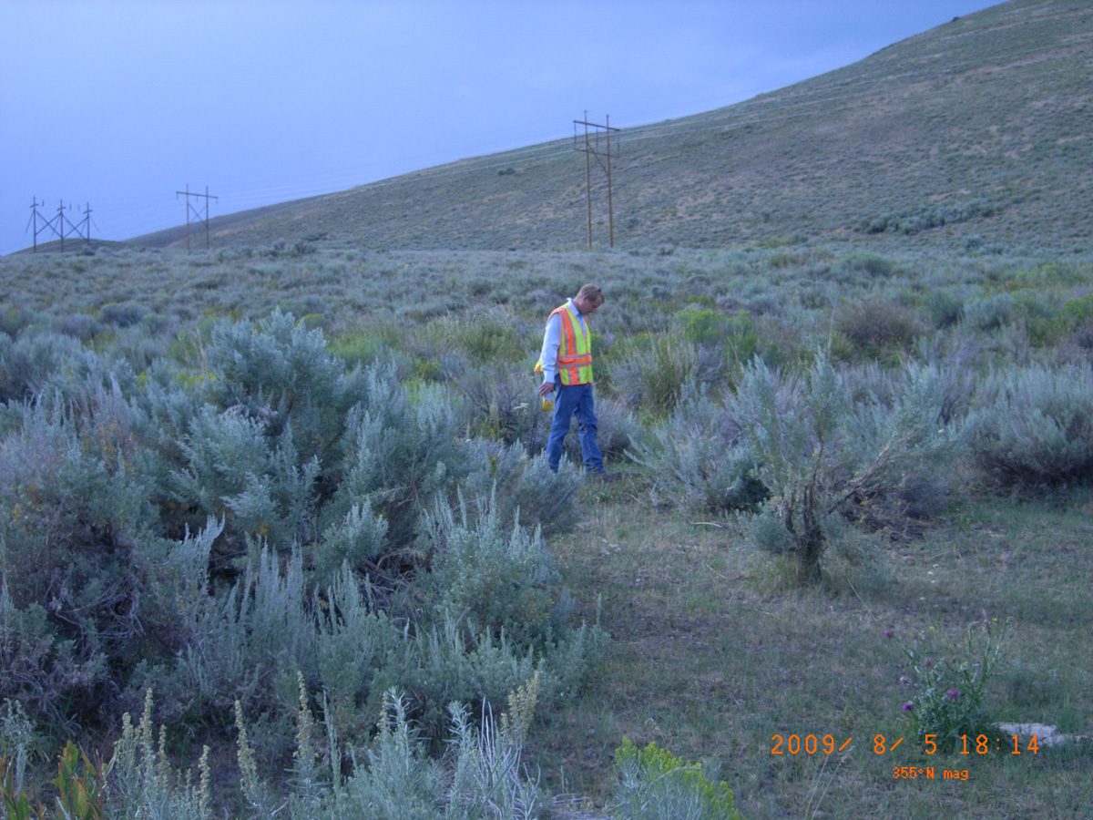
Agency Creek Campground (Lemhi Pass)
Lemhi County, Idaho: 44.950233, -113.558008
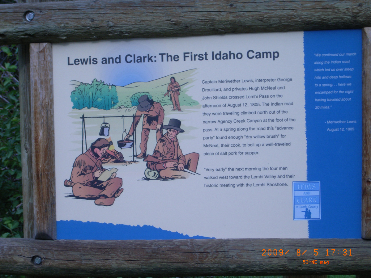
Lewis and Clark: The First Idaho Camp
- Date Assessed: 2009-08-05
- File Name: RIMG0178.JPG
- Folder: C05AugustCam2
- Camera Direction: 204°
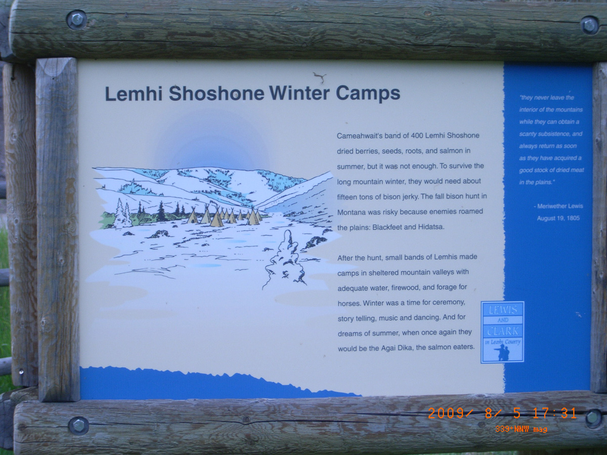
Lemhi Shoshone Winter Camps
- Date Assessed: 2009-08-05
- File Name: RIMG0179.JPG
- Folder: C05AugustCam2
- Camera Direction: 167°
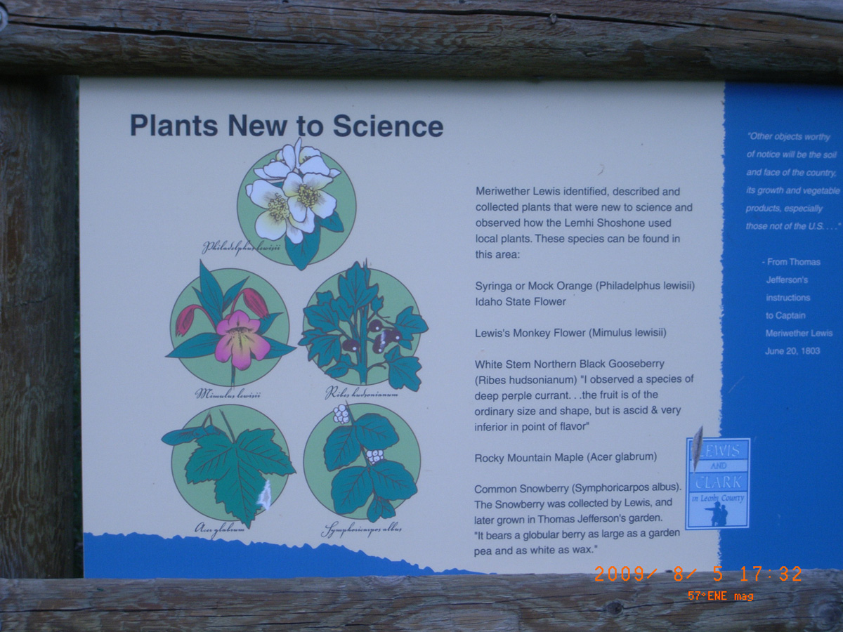
Plants New to Science
- Date Assessed: 2009-08-05
- File Name: RIMG0180.JPG
- Folder: C05AugustCam2
- Camera Direction: 165°
- Date Assessed: 2009-08-05
- File Name: RIMG0181.JPG
- Folder: C05AugustCam2
- Camera Direction: 163°
- Date Assessed: 2009-08-05
- File Name: RIMG0182.JPG
- Folder: C05AugustCam2
- Camera Direction: 163°
- Date Assessed: 2009-08-05
- File Name: RIMG0183.JPG
- Folder: C05AugustCam2
- Camera Direction: 21°
- Date Assessed: 2009-08-05
- File Name: RIMG0184.JPG
- Folder: C05AugustCam2
- Camera Direction: 86°
- Date Assessed: 2009-08-05
- File Name: RIMG0185.JPG
- Folder: C05AugustCam2
- Camera Direction: 247°
- Date Assessed: 2009-08-05
- File Name: RIMG0186.JPG
- Folder: C05AugustCam2
- Camera Direction: 247°
- Date Assessed: 2009-08-05
- File Name: RIMG0187.JPG
- Folder: C05AugustCam2
- Camera Direction: 217°
- Date Assessed: 2009-08-05
- File Name: RIMG0188.JPG
- Folder: C05AugustCam2
- Camera Direction: 336°
- Date Assessed: 2009-08-05
- File Name: RIMG0189.JPG
- Folder: C05AugustCam2
- Camera Direction: 336°
- Date Assessed: 2009-08-05
- File Name: RIMG0190.JPG
- Folder: C05AugustCam2
- Camera Direction: 336°
- Date Assessed: 2009-08-05
- File Name: RIMG0191.JPG
- Folder: C05AugustCam2
- Camera Direction: 303°
- Date Assessed: 2009-08-05
- File Name: RIMG0192.JPG
- Folder: C05AugustCam2
- Camera Direction: 304°
- Date Assessed: 2009-08-05
- File Name: RIMG0193.JPG
- Folder: C05AugustCam2
- Camera Direction: 257°
- Date Assessed: 2009-08-05
- File Name: RIMG0194.JPG
- Folder: C05AugustCam2
- Camera Direction: 257°
- Date Assessed: 2009-08-05
- File Name: RIMG0195.JPG
- Folder: C05AugustCam2
- Camera Direction: 77°
- Date Assessed: 2009-08-05
- File Name: RIMG0196.JPG
- Folder: C05AugustCam2
- Camera Direction: 77°

Flume Creek
- Date Assessed: 2009-08-05
- File Name: RIMG0197.JPG
- Folder: C05AugustCam2
- Camera Direction: 19°
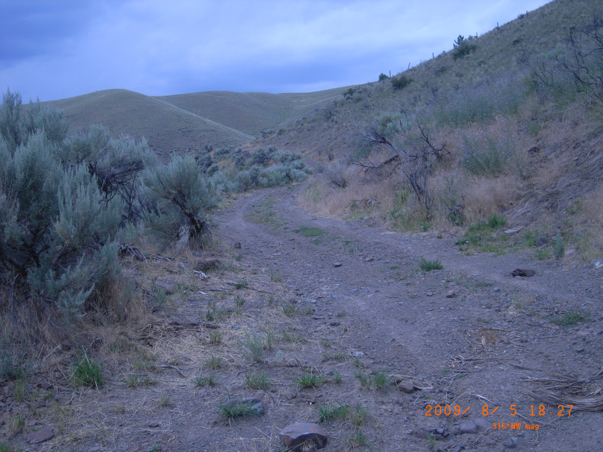
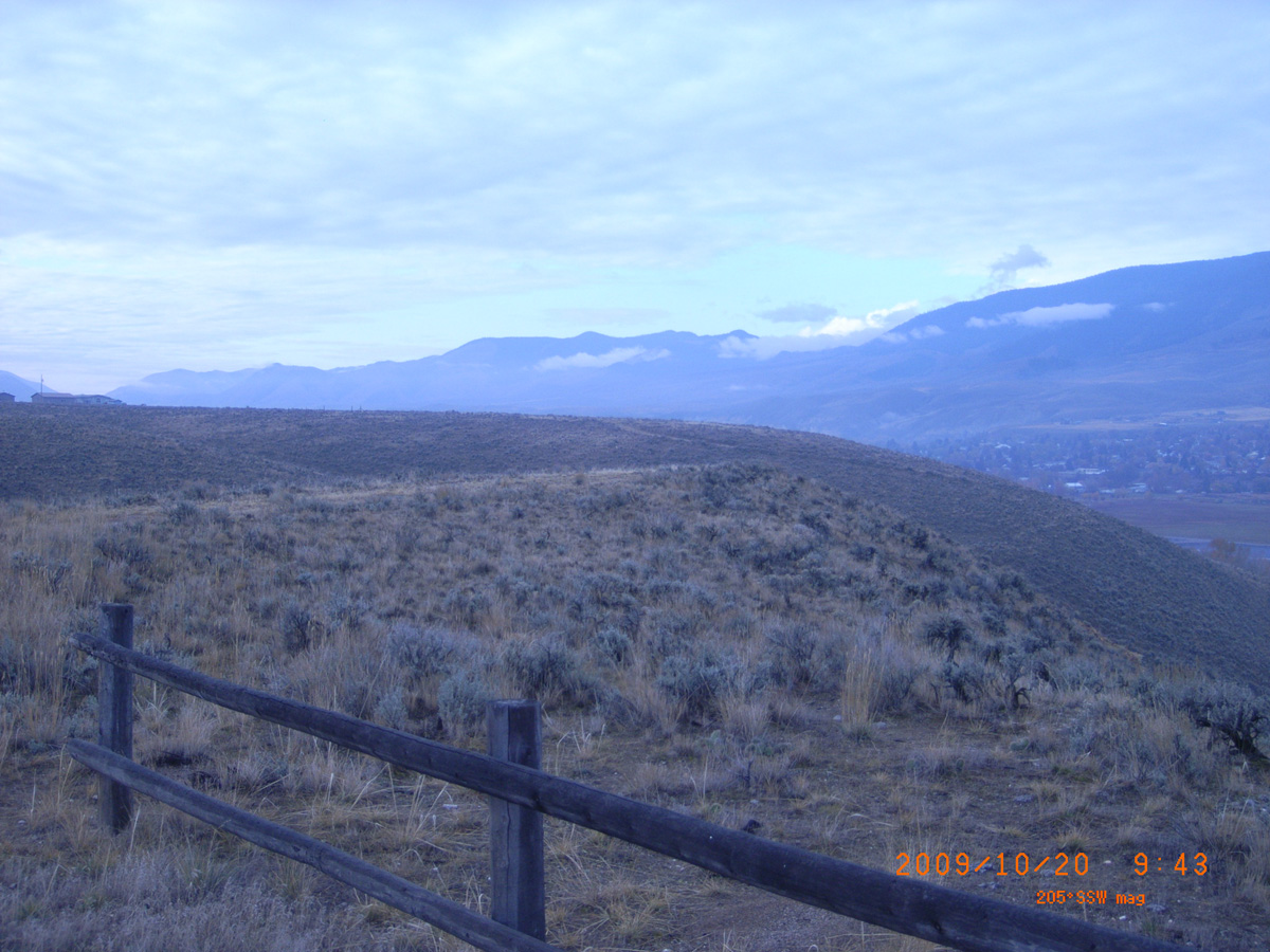
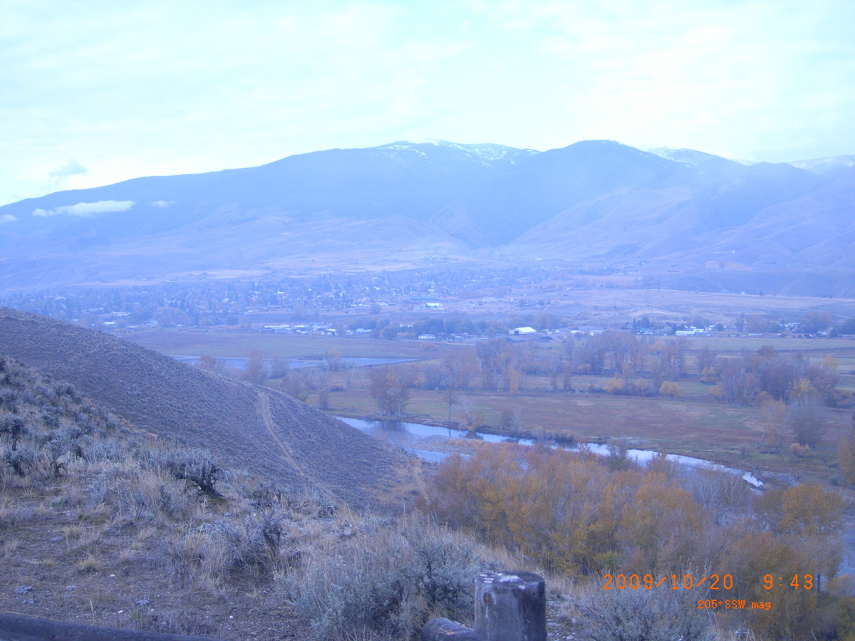
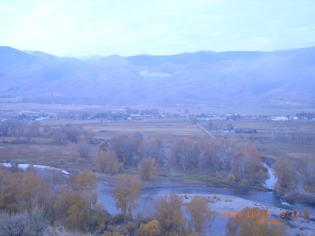
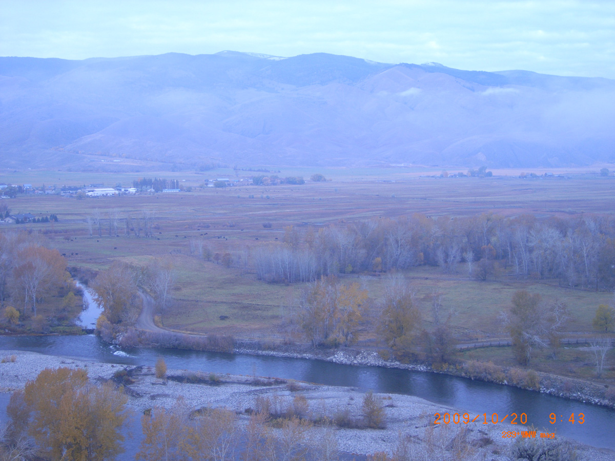
Discovery Hill Recreation Site (Salmon)
Lemhi County, Idaho: 45.19651462, -113.8800415
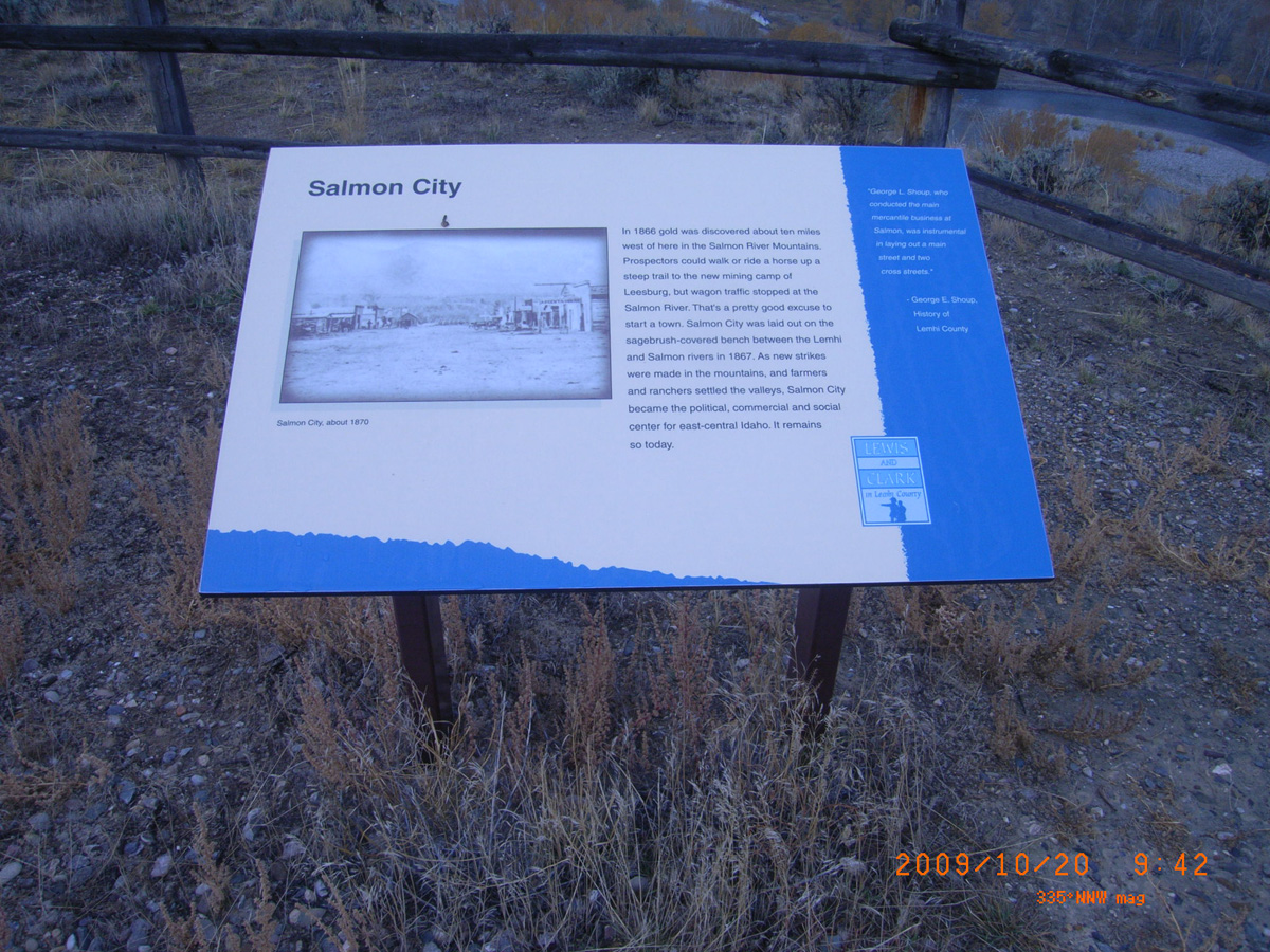
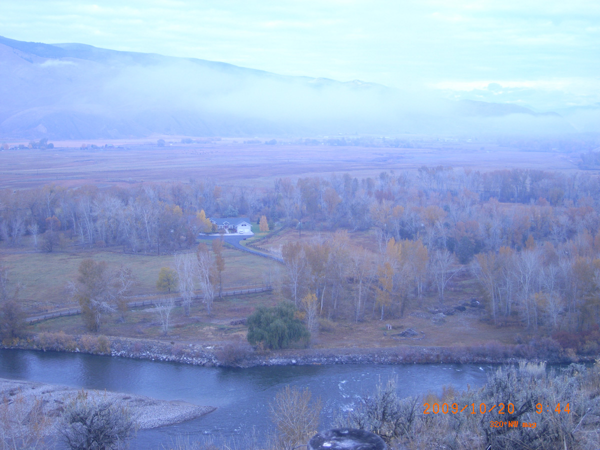
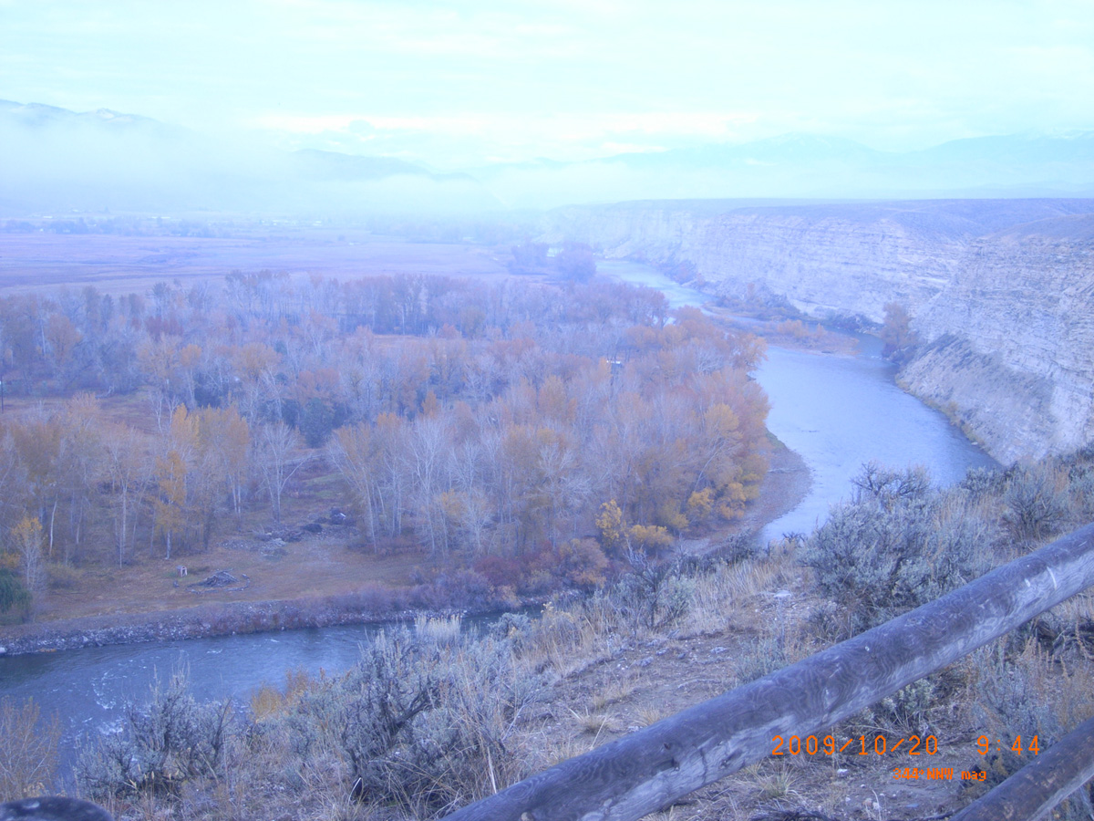
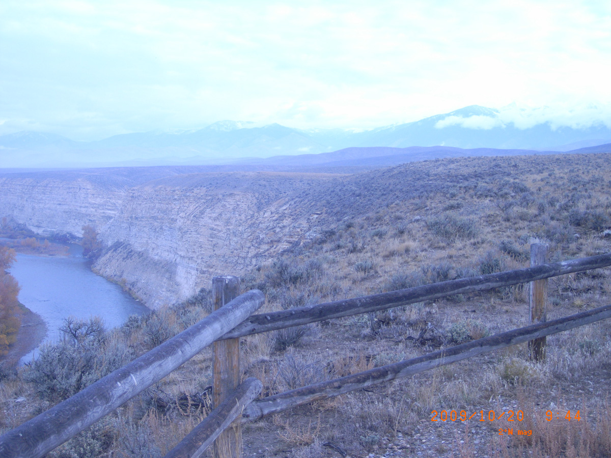
Salmon City
- Date Assessed: 2009-10-20
- File Name: RIMG0001.JPG
- Folder: C20OctoberCam1
- Camera Direction: 13°
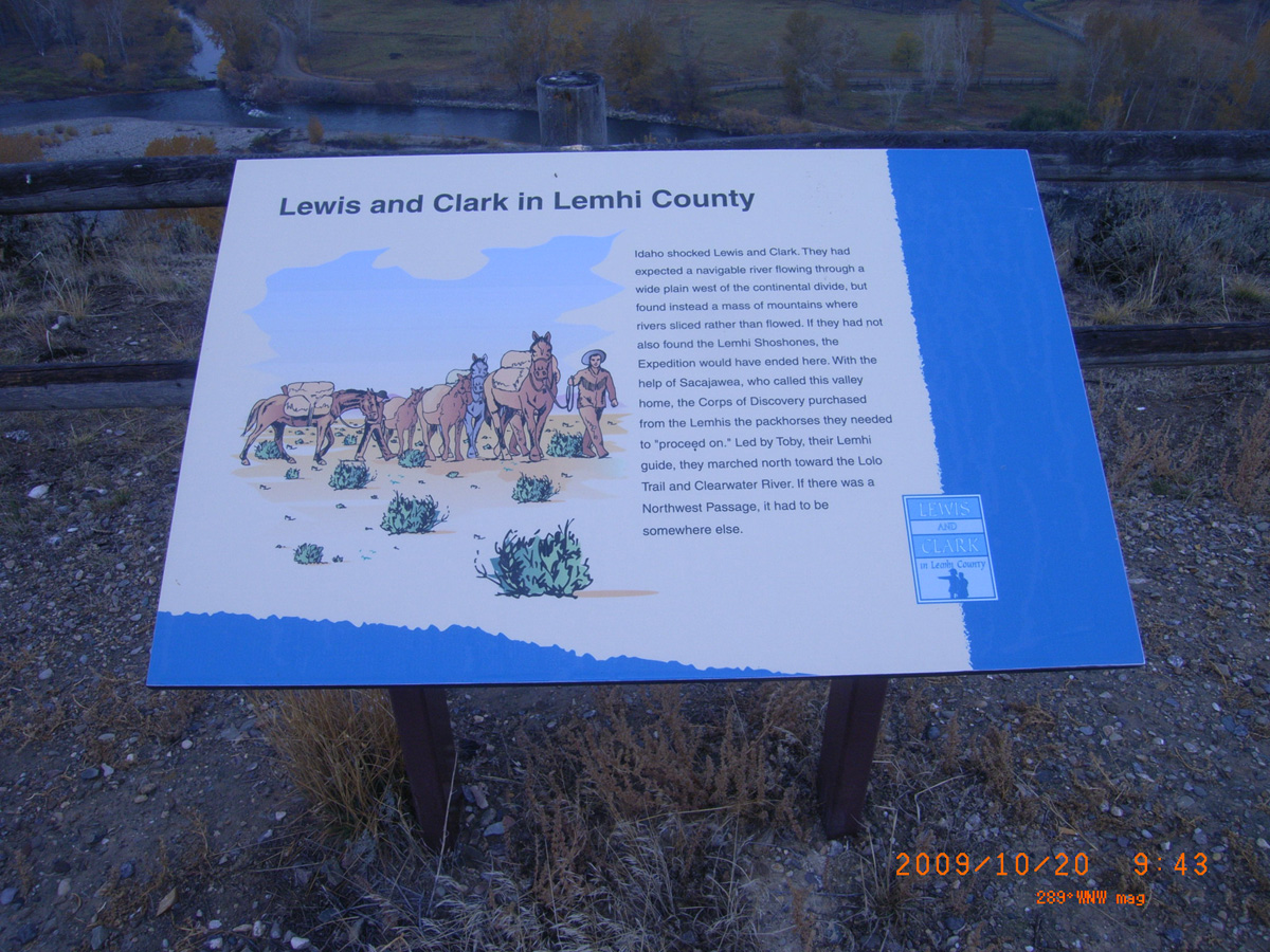
Lewis and Clark in Lemhi County
- Date Assessed: 2009-10-20
- File Name: RIMG0002.JPG
- Folder: C20OctoberCam1
- Camera Direction: 13°
Fishing at the Forks
- Date Assessed: 2009-10-20
- File Name: RIMG0003.JPG
- Folder: C20OctoberCam1
- Camera Direction: 13°
- Date Assessed: 2009-10-20
- File Name: RIMG0004.JPG
- Folder: C20OctoberCam1
- Camera Direction: 70°
- Date Assessed: 2009-10-20
- File Name: RIMG0005.JPG
- Folder: C20OctoberCam1
- Camera Direction: 74°
- Date Assessed: 2009-10-20
- File Name: RIMG0006.JPG
- Folder: C20OctoberCam1
- Camera Direction: 77°
- Date Assessed: 2009-10-20
- File Name: RIMG0007.JPG
- Folder: C20OctoberCam1
- Camera Direction: 145°
- Date Assessed: 2009-10-20
- File Name: RIMG0008.JPG
- Folder: C20OctoberCam1
- Camera Direction: 145°
- Date Assessed: 2009-10-20
- File Name: RIMG0009.JPG
- Folder: C20OctoberCam1
- Camera Direction: 350°
- Date Assessed: 2009-10-20
- File Name: RIMG0010.JPG
- Folder: C20OctoberCam1
- Camera Direction: 286°
Lewis and Clark in Lemhi County
- Date Assessed: 2009-10-20
- File Name: RIMG0011.JPG
- Folder: C20OctoberCam1
- Camera Direction: 65°
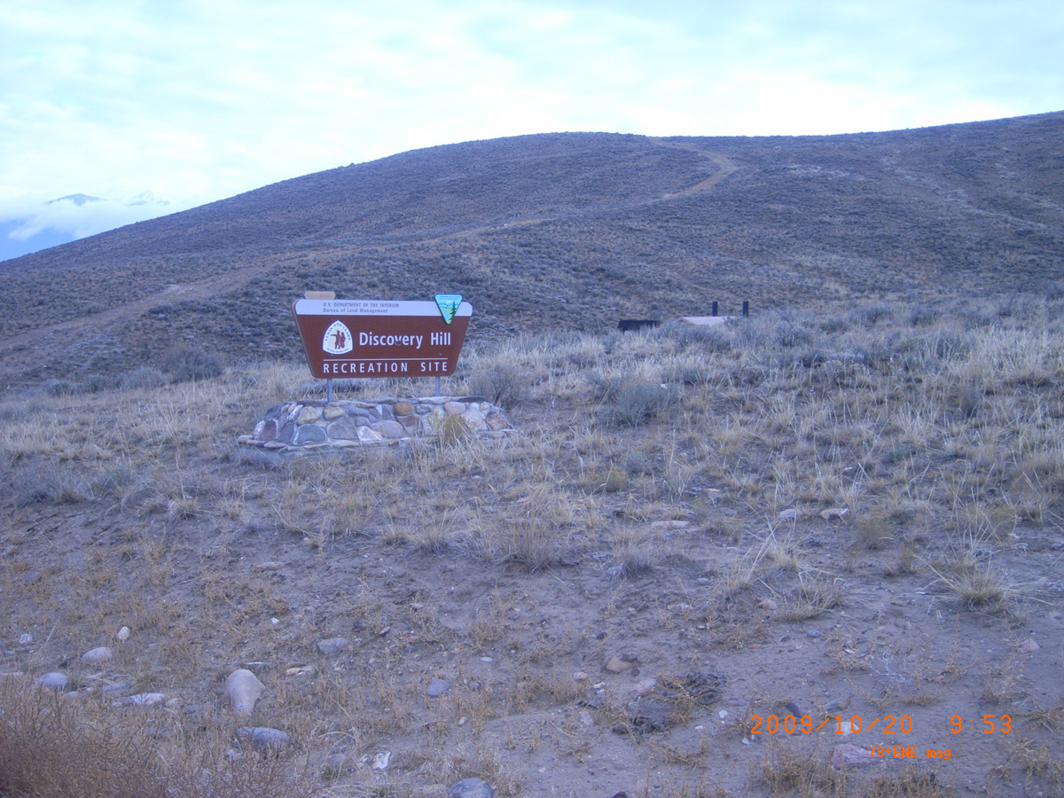
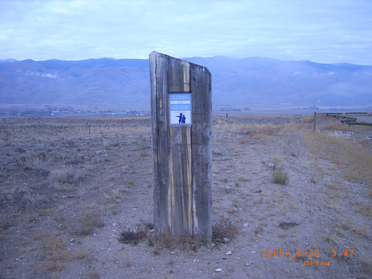
Discovery Hill Recreation Site
- Date Assessed: 2009-10-20
- File Name: RIMG0012.JPG
- Folder: C20OctoberCam1
- Camera Direction: 58°
US Forest Service Offices, Riverside
Clearwater County, Idaho: 46.49835548, -116.314179
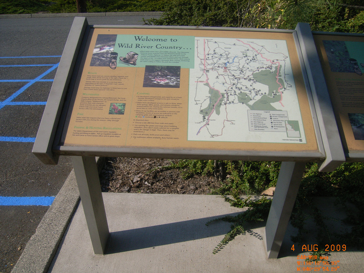
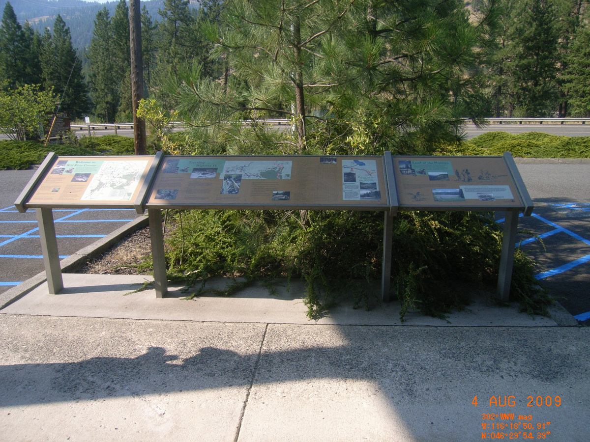
Welcome to Wild River Country . . .
- Date Assessed: 2009-08-04
- File Name: RIMG0040.JPG
- Folder: C03AugustCam1
- Camera Direction: 87°
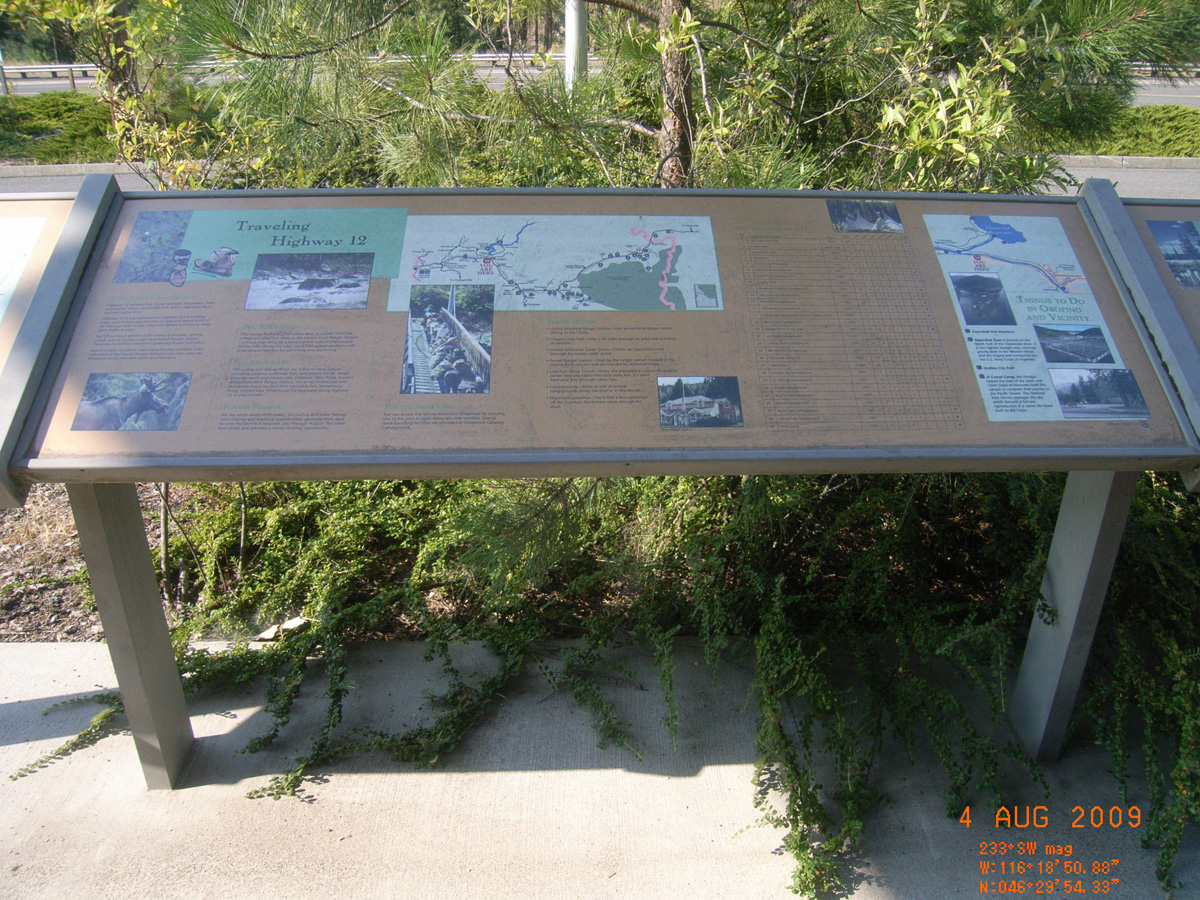
Traveling Highway 12
- Date Assessed: 2009-08-04
- File Name: RIMG0041.JPG
- Folder: C03AugustCam1
- Camera Direction: 188°
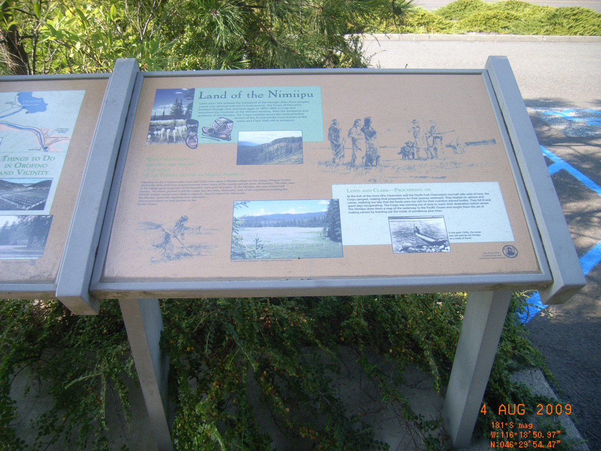
Land of the Nimmiipu
- Date Assessed: 2009-08-04
- File Name: RIMG0042.JPG
- Folder: C03AugustCam1
- Camera Direction: 272°
- Date Assessed: 2009-08-04
- File Name: RIMG0043.JPG
- Folder: C03AugustCam1
- Camera Direction: 270°
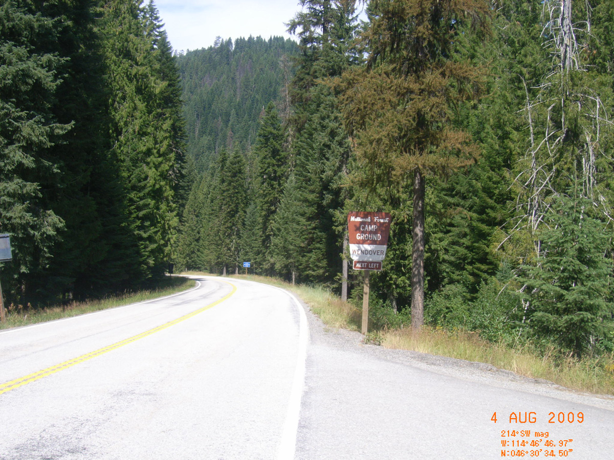
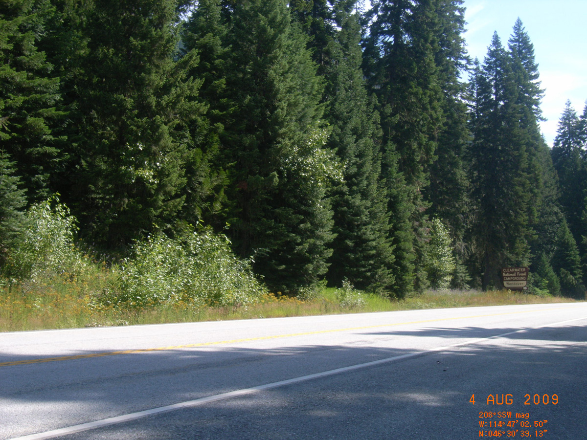
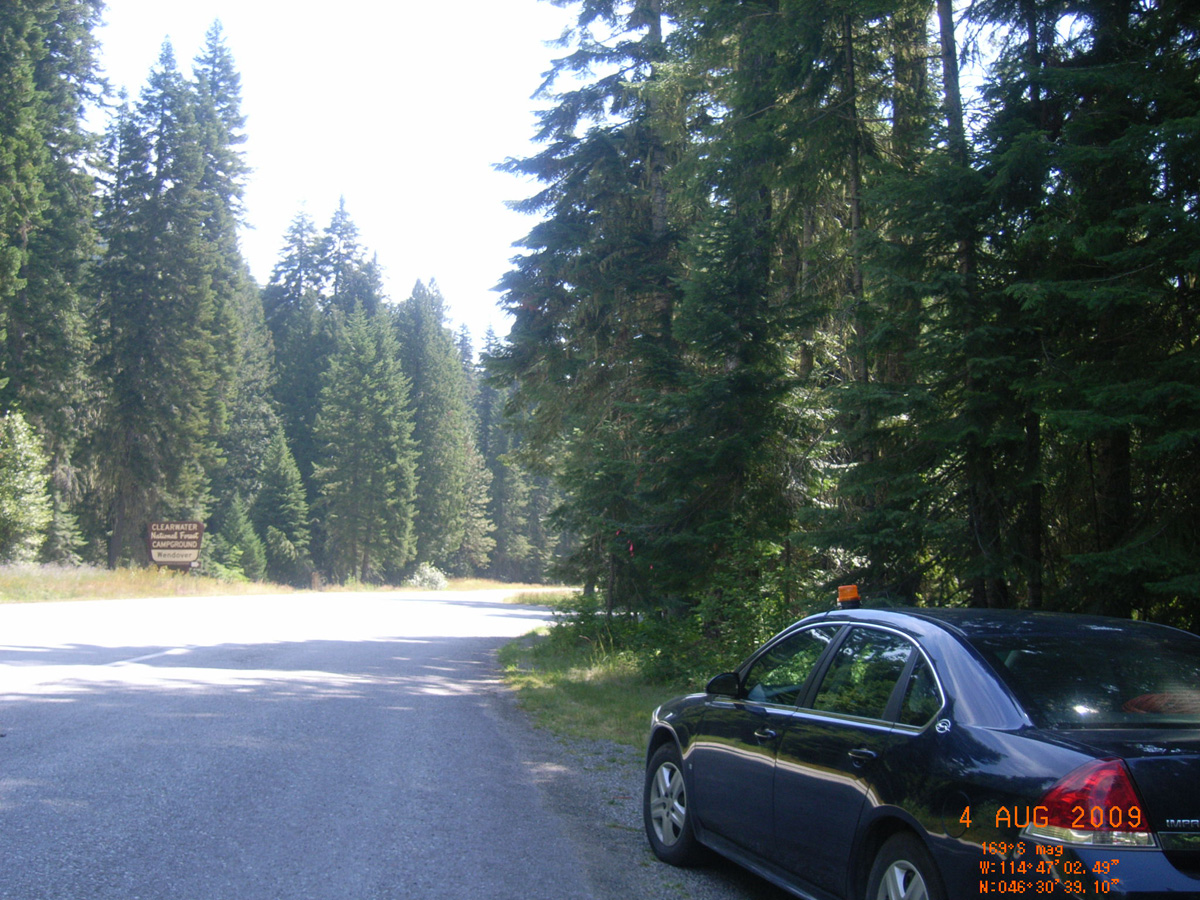
Wendover Campground, HW 12
Idaho County, Idaho: 46.51078464, -114.7840211
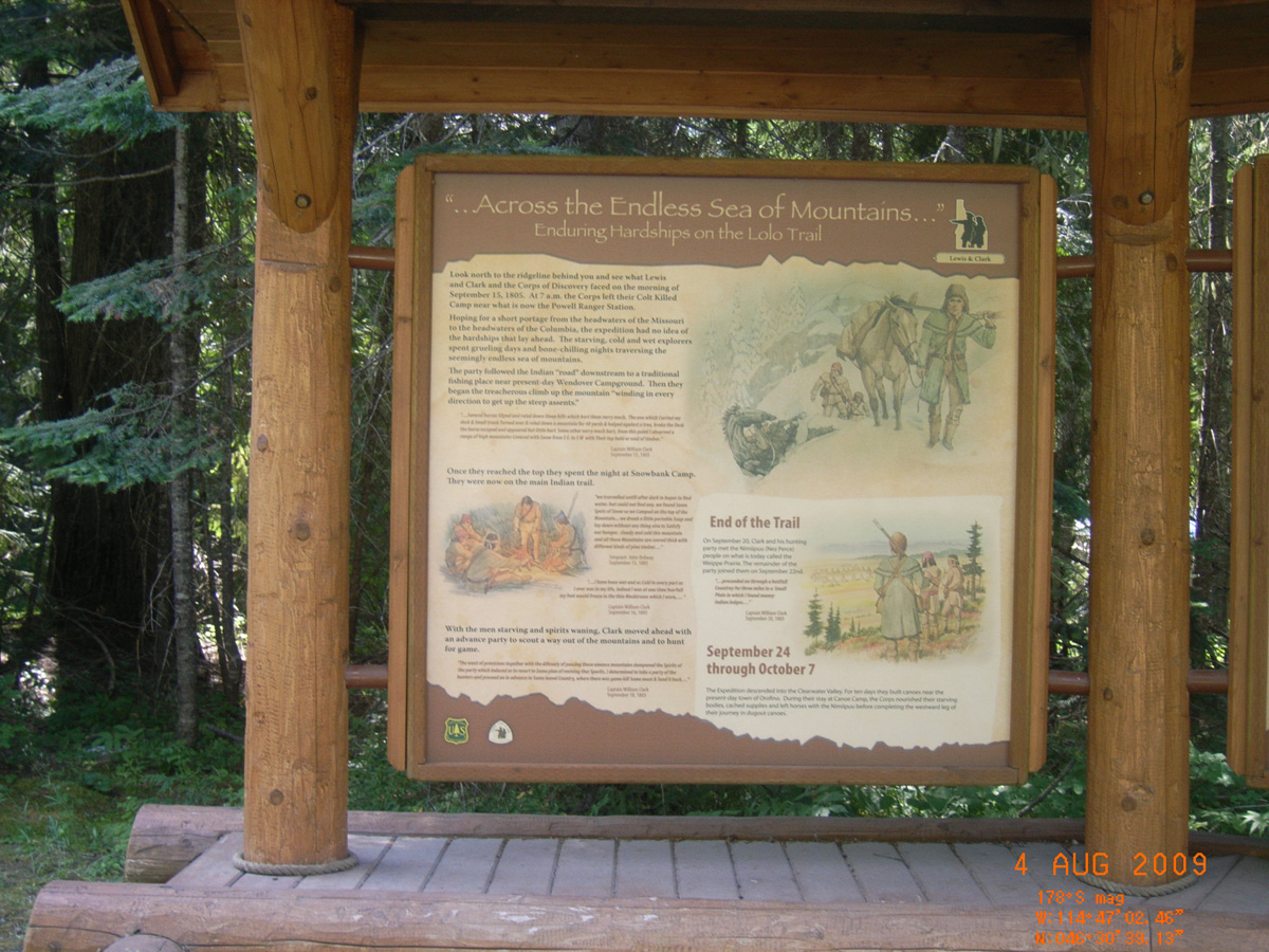
'...Across the Endless Sea of Mountains...'
- Date Assessed: 2009-08-04
- File Name: RIMG0107.JPG
- Folder: C04AugustCam1
- Camera Direction: 260°
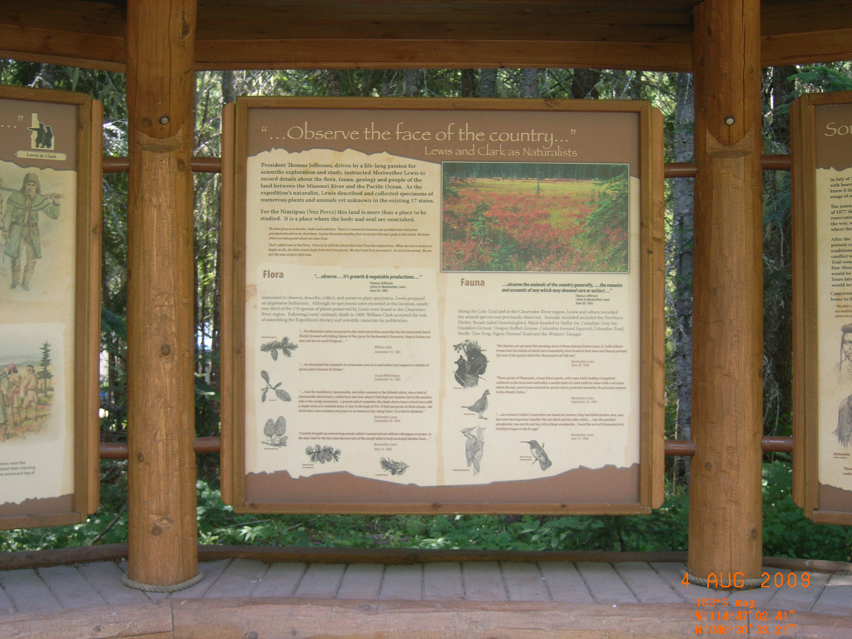
'...Observe the face of the country...'
- Date Assessed: 2009-08-04
- File Name: RIMG0108.JPG
- Folder: C04AugustCam1
- Camera Direction: 295°
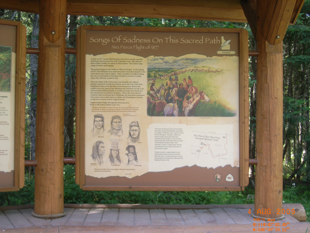
Songs of Sadness on This Sacred Path: Nez Perce Flight of 1877
- Date Assessed: 2009-08-04
- File Name: RIMG0109.JPG
- Folder: C04AugustCam1
- Camera Direction: 11°
- Date Assessed: 2009-08-04
- File Name: RIMG0110.JPG
- Folder: C04AugustCam1
- Camera Direction: 158°
- Date Assessed: 2009-08-04
- File Name: RIMG0111.JPG
- Folder: C04AugustCam1
- Camera Direction: 158°
- Date Assessed: 2009-08-04
- File Name: RIMG0112.JPG
- Folder: C04AugustCam1
- Camera Direction: 293°
- Date Assessed: 2009-08-04
- File Name: RIMG0113.JPG
- Folder: C04AugustCam1
- Camera Direction: 294°
- Date Assessed: 2009-08-04
- File Name: RIMG0114.JPG
- Folder: C04AugustCam1
- Camera Direction: 286°
- Date Assessed: 2009-08-04
- File Name: RIMG0115.JPG
- Folder: C04AugustCam1
- Camera Direction: 297°
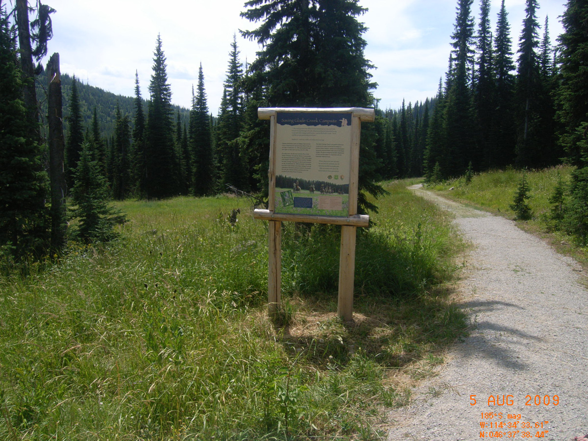
Glade Creek Campsite overlook
Idaho County, Idaho: 46.62731517, -114.5760217
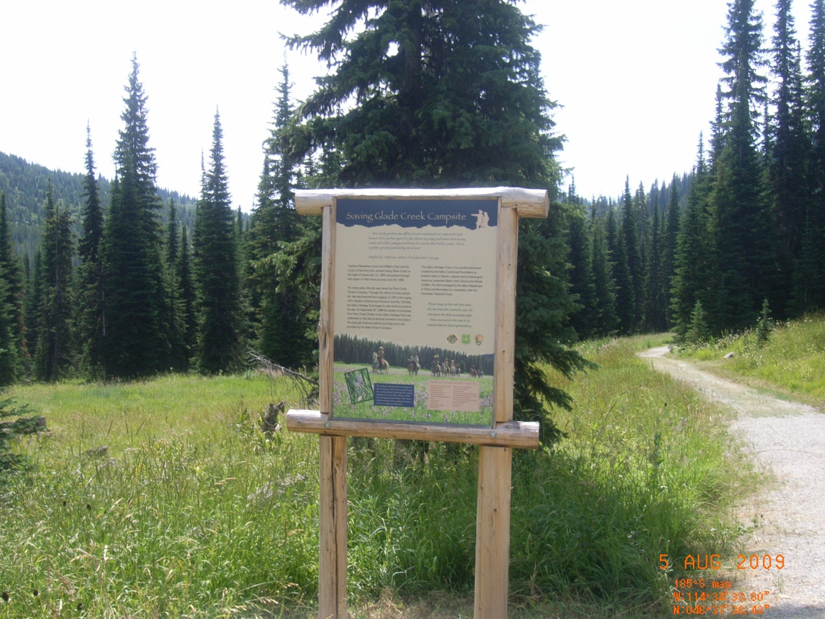
Saving Glade Creek Campsite
- Date Assessed: 2009-08-05
- File Name: RIMG0141.JPG
- Folder: C04AugustCam1
- Camera Direction: 19°
Saving Glade Creek Campsite
- Date Assessed: 2009-08-05
- File Name: RIMG0142.JPG
- Folder: C04AugustCam1
- Camera Direction: 2°
Saddle Camp Junction, Lolo Motorway and FSR 107
Idaho County, Idaho: 46.513452, -115.100898
A Step Back in Time...You are About to Discover the Lolo Trail
- Date Assessed: 2009-08-04
- File Name: RIMG0041.JPG
- Folder: C04AugustCam2
- Camera Direction: 222°
Finding Your Way: Traveling the Lolo Trail
- Date Assessed: 2009-08-04
- File Name: RIMG0042.JPG
- Folder: C04AugustCam2
- Camera Direction: 344°
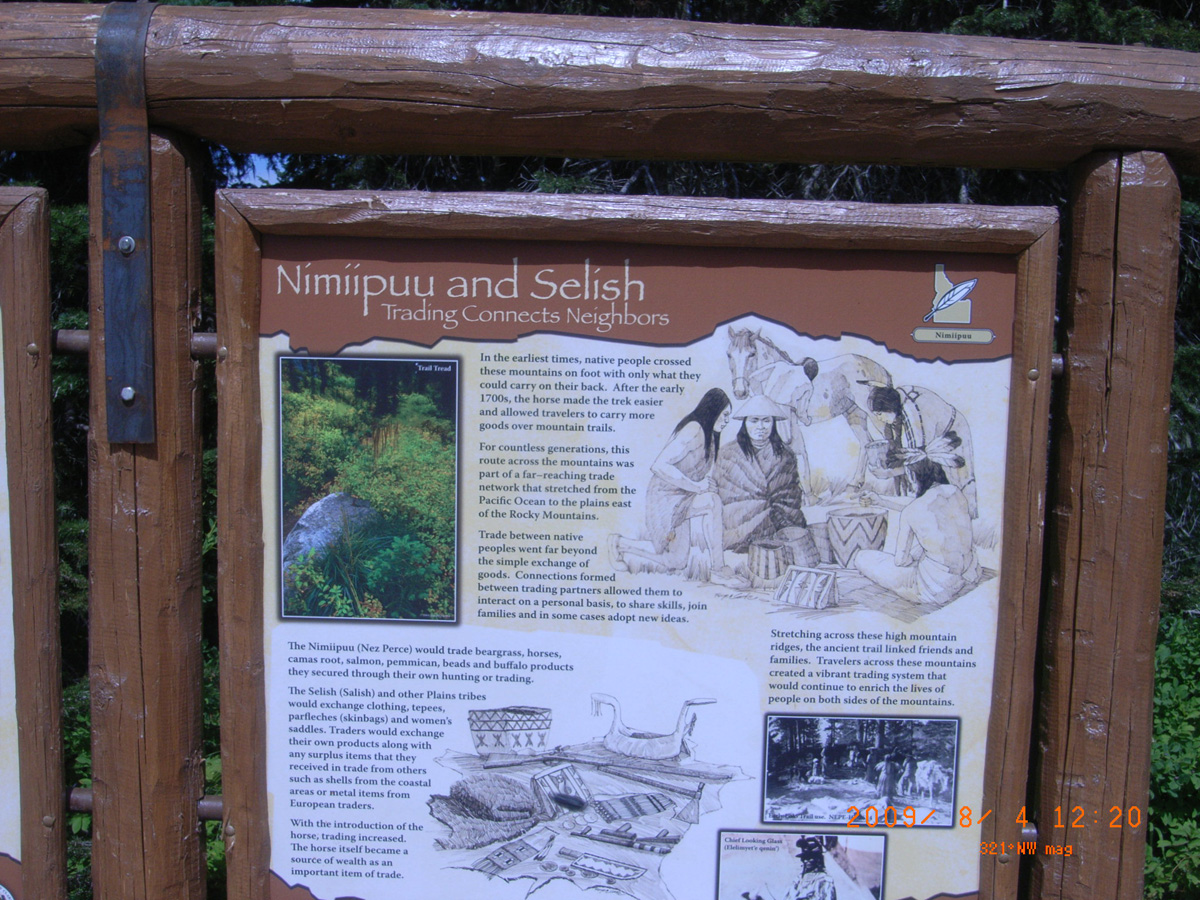
Nimiipuu and Selish: Trading Connects Neighbors
- Date Assessed: 2009-08-04
- File Name: RIMG0043.JPG
- Folder: C04AugustCam2
- Camera Direction: 344°