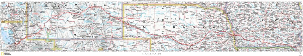
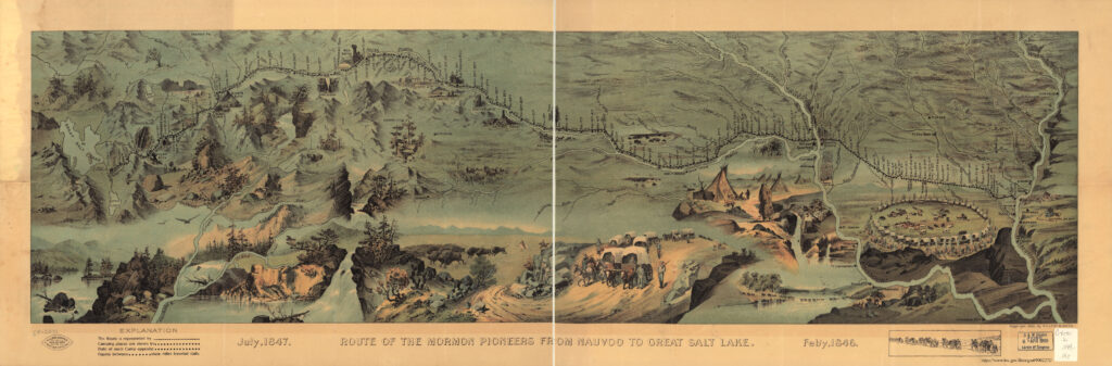
1846 Mormon Pioneer Trail
Contributed by Steve F. Russell
Leaving from Omaha/Council Bluffs in 1846, the Mormon Pioneers used this route to go from Council Bluffs to the Great Salt Lake Valley. They stayed on the north side of the Platte River moving westward to Fort Laramie. They then crossed to the south side of the Platte to continue on the original 1845 Oregon Trail until reaching Fort Bridger. From Fort Bridger, they continued westward using the Hasting’s Cutoff (and the Weber River) reaching present-day Salt Lake City. Later Mormon emigrants used alternate routes such as Child’s Cutoff, trails around Casper, and Parlay’s Road to the Great Salt Lake Valley.
The trail’s highest elevation, at Altamont, Wyoming, is 7732 feet. The elevation at the crossing of the Wasatch Mountains, at Big Mountain Pass, is 7420 feet (South Pass is 7411 feet). The length of the trail from Council Bluffs, Iowa to Salt Lake City, is approximately 1018 topographic miles. The distance varies depending on the route taken over the Wasatch Mountains.
Aliases: Mormon Trail, Mormon Pioneer Trail, Mormon Pioneer National Historic Trail
Static Map Images