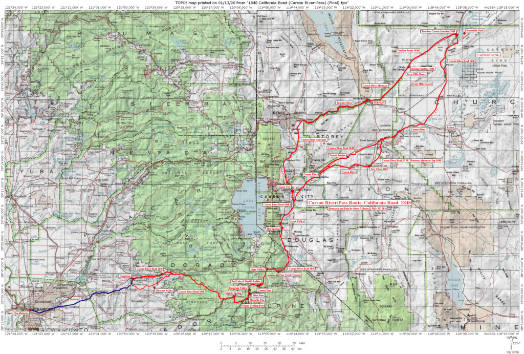
1848 Carson River Road
Contributed by Steve F. Russell
This route was made into a wagon road in 1848 by the Mormon Battalion on their way to Salt Lake City from California. They left Placerville with 17 wagons and worked the existing trail so it would pass wagons. The eastern terminus of the trail was its junction with the Truckee Trail, east of Humboldt Sink. It’s high elevation and rugged route was eliminated by the creation of Johnson’s Cutoff in 1852. Its pass across the Sierra Nevada mountains was the highest of all the crossings until the building of the Walker River-Sonora Trail in 1852.
Its highest elevation, at Melissa Coray Peak (south of Emigrant Lake), is 9564 feet. In contrast, the elevation of Carson Pass is 8609 feet—955 feet lower. The length of the trail from Placerville, California to the trail junction west of Humboldt Sink, is 197.9 topographic miles.
Aliases: Carson River Road, Carson Pass Road, Carson River Route
Static Map Image