The Portage Route of Lewis and Clark
Contributed by Robert N. Bergantino
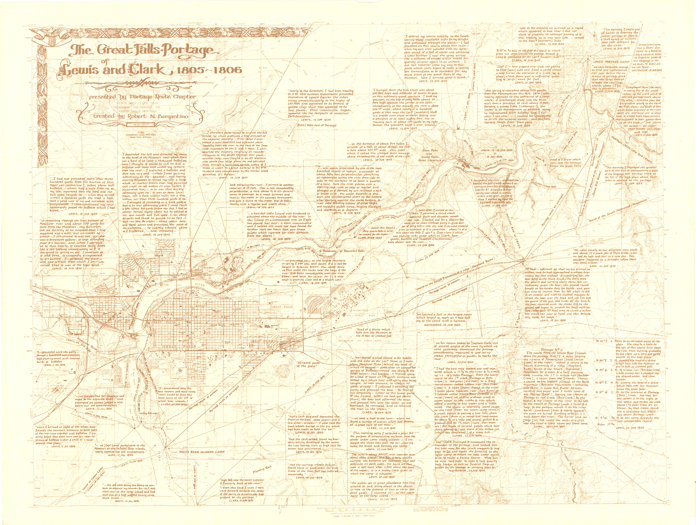
This map of Lewis and Clark’s Portage Route around the Great Falls of the Missouri in June and July of 1805 is offered here in two resolutions. Shown below is the medium-resolution (2400 x 1810). The high-resolution version (19817 x 14948, 61.6 MB) can be downloaded.

Topics
Google Maps
Lewis and Clark Trail
Route Center Line
Oregon-California Trails
Lolo Trail
Nee-Me-Poo National Historic Trail
Mullan Road
Other
Trail Inventory
Bird-Truax Trail
Pacific Ocean Exploration
Fur Trade
Historic Map
Carroll Trail
Timeline
Methodology
Old North Trail
The Wilderness Road
Contributors
Steve F. Russell
Kristopher K. Townsend
US National Park Service (LCNHT)
Robert Heacock
Robert H. Dunsmore
Robert N. Bergantino
Richard S. Buswell
Charles Raddon
U.S. Army National Guard
Raymond Borchers
Merle Wells
David and Sue Eakin
Larry Jones
John (Jack) P. Harlan
Martin Plamondon II
James D. Harlan
Ralph Saunders