1852 Ham’s Fork Cutoff (Meeker)
Contributed by Steve F. Russell
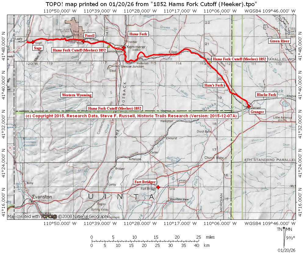
The history and date of the Ham’s Fork Cutoff has not been established but it is shown on the 1852 Ezra Meeker map. Some segments are also shown on the GLO survey plat maps of the area. the cutoff avoided the Fort Bridger loop.
Its highest elevation, just west of Kemmerer, Wyoming, was 7277 feet, and the length of the trail from Granger, Wyoming to the Bear River west of Sage, Wyoming, was 77.7 topographic miles. With the lowest elevations of all the cutoff routes in the area, it seems to have been the best route.
Static Map
Topics
Google Maps
Lewis and Clark Trail
Route Center Line
Oregon-California Trails
Lolo Trail
Nee-Me-Poo National Historic Trail
Mullan Road
Other
Trail Inventory
Pacific Ocean Exploration
Bird-Truax Trail
Fur Trade
Historic Map
Carroll Trail
Timeline
Methodology
Old North Trail
The Wilderness Road
Contributors
Steve F. Russell
Kristopher K. Townsend
US National Park Service (LCNHT)
Robert Heacock
Robert H. Dunsmore
Robert N. Bergantino
Richard S. Buswell
Charles Raddon
U.S. Army National Guard
Raymond Borchers
Merle Wells
David and Sue Eakin
Larry Jones
John (Jack) P. Harlan
Martin Plamondon II
James D. Harlan
Ralph Saunders