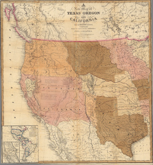
Map of Texas Oregon and California 1849
Published by Thomas and Cowperthwait and annotated by Steve F. Russell
Contributed by Steve F. Russell
This hand-colored map of the Western United States in 1845 shows emigrant routes and landmarks from Missouri to Oregon and California. The map documents the pivotal era defined by the Mexican-American War, Oregon migration, and the initial California Gold Rush. It also depicts locations of Native American tribal groups.
A
New Map of
Texas Oregon
and
California
with the Regions Adjoining
Compiled
from the most recent authorities
Philadelphia
Published by
Thomas Cowperthwait & Co.
Market St. No. 253
1849
Thomas, Cowperthwait & Co. published this map from plates originally engraved under H.N. Burroughs and S.A. Mitchell copyrighted in 1845. It measures roughly 54 x 50 cm and was considered a pocket map.
In this file, historic trail researcher Steve F. Russell has embedded bookmarks to enable the viewer to quickly key landmarks.