1852 Nobles Road
Contributed by Steve F. Russell
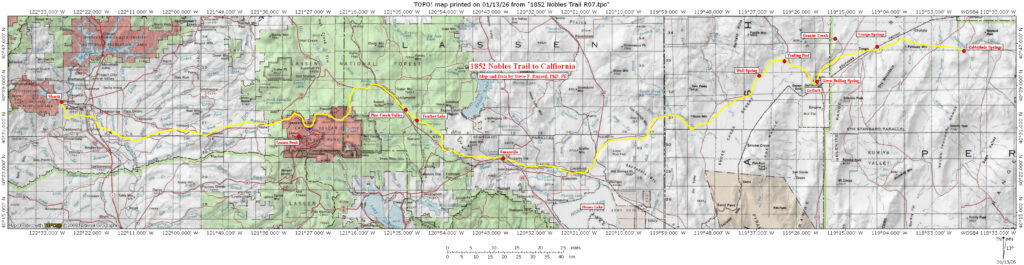
The road pioneered by William Nobles between Rye Patch Reservoir and Shasta, California was advertised as the being shorter and more practical than any other roads to the northern gold fields. From a topographical perspective, it seems to have lived up to that reputation being shorter than either the route of Donner Pass or the Lassen Route. Its highest elevation, at Cinder Cone and Painted Dunes, was 6437 feet. The elevation at Nobles Pass was 6230 feet, and the length of the trail was 204.2 topographic miles.
Static Map
Topics
Google Maps
Lewis and Clark Trail
Route Center Line
Oregon-California Trails
Lolo Trail
Nee-Me-Poo National Historic Trail
Mullan Road
Other
Trail Inventory
Pacific Ocean Exploration
Bird-Truax Trail
Fur Trade
Historic Map
Carroll Trail
Timeline
Methodology
Old North Trail
The Wilderness Road
Contributors
Steve F. Russell
Kristopher K. Townsend
US National Park Service (LCNHT)
Robert Heacock
Robert H. Dunsmore
Robert N. Bergantino
Richard S. Buswell
Charles Raddon
U.S. Army National Guard
Raymond Borchers
Merle Wells
David and Sue Eakin
Larry Jones
John (Jack) P. Harlan
Martin Plamondon II
James D. Harlan
Ralph Saunders